Photo: Wikipedia
Strategic Assessment of Medford, OR
Workable tactical position. Some exposure to population density or targets, but generally defensible in a crisis.
What does the Strategic Assessment tell us?
Our Strategic Assessment grades tactical survivability of an area. Major population centers, military targets, fallout zones, natural disasters, and border exposure all drive risk — lower exposure means a more defensible position in a crisis.
This is heavily inspired by Joel Skousen's Strategic Relocation book. Highly recommended you checkout the book ($)What does this tell us?
Our Strategic Assessment grades tactical survivability of an area. Major population centers, military targets, fallout zones, natural disasters, and border exposure all drive risk — lower exposure means a more defensible position in a crisis.
This is heavily inspired by Joel Skousen's Strategic Relocation book. Highly recommended you checkout the book ($)Strategic Pillars

Key Distances
Regional Safe Places
Below is our recommended "safe zones" in Oregon and the surrounding area based on our strategic heuristics. For most people, it's unrealistic to live in a “safe zone” full-time due to work, family or other personal reasons. They tend to be more rural. However, many of these areas are perfect for second homes and retreat properties that double as a vacation home or even a short-term rental.


Important Note: For informational purposes only. This does not mean nothing bad ever happens in the green zones. Please use common sense. This is based on public data and modeled with AI. We tried to take a conservative approach but mistakes happen. We update this regularly as new information becomes available.
Solar Generator Recommendations
Backup power matters more here than in safer locations. We've picked three solar generators across budgets and capacity tiers — start with the budget unit if you only need a few essentials, or step up if you want to run a fridge and HVAC for days at a time.

Jackery Portable Power Station Explorer 300
Budget OptionPower on the Go: Weighing only 11 lbs, it's convenient to set up and store with book-sized foldable solar panels

BLUETTI Portable Power Station AC180
Designed for both indoor and outdoor scenarios, AC180 is highly capable as it has a robost capacity and continuous output power.

EF ECOFLOW DELTA Pro Ultra Power Station
Upgraded PickEcoFlow DELTA Pro Ultra is a whole-home energy system designed to grow with your family. Integrated with the Smart Home Panel 2, it scales to meet your evolving energy needs — keeping your home powered, intelligent, and secure through every stage of life.
We earn a commission, at no additional cost to you.
Strategic Assessment Analysis
Medford, Oregon, offers a compelling mix of geographic isolation and practical self-sufficiency that makes it a serious contender for those prioritizing resilience and preparedness. Situated in the Rogue Valley, the city benefits from a temperate climate, a robust local food system, and a position far from major metropolitan targets, yet it is not without its own set of strategic vulnerabilities. For a relocator thinking about disaster readiness, Medford presents a balanced picture: strong natural advantages for long-term sustainability, tempered by real risks from wildfire, seismic activity, and its role as a regional hub.
Geographic position and natural advantages for long-term sustainability
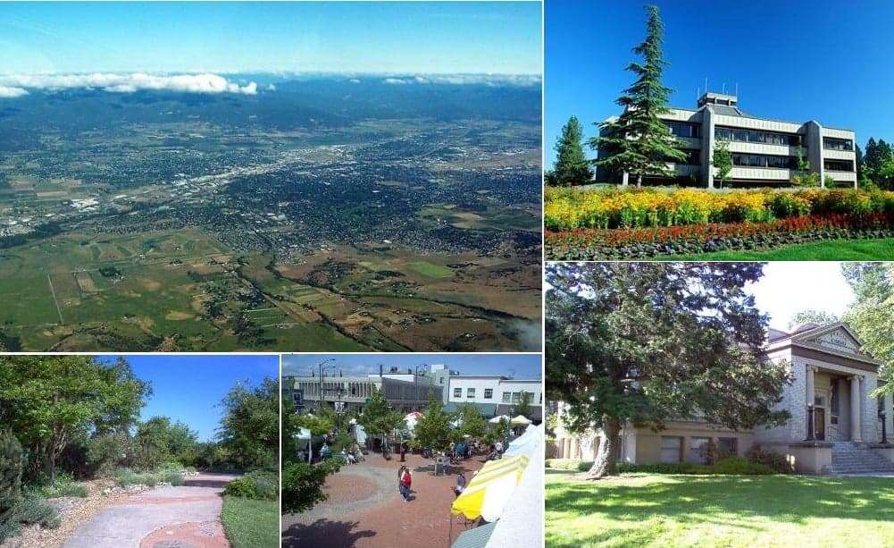
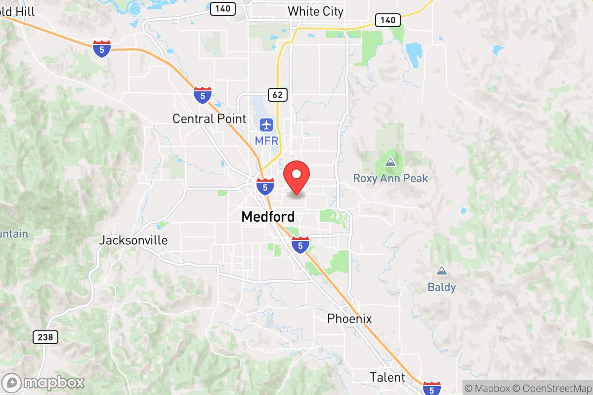
Medford’s primary strategic asset is its location in the Rogue Valley, a fertile basin surrounded by the Siskiyou and Cascade mountain ranges. This topography provides a natural buffer against large-scale coastal or inland threats. The valley’s elevation (roughly 1,300 feet) and Mediterranean-like climate—with hot, dry summers and mild, wet winters—support a growing season of over 200 days, enabling year-round food production. The area is part of the larger Klamath-Siskiyou ecoregion, one of the most biodiverse temperate zones in North America, which translates into abundant wild game, forage, and timber resources. Water is a relative strength: the Rogue River and its tributaries (Bear Creek, Applegate River) provide surface water, and the region’s aquifer system is generally reliable, though drought cycles are a recurring concern. For a relocator, the ability to tap into local agriculture—pears, wine grapes, hay, and livestock—means a shorter supply chain for basic foodstuffs compared to most urban centers. The valley’s isolation also works in its favor: Medford is roughly 30 miles from the California border, 270 miles from Portland, and 280 miles from San Francisco, placing it outside the immediate fallout zones of major population centers or strategic military targets like Naval Air Station Fallon or Vandenberg Space Force Base.
Risks, exposures, and proximity to fallout-relevant landmarks
No strategic assessment is complete without acknowledging the area’s vulnerabilities. Medford’s most acute risk is wildfire. The 2020 Almeda Fire, which destroyed over 2,500 structures in nearby Talent and Phoenix, demonstrated how quickly a wind-driven fire can overwhelm the valley. The city sits in a fire-prone ecosystem, and the urban-wildland interface is extensive. Summer smoke from regional fires is a near-annual event, degrading air quality for weeks at a time. Earthquake risk is moderate but real: the Cascadia Subduction Zone, roughly 150 miles west, could generate a magnitude 9.0 quake, with shaking felt in Medford and potential damage to older infrastructure. The area is also within the influence of the Mount Mazama (Crater Lake) volcanic system, though the primary hazard would be ashfall rather than lava. From a man-made risk perspective, Medford’s role as a regional hub for southern Oregon and northern California—home to the Rogue Valley International-Medford Airport, major highways (I-5, OR-62, OR-140), and a population of about 85,000 (metro area ~220,000)—makes it a potential secondary target in a conflict scenario. The proximity to critical infrastructure is a double-edged sword: the airport and I-5 corridor are vital for supply lines but also represent choke points. The nearest major military installation is Kingsley Field Air National Guard Base in Klamath Falls (70 miles east), which hosts F-15 fighter operations, a moderate-risk asset. The Oregon Institute of Technology in Klamath Falls also operates a research reactor, though it is low-power and not a high-value target. For a relocator, the key takeaway is that Medford is not a primary target but could face secondary effects from regional disruptions, particularly if the I-5 corridor is compromised.
Practical resilience for a relocator: food, water, energy, and defensibility
Medford’s practical resilience is above average for a city of its size, but it requires active preparation. Food security is a standout: the Rogue Valley is a major agricultural producer, with over 1,000 farms in Jackson County. The Medford Growers Market operates year-round, and local food co-ops (like the Ashland Food Co-op) and CSAs are well-established. For a relocator with land, the valley’s soil and climate support a wide variety of crops, from stone fruits to vegetables to grains. Water access is generally good, but not unlimited. The Rogue River Basin is managed by the Bureau of Reclamation and local irrigation districts, and residential wells are common in rural areas. However, drought years can lead to curtailments, so rainwater catchment and storage are wise investments. Energy infrastructure is a mixed bag. Medford is served by Pacific Power, which relies on a mix of hydro, coal, and natural gas. The region has significant solar potential (over 200 sunny days per year), and net metering is available, making rooftop solar a viable option for off-grid capability. The area also has a growing number of small-scale hydro and biomass projects. Defensibility is where Medford’s geography shines. The valley is ringed by mountains with limited access points: I-5 from the north and south, OR-62 from the east, and OR-140 from the west. This natural chokepoint structure makes it easier to monitor and control movement in a crisis. The local population is generally self-reliant, with a strong culture of hunting, fishing, and gardening. The Jackson County Sheriff’s Office and local emergency management have a solid reputation for community preparedness, with regular CERT (Community Emergency Response Team) training and a well-organized emergency alert system. For a relocator, the biggest practical gaps are medical infrastructure (the area has two hospitals, but specialized trauma care is limited) and the need for a robust personal emergency plan, particularly for wildfire evacuation.
The overall strategic picture for Medford is one of cautious optimism. It offers a rare combination of agricultural self-sufficiency, geographic isolation, and a climate that supports year-round living without extreme cold or heat. The risks—wildfire, earthquake, and regional hub vulnerability—are real but manageable with proper planning. For a relocator serious about disaster readiness, Medford provides a strong foundation: a community that understands self-reliance, a landscape that rewards preparation, and a location that is far enough from the coasts and major cities to avoid the worst of a cascading collapse. The key is to treat it as a base of operations, not a fortress—invest in fire-resistant construction, secure a reliable water source, and build connections with the local farming and preparedness communities. Medford is not a bunker, but it is one of the better bets in the Pacific Northwest for those who want to live with resilience, not fear.

* Values derived from national, state, county, city and local statistics and may differ in a specific area. Last updated: 2026-06-14T13:55:25.000Z
Narrative content on this page is AI-generated and may contain mistakes. Verify any details that matter before acting on them.
ReloMaps may earn a commission from affiliate links at no extra cost to you.

