Photo: Wikipedia
Quality of Life in Queen Annes County
A livable area that tracks near national norms for affordability, walkability, and neighborhood health.
What does Quality of Life tell us?
Quality of Life measures an area by evaluating factors like cost of living, nearby amenities, country club access, airport proximity, socioeconomic signals and neighborhood character. For large states, this is a general average — quality of life can vary dramatically between metro areas, suburbs, and rural communities within the same state.
What does this tell us?
Quality of Life measures an area by evaluating factors like cost of living, nearby amenities, country club access, airport proximity, socioeconomic signals and neighborhood character. For large states, this is a general average — quality of life can vary dramatically between metro areas, suburbs, and rural communities within the same state.
Cost of Living
46% above national average
90%
The Real Cost of Living in Queen Annes County for 2026
| Tier | Individual | Family (4) |
|---|---|---|
| Survival | $26k | $48k |
| Comfortable | $86k | $126k |
| Luxury | $177k+ | $274k+ |
| Elite (Top 5%) | $208k+ | $322k+ |
Quality-of-Life Analysis
Queen Anne’s County offers a distinct quality-of-life spectrum that ranges from the walkable, historic waterfront of its largest town, Stevensville, to the deep agricultural quiet of rural communities like Crumpton and Sudlersville. The county’s overall character is defined by its Chesapeake Bay shoreline, working farms, and a commuter population that largely heads west across the Bay Bridge to Annapolis or Baltimore. People are drawn to different parts of the county based on whether they prioritize immediate water access and town amenities, a slower small-town pace, or the privacy and land of a true rural setting.
Largest town(s) & population centers
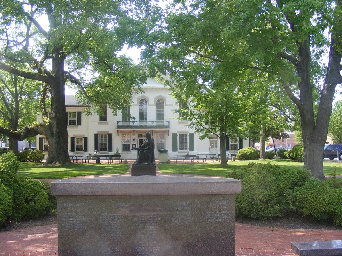
Stevensville is the county’s most prominent population center, functioning as the primary gateway from the Bay Bridge. Daily life here revolves around the historic Stevensville Main Street district, with its independent shops, restaurants, and the popular Stevensville Farmers Market. The town offers a mix of older single-family homes on tree-lined streets and newer subdivisions. Chester, directly adjacent, is a more commercial and residential hub, home to the large Kent Island shopping corridor along Route 50, including grocery stores, big-box retailers, and medical offices. Residents of Stevensville and Chester enjoy the closest proximity to the bridge for commuting, but also contend with the heaviest traffic, particularly during summer weekends. The average commute of 33.8 minutes reflects the many residents who cross the bridge daily, though those working on the Eastern Shore itself often have a much shorter drive. Centreville, the county seat, offers a different character: a historic courthouse square, a slower pace, and a more family-oriented, self-contained community feel, with its own hospital and a growing number of local businesses.
Smaller towns & rural pockets
Beyond the main corridors, Queen Anne’s County is dotted with smaller communities that each have a distinct identity. Grasonville, on Kent Island, is a working waterfront village with seafood restaurants, marinas, and a more laid-back, less commercial feel than Stevensville. Church Hill is a small, historic town with a well-preserved 18th-century Main Street, a strong sense of community, and a popular annual antique show. Further south and east, Queenstown is known for the Queenstown Premium Outlets and its rural residential character, while Sudlersville and Crumpton are deeply rural, unincorporated areas where agriculture dominates the landscape. These eastern and southern parts of the county offer the most land per dollar, with many properties on well and septic, and a lifestyle centered on farming, hunting, and quiet country living. The county’s rural character is protected by its agricultural preservation programs, which keep large tracts of land in active farm use.
Cost & lifestyle range
The cost of living in Queen Anne’s County is 46% above the national average, driven largely by housing. The median home value of $441,800 and median rent of $1,611 reflect the premium placed on waterfront and near-waterfront properties, especially on Kent Island. The highest end of the cost spectrum is found in Stevensville and Chester, where homes with direct water access or deep-water docks can exceed $1 million, and where the convenience of nearby shopping and a short commute to the bridge commands a premium. The middle range is represented by Centreville and Church Hill, where a well-maintained single-family home on a half-acre lot might fall closer to the county median, and where residents trade some commuting convenience for a quieter, more historic setting. The most affordable end of the spectrum is in the rural eastern communities like Sudlersville and Crumpton, where older farmhouses and smaller homes on larger lots can be found for well under $300,000, though this comes with longer drives to grocery stores, schools, and medical facilities. Amenities vary accordingly: Kent Island offers the most dining, retail, and entertainment options, while the rest of the county relies on Centreville as its primary service center, with smaller towns offering little more than a post office and a general store.
This county is best suited for those who value a mix of Chesapeake Bay access and rural space, and who are willing to accept a longer commute to the Western Shore for employment. Families seeking good schools and a safe environment find the county appealing, particularly in Centreville and the Kent Island communities. Retirees and second-home buyers are drawn to the waterfront lifestyle, while farmers and those seeking a quiet, land-based life find the eastern part of the county ideal. The key trade-off is proximity to the Bay Bridge: the closer you are, the higher the cost and the more traffic you endure, but the easier the access to regional job centers and urban amenities.

Crime in Queen Annes County
Higher crime rates than 58% of comparable U.S. locations.
Violent CrimeViolent Crime Analysis
Property CrimeProperty Crime Analysis
Crime Analysis
Queen Anne’s County, Maryland, presents a mixed safety picture: its overall crime rates sit below the national average for property offenses but above the state average for violent crime, creating a landscape where residents in different towns experience markedly different levels of risk. With a violent crime rate of 364.1 per 100,000 residents and a property crime rate of 1,849.2 per 100,000, the county is safer than many urban centers in the Baltimore-Washington corridor but still faces challenges that prospective movers should weigh carefully. The county’s proximity to the Eastern Shore’s larger population centers and its role as a bedroom community for Annapolis and Baltimore influence both its crime patterns and the effectiveness of local law enforcement.
Crime in context
Queen Anne’s County’s violent crime rate of 364.1 per 100,000 is roughly 4% higher than the Maryland state average of approximately 350 per 100,000, and about 5% above the national median for non-metropolitan counties. Property crime, at 1,849.2 per 100,000, is about 12% lower than the national average of roughly 2,100 per 100,000, but still significant enough to warrant attention. The county’s figures are heavily influenced by incidents in its more densely populated areas—particularly Centreville, the county seat, and Stevensville, which sits closest to the Bay Bridge and sees higher transient traffic. By contrast, rural communities like Church Hill and Sudlersville report far fewer incidents per capita, though their small populations can make year-to-year rates volatile. The Maryland State Police and the Queen Anne’s County Sheriff’s Office share jurisdiction, with the Sheriff’s Office handling most rural patrols and the State Police covering major highways like US-50 and US-301, where drug trafficking and stolen-vehicle recoveries are common.
What residents experience
For daily life, the most tangible safety concern in Queen Anne’s County is property crime—particularly theft from vehicles and burglaries in unincorporated subdivisions. Residents in Chester and Grasonville, both near the Bay Bridge, report higher rates of larceny and vehicle break-ins, often attributed to transient offenders using the highway corridor. Violent crime is less common but not absent: aggravated assault accounts for the majority of violent incidents, while robbery and homicide are rare but concentrated in specific areas. The county’s judicial system, overseen by the Circuit Court for Queen Anne’s County, has historically taken a moderate-to-conservative approach to sentencing, but the broader influence of progressive policies from nearby jurisdictions—particularly the more liberal District Court and State’s Attorney offices in Anne Arundel County and Baltimore City—can create a revolving-door effect for offenders who cross county lines. Residents in communities like Queenstown and Barclay often express frustration that repeat property offenders face minimal consequences, a pattern that mirrors concerns seen across Maryland’s Eastern Shore.
Neighborhood-level variation is pronounced. The safest areas tend to be the small inland towns—Sudlersville and Millington—where violent crime is virtually nonexistent and property crime is limited to occasional thefts. The most crime-prone areas are the waterfront communities along the Chester River and the Bay Bridge corridor, where higher population density and tourist traffic create more opportunities for theft. Prospective residents should examine block-level data for specific subdivisions, as a single street can differ dramatically from its neighbors. Overall, Queen Anne’s County offers a relatively safe environment compared to the state’s urban centers, but the property crime rate and the influence of progressive criminal justice policies in adjacent jurisdictions are legitimate concerns for anyone considering a move to the area.
* Values derived from national, state, county, city and local statistics and may differ in a specific area. Last updated: 2026-07-25T08:52:43.000Z
Narrative content on this page is AI-generated and may contain mistakes. Verify any details that matter before acting on them.
ReloMaps may earn a commission from affiliate links at no extra cost to you.

