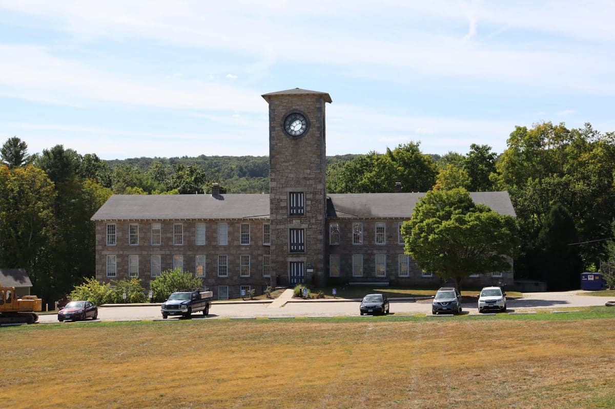
Photo: Wikipedia
Strategic Assessment of Mansfield, CT
Workable tactical position. Some exposure to population density or targets, but generally defensible in a crisis.
What does the Strategic Assessment tell us?
Our Strategic Assessment grades tactical survivability of an area. Major population centers, military targets, fallout zones, natural disasters, and border exposure all drive risk — lower exposure means a more defensible position in a crisis.
This is heavily inspired by Joel Skousen's Strategic Relocation book. Highly recommended you checkout the book ($)What does this tell us?
Our Strategic Assessment grades tactical survivability of an area. Major population centers, military targets, fallout zones, natural disasters, and border exposure all drive risk — lower exposure means a more defensible position in a crisis.
This is heavily inspired by Joel Skousen's Strategic Relocation book. Highly recommended you checkout the book ($)Strategic Pillars

Key Distances
Regional Safe Places
Below is our recommended "safe zones" in Connecticut and the surrounding area based on our strategic heuristics. For most people, it's unrealistic to live in a “safe zone” full-time due to work, family or other personal reasons. They tend to be more rural. However, many of these areas are perfect for second homes and retreat properties that double as a vacation home or even a short-term rental.
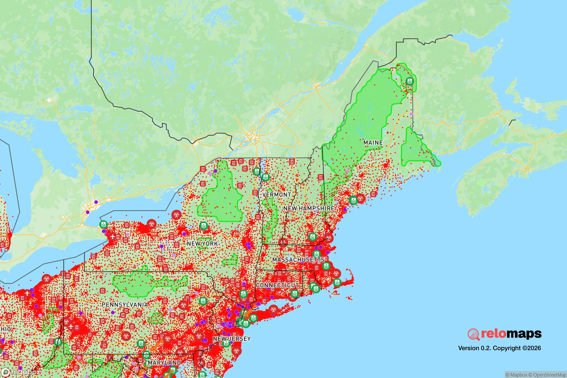
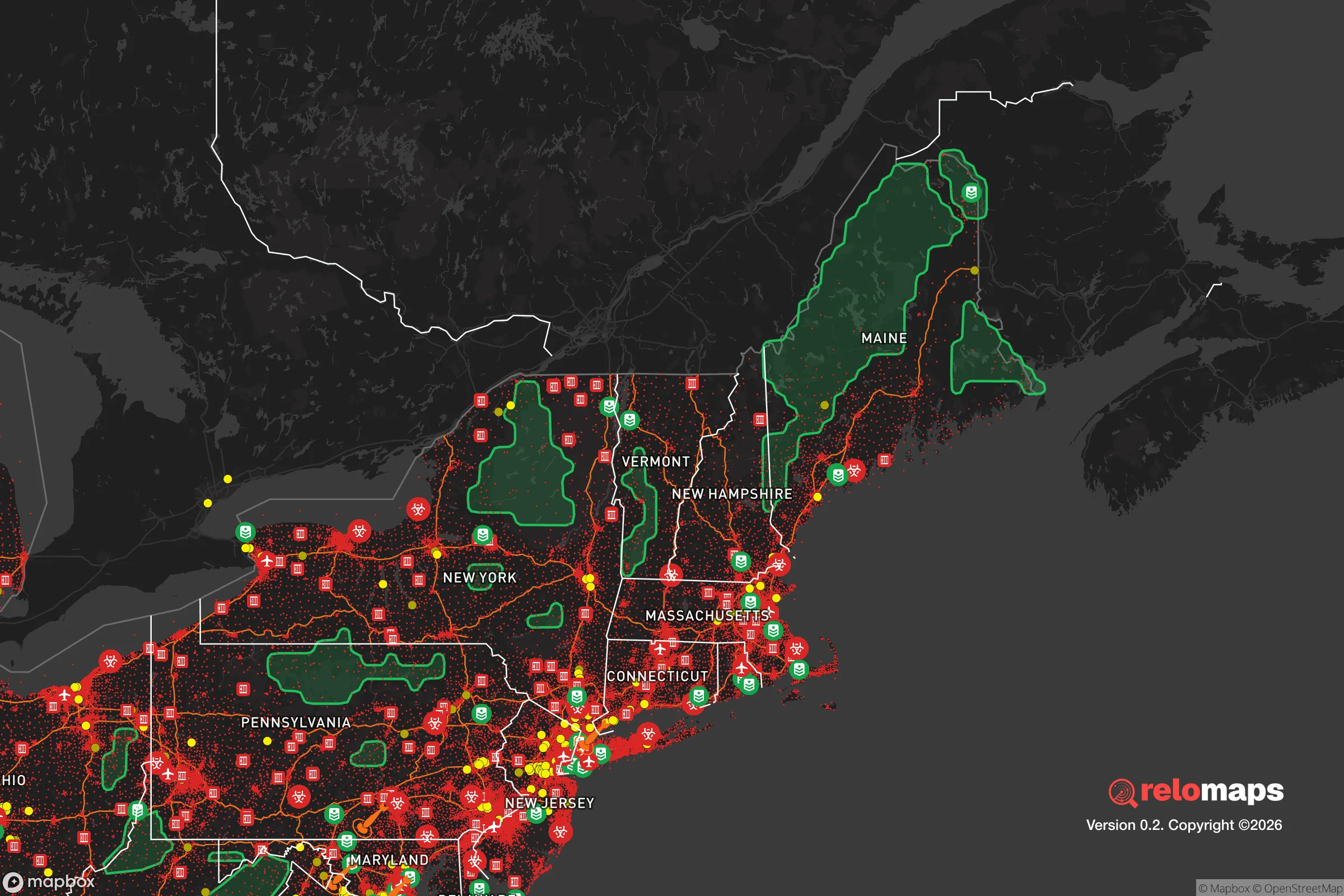


Important Note: For informational purposes only. This does not mean nothing bad ever happens in the green zones. Please use common sense. This is based on public data and modeled with AI. We tried to take a conservative approach but mistakes happen. We update this regularly as new information becomes available.
Solar Generator Recommendations
Backup power matters more here than in safer locations. We've picked three solar generators across budgets and capacity tiers — start with the budget unit if you only need a few essentials, or step up if you want to run a fridge and HVAC for days at a time.

Jackery Portable Power Station Explorer 300
Budget OptionPower on the Go: Weighing only 11 lbs, it's convenient to set up and store with book-sized foldable solar panels

BLUETTI Portable Power Station AC180
Designed for both indoor and outdoor scenarios, AC180 is highly capable as it has a robost capacity and continuous output power.

EF ECOFLOW DELTA Pro Ultra Power Station
Upgraded PickEcoFlow DELTA Pro Ultra is a whole-home energy system designed to grow with your family. Integrated with the Smart Home Panel 2, it scales to meet your evolving energy needs — keeping your home powered, intelligent, and secure through every stage of life.
We earn a commission, at no additional cost to you.
Strategic Assessment Analysis
Mansfield, Connecticut, presents a mixed strategic picture for the relocation-minded reader focused on resilience and self-sufficiency. While its location in the quiet corner of eastern Connecticut offers genuine advantages in terms of low population density and access to natural resources, its proximity to major metropolitan areas and specific infrastructure vulnerabilities require careful consideration. For a family or individual weighing disaster readiness, Mansfield is not a hardened bunker, but a defensible, resource-rich position that demands active preparation to offset its exposure to regional risks.
Geographic position and natural advantages for long-term stability
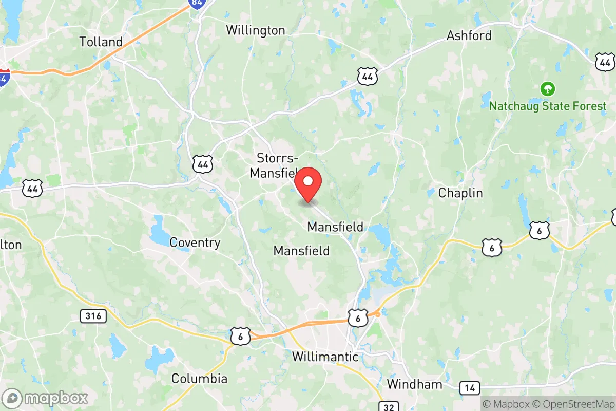
Mansfield sits in Tolland County, roughly 25 miles east of Hartford and 30 miles west of Providence, Rhode Island. This places it in a sweet spot: close enough to urban job markets and supply chains for normal life, yet far enough to avoid the immediate blast and fallout zones of a major city in a worst-case scenario. The town is part of the Eastern Connecticut Highlands, a region of rolling hills, forests, and numerous small lakes and ponds. The elevation, generally between 400 and 800 feet, provides a slight advantage in terms of drainage and cooler temperatures during heat events, though it is not mountainous enough to offer significant defensive terrain. The area's primary natural advantage is water. Mansfield is home to the Mansfield Hollow Reservoir and the Fenton River, both part of the larger Natchaug River watershed. The reservoir, managed by the U.S. Army Corps of Engineers, provides a substantial, reliable freshwater source. For a relocator, this means a surface water supply that is less dependent on groundwater wells, which can be vulnerable to contamination or drought. The surrounding forests—primarily mixed hardwoods and pines—offer ample firewood, building materials, and game for hunting, though the deer population is moderate and small game like squirrel and rabbit is more common. The soil is a mix of sandy loam and glacial till, which drains well but is not exceptionally fertile for large-scale agriculture without amendment. Community gardens and small-scale farming are viable, but a full subsistence farm would require significant land and effort.
Risks, exposures, and proximity to fallout-relevant landmarks
The most significant risk for Mansfield is its location within the broader Northeast Corridor. While the town itself is rural, it lies within 100 miles of Boston, New York City, and the submarine base at Groton, Connecticut. In a nuclear exchange scenario, these are high-priority targets. Fallout patterns are highly wind-dependent, but prevailing westerlies mean that a strike on Hartford or the Bradley International Airport area (a major cargo and military airlift hub) could deposit fallout directly over Mansfield within hours. The town is also within 50 miles of the Millstone Nuclear Power Station in Waterford, Connecticut. While a meltdown or sabotage event at Millstone is a lower-probability risk, the proximity means that a radiological release could affect the area, particularly if the wind is blowing inland. Beyond nuclear threats, Mansfield faces natural hazards typical of southern New England. Severe thunderstorms, occasional tornadoes (EF-0 to EF-2 historically), and ice storms are the most common disruptive events. The 2011 October snowstorm (Winter Storm Alfred) knocked out power to much of the town for up to 10 days, demonstrating the vulnerability of the overhead power grid. Flooding is localized, primarily along the Fenton River and near Mansfield Hollow Dam, but most residential areas are on higher ground. The dam itself is well-maintained and has a low risk of failure, but it is a critical infrastructure point that, if compromised, could affect downstream areas. For the resilience-minded relocator, the key takeaway is that Mansfield is not a remote, self-contained redoubt. It is a rural town embedded in a dense, interconnected region. A major disaster affecting the Northeast Corridor would likely overwhelm local resources, including hospitals (the nearest major trauma center is in Hartford) and supply chains. The town's population of roughly 26,000 (including the University of Connecticut's Storrs campus) means that in a crisis, you are competing with a significant number of people for limited resources.
Practical resilience for a relocator: food, water, energy, and defensibility
For a relocator serious about self-sufficiency, Mansfield offers a solid foundation but requires deliberate investment. Water is the strongest asset. The Mansfield Hollow Reservoir and the Fenton River provide accessible surface water, but you will need a reliable filtration system (e.g., a Berkey or Sawyer filter) and a means to transport it, as most residential lots are not directly on the water. Wells are common in rural areas, but they require electricity to pump; a hand pump or a generator with a transfer switch is essential. Food production is feasible but not effortless. The growing season is roughly 150 days (mid-May to mid-October), suitable for cool-weather crops like potatoes, carrots, kale, and brassicas. Warm-weather crops like tomatoes and peppers require careful site selection and possibly a hoop house. The local soil benefits from amendment with compost, which is readily available from the town's leaf composting program. For protein, raising chickens is legal in most residential zones, and the town allows beekeeping. Deer hunting is permitted in season, and the nearby Natchaug State Forest and Shenipsit State Forest offer public hunting access. Energy resilience is a weak point. The grid is vulnerable to ice storms and high winds. Solar is viable—the area receives about 4.5 peak sun hours per day on average—but a grid-tied system without battery storage is useless during a blackout. A propane or wood backup generator is the most practical solution for most homes. Wood heat is excellent, but you need a wood stove or fireplace insert and a supply of seasoned firewood (about 3-5 cords per winter). Defensibility is moderate. Mansfield is not a natural fortress. The terrain is rolling, not steep, and the road network is well-developed, with multiple state routes (195, 32, 44, 89) providing easy access. This is a double-edged sword: it makes evacuation straightforward but also means that outsiders can enter easily. The town has a small police force (about 25 officers) and a volunteer fire department, which would be quickly overwhelmed in a large-scale event. For a relocator, the best strategy is to choose a home set back from main roads, with a long driveway and natural screening (trees, hedges). A rural property with a well, septic, and a wood lot is ideal. The presence of the University of Connecticut (UConn) adds a unique dimension: the campus has its own police force, emergency management, and significant food and fuel reserves. In a crisis, UConn may become a focal point for resources and security, which could be either a benefit or a liability depending on your perspective.
Overall, Mansfield offers a defensible, resource-rich base for a relocator who is willing to invest in off-grid capabilities and accept the risks of being within the Northeast Corridor. It is not a remote survivalist retreat, but a practical, livable town with genuine natural advantages—particularly water and wood—that can be leveraged with moderate preparation. The key vulnerability is its proximity to high-value targets and the resulting fallout risk, which cannot be mitigated by any amount of local preparedness. For a family or individual who wants a balance of normal life and serious resilience, Mansfield is a strong candidate, provided you treat it as a starting point, not a finished solution. The smartest move is to build a home with a well, a wood stove, solar panels with battery backup, and a deep pantry, and to develop a network of like-minded neighbors. In a crisis, the town's greatest strength will be its people, not its infrastructure.

* Values derived from national, state, county, city and local statistics and may differ in a specific area. Last updated: 2026-10-29T02:36:58.000Z
Narrative content on this page is AI-generated and may contain mistakes. Verify any details that matter before acting on them.
ReloMaps may earn a commission from affiliate links at no extra cost to you.

