Photo: Wikipedia
Strategic Assessment of Sagadahoc County
Meaningful friction. Expect exposure to either population pressure, blast zones, or natural disaster risk. Consider buying a retreat property.
What does the Strategic Assessment tell us?
Our Strategic Assessment grades tactical survivability of an area. Major population centers, military targets, fallout zones, natural disasters, and border exposure all drive risk — lower exposure means a more defensible position in a crisis.
This is heavily inspired by Joel Skousen's Strategic Relocation book. Highly recommended you checkout the book ($)What does this tell us?
Our Strategic Assessment grades tactical survivability of an area. Major population centers, military targets, fallout zones, natural disasters, and border exposure all drive risk — lower exposure means a more defensible position in a crisis.
This is heavily inspired by Joel Skousen's Strategic Relocation book. Highly recommended you checkout the book ($)Strategic Pillars

Key Distances
Strategic Assessment Analysis
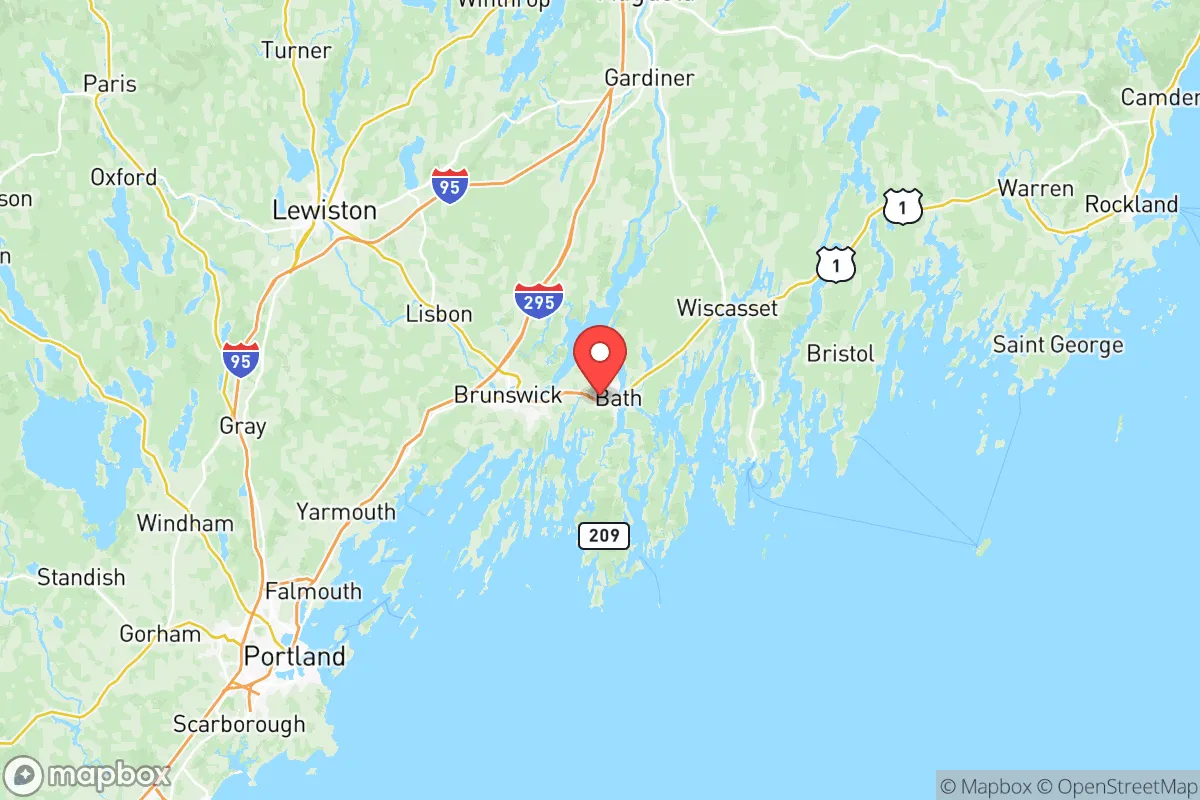
Sagadahoc County, Maine, presents a compelling case for the relocation-minded reader prioritizing resilience and strategic positioning. Its location along the central Maine coast offers a rare combination of access to marine resources, a moderate climate relative to inland areas, and a low population density that avoids the congestion and vulnerabilities of larger urban centers. The county's seat, Bath, is a historic shipbuilding town, while smaller communities like Topsham, Bowdoinham, and Phippsburg provide a range of living environments from riverfront villages to coastal hamlets, all within a reasonable distance from essential services but far enough from major metropolitan fallout zones to offer a meaningful buffer.
Geographic position and natural advantages for long-term stability
Sagadahoc County's geography is defined by the Kennebec River estuary, which cuts through the county and empties into the Atlantic at the Gulf of Maine. This river system provides a natural transportation corridor and a reliable freshwater source, a critical asset for any long-term resilience plan. The county is bordered by Lincoln County to the east and Cumberland County to the south, with the latter containing Portland, Maine's largest city. However, Sagadahoc itself remains predominantly rural and forested, with a 2020 population of just over 35,000 spread across 254 square miles. This low density means that in a crisis, competition for local resources would be far less intense than in suburban or urban areas. The coastline, while exposed to nor'easters, is less hurricane-prone than areas further south, and the region's hardiness zone (5b-6a) supports a growing season long enough for substantial home food production. The presence of the Kennebec River and numerous smaller streams and ponds means that surface water is abundant, and groundwater recharge rates are generally favorable. For a relocator, this translates to a lower baseline risk of drought-induced water scarcity compared to the American West or Southwest.
Risk exposure and proximity to fallout-relevant landmarks
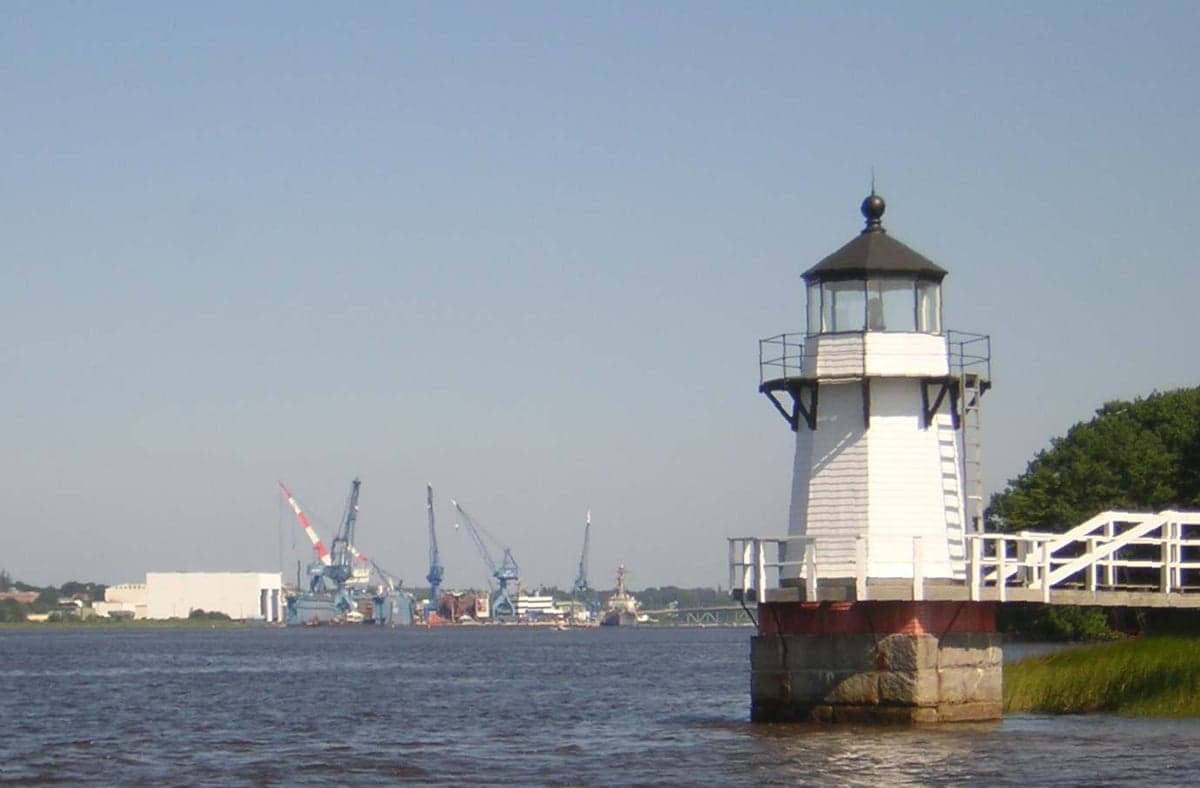
No strategic assessment is complete without a sober look at risks. Sagadahoc County's primary natural threats are winter storms, coastal flooding from storm surge, and the occasional inland flooding from heavy rain or snowmelt. These are manageable with proper preparation—adequate home heating fuel stores, a generator, and a well-drained property. The man-made risk landscape is more nuanced. The most significant fallout-relevant landmark within the county is the Bath Iron Works (BIW), a major U.S. Navy shipyard located on the Kennebec River in Bath. BIW is a critical defense industrial asset, constructing destroyers and other warships. In a conflict scenario, this facility could be a target, though its coastal location and the presence of naval defenses mitigate some risk. For the relocator, living in Bath itself or immediately adjacent areas like Woolwich or West Bath would place you within the potential blast or fallout zone of a precision strike. However, communities further inland, such as Bowdoinham, Bowdoin, or Richmond (just over the line in Kennebec County), are far enough away to be outside the immediate danger area while still being close enough for commuting or supply runs. Other landmarks of note include the Wiscasset Dam on the Sheepscot River (just north in Lincoln County) and the Maine Yankee nuclear decommissioning site in Wiscasset, which is no longer an active reactor but still holds low-level radioactive waste. The decommissioning site is a low-probability, low-consequence risk. More broadly, Sagadahoc's distance from major population centers like Boston (about 150 miles south) and Portland (about 40 miles south) means that a nuclear event or major disaster in those cities would not directly threaten the county, though it could trigger an influx of evacuees. The county's position on the coast also means it is not downwind of any major industrial corridors like those in the Ohio River Valley or the Gulf Coast.
Practical resilience for a relocator: food, water, energy, and defensibility
For the individual or family seeking self-sufficiency, Sagadahoc County offers a strong foundation. Food security is bolstered by the county's agricultural heritage. The fertile river valleys of the Kennebec and its tributaries support small farms, orchards, and community gardens. Farmers' markets in Bath and Topsham operate seasonally, and the region's coastal waters provide access to shellfish, lobster, and finfish. A relocator with land can easily establish a substantial vegetable garden, and the local extension service (University of Maine Cooperative Extension) offers resources for home food preservation. Water security is excellent: most rural properties rely on private wells, and the water table is generally high. For those on town water, the Bath Water District and other municipal systems draw from the Kennebec River, a large and reliable source. Energy resilience is a mixed picture. The county is served by Central Maine Power, and grid reliability is average for rural Maine—outages from winter storms are common but usually short-lived. Wood heat is a practical and widely used backup, with abundant firewood available from local forests. Solar potential is moderate; Maine's northern latitude means shorter winter days, but net metering policies are favorable. For defensibility, the county's geography offers natural advantages. The Kennebec River forms a natural barrier to the east, and the many inlets, marshes, and forested areas create chokepoints and limited road access. The primary evacuation routes are U.S. Route 1 (coastal) and Interstate 295 (running from Topsham south to Portland), which could become congested in a crisis. However, the county's low population density and numerous back roads provide alternative movement options for those familiar with the terrain. The local population is generally self-reliant and community-oriented, with a strong tradition of mutual aid, particularly in the smaller towns. The presence of the Bath Iron Works also means a skilled workforce with mechanical and engineering capabilities, which could be invaluable in a prolonged emergency.
The overall strategic picture for Sagadahoc County is one of balanced resilience. It is not a remote wilderness bunker, nor is it a vulnerable urban center. It occupies a middle ground that is attractive for the thoughtful relocator: close enough to essential infrastructure (hospitals in Bath and Brunswick, supply chains via Portland) to be practical, yet far enough from major threats to offer a genuine safety margin. The county's greatest strengths are its abundant freshwater, productive soils, and a population that is accustomed to self-reliance. Its greatest vulnerabilities are its coastal exposure to storms and the presence of a high-value military target in Bath. For a family or individual willing to choose a home a few miles inland—say, in Bowdoinham or Bowdoin—and to invest in basic preparedness (a wood stove, a well, a garden, and a week's worth of stored supplies), Sagadahoc County offers a defensible, sustainable, and livable base for the long term. It is a place where resilience is not an abstract concept but a practical, everyday reality.

* Values derived from national, state, county, city and local statistics and may differ in a specific area. Last updated: 2026-06-27T01:59:07.000Z
Narrative content on this page is AI-generated and may contain mistakes. Verify any details that matter before acting on them.
ReloMaps may earn a commission from affiliate links at no extra cost to you.

