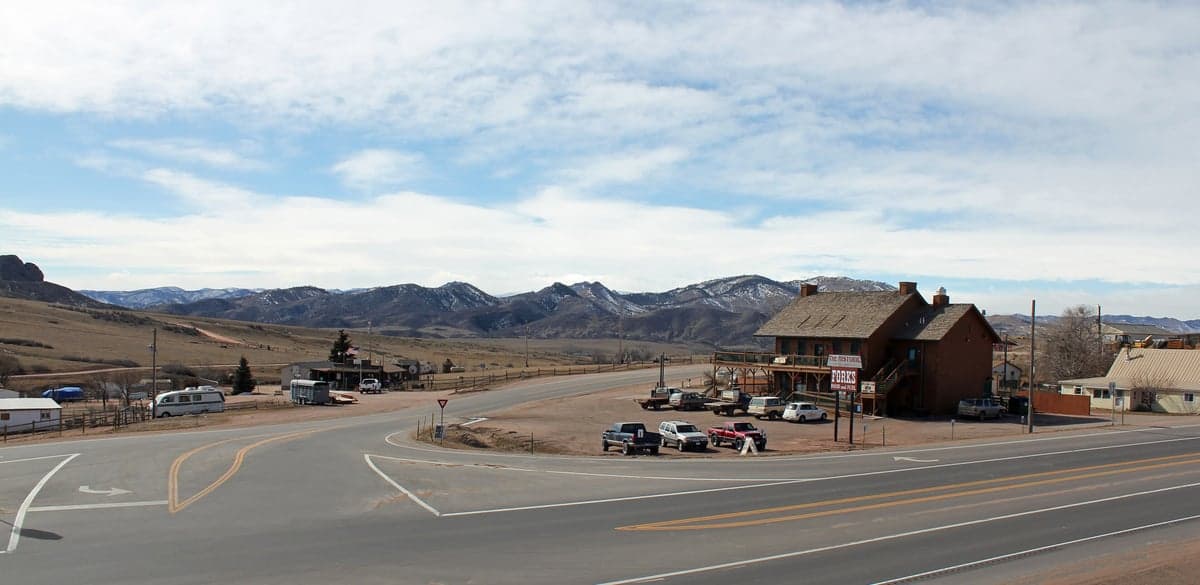
Photo: Wikipedia
Strategic Assessment of Livermore, CO
Strong survivability profile. Good buffer from population centers, with manageable environmental and tactical risks.
What does the Strategic Assessment tell us?
Our Strategic Assessment grades tactical survivability of an area. Major population centers, military targets, fallout zones, natural disasters, and border exposure all drive risk — lower exposure means a more defensible position in a crisis.
This is heavily inspired by Joel Skousen's Strategic Relocation book. Highly recommended you checkout the book ($)What does this tell us?
Our Strategic Assessment grades tactical survivability of an area. Major population centers, military targets, fallout zones, natural disasters, and border exposure all drive risk — lower exposure means a more defensible position in a crisis.
This is heavily inspired by Joel Skousen's Strategic Relocation book. Highly recommended you checkout the book ($)Strategic Pillars

Key Distances
Regional Safe Places
Below is our recommended "safe zones" in Colorado and the surrounding area based on our strategic heuristics. For most people, it's unrealistic to live in a “safe zone” full-time due to work, family or other personal reasons. They tend to be more rural. However, many of these areas are perfect for second homes and retreat properties that double as a vacation home or even a short-term rental.
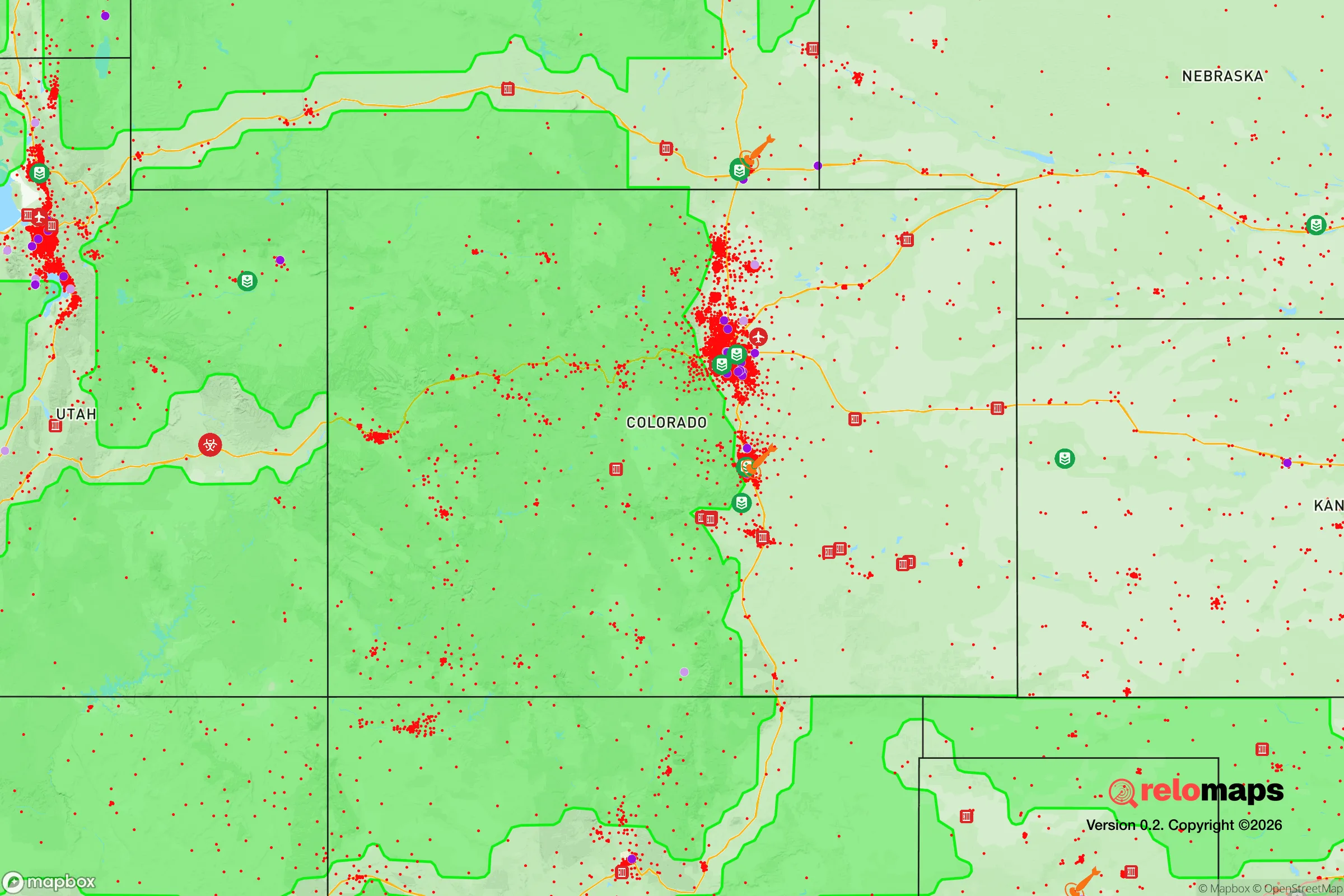
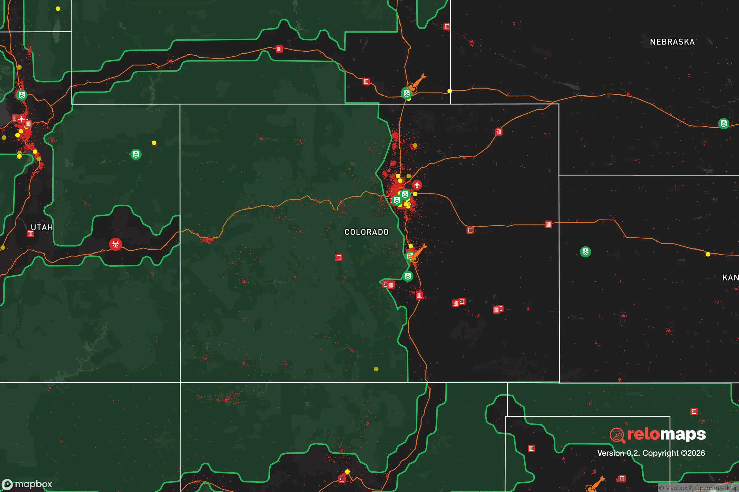


Important Note: For informational purposes only. This does not mean nothing bad ever happens in the green zones. Please use common sense. This is based on public data and modeled with AI. We tried to take a conservative approach but mistakes happen. We update this regularly as new information becomes available.
Solar Generator Recommendations
Backup power matters more here than in safer locations. We've picked three solar generators across budgets and capacity tiers — start with the budget unit if you only need a few essentials, or step up if you want to run a fridge and HVAC for days at a time.

Jackery Portable Power Station Explorer 300
Budget OptionPower on the Go: Weighing only 11 lbs, it's convenient to set up and store with book-sized foldable solar panels

BLUETTI Portable Power Station AC180
Designed for both indoor and outdoor scenarios, AC180 is highly capable as it has a robost capacity and continuous output power.

EF ECOFLOW DELTA Pro Ultra Power Station
Upgraded PickEcoFlow DELTA Pro Ultra is a whole-home energy system designed to grow with your family. Integrated with the Smart Home Panel 2, it scales to meet your evolving energy needs — keeping your home powered, intelligent, and secure through every stage of life.
We earn a commission, at no additional cost to you.
Strategic Assessment Analysis
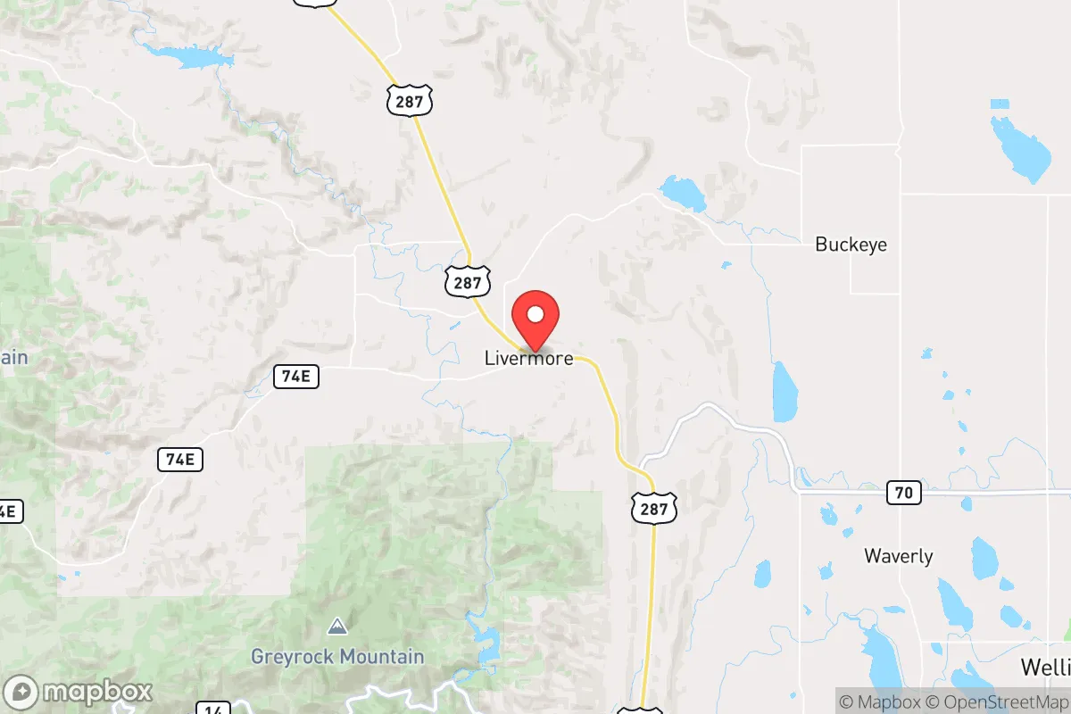
Livermore, Colorado, offers a compelling strategic profile for those prioritizing resilience and self-sufficiency, primarily due to its extreme geographic isolation combined with proximity to the critical infrastructure of the Front Range. Located in Larimer County, roughly 30 miles northwest of Fort Collins, this unincorporated community sits in a high mountain valley at approximately 7,000 feet, buffered by the Medicine Bow Mountains and Roosevelt National Forest. For a relocator serious about disaster readiness, Livermore provides a rare combination: deep rural seclusion within a two-hour drive of a major metropolitan hub (Denver), yet far enough removed to avoid the immediate fallout zones and congestion patterns that would cripple suburban escape routes. The area's low population density—fewer than 2,000 residents spread across a vast, rugged landscape—means that in a crisis, competition for local resources would be minimal compared to denser mountain towns like Estes Park or Fort Collins itself.
Geographic position and natural advantages for long-term survival
Livermore's primary strategic asset is its position in a high-altitude basin that is naturally defensible and resource-rich. The area is ringed by the Laramie River to the west and the Cache la Poudre River to the south, providing reliable surface water sources that are less likely to be contaminated by upstream industrial activity than Front Range waterways. The surrounding national forest offers a massive buffer zone—over 800,000 acres of public land that would serve as a de facto wilderness redoubt, rich in game (elk, mule deer, turkey) and timber for fuel and construction. The local geography features numerous natural choke points: the only paved access routes are via Red Feather Lakes Road (Larimer County Road 74E) from the south and a handful of gravel Forest Service roads from the west and north. This makes the area highly defensible against both human threats and the uncontrolled spread of wildfire, as responders can effectively seal off the valley. The elevation also provides a natural advantage against electromagnetic pulse (EMP) effects, as the thinner atmosphere and rocky terrain reduce the coupling of high-altitude electromagnetic fields into local power grids, though this is a marginal benefit compared to the isolation itself.
Risks, exposures, and proximity to fallout-relevant landmarks
No strategic assessment is complete without acknowledging Livermore's vulnerabilities, and the primary risk is wildfire. The 2020 Cameron Peak Fire, the largest in Colorado history, burned over 208,000 acres and came within miles of Livermore, forcing evacuations and demonstrating that even this remote valley is not immune to catastrophic fire. The area's heavy pine and juniper forests, combined with periodic drought and high winds, create a genuine annual threat. However, the valley's open meadows and irrigated hay fields do provide natural firebreaks that denser forest communities lack. On the man-made risk side, Livermore's distance from major targets is a significant advantage. The nearest likely nuclear or industrial targets are the Front Range urban corridor (Denver, Colorado Springs, Cheyenne) and the U.S. Strategic Command facilities near Cheyenne, all over 100 miles away. Prevailing westerly winds would carry fallout from a Denver-area detonation eastward, away from Livermore. The community is also far from major rail lines, interstate highways, and chemical storage facilities. The most proximate risk is the Cache la Poudre River corridor, which hosts a natural gas pipeline and a major water diversion tunnel (the Colorado-Big Thompson Project), but these are low-yield targets compared to the missile silos and NORAD facilities further south. For a relocator, the key takeaway is that Livermore sits in a "low-value" zone from a targeting perspective, while still being within a day's drive of medical and logistical support in Fort Collins.
Practical resilience for a relocator: food, water, energy, and defensibility
For a family or individual serious about self-sufficiency, Livermore offers a workable baseline but requires significant upfront investment. Water is the strongest asset: the area sits atop the Laramie River aquifer, and most properties have access to shallow wells (typically 50-150 feet) with excellent yields. Surface water from the Laramie and Poudre rivers is also accessible with proper rights, though Colorado water law is complex and senior water rights are expensive. For off-grid energy, Livermore's 300+ days of sunshine per year make solar photovoltaic systems highly viable, and the area's frequent winds (average 12-15 mph) support small wind turbines as a complement. However, winter snow cover can reduce solar output for weeks at a time, so a hybrid system with propane or diesel backup is essential. The local soil is thin and rocky, making large-scale agriculture difficult; most residents rely on greenhouses and raised beds for vegetables, with hay and livestock (cattle, goats) being the primary agricultural products. The growing season is short (roughly 90 days between last and first frost), so cold-hardy crops and season extension techniques are necessary. Defensibility is excellent: the valley's single paved access road is easily monitored, and the dispersed settlement pattern means neighbors are far enough apart to avoid cascading resource conflicts but close enough for mutual aid. The nearest full-service grocery and hardware store is in Fort Collins (45 minutes), so bulk purchasing and deep pantry storage are non-negotiable. Medical care is limited to a small clinic in Red Feather Lakes (15 minutes) and a hospital in Fort Collins, so advanced first aid training and a comprehensive medical kit are strongly recommended.
The overall strategic picture for Livermore is that of a high-altitude redoubt with genuine natural advantages—abundant water, defensible terrain, and extreme isolation from major targets—offset by a harsh climate and wildfire risk that demands serious preparation. For the conservative-leaning relocator who values self-reliance, limited government interference, and a community of like-minded individuals (the area is heavily libertarian and Second Amendment-friendly), Livermore represents one of the better options in the contiguous United States. It is not a bug-out location for the unprepared; it is a long-term homesteading environment that rewards those who arrive with skills, supplies, and a realistic understanding of mountain living. The key trade-off is between security and convenience: Livermore offers genuine strategic depth, but at the cost of a short growing season, heavy winter snow, and a 90-minute round trip for a gallon of milk. For those willing to make that trade, the valley provides a foundation for resilience that few other locations in the lower 48 can match.

* Values derived from national, state, county, city and local statistics and may differ in a specific area. Last updated: 2026-10-21T19:15:22.000Z
Narrative content on this page is AI-generated and may contain mistakes. Verify any details that matter before acting on them.
ReloMaps may earn a commission from affiliate links at no extra cost to you.

