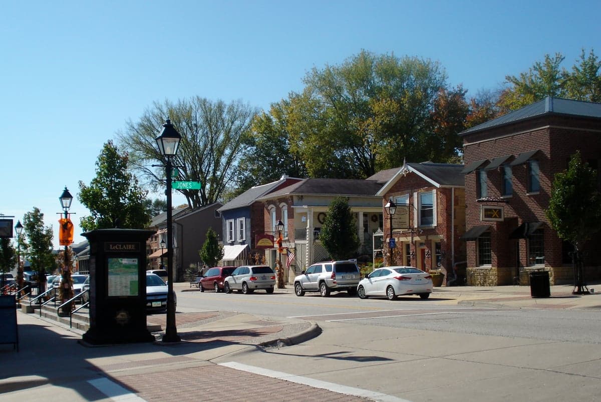
Photo: Wikipedia
Strategic Assessment of Le Claire, IA
Meaningful friction. Expect exposure to either population pressure, blast zones, or natural disaster risk. Consider buying a retreat property.
What does the Strategic Assessment tell us?
Our Strategic Assessment grades tactical survivability of an area. Major population centers, military targets, fallout zones, natural disasters, and border exposure all drive risk — lower exposure means a more defensible position in a crisis.
This is heavily inspired by Joel Skousen's Strategic Relocation book. Highly recommended you checkout the book ($)What does this tell us?
Our Strategic Assessment grades tactical survivability of an area. Major population centers, military targets, fallout zones, natural disasters, and border exposure all drive risk — lower exposure means a more defensible position in a crisis.
This is heavily inspired by Joel Skousen's Strategic Relocation book. Highly recommended you checkout the book ($)Strategic Pillars

Key Distances
Regional Safe Places
Below is our recommended "safe zones" in Iowa and the surrounding area based on our strategic heuristics. For most people, it's unrealistic to live in a “safe zone” full-time due to work, family or other personal reasons. They tend to be more rural. However, many of these areas are perfect for second homes and retreat properties that double as a vacation home or even a short-term rental.
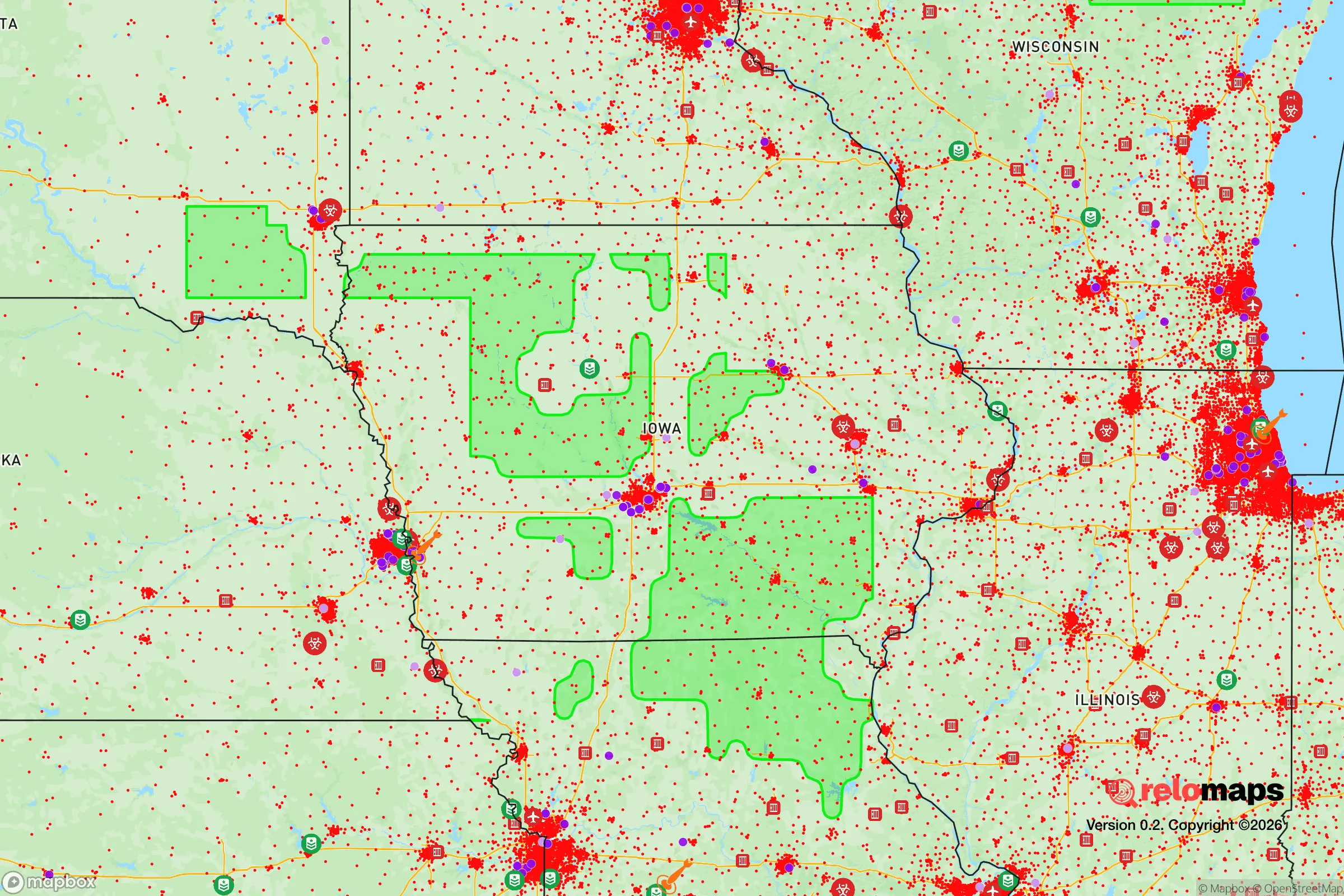
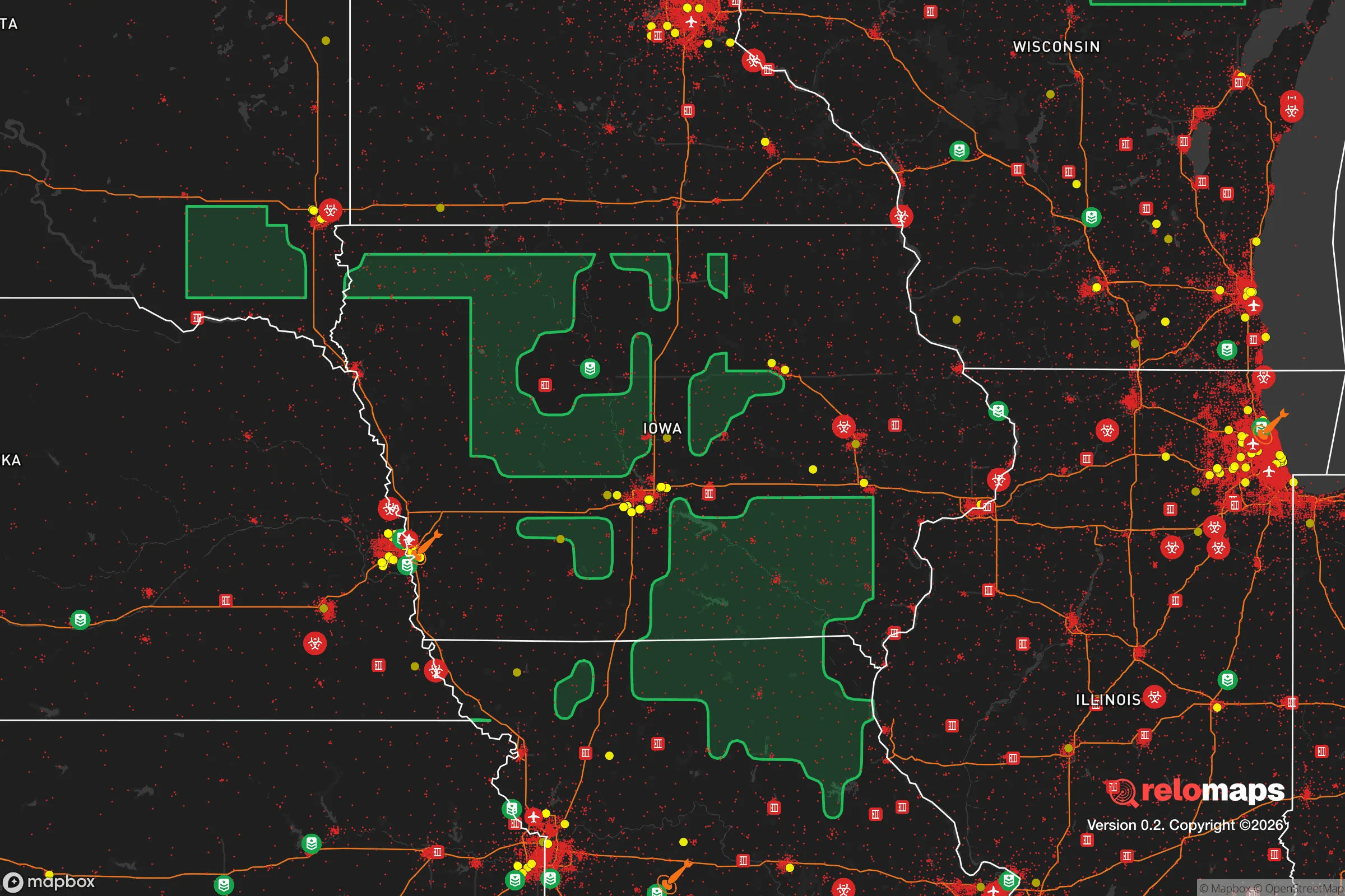


Important Note: For informational purposes only. This does not mean nothing bad ever happens in the green zones. Please use common sense. This is based on public data and modeled with AI. We tried to take a conservative approach but mistakes happen. We update this regularly as new information becomes available.
Solar Generator Recommendations
Backup power matters more here than in safer locations. We've picked three solar generators across budgets and capacity tiers — start with the budget unit if you only need a few essentials, or step up if you want to run a fridge and HVAC for days at a time.

Jackery Portable Power Station Explorer 300
Budget OptionPower on the Go: Weighing only 11 lbs, it's convenient to set up and store with book-sized foldable solar panels

BLUETTI Portable Power Station AC180
Designed for both indoor and outdoor scenarios, AC180 is highly capable as it has a robost capacity and continuous output power.

EF ECOFLOW DELTA Pro Ultra Power Station
Upgraded PickEcoFlow DELTA Pro Ultra is a whole-home energy system designed to grow with your family. Integrated with the Smart Home Panel 2, it scales to meet your evolving energy needs — keeping your home powered, intelligent, and secure through every stage of life.
We earn a commission, at no additional cost to you.
Strategic Assessment Analysis
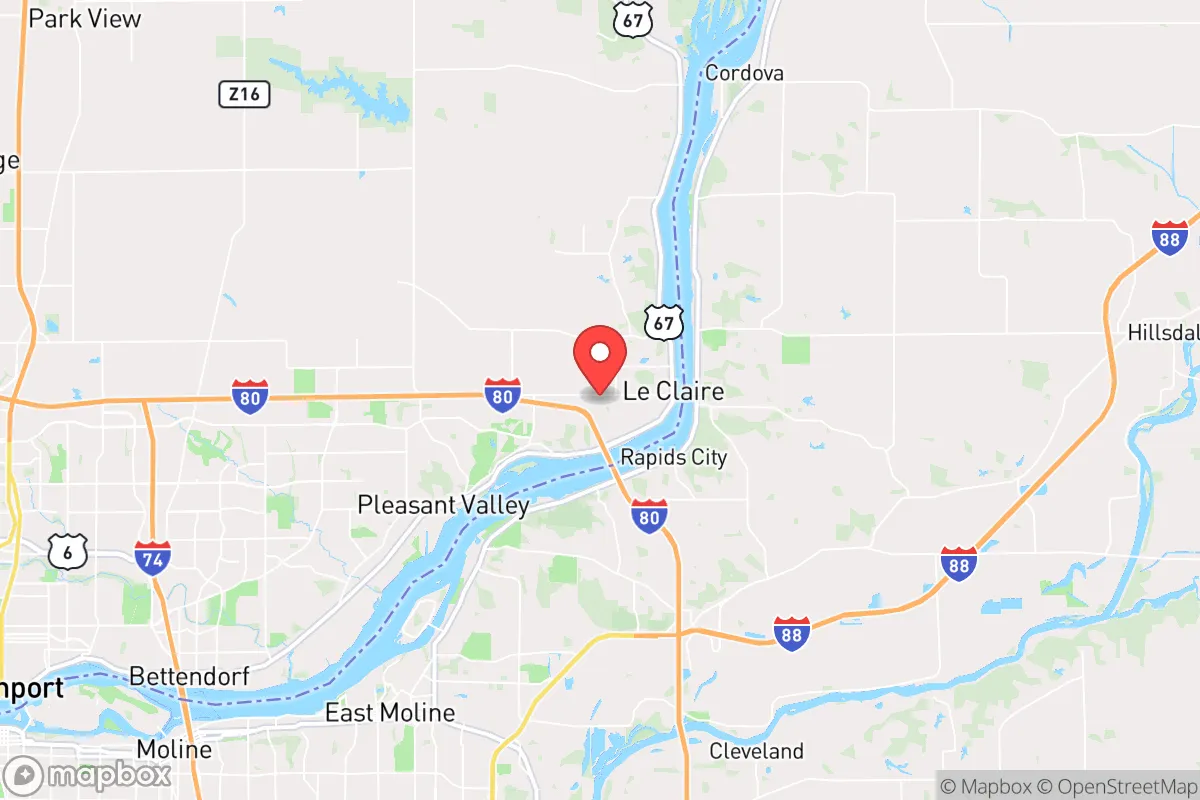
Le Claire, Iowa, occupies a strategic position along the Mississippi River that offers a blend of natural defensibility and access to critical resources, but its proximity to major urban and industrial targets introduces significant risk for those prioritizing disaster readiness and self-sufficiency. The town’s location roughly 10 miles north of the Quad Cities—a metropolitan area of nearly 400,000 people—places it within the fallout and secondary-effect zone of a potential nuclear or industrial incident, while its riverfront setting provides both a reliable water source and a natural barrier against certain threats. For a relocator weighing resilience, Le Claire presents a mixed picture: strong local food and water potential, moderate defensibility, and a serious exposure to man-made hazards that demand a clear-eyed plan.
Geographic position and natural advantages for self-sufficiency
Le Claire sits on a bluff-lined stretch of the Mississippi River, giving it a topographical advantage over flood-prone lowlands while still offering direct access to the continent’s largest freshwater system. The river serves as a year-round water source, a transportation corridor for bulk goods, and a natural barrier that complicates approach from the east. The surrounding Scott County landscape is a mix of working farmland, wooded bluffs, and river bottoms, providing multiple options for local food production, foraging, and timber. The area’s agricultural base is substantial—Iowa is the nation’s top corn and soybean producer—and within a 20-mile radius of Le Claire, you’ll find grain elevators, livestock operations, and small-scale vegetable farms that could support a localized food network in a crisis. The climate is temperate, with a growing season of roughly 160 days, sufficient for home gardens and small orchards. Groundwater is generally accessible via private wells in rural parts of the county, though the town itself relies on municipal supply drawn from the Mississippi. For a relocator, the key natural advantage is the combination of a massive, reliable surface water source and fertile soil within walking or short-driving distance of most homes.
Risks, exposures, and proximity to fallout-relevant landmarks
The most serious risk for Le Claire is its proximity to the Quad Cities, which includes the Rock Island Arsenal—a major U.S. Army manufacturing and logistics center that produces small arms, artillery, and vehicle components. The Arsenal is a high-value target in any conflict scenario, and its location just 10 miles south of Le Claire means the town sits well within the dangerous fallout plume zone for a ground burst or air burst targeting that facility. Additionally, the Quad Cities are home to two nuclear power plants: the Quad Cities Generating Station (a boiling water reactor) in Cordova, Illinois, directly across the river, and the Clinton Power Station about 50 miles east. A conventional or terrorist attack on either plant could release radioactive material, and prevailing winds from the west would push contamination toward Le Claire. The Mississippi River itself is a chokepoint for barge traffic carrying chemicals, fertilizers, and petroleum products; a major spill or fire on the river could disrupt water supply and force evacuation. Flooding is a recurring natural hazard—the Mississippi reached major flood stage in 2019, 2023, and 2024—but the town’s bluff-side neighborhoods are largely above the 500-year floodplain. Tornado risk is moderate; Scott County averages 3-5 tornado warnings per year, with a direct hit being a low-probability but high-consequence event. For a relocator, the man-made risks—especially the Arsenal and nuclear plants—are the dominant concern, and any resilience plan must account for the possibility of rapid evacuation or extended shelter-in-place during a radiological event.
Practical resilience for a relocator: food, water, energy, and defensibility
Le Claire offers a workable baseline for practical self-sufficiency, but it requires deliberate investment. Water is the strongest asset: the Mississippi is a near-limitless source, but it requires filtration and treatment for safe consumption. A household with a Berkey or similar gravity filter, plus a supply of purification tablets, can draw directly from the river in a pinch. For long-term security, a drilled well on a rural property is the gold standard—depths in Scott County typically range from 60 to 150 feet, with yields of 10-20 gallons per minute. Food is also favorable: the surrounding farmland means that even in a supply-chain disruption, local producers and farmers’ markets (like the Le Claire Farmers Market, active May-October) can provide fresh produce, eggs, and meat. The town’s location on the river also supports fishing for catfish, walleye, and bass, though mercury advisories are in effect for some species. Home gardening is viable, with loamy soil and adequate rainfall (about 36 inches annually). Energy is a weak point: the grid is served by MidAmerican Energy, which relies on a mix of coal, natural gas, and wind. Outages from storms or grid strain are common—the 2020 derecho knocked out power for 5-7 days in parts of Scott County. Solar is feasible, with about 200 sunny days per year, but battery storage is essential for nighttime and cloudy periods. Propane and wood are the most reliable backup heating options; firewood is abundant in the wooded bluffs. Defensibility is moderate: the town’s layout along the river and bluffs creates natural chokepoints on the main roads (U.S. 67 and I-80), but the population density (roughly 1,200 residents) means a determined group could secure a neighborhood perimeter. The local police department is small (about 6 officers), so security in a prolonged crisis would fall to residents. The nearest hospital is Genesis Medical Center in Davenport, 12 miles south—a 15-minute drive under normal conditions, but potentially compromised in a disaster. For a relocator, the practical takeaway is that Le Claire provides a solid foundation for water and food self-sufficiency, but energy independence and medical access require upfront planning and investment.
The overall strategic picture for Le Claire is one of calculated trade-offs. Its natural advantages—the Mississippi River, fertile farmland, and bluff-top defensibility—are genuine assets for a self-sufficient lifestyle. But the town’s location within the shadow of the Quad Cities and its nuclear and military infrastructure means that a relocator must treat it as a high-risk, high-reward position. If you can accept the need for a robust evacuation plan (e.g., a pre-planned route east into rural Illinois or north toward Dubuque) and invest in independent water, power, and food systems, Le Claire offers a livable base with strong local resources. For those unwilling to tolerate the proximity to fallout-relevant targets, a more remote location in central or western Iowa would be a safer bet. But for a prepared individual or family who understands the risks and plans accordingly, Le Claire’s combination of river access and agricultural abundance makes it a defensible, resilient choice in the upper Midwest.

* Values derived from national, state, county, city and local statistics and may differ in a specific area. Last updated: 2026-09-05T14:18:40.000Z
Narrative content on this page is AI-generated and may contain mistakes. Verify any details that matter before acting on them.
ReloMaps may earn a commission from affiliate links at no extra cost to you.

