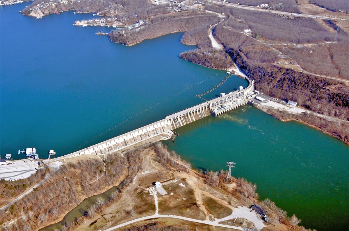
Photo: Wikipedia
Strategic Assessment of Lake Ozark, MO
Workable tactical position. Some exposure to population density or targets, but generally defensible in a crisis.
What does the Strategic Assessment tell us?
Our Strategic Assessment grades tactical survivability of an area. Major population centers, military targets, fallout zones, natural disasters, and border exposure all drive risk — lower exposure means a more defensible position in a crisis.
This is heavily inspired by Joel Skousen's Strategic Relocation book. Highly recommended you checkout the book ($)What does this tell us?
Our Strategic Assessment grades tactical survivability of an area. Major population centers, military targets, fallout zones, natural disasters, and border exposure all drive risk — lower exposure means a more defensible position in a crisis.
This is heavily inspired by Joel Skousen's Strategic Relocation book. Highly recommended you checkout the book ($)Strategic Pillars

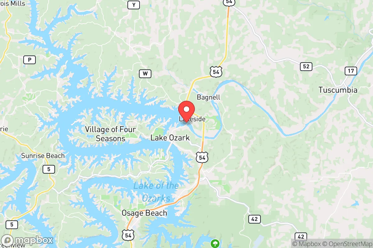
Key Distances
Regional Safe Places
Below is our recommended "safe zones" in Missouri and the surrounding area based on our strategic heuristics. For most people, it's unrealistic to live in a “safe zone” full-time due to work, family or other personal reasons. They tend to be more rural. However, many of these areas are perfect for second homes and retreat properties that double as a vacation home or even a short-term rental.


Important Note: For informational purposes only. This does not mean nothing bad ever happens in the green zones. Please use common sense. This is based on public data and modeled with AI. We tried to take a conservative approach but mistakes happen. We update this regularly as new information becomes available.
Solar Generator Recommendations
Backup power matters more here than in safer locations. We've picked three solar generators across budgets and capacity tiers — start with the budget unit if you only need a few essentials, or step up if you want to run a fridge and HVAC for days at a time.
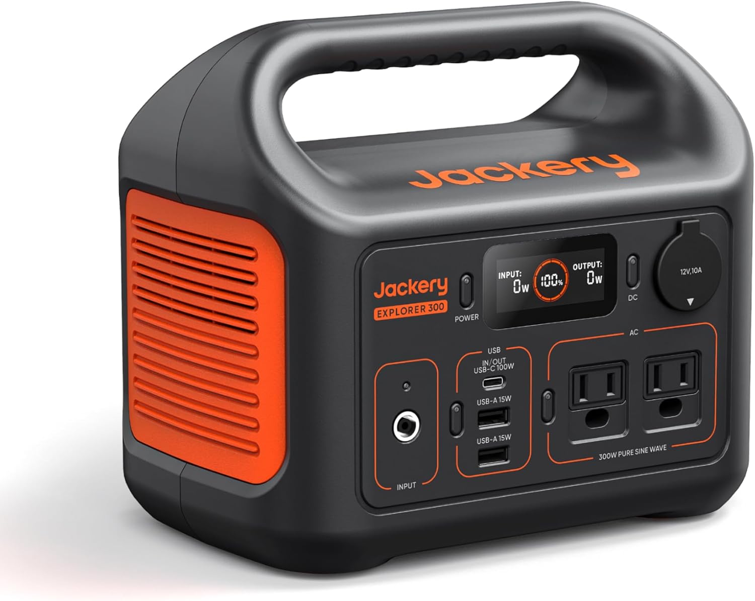
Jackery Portable Power Station Explorer 300
Budget OptionPower on the Go: Weighing only 11 lbs, it's convenient to set up and store with book-sized foldable solar panels

BLUETTI Portable Power Station AC180
Designed for both indoor and outdoor scenarios, AC180 is highly capable as it has a robost capacity and continuous output power.

EF ECOFLOW DELTA Pro Ultra Power Station
Upgraded PickEcoFlow DELTA Pro Ultra is a whole-home energy system designed to grow with your family. Integrated with the Smart Home Panel 2, it scales to meet your evolving energy needs — keeping your home powered, intelligent, and secure through every stage of life.
We earn a commission, at no additional cost to you.
Strategic Assessment Analysis
Lake Ozark sits at the 20-mile mark of the Lake of the Ozarks, the serpentine reservoir impounded by Bagnell Dam in 1931, and that position gives it a genuine resilience profile: abundant fresh water, low population density relative to the Missouri and Mississippi metros, and a location roughly 170 miles from both St. Louis and Kansas City — far enough to avoid immediate fallout from a strike on either, close enough to be reachable. The trade-offs are real, though: the area's economy is tourism-dependent, its infrastructure is seasonal and storm-exposed, and its main highway corridor is a single point of failure. Here's how the pieces stack up for someone thinking seriously about preparedness.
Geographic position and natural advantages of the Lake of the Ozarks area
The Lake of the Ozarks is one of the largest man-made reservoirs in the United States — roughly 1,150 miles of shoreline and about 55,000 surface acres of water — and Lake Ozark sits near the dam end, where the lake is deepest and the water supply most reliable. The surrounding terrain is the northern Ozarks: rolling hardwood ridges, karst limestone, and plenty of springs and wells. That means a relocator has access to surface water, groundwater, and rainfall in a region that averages around 43 inches of precipitation a year, which is a meaningful advantage over the arid West.
Population is another factor. Miller County, which contains most of the Lake Ozark area, runs roughly 25,000–26,000 residents across about 600 square miles — density in the low 40s per square mile, a fraction of St. Louis County's roughly 2,000. The nearest interstate is U.S. 54, which runs east–west through the region; U.S. 54 connects to I-70 at Kingdom City and to I-44 near Camdenton, giving two metro escape routes without living on top of either. The region is also outside the primary target sets — no major military installations, no strategic ports, no dense industrial corridors. Whiteman Air Force Base near Knob Noster, home to the B-2 fleet, is roughly 90 miles northwest, which is close enough to matter in a strategic exchange but far enough that Lake Ozark isn't in the immediate footprint.
Risks, exposures, and proximity to fallout-relevant landmarks
The most concrete man-made risk is the dam itself. Bagnell Dam holds back the reservoir, and while it's a concrete gravity structure that has performed through major floods, a failure scenario — whether from seismic activity on the New Madrid fault (about 150 miles southeast) or sabotage — would put the Osage River valley at risk. Lake Ozark sits downstream-adjacent, so this is a real consideration, not a theoretical one. The New Madrid seismic zone itself is the region's most cited natural hazard; the 1811–12 earthquakes were felt across the Midwest, and modern building codes in the area are not uniformly seismic-hardened.
On the fallout question: the nearest large population centers are Springfield (about 90 miles southwest), Columbia (about 90 miles north), and Jefferson City (about 60 miles north). Jefferson City is the state capital and a state-government target; Columbia hosts the University of Missouri; St. Louis and Kansas City are the major metros. None of these are primary strategic targets in most public assessments, but a relocator should understand that Lake Ozark is within a few hours' drive of several secondary nodes. The bigger practical exposure is severe weather: the Ozarks see tornadoes, ice storms, and flash flooding, and the lake's shoreline development means storm surge and debris are real concerns. Wildfire risk is lower than in the West but not zero on the wooded ridges.
Practical resilience for a relocator: food, water, energy, and defensibility
Water is the area's strongest card. The lake itself, plus wells and springs, means a household with a hand pump or a gravity-fed system can maintain supply without municipal dependence. Lake Ozark's municipal water system serves the town, but rural parcels in Miller County commonly rely on private wells — a plus for self-sufficiency, provided the well is tested and the pump has a backup power source.
Food is more mixed. The region has a strong agricultural base — cattle, poultry, and row crops — and farmers' markets in Eldon, Osage Beach, and Camdenton operate seasonally. But the local grocery infrastructure is oriented toward tourism, and a serious disruption would strain supply chains that run through Springfield and Jefferson City. A household serious about food security should plan on a garden, a chest freezer with backup power, and a stored pantry; the growing season runs roughly April through October, with a last frost around mid-April.
Energy is the weak point. The area is served by Ameren Missouri and local cooperatives, and the grid is exposed to ice storms and tornado damage. Solar potential is decent — around 4.5–5 peak sun hours daily — but winter ice and summer storms mean a generator, battery bank, or both are worth the investment. Propane is common in rural Miller County, which helps for heating and cooking.
Defensibility is a matter of layout. Lake Ozark's geography — ridges, coves, and a single main highway — means access is naturally constrained, which cuts both ways: it slows intruders but also complicates evacuation. A rural parcel with a long driveway, clear sightlines, and a well and septic system is the practical target for a preparedness-minded buyer. The trade-off is that the lake's tourism economy means seasonal population swings and a lot of short-term rentals, which affects neighbor reliability.
Overall strategic picture for a preparedness-minded relocator
Lake Ozark is a solid but not exceptional resilience play. It scores well on water, low density, distance from primary targets, and agricultural surroundings; it scores poorly on grid reliability, dam-adjacent risk, and a tourism-dependent economy that isn't built for disruption. For a family or single person prioritizing self-sufficiency, the right move is a rural Miller County parcel with a well, septic, propane, and a backup power plan — not a lakefront condo. The area rewards preparation rather than promising it, which is a reasonable trade for someone willing to do the work.

* Values derived from national, state, county, city and local statistics and may differ in a specific area. Last updated: 2026-11-03T04:17:38.000Z
Narrative content on this page is AI-generated and may contain mistakes. Verify any details that matter before acting on them.
ReloMaps may earn a commission from affiliate links at no extra cost to you.

