Photo: Wikipedia
Strategic Assessment of Simpson County
Workable tactical position. Some exposure to population density or targets, but generally defensible in a crisis.
What does the Strategic Assessment tell us?
Our Strategic Assessment grades tactical survivability of an area. Major population centers, military targets, fallout zones, natural disasters, and border exposure all drive risk — lower exposure means a more defensible position in a crisis.
This is heavily inspired by Joel Skousen's Strategic Relocation book. Highly recommended you checkout the book ($)What does this tell us?
Our Strategic Assessment grades tactical survivability of an area. Major population centers, military targets, fallout zones, natural disasters, and border exposure all drive risk — lower exposure means a more defensible position in a crisis.
This is heavily inspired by Joel Skousen's Strategic Relocation book. Highly recommended you checkout the book ($)Strategic Pillars

Key Distances
Strategic Assessment Analysis
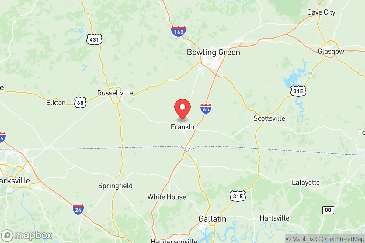
Simpson County, Kentucky, anchored by the city of Franklin, presents a compelling case for relocation-minded individuals and families who prioritize strategic depth and resilience over proximity to urban chaos. Its position roughly 70 miles north of Nashville, Tennessee, and 120 miles south of Louisville places it within a practical buffer zone—close enough to access major medical and supply hubs, yet far enough to avoid the immediate blast and fallout risks associated with those metropolitan centers. The county’s agricultural foundation, modest population density (around 20,000 residents), and lack of high-value military or industrial targets give it a baseline resilience that many more suburban or exurban counties lack.
Geographic position and natural advantages for long-term stability
Simpson County sits in the Pennyroyal Plateau region of south-central Kentucky, a landscape characterized by rolling hills, limestone bedrock, and fertile river valleys. The county is drained by the West Fork of the Drakes Creek and the Barren River, both of which feed into the larger Green River system. This topography offers several natural advantages: the limestone geology provides excellent groundwater filtration and storage, making well water a viable and relatively reliable option for those seeking off-grid water security. The rolling hills also offer natural defensibility—elevated ridgelines provide vantage points over the surrounding farmland, while the numerous hollows and creek bottoms create natural chokepoints and concealment. The county’s position in the Ohio River Valley’s southern tier means it avoids the worst of the lake-effect snow bands that plague areas farther north, while still receiving adequate rainfall (roughly 50 inches annually) to support rain-fed agriculture. The growing season averages 190 days, long enough for corn, soybeans, and tobacco—the county’s traditional cash crops—as well as a wide variety of garden vegetables. For a relocator thinking about food sovereignty, this is a significant plus.
Risk exposure and proximity to fallout-relevant landmarks
Simpson County’s primary risk exposure comes not from direct targeting but from its position relative to higher-value assets. The most significant nearby landmark is Fort Campbell, the U.S. Army base straddling the Kentucky-Tennessee line roughly 45 miles to the west. Home to the 101st Airborne Division, Fort Campbell is a high-priority target in any major conflict scenario. A ground burst at the base would generate fallout that, depending on wind direction, could drift eastward across Simpson County within 4-6 hours. Similarly, Nashville—70 miles south—contains multiple potential targets: the Tennessee Valley Authority’s Cumberland Fossil Plant, the Nashville International Airport, and the city’s role as a regional transportation and logistics hub. A surface burst on Nashville would produce a fallout plume that could reach Simpson County in 6-8 hours under prevailing southwesterly winds. On the plus side, the county itself contains no major military installations, no refineries, no nuclear power plants, and no major ports. The nearest nuclear facility is the Tennessee Valley Authority’s Browns Ferry Nuclear Plant near Athens, Alabama, roughly 130 miles south—far enough to be a secondary concern. The county’s lack of strategic value means it is unlikely to be a direct target, but its position downwind of two major target zones (Fort Campbell and Nashville) means fallout preparedness is a legitimate consideration. The Bowling Green area, just 20 miles north, hosts a General Motors assembly plant and a regional medical center, but neither rises to the level of a primary strategic target.
Practical resilience for a relocator: food, water, energy, and defensibility
For a relocator serious about self-sufficiency, Simpson County offers a strong foundation. Water security is the county’s standout advantage. The limestone karst aquifer system provides abundant groundwater, and many rural properties already have functioning wells. The Barren River and its tributaries offer surface water backup, though treatment would be necessary. The county’s average annual rainfall of 50 inches means rainwater catchment is highly viable—a 1,000-square-foot roof can collect roughly 600 gallons per inch of rain. Food production is equally promising. Simpson County has over 600 farms covering roughly 80% of its land area, with a strong tradition of row cropping and livestock. The local agricultural extension service at the University of Kentucky’s Simpson County office provides practical resources for small-scale farming. The Franklin Farmers Market operates seasonally, and the county’s position in the Kentucky-Tennessee border region means access to both states’ agricultural networks. For energy resilience, the county’s rural character means solar is a practical option—most properties have unobstructed southern exposure, and the county’s net metering policy allows grid-tied systems to offset consumption. Wood heating is also viable, given the county’s 40% forest cover, primarily oak-hickory hardwood. Defensibility is moderate. The county’s road network is sparse enough that choke points exist—the major routes are I-65 (running north-south through the county’s eastern edge), US 31W, and KY 100. The rural road network is a mix of paved and gravel, with many dead-end roads and farm lanes that would be difficult for outsiders to navigate. The county seat of Franklin has a population of roughly 10,000, making it a practical hub for supplies and community coordination without the anonymity of a larger city. The Simpson County Sheriff’s Office and Franklin Police Department provide law enforcement coverage, but in a prolonged disruption, community-based security would be the primary defense.
The overall strategic picture for Simpson County is one of moderate-to-strong resilience with a clear vulnerability: its position downwind of Fort Campbell and Nashville. For a relocator who is willing to invest in fallout sheltering (a basement or reinforced safe room) and maintain a 3-6 month supply of food and water, the county’s agricultural base, water abundance, and low target profile make it a solid choice. The county’s conservative lean—Simpson County voted +47 for Donald Trump in 2020—aligns with a cultural emphasis on self-reliance, local governance, and community cohesion. The presence of Western Kentucky University in nearby Bowling Green provides access to educational and medical resources without the density of a major city. For families and individuals who want to be within a day’s drive of Nashville’s medical and logistical infrastructure but far enough to breathe, Simpson County offers a practical middle ground—not a fortress, but a defensible position with the resources to ride out most disruptions. The key is preparation, not paranoia: the county’s natural advantages are real, but they require active investment in water storage, food production, and community relationships to fully realize.

* Values derived from national, state, county, city and local statistics and may differ in a specific area. Last updated: 2026-06-17T07:52:02.000Z
Narrative content on this page is AI-generated and may contain mistakes. Verify any details that matter before acting on them.
ReloMaps may earn a commission from affiliate links at no extra cost to you.

