
Photo: Wikipedia
Strategic Assessment of Franklin County
Workable tactical position. Some exposure to population density or targets, but generally defensible in a crisis.
What does the Strategic Assessment tell us?
Our Strategic Assessment grades tactical survivability of an area. Major population centers, military targets, fallout zones, natural disasters, and border exposure all drive risk — lower exposure means a more defensible position in a crisis.
This is heavily inspired by Joel Skousen's Strategic Relocation book. Highly recommended you checkout the book ($)What does this tell us?
Our Strategic Assessment grades tactical survivability of an area. Major population centers, military targets, fallout zones, natural disasters, and border exposure all drive risk — lower exposure means a more defensible position in a crisis.
This is heavily inspired by Joel Skousen's Strategic Relocation book. Highly recommended you checkout the book ($)Strategic Pillars

Key Distances
Strategic Assessment Analysis
Franklin County, Kentucky, anchored by the state capital of Frankfort, presents a surprisingly strong strategic profile for relocators prioritizing resilience and self-sufficiency. Its position in the Bluegrass region offers a blend of geographic insulation from major metropolitan fallout zones while retaining access to critical infrastructure, making it a viable option for those seeking a balance between rural preparedness and practical connectivity. The county’s economy is anchored by stable state government employment and a growing logistics sector, providing a buffer against the boom-and-bust cycles that plague more industrial areas.
Geographic position and natural advantages for long-term stability
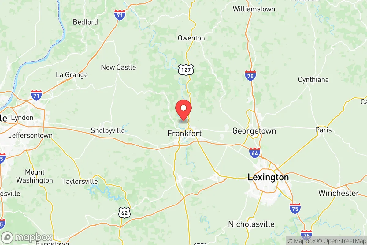
Franklin County sits at the crossroads of I-64 and US-127, roughly 45 miles east of Louisville and 50 miles west of Lexington. This central Kentucky location places it outside the immediate blast and fallout zones of those major cities, while still allowing for supply runs or medical access within an hour. The Kentucky River cuts through the county, providing a reliable surface water source that is less vulnerable to drought than many western states. The surrounding landscape is rolling hills and limestone karst, which offers natural drainage and reduces flood risk compared to river-bottom communities. The area’s agricultural heritage means the soil is productive, and small-scale farming remains viable on parcels of 5-20 acres. For a relocator, this means the potential for supplemental food production is realistic, not theoretical. The county’s elevation, averaging around 600-800 feet, keeps it above the worst of the Ohio River Valley’s floodplains, and the local climate supports a 180-day growing season for staple crops like corn, beans, and squash.
Risks, exposures, and proximity to fallout-relevant landmarks
While Franklin County avoids the worst of urban proximity risks, it is not without strategic vulnerabilities. The most significant nearby target is the Louisville International Airport and the UPS Worldport hub, a major logistics and air freight center that would be a high-priority target in a conflict scenario. Fallout from a strike on that facility could reach Franklin County within hours, depending on wind patterns. Closer to home, the Frankfort Regional Medical Center and the Kentucky State Capitol complex are symbolic targets, though neither is a primary military objective. The county also sits within 100 miles of the Fort Knox gold depository and the Paducah Gaseous Diffusion Plant (a decommissioned uranium enrichment site), both of which carry residual risk from either direct attack or secondary contamination. Natural risks are moderate: the area lies in a seismic zone (the New Madrid Seismic Zone is about 250 miles west), but the primary threat is tornadoes, which occur with regularity in the spring. The county’s hilly terrain actually provides some natural shelter from straight-line winds, but mobile homes and poorly anchored structures remain vulnerable. Flooding along the Kentucky River and its tributaries is a localized concern, particularly in low-lying areas near the state capital.
Practical resilience for a relocator: food, water, energy, and defensibility
For someone serious about self-sufficiency, Franklin County offers a workable baseline. Water access is the strongest asset: the Kentucky River provides a year-round surface source, and the county’s limestone aquifers support private wells at depths of 100-300 feet. Municipal water in Frankfort is treated and reliable, but a relocator should plan for a backup well or rainwater catchment system. Food production is feasible on moderate acreage. The county has a strong network of farmers’ markets, and the surrounding agricultural economy means bulk grains, livestock feed, and seed stock are available locally. The Frankfort Farmers Market operates seasonally, and several u-pick orchards and vegetable farms within a 15-minute drive offer direct-to-consumer sales. For energy, the grid is served by Kentucky Utilities, which relies heavily on coal and natural gas. Solar potential is moderate—the region gets about 200 sunny days per year, less than the Southwest but enough for a supplemental array. Wood heating is practical, as hardwood forests cover much of the county’s rural areas. Defensibility is mixed. The rolling terrain provides good observation points and natural chokepoints on the winding rural roads, but the county’s proximity to I-64 means it could see significant refugee flow from Louisville in a crisis. The ideal property would be set back from major highways, with a clear line of sight to the main approach and access to a secondary egress route. The Bridle Ridge and Peak’s Mill areas, northeast of Frankfort, offer more secluded parcels with good water access and lower population density.
The overall strategic picture for Franklin County
Franklin County occupies a middle ground in the resilience landscape. It is not a remote bunker location like the Montana Rockies, nor is it a high-risk urban core. Its strength lies in its balanced profile: moderate distance from major targets, reliable water, productive soil, and a stable economic base that doesn’t depend on a single industry. The presence of state government jobs and a regional hospital means the area would retain essential services longer than a purely rural county in a crisis. The primary weaknesses are the fallout risk from Louisville and the potential for infrastructure strain from evacuees. For a relocator who wants to be within a day’s drive of family in the Midwest or Southeast, and who is willing to invest in a well, solar panels, and a wood stove, Franklin County offers a defensible, livable option. It is not a prepper’s paradise, but it is a practical choice for someone who wants to be prepared without disappearing into the wilderness. The key is to buy land with water access, avoid the floodplains, and build a home that can operate independently for weeks at a time. Done right, Franklin County can serve as a long-term base for a resilient, self-reliant household.

* Values derived from national, state, county, city and local statistics and may differ in a specific area. Last updated: 2026-07-18T06:34:46.000Z
Narrative content on this page is AI-generated and may contain mistakes. Verify any details that matter before acting on them.
ReloMaps may earn a commission from affiliate links at no extra cost to you.

