Photo: Wikipedia
Strategic Assessment of Montgomery County
Workable tactical position. Some exposure to population density or targets, but generally defensible in a crisis.
What does the Strategic Assessment tell us?
Our Strategic Assessment grades tactical survivability of an area. Major population centers, military targets, fallout zones, natural disasters, and border exposure all drive risk — lower exposure means a more defensible position in a crisis.
This is heavily inspired by Joel Skousen's Strategic Relocation book. Highly recommended you checkout the book ($)What does this tell us?
Our Strategic Assessment grades tactical survivability of an area. Major population centers, military targets, fallout zones, natural disasters, and border exposure all drive risk — lower exposure means a more defensible position in a crisis.
This is heavily inspired by Joel Skousen's Strategic Relocation book. Highly recommended you checkout the book ($)Strategic Pillars

Key Distances
Strategic Assessment Analysis
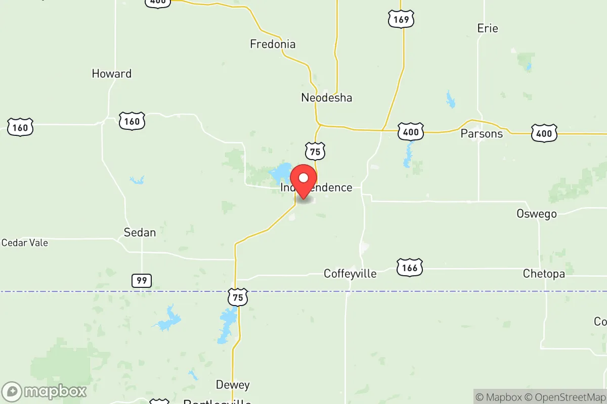
Montgomery County, Kansas, offers a distinctive strategic profile for relocators prioritizing resilience and self-sufficiency, balancing the isolation of the rural Great Plains with the practical assets of a small regional hub. Anchored by the city of Coffeyville and the smaller communities of Independence, Caney, and Cherryvale, the county sits roughly 80 miles from the Tulsa metropolitan area and 150 miles from Wichita, placing it far enough from major population centers to avoid their immediate vulnerabilities while remaining accessible for supply runs or medical care. The area’s low population density—around 32,000 residents spread over 650 square miles—combined with its position away from major interstate corridors, provides a natural buffer against both cascading infrastructure failures and the chaos that can follow a large-scale event.
Geographic position and natural advantages for long-term stability
Montgomery County’s location in the southeastern corner of Kansas, near the Oklahoma border, places it within the Osage Cuestas region—a landscape of rolling hills, limestone outcrops, and wooded creek valleys that offers more defensible terrain than the flat, exposed plains farther west. The county is bisected by the Verdigris River, which flows south toward the Arkansas River system, providing a reliable surface water source that is scarce in much of Kansas. The area sits outside the direct path of most major tornado alleys, though severe weather remains a seasonal risk; the hilly terrain and tree cover reduce the likelihood of a direct hit compared to open prairie counties. Winters are cold but not extreme, and summers are hot and humid, supporting a growing season long enough for substantial food production—a key advantage for anyone serious about self-sufficiency. The county’s position also places it roughly equidistant from the Flint Hills to the west and the Ozark Plateau to the east, offering access to diverse ecological zones for foraging, hunting, and timber.
Risks, exposures, and proximity to fallout-relevant landmarks
The most significant strategic risk for Montgomery County is its proximity to the Coffeyville Resources refinery, a 115,000-barrel-per-day oil refinery located directly adjacent to the Verdigris River in Coffeyville. This facility is a clear target for both natural disaster cascades and man-made disruption; a major incident could contaminate local water supplies or create a toxic plume affecting downwind areas. Additionally, the county lies within 100 miles of the Wichita metropolitan area and the Tulsa metro, both of which contain industrial complexes, rail hubs, and aviation manufacturing plants that could be secondary targets in a conflict scenario. The Kansas City metro, with its major military installations and transportation infrastructure, is roughly 150 miles north—close enough that a major event there could send refugees or supply chain disruptions southward. On the positive side, Montgomery County has no active military bases, no nuclear power plants, and no major ammunition depots within its borders, reducing the likelihood of direct targeting. The nearest significant military presence is Fort Riley, about 180 miles northwest, and the McConnell Air Force Base near Wichita, roughly 120 miles northwest. The county’s position along the Verdigris River also exposes it to flood risks, particularly in low-lying areas of Coffeyville and Independence, which experienced severe flooding in 2007 and 2019. For a relocator, the key takeaway is that the refinery is the single greatest local hazard; choosing a homestead site at least 10 miles upwind or upstream of Coffeyville significantly reduces exposure.
Practical resilience for a relocator: food, water, energy, and defensibility
Montgomery County offers strong practical resilience for those willing to invest in infrastructure. Water availability is a standout advantage: the Verdigris River, Elk River, and Caney River all flow through the county, and the Elk City Lake and Big Hill Lake provide substantial reservoir storage. Groundwater is accessible via wells in most areas, though depth varies; the county sits atop the Ozark Plateau aquifer system, which yields moderate-quality water at depths of 50 to 200 feet. For energy, the county is served by Evergy and local cooperatives, but grid reliability is typical of rural Kansas—occasional outages during storms. Solar potential is good, with roughly 220 sunny days per year, and the rolling terrain allows for passive solar siting. Wood heating is viable given the extensive hardwood forests in the eastern part of the county, particularly around Caney and Cherryvale. For food production, the county has a mix of row-crop agriculture (corn, soybeans, wheat) and pastureland for cattle; local farmers’ markets in Coffeyville and Independence operate seasonally, and the Montgomery County Extension Office provides resources for small-scale farming and gardening. Defensibility is moderate: the hilly terrain and tree cover offer concealment and natural chokepoints, but the county’s road network—primarily two-lane highways like US-169 and US-166—means that any major evacuation or movement would be funneled through a limited number of routes. The population is sparse enough that a determined group could secure a perimeter around a small valley or creek drainage, but the open agricultural areas in the western part of the county offer little cover. For a relocator, the sweet spot is the eastern half of the county, near the wooded creek valleys between Caney and Cherryvale, where water, timber, and defensible terrain converge.
The overall strategic picture for Montgomery County is one of moderate resilience with a clear set of trade-offs. It is not a remote mountain redoubt, nor is it a fortified compound zone; it is a working rural county with real assets—abundant water, arable land, low population density—and real liabilities, chiefly the Coffeyville refinery and its position within a few hours’ drive of major metros. For a relocator who is serious about preparedness but not seeking total isolation, the county offers a viable middle ground: close enough to access regional hospitals, hardware stores, and supply chains, yet far enough from the most likely targets to avoid the worst fallout. The key is to site a homestead deliberately—away from the refinery, near a reliable water source, and within the wooded eastern hills—and to build relationships with the local farming and ranching community, which remains the backbone of the area’s resilience. Montgomery County won’t make the top of a prepper’s list, but for someone looking to balance access with security, it deserves a serious look.

* Values derived from national, state, county, city and local statistics and may differ in a specific area. Last updated: 2026-07-05T00:29:31.000Z
Narrative content on this page is AI-generated and may contain mistakes. Verify any details that matter before acting on them.
ReloMaps may earn a commission from affiliate links at no extra cost to you.

