Strategic Assessment of Israel, WV
Workable tactical position. Some exposure to population density or targets, but generally defensible in a crisis.
What does the Strategic Assessment tell us?
Our Strategic Assessment grades tactical survivability of an area. Major population centers, military targets, fallout zones, natural disasters, and border exposure all drive risk — lower exposure means a more defensible position in a crisis.
This is heavily inspired by Joel Skousen's Strategic Relocation book. Highly recommended you checkout the book ($)What does this tell us?
Our Strategic Assessment grades tactical survivability of an area. Major population centers, military targets, fallout zones, natural disasters, and border exposure all drive risk — lower exposure means a more defensible position in a crisis.
This is heavily inspired by Joel Skousen's Strategic Relocation book. Highly recommended you checkout the book ($)Strategic Pillars

Key Distances
Regional Safe Places
Below is our recommended "safe zones" in West Virginia and the surrounding area based on our strategic heuristics. For most people, it's unrealistic to live in a “safe zone” full-time due to work, family or other personal reasons. They tend to be more rural. However, many of these areas are perfect for second homes and retreat properties that double as a vacation home or even a short-term rental.
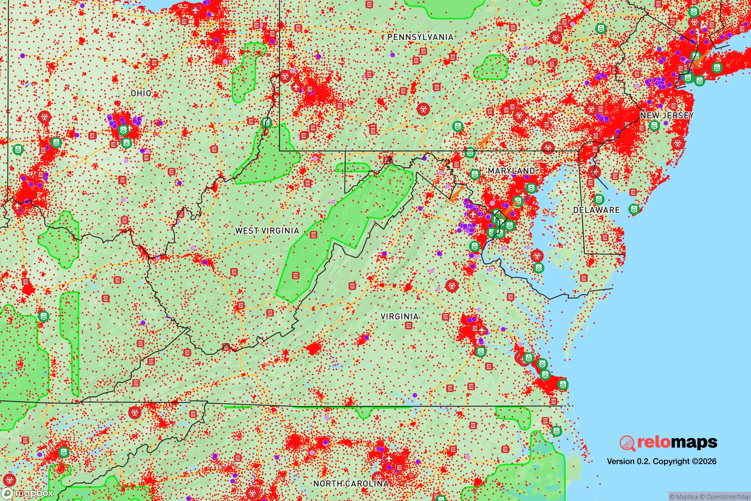
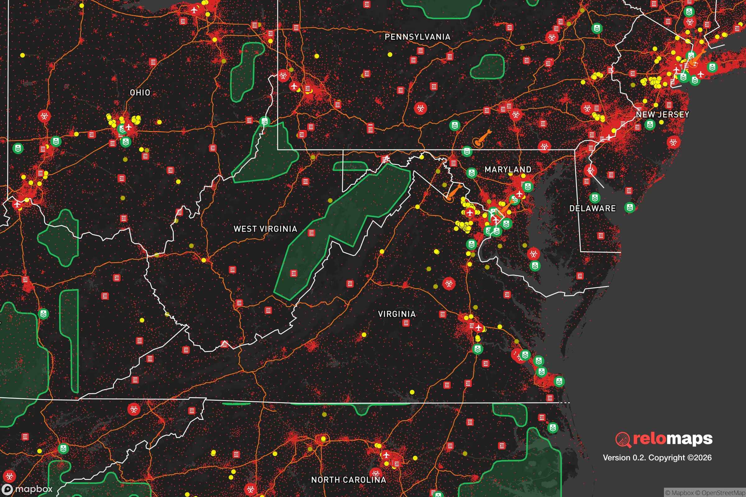


Important Note: For informational purposes only. This does not mean nothing bad ever happens in the green zones. Please use common sense. This is based on public data and modeled with AI. We tried to take a conservative approach but mistakes happen. We update this regularly as new information becomes available.
Solar Generator Recommendations
Backup power matters more here than in safer locations. We've picked three solar generators across budgets and capacity tiers — start with the budget unit if you only need a few essentials, or step up if you want to run a fridge and HVAC for days at a time.

Jackery Portable Power Station Explorer 300
Budget OptionPower on the Go: Weighing only 11 lbs, it's convenient to set up and store with book-sized foldable solar panels

BLUETTI Portable Power Station AC180
Designed for both indoor and outdoor scenarios, AC180 is highly capable as it has a robost capacity and continuous output power.

EF ECOFLOW DELTA Pro Ultra Power Station
Upgraded PickEcoFlow DELTA Pro Ultra is a whole-home energy system designed to grow with your family. Integrated with the Smart Home Panel 2, it scales to meet your evolving energy needs — keeping your home powered, intelligent, and secure through every stage of life.
We earn a commission, at no additional cost to you.
Strategic Assessment Analysis
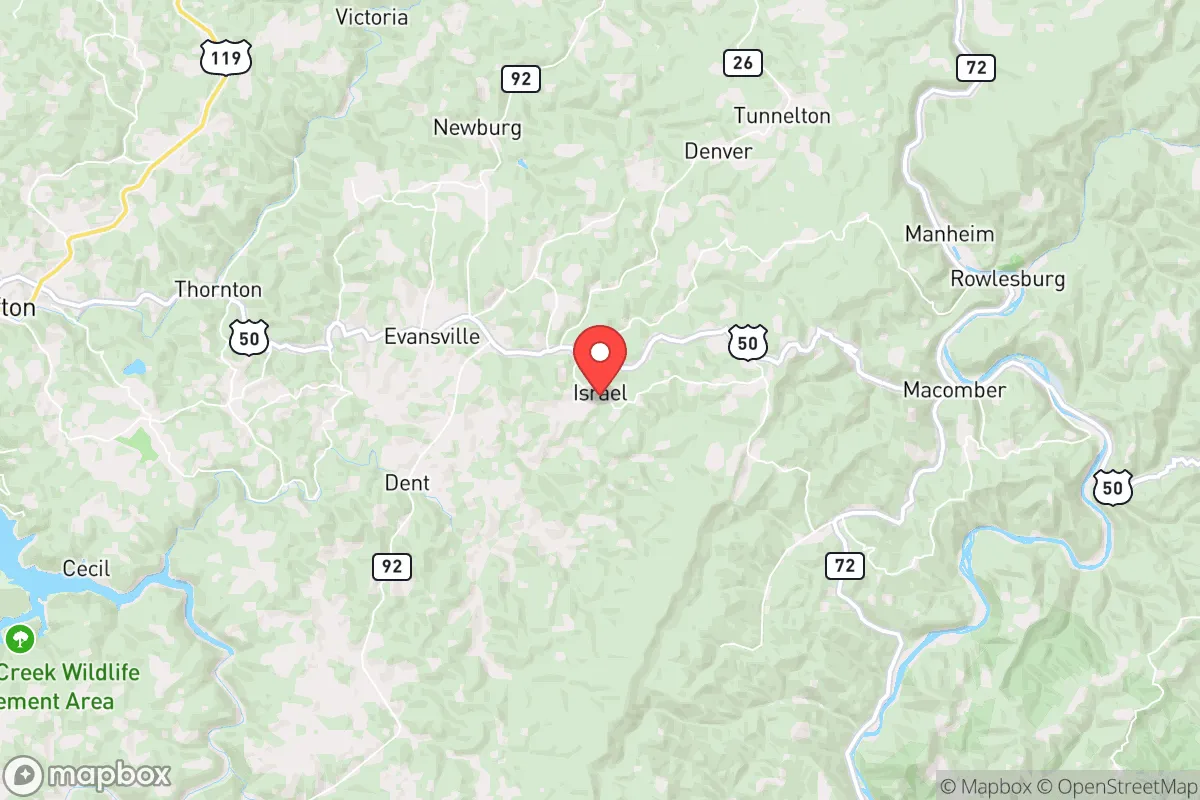
Israel, West Virginia, is a small unincorporated community in Boone County that offers a distinctive combination of geographic isolation and practical resilience for those prioritizing disaster readiness and self-sufficiency. Its location in the rugged Appalachian foothills, roughly 30 miles south of Charleston and 20 miles north of the Kentucky border, places it far from major metropolitan targets while still providing access to regional infrastructure. For a relocator weighing strategic advantages, Israel presents a low-profile, defensible position with natural barriers, though it carries specific exposures tied to its coal-country heritage and proximity to certain industrial and transportation corridors.
Geographic position and natural advantages for self-sufficiency
Israel sits in a valley carved by the Little Coal River, surrounded by steep, forested ridges that create a natural buffer against both casual intrusion and large-scale disasters. The area's elevation ranges from roughly 700 to 1,200 feet, which places it above flood-prone bottomlands while remaining low enough to avoid the extreme weather exposure of higher peaks. The surrounding hills are densely wooded with mixed hardwoods and pines, providing ample cover, firewood, and building materials. Water access is a strong point: the Little Coal River runs through the community, and numerous springs and small creeks feed into it, offering reliable surface water for filtration or diversion. The underlying geology is primarily sandstone and shale, which supports well drilling at moderate depths—typically 100 to 300 feet—with yields adequate for a household. The terrain also offers natural defensibility: the narrow valley roads (primarily WV Route 3 and local spurs) create chokepoints that can be monitored or blocked, and the ridge lines provide excellent vantage points for observation. For a relocator, this means a site that is hard to approach unnoticed and easy to secure with minimal effort.
Risks, exposures, and proximity to fallout-relevant landmarks
No strategic assessment is complete without acknowledging the area's vulnerabilities. Israel's primary risk stems from its location within the Central Appalachian coal field. The region has a history of mountaintop removal mining, underground mine subsidence, and coal slurry impoundments. The nearest large impoundment is the Brushy Fork slurry pond, about 10 miles northeast near Danville, which has been the subject of environmental monitoring. A catastrophic breach, while statistically unlikely, could send sediment-laden water down the Little Coal River drainage. Additionally, the area lies within 50 miles of the John E. Amos Power Plant (a coal-fired facility near Winfield) and the Kanawha River chemical corridor, which includes multiple industrial facilities along the Kanawha Valley from Charleston to Nitro. In a major disaster scenario—whether natural or man-made—these sites could become secondary hazards. On the fallout front, Israel's distance from major population centers is a net positive. Charleston (population ~47,000) is the nearest city of any size, but it is not a high-priority nuclear target. The nearest likely strategic targets are the Yeager Airport (a regional hub) and the aforementioned power plant, both roughly 30 miles north. For context, prevailing winds in the region are from the west-southwest, meaning fallout from a strike on Charleston or the Kanawha Valley would likely blow east-northeast, away from Israel. However, a strike on the power plant or chemical facilities could produce localized contamination depending on wind direction. The area also sits within 100 miles of the Greenbrier Resort bunker (a former government continuity site), which is a low-probability concern. Overall, Israel's risk profile is moderate: low for direct nuclear targeting, moderate for industrial accidents, and low-to-moderate for natural disasters (tornadoes are rare, earthquakes are minor, and flooding is limited to the river bottom).
Practical resilience for a relocator: food, water, energy, and defensibility
For a relocator serious about self-sufficiency, Israel offers a workable baseline with room for improvement. Water is the strongest asset: the Little Coal River and its tributaries provide year-round flow, and the shallow groundwater table means a hand pump or solar-powered well can deliver water even without grid power. Boiling or filtering is recommended due to potential mining runoff, but the volume is sufficient for a household. Food production is feasible but limited by the hilly terrain. The valley bottoms offer small patches of arable land—typically 1 to 5 acres per property—suitable for gardens, fruit trees, and small livestock (chickens, goats, pigs). The growing season runs from late April to early October (Zone 6b), allowing for cool-weather crops like potatoes, greens, and root vegetables. Deer and turkey are abundant for hunting, and the river holds smallmouth bass and panfish. Energy resilience is mixed. The area is served by Appalachian Power, and grid outages are common during winter storms (ice storms are the primary weather threat). Solar potential is moderate: the hilly terrain creates shading on north-facing slopes, but south-facing ridges receive adequate sun for a 2-5 kW off-grid system. Wood heating is the most practical backup, with ample fuel available on the surrounding public and private forestland. Defensibility is high due to the terrain. The single-lane roads and narrow valleys mean that a small group can monitor all approaches. The nearest law enforcement is the Boone County Sheriff's Office in Madison (10 miles north), and response times in a crisis would be slow. For a relocator, this means self-reliance is not optional—it's the default. The community itself is small (population under 200) and tight-knit, with a culture of mutual aid among long-term residents, though newcomers should expect a period of proving themselves. Medical access is a vulnerability: the nearest hospital is Boone Memorial Health in Madison (15 minutes), a critical-access facility with limited trauma capability. For serious care, Charleston Area Medical Center is 45 minutes north. Stockpiling medications and first-aid supplies is essential.
In the overall strategic picture, Israel, WV, offers a solid foundation for a relocator seeking a low-profile, defensible position with reliable water and moderate self-sufficiency potential. Its strengths—natural barriers, water access, and distance from high-value targets—are balanced by real risks tied to the coal industry and limited medical infrastructure. For a family or individual willing to invest in off-grid energy, food storage, and community integration, the area provides a workable long-term base. It is not a prepper's paradise (no remote mountain fortress), but it is a practical, affordable option in a region that has historically weathered economic and environmental shocks. The key takeaway: Israel is a place where resilience is built, not bought, and where the land itself does much of the work—if you respect its limits.

* Values derived from national, state, county, city and local statistics and may differ in a specific area. Last updated: 2026-11-01T22:20:54.000Z
Narrative content on this page is AI-generated and may contain mistakes. Verify any details that matter before acting on them.
ReloMaps may earn a commission from affiliate links at no extra cost to you.

