
Photo: Wikipedia
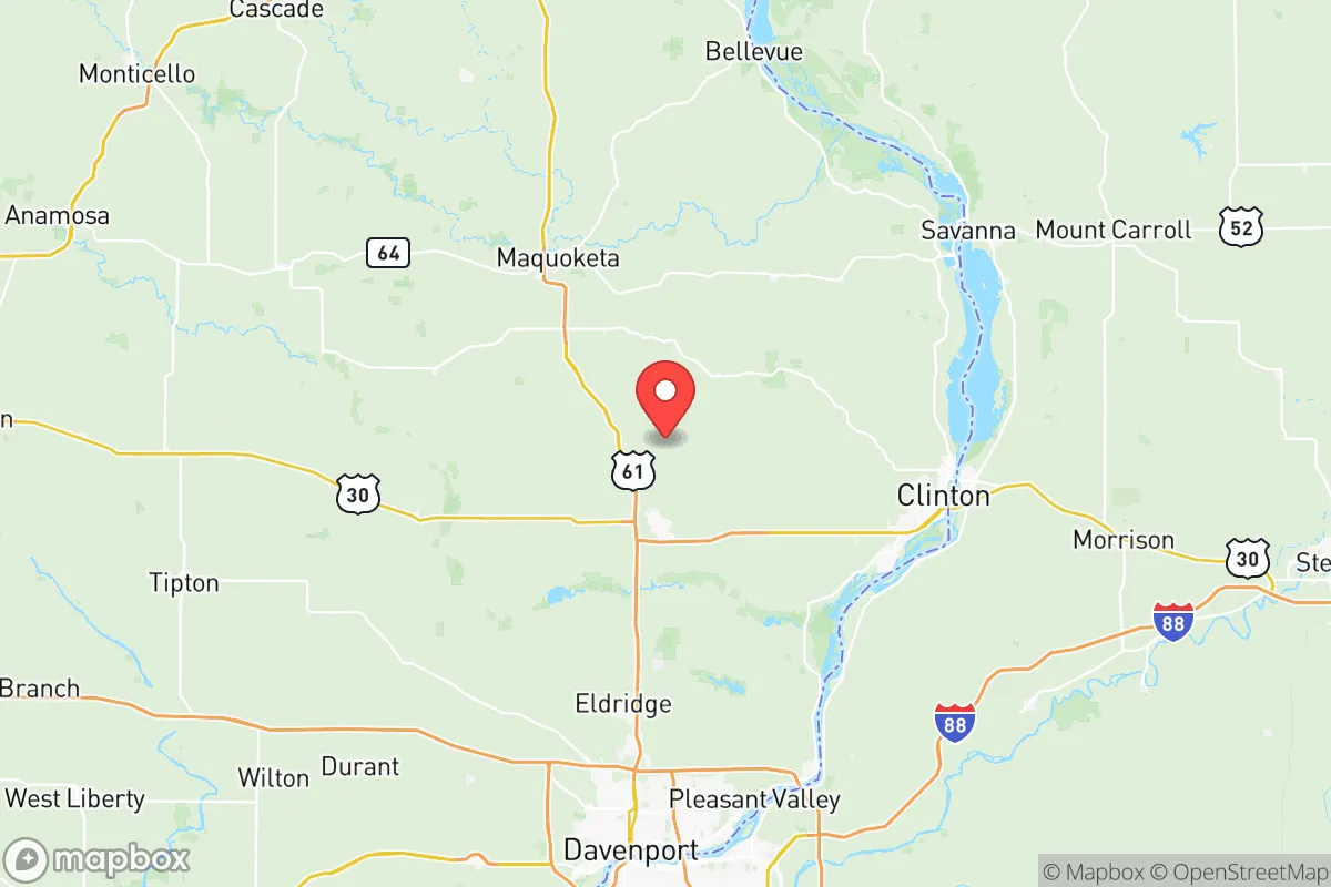
Strategic Assessment of Clinton County
Workable tactical position. Some exposure to population density or targets, but generally defensible in a crisis.
What does the Strategic Assessment tell us?
Our Strategic Assessment grades tactical survivability of an area. Major population centers, military targets, fallout zones, natural disasters, and border exposure all drive risk — lower exposure means a more defensible position in a crisis.
This is heavily inspired by Joel Skousen's Strategic Relocation book. Highly recommended you checkout the book ($)What does this tell us?
Our Strategic Assessment grades tactical survivability of an area. Major population centers, military targets, fallout zones, natural disasters, and border exposure all drive risk — lower exposure means a more defensible position in a crisis.
This is heavily inspired by Joel Skousen's Strategic Relocation book. Highly recommended you checkout the book ($)Strategic Pillars

Key Distances
Strategic Assessment Analysis
Clinton County, Iowa, offers a compelling strategic position for relocators prioritizing resilience and self-sufficiency, balancing proximity to major Midwestern infrastructure with the practical advantages of a smaller, agriculturally rich community. Located roughly 140 miles west of Chicago and 90 miles east of Des Moines, the county sits along the Mississippi River, providing a natural buffer from the densest urban corridors while retaining access to critical supply chains and transportation networks. For a conservative-leaning audience focused on disaster readiness, Clinton County’s blend of riverine resources, modest population density, and distance from high-value targets like nuclear power plants or major military installations makes it a noteworthy option for a long-term relocation strategy.
Geographic position and natural advantages for self-sufficiency
Clinton County’s geography is defined by its eastern border along the Mississippi River, which offers both a reliable freshwater source and a historical transportation artery. The county seat, Clinton, sits directly on the river, while smaller communities like DeWitt and Camanche lie inland, providing a mix of riverfront access and more secluded, defensible terrain. The region’s topography is predominantly rolling hills and fertile farmland, with the Wapsipinicon River cutting through the western part of the county. This natural layout supports decentralized living—ideal for a relocator seeking to establish a homestead or small farm away from concentrated populations. The area’s agricultural output is substantial: corn and soybeans dominate, but local producers also raise livestock and poultry, creating a food-security baseline that urban centers lack. The county’s position in the Upper Mississippi River Valley also means it is less prone to extreme weather events like hurricanes or wildfires, though tornadoes and severe thunderstorms are seasonal risks. For a family or individual looking to reduce dependency on fragile supply chains, Clinton County’s combination of arable land, surface water, and moderate climate provides a solid foundation for long-term self-sufficiency.
Risks, exposures, and proximity to fallout-relevant landmarks
While Clinton County avoids the most obvious high-risk targets, it is not without exposure. The county lies approximately 60 miles from the Quad Cities (Davenport, Moline, Rock Island, Bettendorf), a metropolitan area that hosts the Rock Island Arsenal—a major U.S. Army manufacturing and logistics hub. This facility, which produces small arms and artillery components, could be a secondary target in a conflict scenario, though its distance and the prevailing westerly winds reduce direct fallout risk to Clinton County. More concerning is the Clinton Power Station, a nuclear power plant located just north of the city of Clinton along the Mississippi River. While the plant has a strong safety record, its presence introduces a low-probability, high-consequence risk: a catastrophic failure or targeted attack could render large portions of the county uninhabitable for decades. The plant’s spent fuel pools are a particular concern for long-term contamination. Additionally, the county is within 200 miles of the Dubuque area to the north and the Bettendorf industrial corridor, both of which contain chemical and manufacturing facilities that could produce secondary hazards. For a relocator, the key takeaway is that Clinton County is not a zero-risk zone, but its risks are largely localized and manageable with proper planning—unlike the dense, multi-layered threats found near Chicago or St. Louis. The county’s rural character means that fallout from distant events would likely be diluted by distance and wind patterns, though a direct hit on the power plant would be catastrophic.
Practical resilience for a relocator: food, water, energy, and defensibility
For a family or individual serious about preparedness, Clinton County offers several practical advantages. Water access is excellent: the Mississippi River provides an almost limitless surface water source, though treatment is necessary for drinking. Many rural properties in the county rely on private wells, which tap into the region’s abundant groundwater aquifers—a more resilient option than municipal systems. Food production is viable: the county’s agricultural base means that even a small plot of land can support a garden, and local farmers’ markets in Clinton, DeWitt, and Camanche provide direct access to fresh produce and meat. The county also has a strong hunting culture, with deer, turkey, and waterfowl abundant in the river bottoms and woodlands. Energy resilience is mixed: the grid is reliable but aging, and severe storms can cause outages. However, the prevalence of rural properties means that solar panel installation is feasible, and many residents already use backup generators. The county’s flat to gently rolling terrain also makes wind power a viable supplementary option. Defensibility is moderate: the county’s dispersed population and lack of major choke points make it difficult for a large-scale threat to control, but the river and major highways (U.S. 30 and 67) provide easy access for both resupply and potential adversaries. A relocator should prioritize a property with good sightlines, multiple egress routes, and a location away from the river’s floodplain—flooding is a recurring issue in low-lying areas near Clinton and Camanche. The county’s law enforcement presence is modest, so community self-reliance and neighborhood networks are essential for security.
Overall, Clinton County presents a balanced strategic picture for the disaster-conscious relocator. It offers genuine advantages in water availability, agricultural potential, and moderate distance from high-value targets, but it is not a fortress. The presence of the Clinton Power Station is a real, if low-probability, risk that must be weighed against the benefits of the region’s natural resources and lower population density. For a family willing to invest in well water, solar power, and a defensible rural property, the county provides a workable foundation for a resilient lifestyle. The key is to avoid the riverfront flood zones and the immediate vicinity of the power plant, and instead focus on the inland communities like DeWitt or the unincorporated areas along the Wapsipinicon River. In a world of increasing uncertainty, Clinton County is a pragmatic choice—not a perfect one, but one that rewards careful planning and local knowledge.

* Values derived from national, state, county, city and local statistics and may differ in a specific area. Last updated: 2026-07-03T00:43:13.000Z
Narrative content on this page is AI-generated and may contain mistakes. Verify any details that matter before acting on them.
ReloMaps may earn a commission from affiliate links at no extra cost to you.

