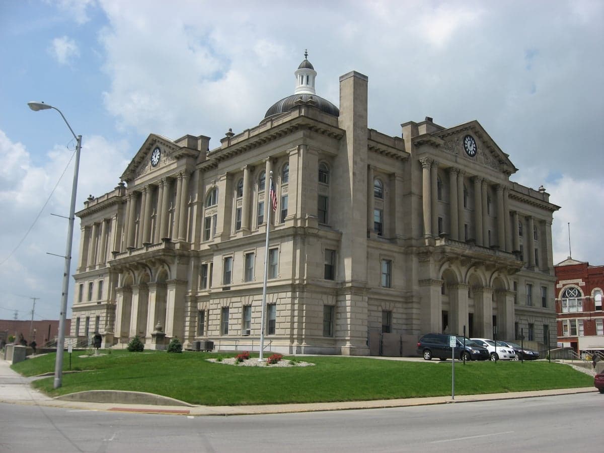
Photo: Wikipedia
Strategic Assessment of Huntington County
Workable tactical position. Some exposure to population density or targets, but generally defensible in a crisis.
What does the Strategic Assessment tell us?
Our Strategic Assessment grades tactical survivability of an area. Major population centers, military targets, fallout zones, natural disasters, and border exposure all drive risk — lower exposure means a more defensible position in a crisis.
This is heavily inspired by Joel Skousen's Strategic Relocation book. Highly recommended you checkout the book ($)What does this tell us?
Our Strategic Assessment grades tactical survivability of an area. Major population centers, military targets, fallout zones, natural disasters, and border exposure all drive risk — lower exposure means a more defensible position in a crisis.
This is heavily inspired by Joel Skousen's Strategic Relocation book. Highly recommended you checkout the book ($)Strategic Pillars

Key Distances
Strategic Assessment Analysis
Huntington County, Indiana, offers a compelling mix of Midwestern stability and strategic depth for those prioritizing resilience and self-sufficiency. Anchored by the city of Huntington and the smaller towns of Roanoke, Markle, and Andrews, this county sits in a sweet spot: far enough from major metropolitan targets to avoid the worst of fallout and cascading infrastructure failures, yet close enough to access critical supplies and medical care when needed. Its position along the Wabash River and its agricultural base provide a foundation for long-term sustainability that few suburban or exurban areas can match.
Geographic position and natural advantages for long-term stability
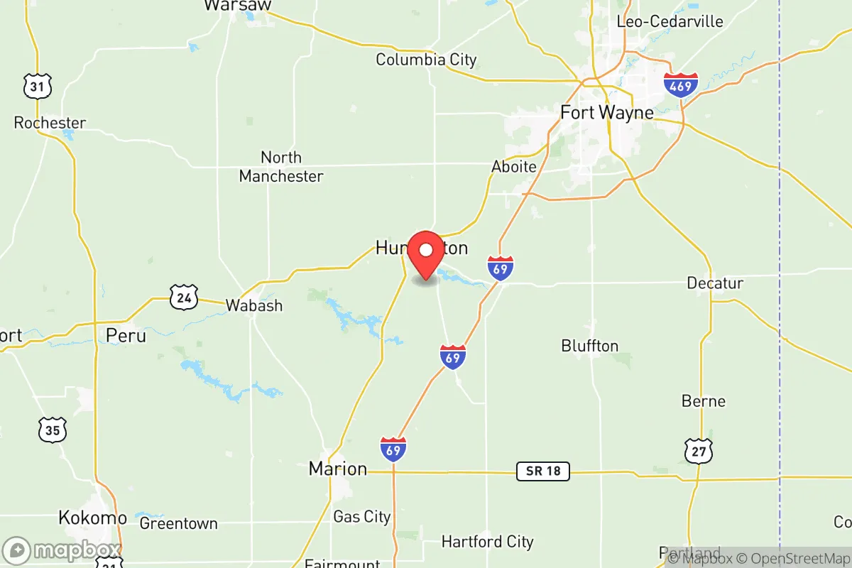
Huntington County’s location in northeastern Indiana places it roughly 25 miles southwest of Fort Wayne and about 90 miles northeast of Indianapolis. This distance from primary population centers is a net positive for a resilience-minded relocator. The county is not directly downwind of any major nuclear power plant, large refinery, or major military installation that would be a primary target in a conflict. The nearest significant military presence is the Fort Wayne Air National Guard Base, a relatively small installation that is unlikely to be a high-priority strike target. The county’s terrain is gently rolling, with the Wabash River cutting through the central portion, providing a reliable water source and natural drainage. The area is not prone to earthquakes, hurricanes, or wildfires, and tornado risk, while present, is lower than in the Great Plains or the Deep South. The region’s deep, fertile soils support robust agriculture, a key advantage for food security that cannot be overstated.
Risks, exposures, and proximity to fallout-relevant landmarks
While Huntington County is not a high-risk zone, it is not immune to man-made and natural threats. The most significant risk is the Wabash River floodplain, which affects low-lying areas near Huntington and Markle. Major flood events in 2003 and 2018 caused significant property damage, and FEMA flood maps show substantial portions of the county in the 100-year flood zone. For a relocator, this means any property purchase should be carefully vetted for flood history and elevation. Another concern is the Norfolk Southern rail line that runs through Huntington, carrying hazardous materials including crude oil and chemicals. A derailment or spill could contaminate local water supplies or require evacuation. The county is also within 100 miles of the Fort Wayne International Airport, which hosts a small Air National Guard refueling wing, and the Marion VA Medical Center, a large federal facility. Neither is a primary strategic target, but both could draw secondary attention in a major conflict. The nearest high-value target is the BP Whiting Refinery in Whiting, Indiana, about 120 miles northwest, which is well outside the dangerous fallout zone for most scenarios. Overall, the county’s risk profile is moderate, with flooding being the most immediate and likely threat.
Practical resilience for a relocator: food, water, energy, and defensibility
For someone serious about self-sufficiency, Huntington County offers strong fundamentals. The county is part of a major agricultural region, with corn, soybeans, and livestock dominating the landscape. Local farmers’ markets in Huntington and Roanoke operate seasonally, and the Huntington County Fairgrounds hosts regular livestock and produce sales. For long-term food security, the area has ample acreage for small-scale farming or homesteading, with land prices significantly lower than in the Indianapolis or Fort Wayne suburbs. Water access is excellent: the Wabash River provides a surface water source, and the county’s groundwater aquifers are generally reliable for private wells, though well depth and yield vary by location. The Huntington Water Department treats water from the Wabash for municipal supply, but a private well with a hand pump or solar-powered pump is a prudent backup. Energy resilience is mixed. The county is served by Indiana Michigan Power, a subsidiary of American Electric Power, and the grid is reasonably stable. However, the area is not a priority for grid hardening, and winter ice storms can cause multi-day outages. Solar potential is moderate, with about 4.5 peak sun hours per day, and many rural properties have space for ground-mounted panels. Wood heating is a viable option, with ample hardwood forests in the southern part of the county. Defensibility is good for a rural area: the county is not a major transportation hub, and the population density is low (about 100 people per square mile). The terrain offers natural chokepoints along the Wabash and its tributaries, and the county’s road network is sparse enough that a determined group could monitor access points. However, the county seat of Huntington (population ~17,000) would be a logical gathering point for displaced persons, which could strain local resources in a prolonged crisis.
The overall strategic picture for Huntington County is one of balanced, practical resilience. It is not a hardened bunker location, nor is it a high-risk zone that demands constant vigilance. For a family or individual looking to build a self-sufficient lifestyle with a reasonable buffer from urban chaos, the county offers affordable land, reliable water, and a strong agricultural base. The primary downsides are flood risk in the river bottoms and the potential for rail-related hazmat incidents. A relocator should prioritize buying property above the floodplain, invest in a private well and solar backup, and build relationships with local farmers and the Huntington County Emergency Management Agency for real-time hazard information. In a world of increasing uncertainty, Huntington County provides a solid, unglamorous foundation for long-term stability — exactly the kind of place that flies under the radar until you need it most.

* Values derived from national, state, county, city and local statistics and may differ in a specific area. Last updated: 2026-11-10T01:16:36.000Z
Narrative content on this page is AI-generated and may contain mistakes. Verify any details that matter before acting on them.
ReloMaps may earn a commission from affiliate links at no extra cost to you.

