Photo: Wikipedia
Strategic Assessment of Idaho Springs, CO
Meaningful friction. Expect exposure to either population pressure, blast zones, or natural disaster risk. Consider buying a retreat property.
What does the Strategic Assessment tell us?
Our Strategic Assessment grades tactical survivability of an area. Major population centers, military targets, fallout zones, natural disasters, and border exposure all drive risk — lower exposure means a more defensible position in a crisis.
This is heavily inspired by Joel Skousen's Strategic Relocation book. Highly recommended you checkout the book ($)What does this tell us?
Our Strategic Assessment grades tactical survivability of an area. Major population centers, military targets, fallout zones, natural disasters, and border exposure all drive risk — lower exposure means a more defensible position in a crisis.
This is heavily inspired by Joel Skousen's Strategic Relocation book. Highly recommended you checkout the book ($)Strategic Pillars

Key Distances
Regional Safe Places
Below is our recommended "safe zones" in Colorado and the surrounding area based on our strategic heuristics. For most people, it's unrealistic to live in a “safe zone” full-time due to work, family or other personal reasons. They tend to be more rural. However, many of these areas are perfect for second homes and retreat properties that double as a vacation home or even a short-term rental.
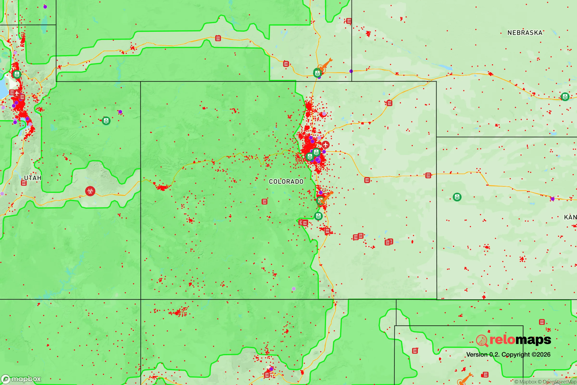
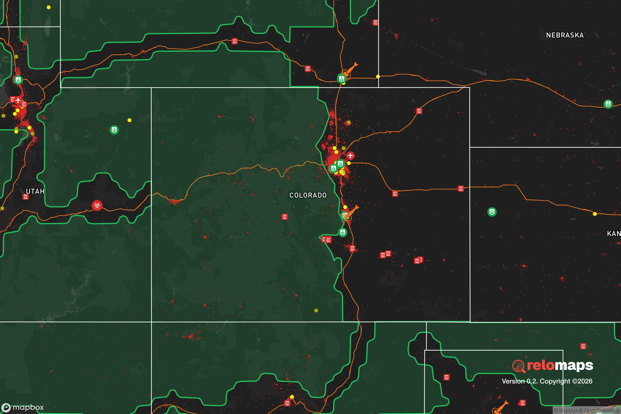


Important Note: For informational purposes only. This does not mean nothing bad ever happens in the green zones. Please use common sense. This is based on public data and modeled with AI. We tried to take a conservative approach but mistakes happen. We update this regularly as new information becomes available.
Solar Generator Recommendations
Backup power matters more here than in safer locations. We've picked three solar generators across budgets and capacity tiers — start with the budget unit if you only need a few essentials, or step up if you want to run a fridge and HVAC for days at a time.

Jackery Portable Power Station Explorer 300
Budget OptionPower on the Go: Weighing only 11 lbs, it's convenient to set up and store with book-sized foldable solar panels

BLUETTI Portable Power Station AC180
Designed for both indoor and outdoor scenarios, AC180 is highly capable as it has a robost capacity and continuous output power.

EF ECOFLOW DELTA Pro Ultra Power Station
Upgraded PickEcoFlow DELTA Pro Ultra is a whole-home energy system designed to grow with your family. Integrated with the Smart Home Panel 2, it scales to meet your evolving energy needs — keeping your home powered, intelligent, and secure through every stage of life.
We earn a commission, at no additional cost to you.
Strategic Assessment Analysis
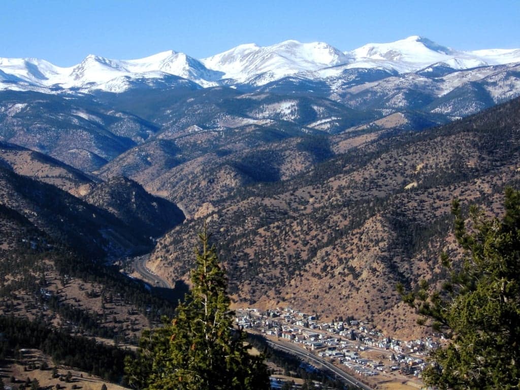
Idaho Springs, Colorado, offers a compelling mix of geographic isolation and strategic access that makes it a serious candidate for a resilience-minded relocator. Nestled in Clear Creek Canyon roughly 30 miles west of Denver, this former gold-mining town sits at 7,500 feet in the Front Range, providing a natural buffer from urban chaos while remaining close enough to supply chains and medical facilities. For someone balancing self-sufficiency with practical necessity, Idaho Springs represents a defensible middle ground — close enough to civilization to be useful, far enough to avoid its worst vulnerabilities.
Geographic position and natural advantages for long-term security
Idaho Springs occupies a narrow valley along Clear Creek, surrounded by the Arapaho and Roosevelt National Forests. This positioning creates several hard-to-replicate advantages. The surrounding mountains provide natural terrain barriers that limit approach routes, making the town inherently more defensible than open-plains communities. The elevation also places it above the inversion layer that traps pollution and particulates in the Denver metro area, meaning air quality remains high even during regional emergencies. The town sits along Interstate 70, the primary east-west corridor through the Colorado Rockies, which provides reliable access to supplies and evacuation routes — though that same highway can become a liability during mass evacuation events. The nearby Mount Evans and Guanella Pass areas offer secondary routes for those who know the back roads, including the rough but passable Yankee Hill and Kingston Peak roads that connect to the South Park region. Water is the standout natural advantage here: Clear Creek runs year-round, fed by high-country snowmelt, and the town's water rights are senior and well-established from its mining-era infrastructure. The surrounding national forest land also means fewer neighbors and more options for hunting, foraging, and timber harvesting, though game populations are modest compared to lower-elevation areas.
Risks, exposures, and proximity to fallout-relevant landmarks
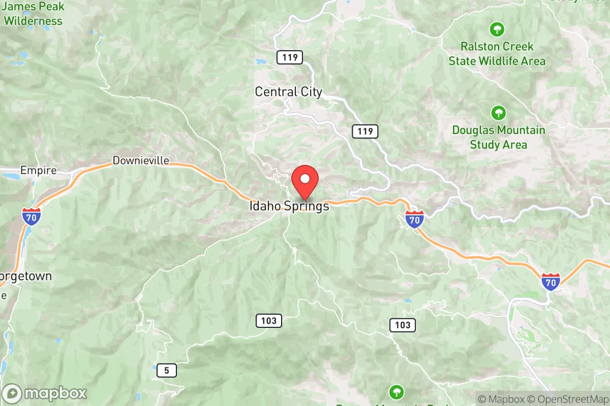
The most significant risk for Idaho Springs is its proximity to the Denver metropolitan area, roughly 30 miles east as the crow flies. In a major disaster scenario — whether natural, economic, or geopolitical — the town sits directly in the path of any mass exodus from the Front Range urban corridor. I-70 through Clear Creek Canyon is a choke point that can gridlock within minutes during a routine snowstorm; a full-scale evacuation would turn it into a parking lot. The town's population of roughly 1,800 swells with tourists and commuters during peak seasons, and the narrow canyon offers limited room for overflow. Wildfire is the most immediate natural threat. The 2020 Cameron Peak Fire and 2021 Marshall Fire demonstrated that Front Range wildfires can move with terrifying speed, and Idaho Springs is surrounded by dense pine and spruce forests that have seen decades of fire suppression. The town's evacuation routes are limited — essentially I-70 west or east, or the winding Colorado 103 up to Echo Lake. Mudslides and flash flooding are secondary concerns, particularly after burn scars, as seen in the 2021 debris flows that closed I-70 near Glenwood Springs. From a man-made risk perspective, the Rocky Flats National Wildlife Refuge sits roughly 20 miles southeast — a former nuclear weapons plant with ongoing contamination monitoring. While no longer an active threat, the site's history of plutonium releases is a consideration for anyone serious about long-term environmental exposure. The town's mining legacy also means some areas have elevated heavy metals in soil and water, particularly around old mine tailings, though municipal water is treated and tested regularly.
Practical resilience for a relocator: food, water, energy, and defensibility
Water security is Idaho Springs' strongest card. Clear Creek provides a reliable surface water source, and the town's water system draws from multiple intake points along the creek. For a relocator looking to drill a well, the fractured granite bedrock makes water unpredictable and expensive to access — expect $15,000 to $30,000 for a successful well, with no guarantee of yield. Rainwater collection is legal in Colorado but limited to 110 gallons per property under state law, making it a supplement rather than a primary source. Food resilience is more challenging. The growing season at 7,500 feet runs roughly from June to September, with frost possible any month of the year. Cold frames and high tunnels can extend the season, but self-sufficiency in vegetables requires serious investment in season extension infrastructure. The local soil is thin, rocky, and acidic, so raised beds with imported soil are the norm. The town has one small grocery store, and the nearest full-service supermarkets are in Evergreen (15 minutes east) or Georgetown (10 minutes west). For long-term storage, the cool, dry climate is excellent for dehydrated and freeze-dried foods, and basements are common in older homes. Energy resilience is mixed. Idaho Springs is served by Xcel Energy, and power outages are common during winter storms — expect several multi-hour outages per year. Solar potential is good despite the elevation, with over 300 sunny days annually, but snow cover on panels is a real issue. Net metering is available, and battery storage is becoming more common among local preppers. Wood heat is the backup of choice here; most older homes have fireplaces or wood stoves, and firewood permits from the national forest are cheap and accessible. Defensibility is moderate. The town's layout — a narrow valley with limited entry points — makes it easier to monitor and control access than a sprawling suburban development. But it also means fewer escape routes if those entry points are compromised. The local sheriff's office is small, and response times to outlying properties can exceed 30 minutes. Neighbors tend to know each other, and the mining-town culture fosters a certain self-reliance, but there's no organized community defense network. For a relocator, the ideal property would be on the western edge of town or up one of the side canyons, where approach routes are limited and neighbors are few.
The overall strategic picture for Idaho Springs is one of trade-offs. It offers genuine advantages in water access, terrain defense, and proximity to national forest resources, all within a reasonable drive of Denver's medical and supply infrastructure. But those same advantages come with real vulnerabilities: limited evacuation routes, wildfire risk, a short growing season, and the ever-present danger of being overrun by urban refugees during a crisis. For a relocator who values isolation but doesn't want to go full off-grid, Idaho Springs is a solid middle option — provided they invest in fire mitigation, backup heat, and a serious food storage program. It's not a bug-out location for the unprepared, but for someone willing to put in the work, it offers a defensible base with the resources to ride out most scenarios short of a full societal collapse.

* Values derived from national, state, county, city and local statistics and may differ in a specific area. Last updated: 2026-10-17T04:06:29.000Z
Narrative content on this page is AI-generated and may contain mistakes. Verify any details that matter before acting on them.
ReloMaps may earn a commission from affiliate links at no extra cost to you.

