Photo: Wikipedia
Strategic Assessment of Huntley, IL
Meaningful friction. Expect exposure to either population pressure, blast zones, or natural disaster risk. Consider buying a retreat property.
What does the Strategic Assessment tell us?
Our Strategic Assessment grades tactical survivability of an area. Major population centers, military targets, fallout zones, natural disasters, and border exposure all drive risk — lower exposure means a more defensible position in a crisis.
This is heavily inspired by Joel Skousen's Strategic Relocation book. Highly recommended you checkout the book ($)What does this tell us?
Our Strategic Assessment grades tactical survivability of an area. Major population centers, military targets, fallout zones, natural disasters, and border exposure all drive risk — lower exposure means a more defensible position in a crisis.
This is heavily inspired by Joel Skousen's Strategic Relocation book. Highly recommended you checkout the book ($)Strategic Pillars

Key Distances
Regional Safe Places
Below is our recommended "safe zones" in Illinois and the surrounding area based on our strategic heuristics. For most people, it's unrealistic to live in a “safe zone” full-time due to work, family or other personal reasons. They tend to be more rural. However, many of these areas are perfect for second homes and retreat properties that double as a vacation home or even a short-term rental.
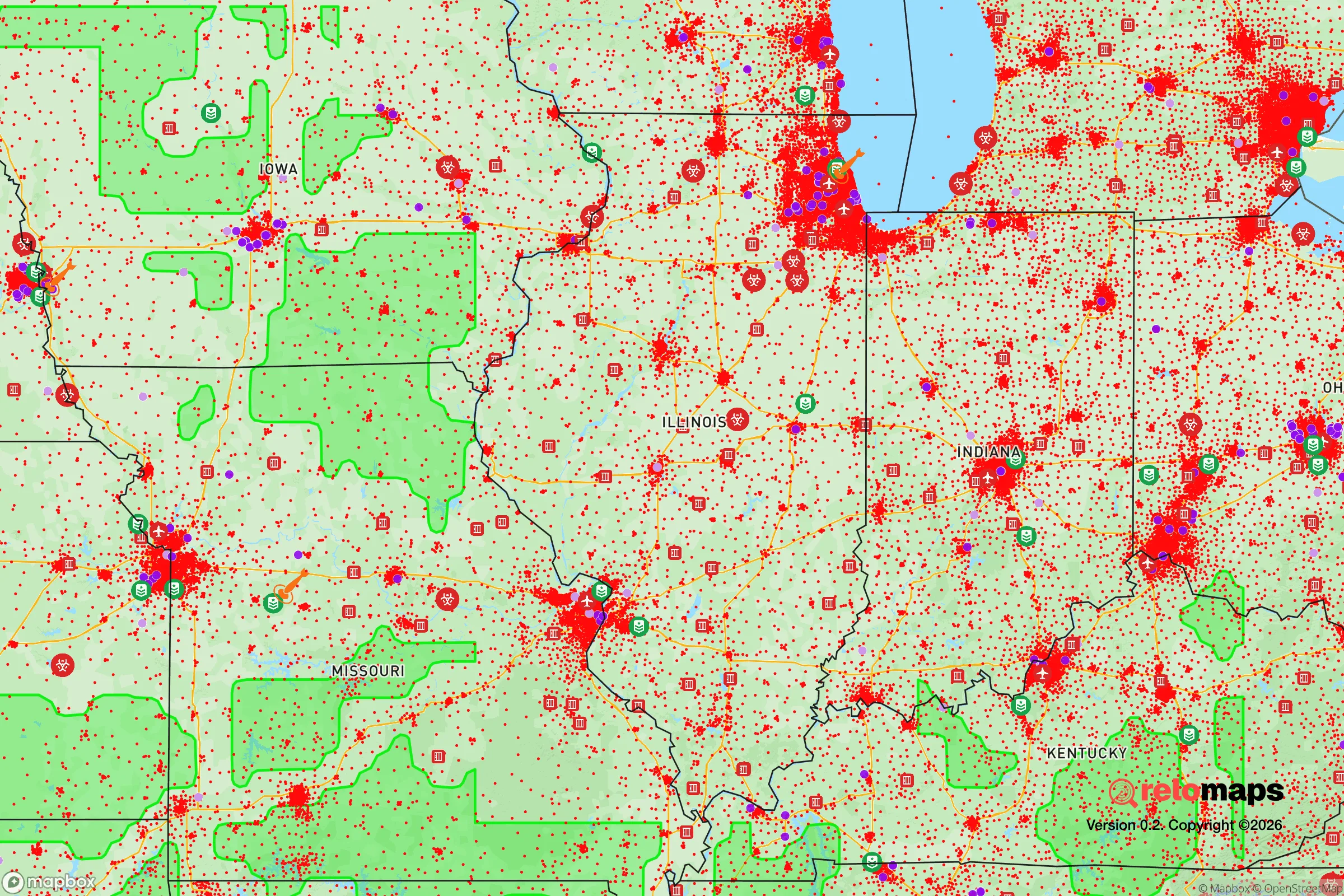
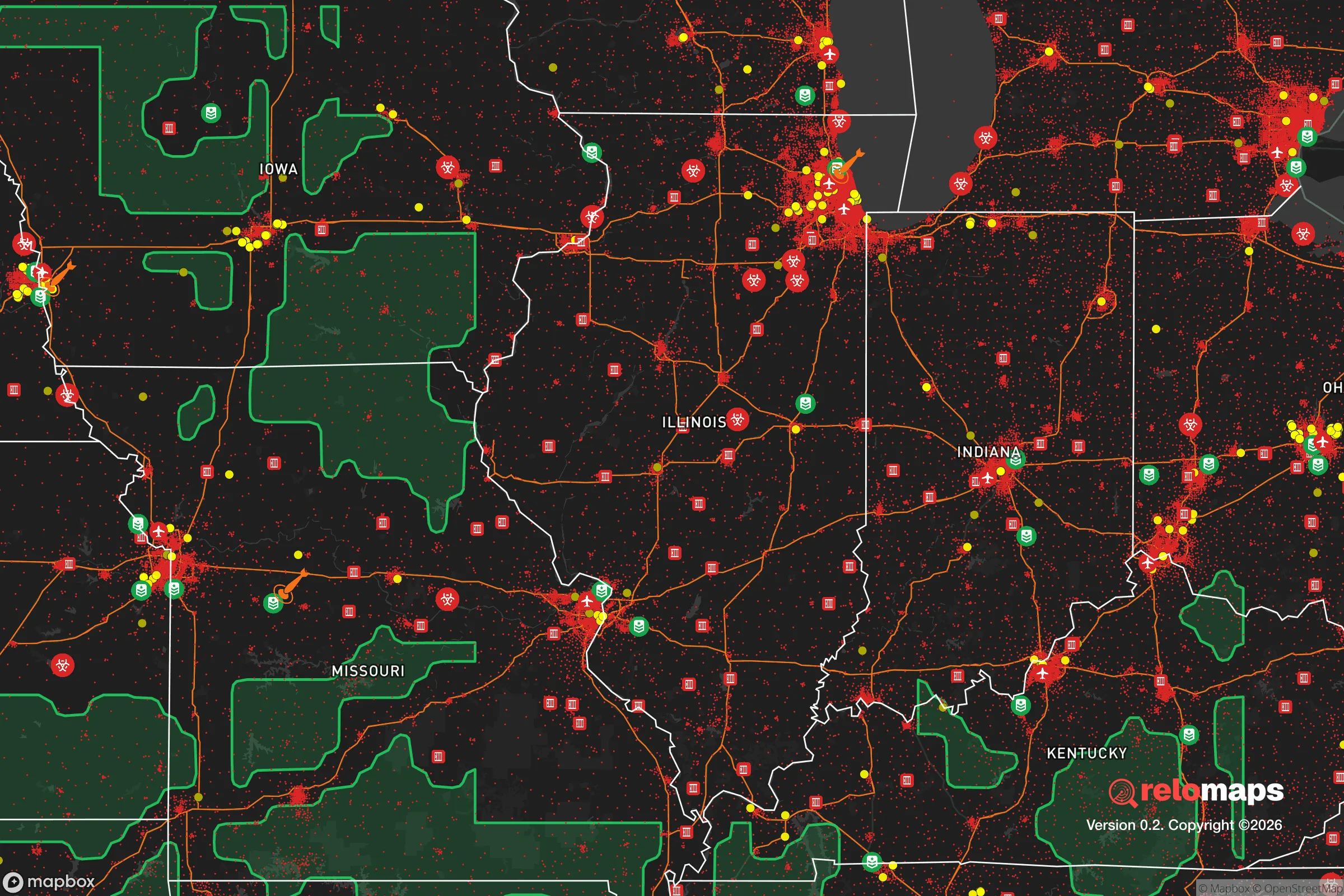


Important Note: For informational purposes only. This does not mean nothing bad ever happens in the green zones. Please use common sense. This is based on public data and modeled with AI. We tried to take a conservative approach but mistakes happen. We update this regularly as new information becomes available.
Solar Generator Recommendations
Backup power matters more here than in safer locations. We've picked three solar generators across budgets and capacity tiers — start with the budget unit if you only need a few essentials, or step up if you want to run a fridge and HVAC for days at a time.

Jackery Portable Power Station Explorer 300
Budget OptionPower on the Go: Weighing only 11 lbs, it's convenient to set up and store with book-sized foldable solar panels

BLUETTI Portable Power Station AC180
Designed for both indoor and outdoor scenarios, AC180 is highly capable as it has a robost capacity and continuous output power.

EF ECOFLOW DELTA Pro Ultra Power Station
Upgraded PickEcoFlow DELTA Pro Ultra is a whole-home energy system designed to grow with your family. Integrated with the Smart Home Panel 2, it scales to meet your evolving energy needs — keeping your home powered, intelligent, and secure through every stage of life.
We earn a commission, at no additional cost to you.
Strategic Assessment Analysis
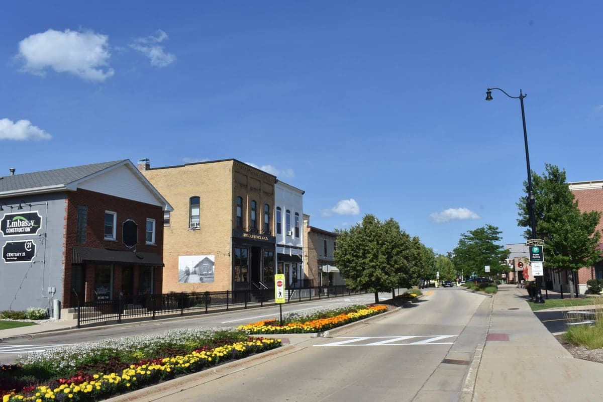
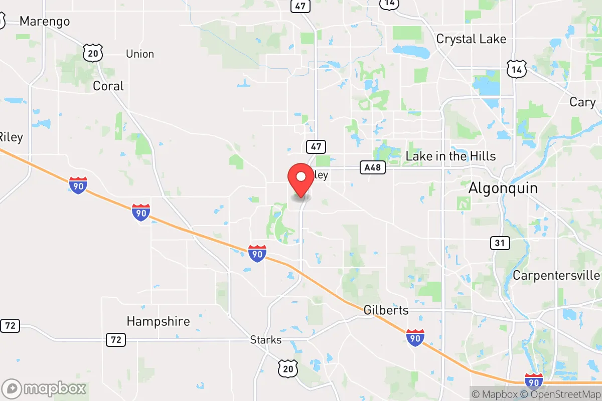
Huntley, Illinois, offers a surprisingly strong resilience profile for a Chicago exurb, balancing small-town self-sufficiency with the resource access of a major metropolitan region. Located roughly 50 miles northwest of the Loop in McHenry County, the village sits at a strategic inflection point between the dense suburban sprawl of Cook County and the agricultural open spaces of DeKalb and Boone counties. For a relocator prioritizing disaster readiness and long-term stability, Huntley’s position provides a meaningful buffer from the highest-risk urban targets while still maintaining practical access to supply chains and medical infrastructure.
Geographic position and natural advantages for long-term stability
Huntley’s primary geographic advantage is its location on the edge of the Chicago metropolitan area’s outermost suburban ring, where population density drops sharply. The village itself is surrounded by a mix of active farmland, forest preserves, and low-density residential development, creating a natural buffer zone that reduces exposure to cascading urban failures. The area sits on relatively flat, well-drained glacial till soils, which are less prone to flooding than river-bottom communities like Algonquin or Carpentersville, though the nearby Kishwaukee River and its tributaries do present localized flood risks in low-lying pockets. Huntley’s elevation, around 900 feet above sea level, is unremarkable but provides no particular vulnerability to storm surge or sea-level rise—a non-issue for inland Illinois. The region’s continental climate means residents must contend with severe winter storms, occasional tornadoes (McHenry County averages one to two tornado touchdowns per decade), and summer heat waves, but these are predictable, manageable hazards for a prepared household. The area’s natural resource base is solid: the underlying aquifer system in McHenry County is part of the shallow sand-and-gravel deposits left by glacial retreat, providing decent groundwater yields for private wells in rural areas, though Huntley itself relies on municipal water drawn from Lake Michigan via the Chicago water system—a potential vulnerability if regional infrastructure is disrupted.
Risks, exposures, and proximity to fallout-relevant landmarks
The most significant risk for Huntley residents is its proximity to Chicago and the broader northeastern Illinois urban corridor. While 50 miles provides meaningful distance from a direct nuclear or industrial incident, the village lies within the plausible fallout plume zone for a major event targeting downtown Chicago or the O’Hare International Airport complex (roughly 35 miles southeast). Prevailing winds in northern Illinois are from the west and southwest, meaning fallout from a Chicago-centric event would likely drift east and northeast, sparing Huntley from the heaviest contamination—but a shift to southerly or easterly winds could change that calculus dramatically. More immediate man-made risks include the Union Pacific Railroad mainline that runs through Huntley, carrying freight including hazardous materials through the village center. The nearby Elgin O’Hare Western Access project and Interstate 90 corridor concentrate transportation risks, including potential chemical spills or accidents. Huntley is also within 20 miles of the Byron Nuclear Generating Station (southwest of Rockford), a single-unit pressurized water reactor that, while well-maintained, represents a fixed risk for any community within its 10-mile emergency planning zone—Huntley sits just outside this zone but could be affected by a severe accident. The village has no major military installations, refineries, or chemical plants within its immediate vicinity, which is a net positive for resilience.
Practical resilience for a relocator: food, water, energy, and defensibility
For a relocator serious about self-sufficiency, Huntley offers a mixed but workable picture. Food security is a genuine strength: the surrounding McHenry County is one of Illinois’s top agricultural producers, with extensive corn, soybean, and dairy operations within a 15-minute drive. The Huntley Farmers Market operates seasonally, and the village’s agricultural zoning allows for backyard gardens, small livestock, and even hobby farms on larger lots in unincorporated areas. Local food processing is limited, but the presence of grain elevators and livestock auctions within the county provides a baseline for local food networks. Water resilience is more complicated. Huntley’s municipal water comes from Lake Michigan via the Chicago system, a highly engineered supply that is vulnerable to pump failures, power outages, or intentional disruption. Residents on private wells in the surrounding township have better independence, but well yields vary and require electricity for pumping. A backup generator and a 1,000-gallon cistern or rainwater catchment system would be prudent for any relocator seeking true water autonomy. Energy resilience is average for the region: ComEd provides grid electricity with typical suburban reliability, but winter ice storms can cause multi-day outages. Solar potential is moderate (Illinois averages about 4.5 peak sun hours per day), and net metering is available, but homeowners’ associations in some Huntley subdivisions may restrict panel placement. Natural gas is widely available for heating and cooking, which is a resilience advantage over all-electric homes. Defensibility is Huntley’s weakest resilience category. The village is laid out as a typical suburban grid with multiple entry points via Route 47, I-90, and local roads, making it difficult to secure or control access during a crisis. The population of roughly 30,000 is spread across a mix of single-family subdivisions, townhome developments, and a small historic downtown, with no natural chokepoints or defensible terrain. The McHenry County Sheriff’s Office and Huntley Police Department maintain a visible presence, but the area’s open geography and proximity to major highways mean it would be challenging to isolate from outside disruption. For a relocator prioritizing defensibility, a rural property on a dead-end road in unincorporated McHenry County would be far more secure than a home within Huntley’s village limits.
The overall strategic picture for Huntley is one of moderate-to-strong baseline resilience with clear trade-offs. Its agricultural surroundings, distance from primary urban targets, and manageable natural hazard profile make it a solid choice for a family or individual who wants suburban convenience without being in the bullseye. The village’s schools are well-regarded (Huntley Community School District 158 consistently ranks among the top in McHenry County), and the local economy is diversified enough to provide employment stability outside of a crisis. However, the reliance on Chicago’s water system, the open suburban layout, and the transportation corridor risks mean that a relocator must invest in household-level preparedness—backup power, water storage, food reserves, and a plan for self-sufficiency during extended grid outages. For someone willing to make those investments, Huntley offers a defensible, livable base that balances access to urban resources with genuine rural buffers. It is not a bug-out location or a prepper’s paradise, but it is a pragmatic, data-grounded choice for a relocator who wants to be ready without living off-grid.

* Values derived from national, state, county, city and local statistics and may differ in a specific area. Last updated: 2026-11-09T21:55:00.000Z
Narrative content on this page is AI-generated and may contain mistakes. Verify any details that matter before acting on them.
ReloMaps may earn a commission from affiliate links at no extra cost to you.

