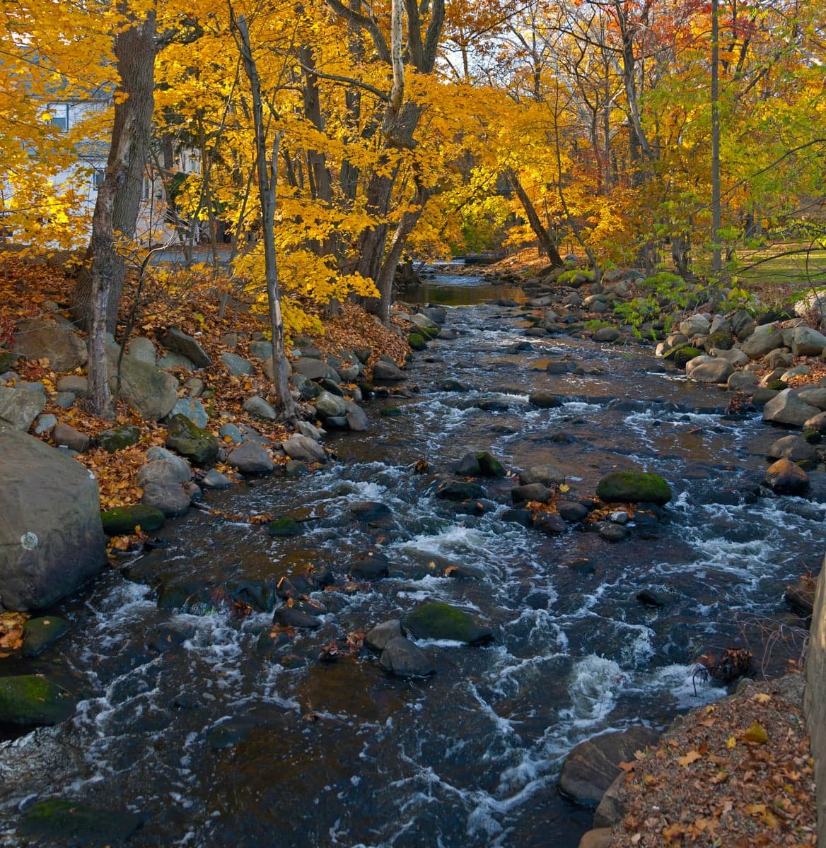
Photo: Wikipedia
Strategic Assessment of Ho-Ho-Kus, NJ
High tactical risk. This location is likely close to major population centers, strategic targets, or sits in a high-disaster corridor. A retreat property and careful exit planning is required.
What does the Strategic Assessment tell us?
Our Strategic Assessment grades tactical survivability of an area. Major population centers, military targets, fallout zones, natural disasters, and border exposure all drive risk — lower exposure means a more defensible position in a crisis.
This is heavily inspired by Joel Skousen's Strategic Relocation book. Highly recommended you checkout the book ($)What does this tell us?
Our Strategic Assessment grades tactical survivability of an area. Major population centers, military targets, fallout zones, natural disasters, and border exposure all drive risk — lower exposure means a more defensible position in a crisis.
This is heavily inspired by Joel Skousen's Strategic Relocation book. Highly recommended you checkout the book ($)Strategic Pillars

Key Distances
Regional Safe Places
Below is our recommended "safe zones" in New Jersey and the surrounding area based on our strategic heuristics. For most people, it's unrealistic to live in a “safe zone” full-time due to work, family or other personal reasons. They tend to be more rural. However, many of these areas are perfect for second homes and retreat properties that double as a vacation home or even a short-term rental.
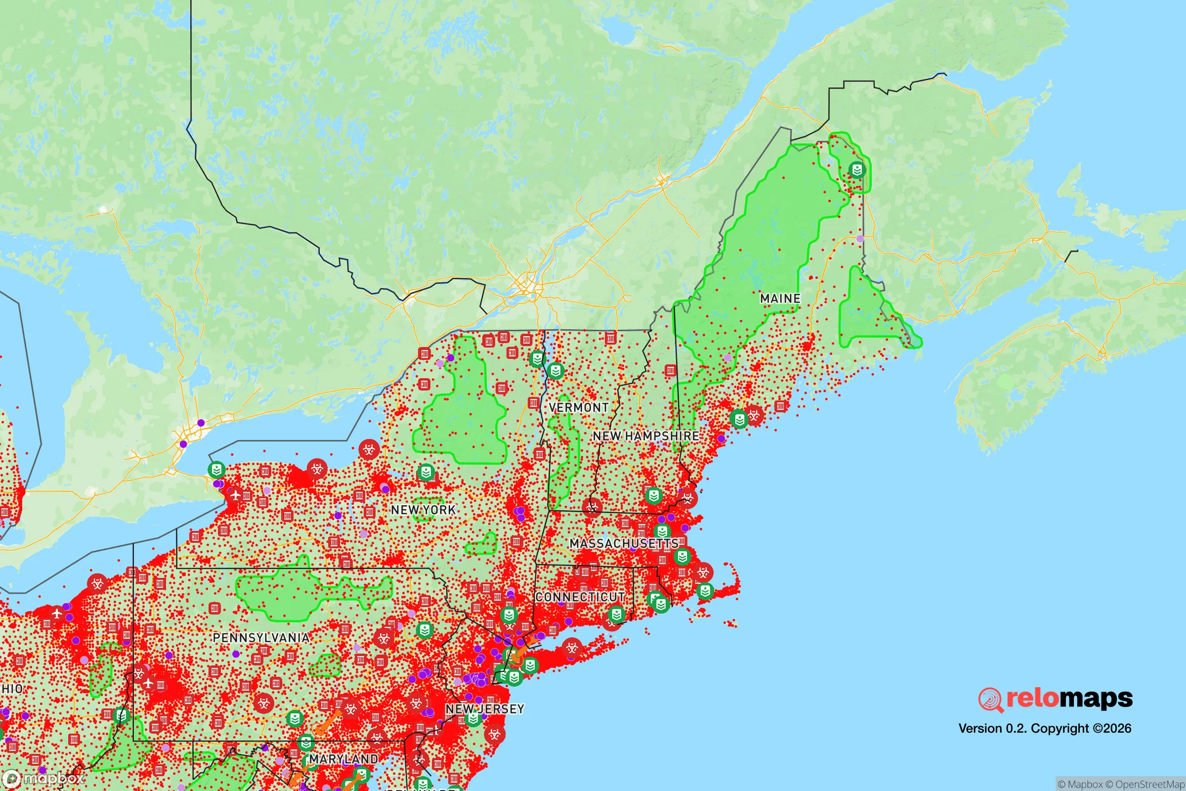
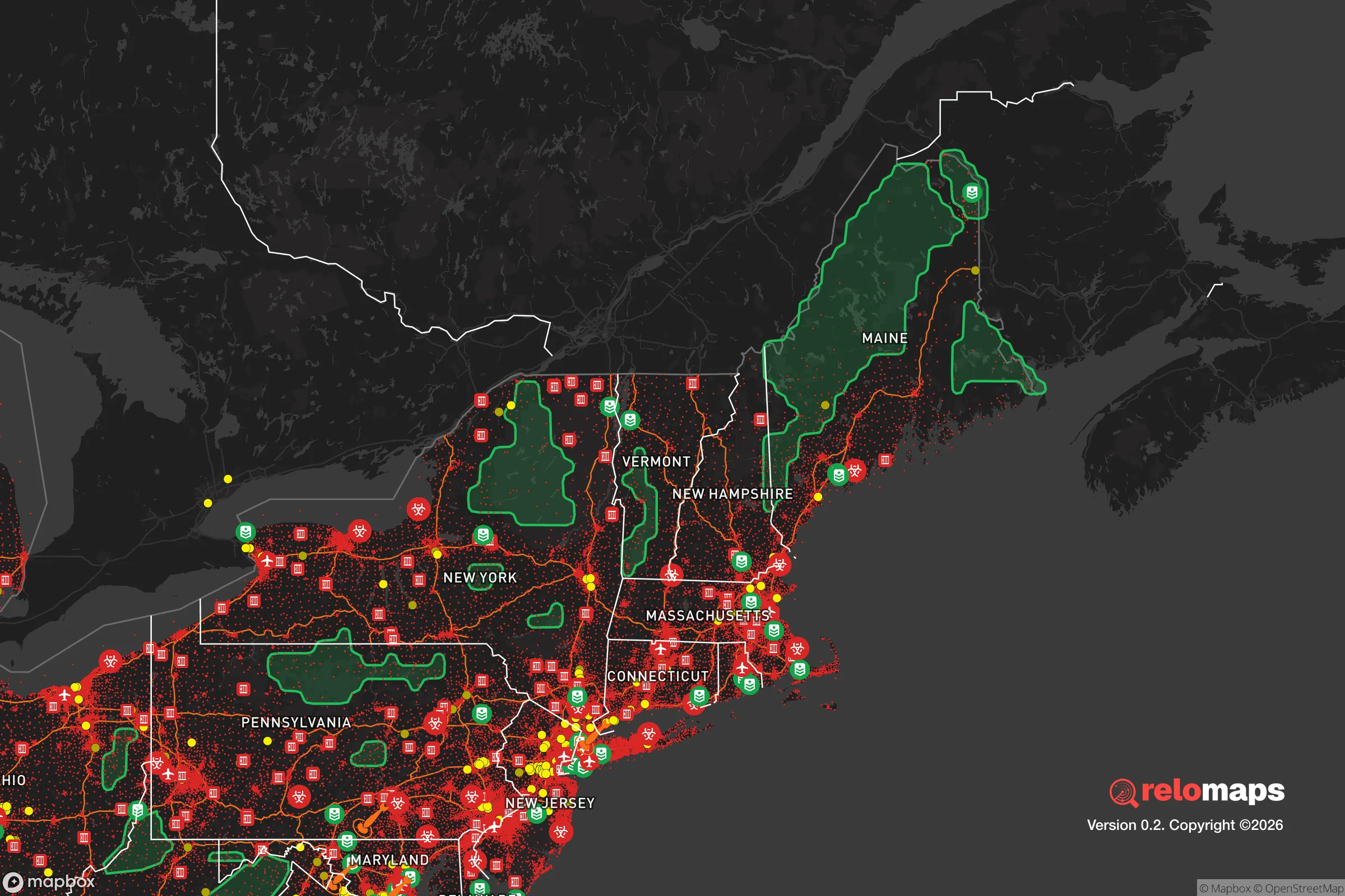


Important Note: For informational purposes only. This does not mean nothing bad ever happens in the green zones. Please use common sense. This is based on public data and modeled with AI. We tried to take a conservative approach but mistakes happen. We update this regularly as new information becomes available.
Solar Generator Recommendations
Backup power matters more here than in safer locations. We've picked three solar generators across budgets and capacity tiers — start with the budget unit if you only need a few essentials, or step up if you want to run a fridge and HVAC for days at a time.

Jackery Portable Power Station Explorer 300
Budget OptionPower on the Go: Weighing only 11 lbs, it's convenient to set up and store with book-sized foldable solar panels

BLUETTI Portable Power Station AC180
Designed for both indoor and outdoor scenarios, AC180 is highly capable as it has a robost capacity and continuous output power.

EF ECOFLOW DELTA Pro Ultra Power Station
Upgraded PickEcoFlow DELTA Pro Ultra is a whole-home energy system designed to grow with your family. Integrated with the Smart Home Panel 2, it scales to meet your evolving energy needs — keeping your home powered, intelligent, and secure through every stage of life.
We earn a commission, at no additional cost to you.
Strategic Assessment Analysis
Ho-Ho-Kus, New Jersey, presents a mixed strategic picture for the relocation-minded reader prioritizing resilience and self-sufficiency. While its location in Bergen County offers proximity to economic opportunity and established infrastructure, that same proximity to the New York City metropolitan area introduces significant vulnerabilities that a serious preparedness-minded individual must weigh. The borough’s small population (roughly 4,000 residents), tree-lined streets, and historic character provide a surface-level sense of security, but a deeper assessment reveals a location that is more exposed than it first appears, particularly regarding man-made risks and logistical independence.
Geographic position and natural advantages: What the area offers
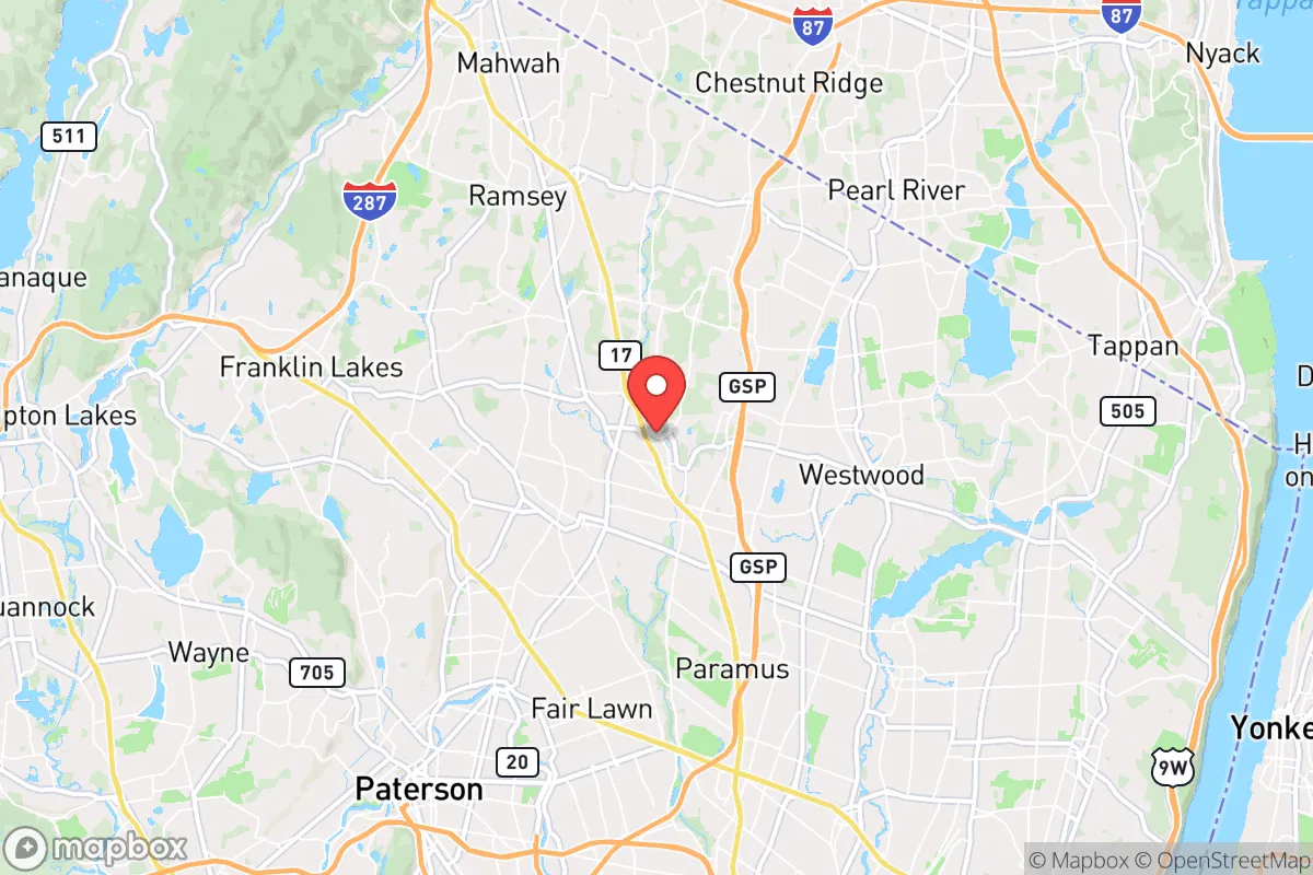
Ho-Ho-Kus sits in the Saddle River Valley, roughly 25 miles northwest of Midtown Manhattan, placing it within the outer ring of the New York City commuter shed. The borough’s natural setting is defined by the Saddle River, which runs through its center, and the surrounding wooded hills of the Piedmont region. This topography provides some modest natural advantages: the area is not flood-prone in the catastrophic sense of coastal New Jersey, though the Saddle River can rise during heavy rain events. The borough’s elevation, ranging from roughly 100 to 200 feet above sea level, offers no meaningful defensive high ground but does keep it clear of storm surge risks from the Atlantic, which is about 30 miles east. The local climate is typical of northern New Jersey—humid continental, with cold winters and warm summers—meaning winter storms and occasional nor’easters are the primary natural threats. Tornado activity is rare but not unheard of; Bergen County averages less than one tornado per decade. For a relocator seeking a buffer from coastal hurricanes, Ho-Ho-Kus is reasonably positioned, but it offers no exceptional natural fortress qualities compared to more rural parts of the state or the Appalachian foothills further west.
Risks, exposures, and proximity to fallout-relevant landmarks
The most significant strategic liability of Ho-Ho-Kus is its proximity to high-value targets and population centers. The borough lies within 30 miles of Newark Liberty International Airport, the Port of Newark and Elizabeth (one of the busiest container ports on the East Coast), and multiple major infrastructure nodes including the New Jersey Turnpike and the Lincoln Tunnel approach. In a scenario involving a major man-made disaster—whether a terrorist attack, industrial accident, or geopolitical escalation—this region would be a primary zone of disruption. The borough is also within 15 miles of the Indian Point Energy Center (though it is now decommissioned, its spent fuel remains on site), and within 20 miles of multiple chemical and refining facilities along the New Jersey Turnpike corridor. For a reader concerned about fallout or secondary effects from a strike on New York City, Ho-Ho-Kus is close enough to experience significant fallout patterns depending on wind direction, yet far enough that evacuation routes (primarily Route 17 and the Garden State Parkway) would be choked immediately. The borough’s location in a densely developed suburban corridor means that any large-scale event would trigger cascading failures in power, communications, and supply chains. The local population density of roughly 1,200 people per square mile is moderate, but the surrounding region is among the most densely populated in the United States, which amplies competition for resources during a crisis.
Practical resilience for a relocator: Food, water, energy, and defensibility
For a relocator serious about self-sufficiency, Ho-Ho-Kus presents significant challenges. The borough is almost entirely residential and commercial, with no agricultural land within its borders. The nearest working farms are in western Bergen County or Passaic County, 10 to 15 miles away, meaning food security would depend entirely on stored supplies or the ability to travel into less populated areas. The local water supply comes from the Saddle River and groundwater wells, treated by the Ho-Ho-Kus Water Department, which serves the entire borough. In a prolonged power outage, the water system would fail without backup generation—a common vulnerability in suburban systems. Residents on private wells (a minority in the borough) would fare better but still face pump failures without electricity. Energy infrastructure is grid-dependent, with no community solar or microgrid programs in place. Natural gas is the primary heating fuel, which would remain available during a grid outage but requires electric igniters for most modern furnaces. Wood-burning fireplaces are present in many older homes, but the borough’s tree canopy, while attractive, would become a hazard during ice storms rather than a reliable fuel source without proper processing and storage.
Defensibility is a weak point. Ho-Ho-Kus is a classic suburban bedroom community with a street grid that is open and accessible from multiple directions. The borough is bisected by Route 17, a major north-south arterial, and has multiple secondary roads connecting to neighboring towns (Waldwick, Ridgewood, Saddle River). There are no natural chokepoints or defensible perimeters. The local police department is small (roughly 20 officers), and mutual aid agreements with surrounding towns would be strained during a regional crisis. For a family seeking a location that can be secured or held against external pressure, Ho-Ho-Kus offers no inherent advantage. The borough’s social cohesion is a double-edged sword: the community is tight-knit and affluent, which could foster mutual aid, but that same affluence means many residents are accustomed to relying on external systems and may not have deep stores of supplies or skills. The local school system (Ho-Ho-Kus School, K-8, and Northern Highlands Regional High School) is excellent for normal times but would be a liability during a prolonged disruption, as schools would likely become gathering points for displaced populations.
The overall strategic picture for Ho-Ho-Kus is one of moderate natural resilience undermined by severe man-made exposure. For a relocator who works in New York City and wants a pleasant suburban life with a reasonable commute, the borough is a solid choice—good schools, low crime, and a stable community. But for someone prioritizing disaster readiness and self-sufficiency, the location’s proximity to high-value targets, dependence on fragile infrastructure, and lack of agricultural or defensive assets make it a less attractive option. The borough’s best-case scenario is a localized natural disaster (a winter storm or flood) where regional resources remain intact. Its worst-case scenario involves any event that disrupts the New York metropolitan area as a whole, in which case Ho-Ho-Kus would face the same pressures as the broader region with few unique advantages. A more resilient alternative would be further west, into the New Jersey Highlands or Pennsylvania’s Pocono region, where population density drops, agricultural land increases, and distance from major targets grows. For the reader who must remain within commuting distance of New York but wants to improve their resilience posture, Ho-Ho-Kus is a compromise—not a fortress, but not a front-line exposure either, provided one invests heavily in on-site water storage, backup power, and a well-stocked pantry.

* Values derived from national, state, county, city and local statistics and may differ in a specific area. Last updated: 2026-11-09T05:52:53.000Z
Narrative content on this page is AI-generated and may contain mistakes. Verify any details that matter before acting on them.
ReloMaps may earn a commission from affiliate links at no extra cost to you.

