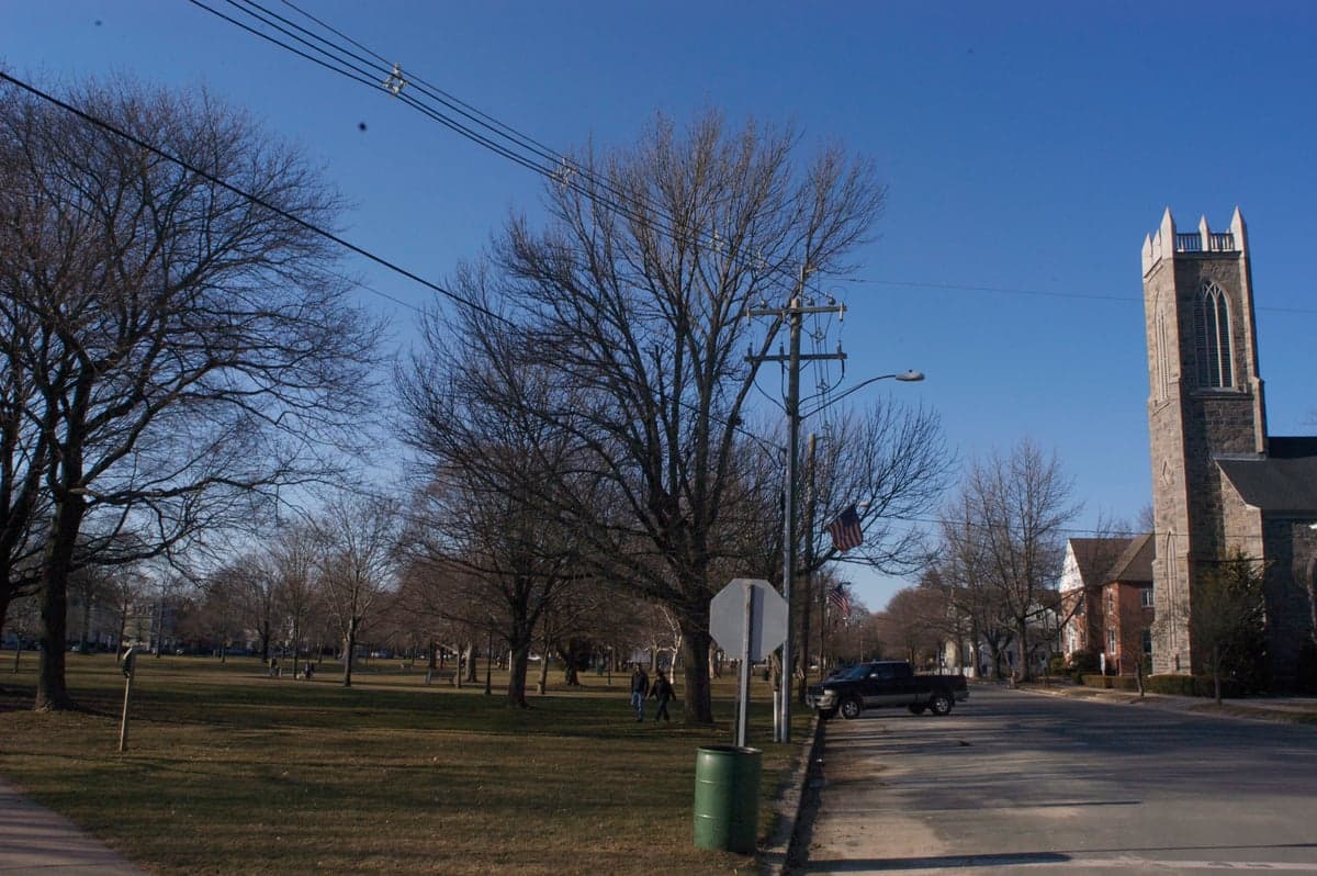
Photo: Wikipedia
Strategic Assessment of Guilford, CT
Meaningful friction. Expect exposure to either population pressure, blast zones, or natural disaster risk. Consider buying a retreat property.
What does the Strategic Assessment tell us?
Our Strategic Assessment grades tactical survivability of an area. Major population centers, military targets, fallout zones, natural disasters, and border exposure all drive risk — lower exposure means a more defensible position in a crisis.
This is heavily inspired by Joel Skousen's Strategic Relocation book. Highly recommended you checkout the book ($)What does this tell us?
Our Strategic Assessment grades tactical survivability of an area. Major population centers, military targets, fallout zones, natural disasters, and border exposure all drive risk — lower exposure means a more defensible position in a crisis.
This is heavily inspired by Joel Skousen's Strategic Relocation book. Highly recommended you checkout the book ($)Strategic Pillars

Key Distances
Regional Safe Places
Below is our recommended "safe zones" in Connecticut and the surrounding area based on our strategic heuristics. For most people, it's unrealistic to live in a “safe zone” full-time due to work, family or other personal reasons. They tend to be more rural. However, many of these areas are perfect for second homes and retreat properties that double as a vacation home or even a short-term rental.




Important Note: For informational purposes only. This does not mean nothing bad ever happens in the green zones. Please use common sense. This is based on public data and modeled with AI. We tried to take a conservative approach but mistakes happen. We update this regularly as new information becomes available.
Solar Generator Recommendations
Backup power matters more here than in safer locations. We've picked three solar generators across budgets and capacity tiers — start with the budget unit if you only need a few essentials, or step up if you want to run a fridge and HVAC for days at a time.

Jackery Portable Power Station Explorer 300
Budget OptionPower on the Go: Weighing only 11 lbs, it's convenient to set up and store with book-sized foldable solar panels

BLUETTI Portable Power Station AC180
Designed for both indoor and outdoor scenarios, AC180 is highly capable as it has a robost capacity and continuous output power.

EF ECOFLOW DELTA Pro Ultra Power Station
Upgraded PickEcoFlow DELTA Pro Ultra is a whole-home energy system designed to grow with your family. Integrated with the Smart Home Panel 2, it scales to meet your evolving energy needs — keeping your home powered, intelligent, and secure through every stage of life.
We earn a commission, at no additional cost to you.
Strategic Assessment Analysis
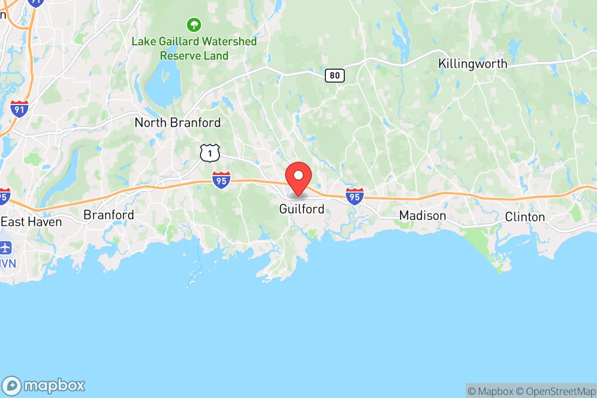
Guilford, Connecticut, occupies a strategic position along the Long Island Sound that offers a blend of coastal access and inland buffer, making it a noteworthy option for relocators prioritizing resilience and self-sufficiency. Its location roughly 20 miles east of New Haven and 100 miles northeast of New York City places it within the orbit of major metropolitan areas while maintaining a distinct, semi-rural character that supports a more independent lifestyle. For the reader thinking seriously about disaster readiness, Guilford presents a mixed picture: genuine geographic advantages in terms of natural resources and defensible terrain are tempered by its proximity to dense population centers and the vulnerabilities that come with coastal living. This assessment weighs those factors factually, without alarmism, to help you decide if Guilford fits your strategic relocation goals.
Geographic position and natural advantages for long-term stability
Guilford's geography is defined by its position on the north shore of Long Island Sound, with a coastline that includes tidal marshes, rocky headlands, and sandy beaches. The town's 47 square miles extend inland through rolling hills, forested tracts, and working farms, creating a layered landscape that offers both access to marine resources and room for dispersion. The presence of the West River, East River, and numerous smaller streams provides surface water sources, though none are large enough to pose a significant flood risk to most developed areas. The underlying geology is primarily crystalline bedrock with glacial till, which supports stable building foundations and limits the risk of liquefaction during seismic events—a minor but real consideration in a region with occasional earthquake activity. Guilford's elevation ranges from sea level along the coast to roughly 300 feet in its northern sections, offering natural vantage points and reducing vulnerability to storm surge for properties set back from the shoreline. The town's extensive open space, including the 1,000-acre Westwoods trail system and the 800-acre Guilford Land Conservation Trust holdings, provides both a buffer against overdevelopment and potential resources for subsistence activities like foraging, firewood gathering, and small-game hunting. For a relocator, the key takeaway is that Guilford's geography supports a degree of self-sufficiency that is increasingly rare within commuting distance of major employment centers.
Risk exposure: natural hazards and proximity to high-value targets
The most significant natural risk in Guilford is coastal storm surge from hurricanes and nor'easters, which can push water several feet above normal tide levels into low-lying areas along the Sound. The town's floodplain maps show that properties near the shoreline, particularly around the Guilford Harbor and the tidal creeks feeding into it, face the highest exposure. The Federal Emergency Management Agency (FEMA) designates portions of these areas as Special Flood Hazard Areas, meaning flood insurance is mandatory for federally backed mortgages. Inland areas, especially those above the 50-foot contour line, are largely insulated from surge risk but remain susceptible to wind damage from severe storms. The 2011 tornado that struck nearby Hamden and the 2018 microburst that damaged parts of Guilford itself are reminders that inland severe weather is a real, if less frequent, concern. Snow and ice storms are annual events, with the potential to knock out power for days or weeks, as seen during the 2011 October snowstorm that left much of the region without electricity for up to 11 days. On the man-made risk side, Guilford's proximity to New Haven (home to Yale University, a major medical center, and the Port of New Haven) and its location along the I-95 corridor place it within the fallout zone of potential high-value targets in a conflict scenario. The town is roughly 25 miles from the Millstone Nuclear Power Station in Waterford, which, while not a target itself, could be a source of radiological release in the event of an accident or attack. For the resilience-minded relocator, the practical implication is that Guilford offers a reasonable balance of natural hazard exposure—manageable with proper site selection and preparation—but carries the inherent risk of being within the shadow of larger, more attractive targets.
Practical resilience: food, water, energy, and defensibility for daily life
Guilford's practical resilience for a relocator focused on self-sufficiency is above average for coastal Connecticut, driven by several concrete factors. The town's agricultural heritage is still alive, with multiple working farms—including Bishop's Orchards, which has been operating since 1871, and several smaller CSA operations—that provide local food sources. The presence of the Guilford Farmers Market, operating from June through October, and the town's right-to-farm ordinance support a local food ecosystem that could be expanded in a crisis. Water availability is generally good, with the town's public water supply drawn from the Lake Gaillard reservoir system, which has a capacity of roughly 2.5 billion gallons and serves multiple communities. For those on private wells, the underlying aquifer is productive in most areas, though well yields vary by location and should be tested before purchase. Energy resilience is a mixed picture: Eversource is the primary electric utility, and its overhead lines are vulnerable to storm damage. However, the town's relatively low population density (roughly 400 people per square mile) means that power restoration can be slower than in denser areas, making a backup generator or solar-plus-battery system a wise investment. Natural gas is available in the more developed village areas but not in the outlying rural sections, where heating oil and propane are common. Defensibility is a more subjective factor, but Guilford's layout offers some advantages: the town center is compact and walkable, while the outlying areas are characterized by winding roads, wooded lots, and limited through-traffic, which can slow unauthorized access. The town's police department is professional and well-regarded, with a force of roughly 40 officers, but in a prolonged disruption, residents in the more remote northern sections would likely need to rely on themselves and their neighbors. For the relocator, the strategic picture is that Guilford provides a solid foundation for building a resilient lifestyle, but it requires active investment in backup systems, food storage, and community connections to realize its full potential.
The overall strategic picture for Guilford is one of qualified opportunity. Its geographic position offers genuine advantages in terms of natural resources, open space, and a layered landscape that supports both coastal access and inland security. The risks are real but manageable: storm surge is a localized threat that can be mitigated by choosing higher ground, and the proximity to metropolitan areas is a double-edged sword that provides economic access while introducing vulnerability to man-made events. For the relocator who is serious about disaster readiness and self-sufficiency, Guilford represents a middle path—not as remote as northern New England, but more resilient than a dense suburb. The town's combination of working farms, surface water, and defensible terrain, paired with its established community infrastructure, makes it a viable option for those willing to invest in preparation. The key is to approach the decision with clear eyes: Guilford is not a bunker, but it is a place where a thoughtful, prepared individual or family can build a life that is both connected and resilient.

* Values derived from national, state, county, city and local statistics and may differ in a specific area. Last updated: 2026-09-27T19:25:44.000Z
Narrative content on this page is AI-generated and may contain mistakes. Verify any details that matter before acting on them.
ReloMaps may earn a commission from affiliate links at no extra cost to you.

