Photo: Wikipedia
Strategic Assessment of Gloucester, MA
Multiple tactical vulnerabilities. Population density, target proximity, or disaster risk are likely compounding. A retreat property and exit planning is required.
What does the Strategic Assessment tell us?
Our Strategic Assessment grades tactical survivability of an area. Major population centers, military targets, fallout zones, natural disasters, and border exposure all drive risk — lower exposure means a more defensible position in a crisis.
This is heavily inspired by Joel Skousen's Strategic Relocation book. Highly recommended you checkout the book ($)What does this tell us?
Our Strategic Assessment grades tactical survivability of an area. Major population centers, military targets, fallout zones, natural disasters, and border exposure all drive risk — lower exposure means a more defensible position in a crisis.
This is heavily inspired by Joel Skousen's Strategic Relocation book. Highly recommended you checkout the book ($)Strategic Pillars

Key Distances
Regional Safe Places
Below is our recommended "safe zones" in Massachusetts and the surrounding area based on our strategic heuristics. For most people, it's unrealistic to live in a “safe zone” full-time due to work, family or other personal reasons. They tend to be more rural. However, many of these areas are perfect for second homes and retreat properties that double as a vacation home or even a short-term rental.




Important Note: For informational purposes only. This does not mean nothing bad ever happens in the green zones. Please use common sense. This is based on public data and modeled with AI. We tried to take a conservative approach but mistakes happen. We update this regularly as new information becomes available.
Solar Generator Recommendations
Backup power matters more here than in safer locations. We've picked three solar generators across budgets and capacity tiers — start with the budget unit if you only need a few essentials, or step up if you want to run a fridge and HVAC for days at a time.

Jackery Portable Power Station Explorer 300
Budget OptionPower on the Go: Weighing only 11 lbs, it's convenient to set up and store with book-sized foldable solar panels

BLUETTI Portable Power Station AC180
Designed for both indoor and outdoor scenarios, AC180 is highly capable as it has a robost capacity and continuous output power.

EF ECOFLOW DELTA Pro Ultra Power Station
Upgraded PickEcoFlow DELTA Pro Ultra is a whole-home energy system designed to grow with your family. Integrated with the Smart Home Panel 2, it scales to meet your evolving energy needs — keeping your home powered, intelligent, and secure through every stage of life.
We earn a commission, at no additional cost to you.
Strategic Assessment Analysis
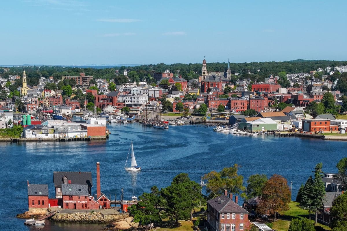
Gloucester, Massachusetts, presents a complex strategic picture for the disaster-conscious relocator: it offers genuine natural advantages in the form of a defensible peninsula and abundant local resources, but its proximity to the Boston metro area and specific geographic exposures introduce significant vulnerabilities that cannot be ignored. For a single individual or family prioritizing self-sufficiency and resilience, Gloucester is not a standalone fortress but rather a location that requires active preparation to offset its risks. The city's working waterfront, established fishing industry, and historic character provide a foundation for local food security that is rare in New England, yet its position on the Atlantic coast and its reliance on a single arterial road create a double-edged sword that demands careful strategic consideration.
Geographic position and natural advantages for self-sufficiency
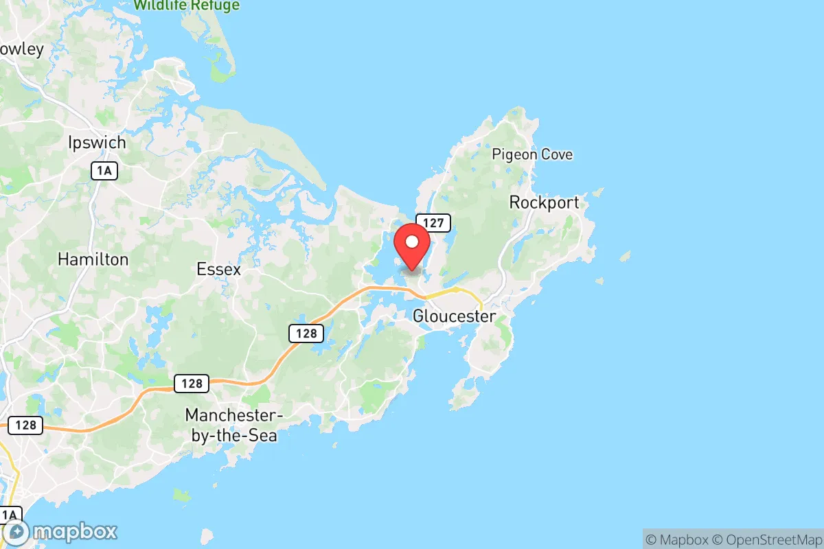
Gloucester occupies the tip of Cape Ann, roughly 30 miles northeast of Boston, a position that offers both isolation and access. The peninsula's geography provides a natural buffer: the city is surrounded on three sides by water, with only a narrow land connection to the mainland at the town of Essex. This chokepoint, where Route 128 crosses the Annisquam River, is the sole road access for vehicles, making it both a defensible bottleneck and a critical vulnerability. The surrounding waters of the Atlantic Ocean, Ipswich Bay, and Massachusetts Bay create a maritime climate that moderates temperature extremes, reducing the risk of the deep freezes that can cripple inland areas. The rocky coastline and numerous harbors, including Gloucester Harbor and the Annisquam River, offer protected anchorages for small craft, which could serve as alternative transportation routes if road access is compromised. The city's elevation is generally low, with most developed areas sitting between 10 and 50 feet above sea level, though several hills rise to over 150 feet, providing vantage points and potential high-ground refuge zones. The local geology is dominated by granite bedrock, which supports stable building foundations and, critically, offers potential for groundwater wells in areas not served by municipal water. The city's 26 square miles include significant tracts of woodland, particularly in the Dogtown Common area, a 3,000-acre forested plateau at the center of the peninsula that could serve as a source of firewood, game, and natural shelter.
Risks, exposures, and proximity to fallout-relevant landmarks
The most significant strategic liability for Gloucester is its proximity to the Boston metropolitan area, a dense population center of over 4.5 million people that would be a primary target in any major conflict or disaster scenario. The city lies roughly 30 miles from downtown Boston and approximately 25 miles from the Boston Navy Yard and the Port of Boston, both of which are high-value military and logistical targets. Additionally, the Seabrook Station Nuclear Power Plant is located just 15 miles north in New Hampshire, a facility that, while operational, represents a potential radiological hazard in the event of an accident or attack. The prevailing wind patterns in the region are from the west and northwest, meaning that fallout from a strike on Boston or Seabrook would likely be carried eastward over Cape Ann, directly affecting Gloucester. The city's coastal position also exposes it to hurricane storm surge; the National Hurricane Center's SLOSH model indicates that a Category 2 hurricane could produce storm surge of 8 to 12 feet in Gloucester Harbor, flooding low-lying areas including the downtown waterfront, the Blynman Bridge area, and parts of East Gloucester. Sea level rise is a slower but persistent threat, with NOAA projections showing a 1 to 2 foot rise by 2050, which would increase the frequency of nuisance flooding and erode coastal infrastructure. The city's reliance on the Route 128 bridge over the Annisquam River as the sole road egress is a critical single point of failure; if that bridge is damaged or blocked, the only alternative is a lengthy detour through Rockport or a water crossing. Earthquake risk is low but not zero, with the region experiencing minor seismic events every few decades, though the granite bedrock provides some resilience against ground shaking.
Practical resilience for a relocator: food, water, energy, and defensibility
Gloucester's greatest practical resilience asset is its working waterfront and commercial fishing fleet, which lands millions of pounds of groundfish, lobster, and shellfish annually. The city is home to the oldest continuously operating fishing port in the United States, and the presence of active fish processing facilities, wholesale markets, and a network of local fishermen means that fresh protein is available locally even if supply chains are disrupted. The city also has a strong agricultural presence in its surrounding areas, with several farms in Essex, Ipswich, and Manchester-by-the-Sea producing vegetables, poultry, and dairy within a 10-mile radius. The Gloucester Farmers Market operates seasonally, and the city's coastal location supports foraging for shellfish, seaweed, and wild edibles along the shoreline. For water security, the city's municipal water supply comes from the Gloucester Reservoir system, which includes the Babson Reservoir, the Goose Cove Reservoir, and several smaller impoundments, providing a combined storage capacity of roughly 1.5 billion gallons. However, this system is vulnerable to contamination and power outages; residents relying on municipal water should have backup filtration and storage. Homes with private wells on the granite bedrock can achieve good water quality, though yields vary and well drilling is expensive. Energy resilience is a mixed picture: the city is served by National Grid for electricity and natural gas, but the coastal location means that power outages from nor'easters and hurricanes are frequent, with some storms causing multi-day blackouts. Solar panel adoption is growing but remains below the state average, and the city's tree canopy poses a risk of falling limbs during storms. For defensibility, the peninsula's single-road access creates a natural chokepoint that could be secured with minimal personnel, but the extensive coastline and numerous coves make it impossible to monitor all potential landing points. The city's population of roughly 30,000 includes a significant number of fishermen, boat builders, and tradespeople with practical skills, which is a social resilience asset. The local police force is well-funded and has mutual aid agreements with surrounding communities, but response times to remote areas of the peninsula could be slow during a widespread event.
The overall strategic picture for Gloucester is one of high potential tempered by significant exposure. The city offers genuine advantages for the self-sufficient relocator: abundant local seafood, a defensible geography, a skilled working population, and a moderate climate that reduces some risks. However, the proximity to Boston and the Seabrook nuclear plant, the single-road egress, and the vulnerability to storm surge and sea level rise are serious liabilities that cannot be mitigated by individual preparation alone. For a family or individual willing to invest in backup power, water storage, and a robust emergency plan, Gloucester can be a viable long-term base, particularly if they secure a property on high ground away from the immediate waterfront and maintain a small boat for alternative transportation. The city is not a remote survival retreat, but it is a functional coastal community where a prepared relocator can build a resilient life while remaining within reach of urban resources when conditions are stable. The key is to treat Gloucester as a location that requires active management of its risks rather than a place that offers passive safety.

* Values derived from national, state, county, city and local statistics and may differ in a specific area. Last updated: 2026-10-13T18:16:17.000Z
Narrative content on this page is AI-generated and may contain mistakes. Verify any details that matter before acting on them.
ReloMaps may earn a commission from affiliate links at no extra cost to you.

