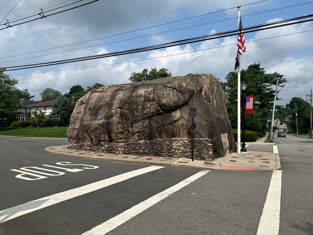
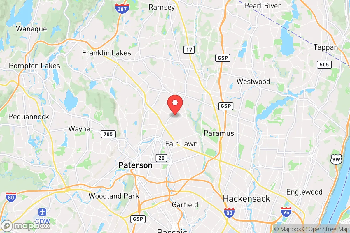
Photo: Wikipedia
Strategic Assessment of Glen Rock, NJ
High tactical risk. This location is likely close to major population centers, strategic targets, or sits in a high-disaster corridor. A retreat property and careful exit planning is required.
What does the Strategic Assessment tell us?
Our Strategic Assessment grades tactical survivability of an area. Major population centers, military targets, fallout zones, natural disasters, and border exposure all drive risk — lower exposure means a more defensible position in a crisis.
This is heavily inspired by Joel Skousen's Strategic Relocation book. Highly recommended you checkout the book ($)What does this tell us?
Our Strategic Assessment grades tactical survivability of an area. Major population centers, military targets, fallout zones, natural disasters, and border exposure all drive risk — lower exposure means a more defensible position in a crisis.
This is heavily inspired by Joel Skousen's Strategic Relocation book. Highly recommended you checkout the book ($)Strategic Pillars

Key Distances
Regional Safe Places
Below is our recommended "safe zones" in New Jersey and the surrounding area based on our strategic heuristics. For most people, it's unrealistic to live in a “safe zone” full-time due to work, family or other personal reasons. They tend to be more rural. However, many of these areas are perfect for second homes and retreat properties that double as a vacation home or even a short-term rental.
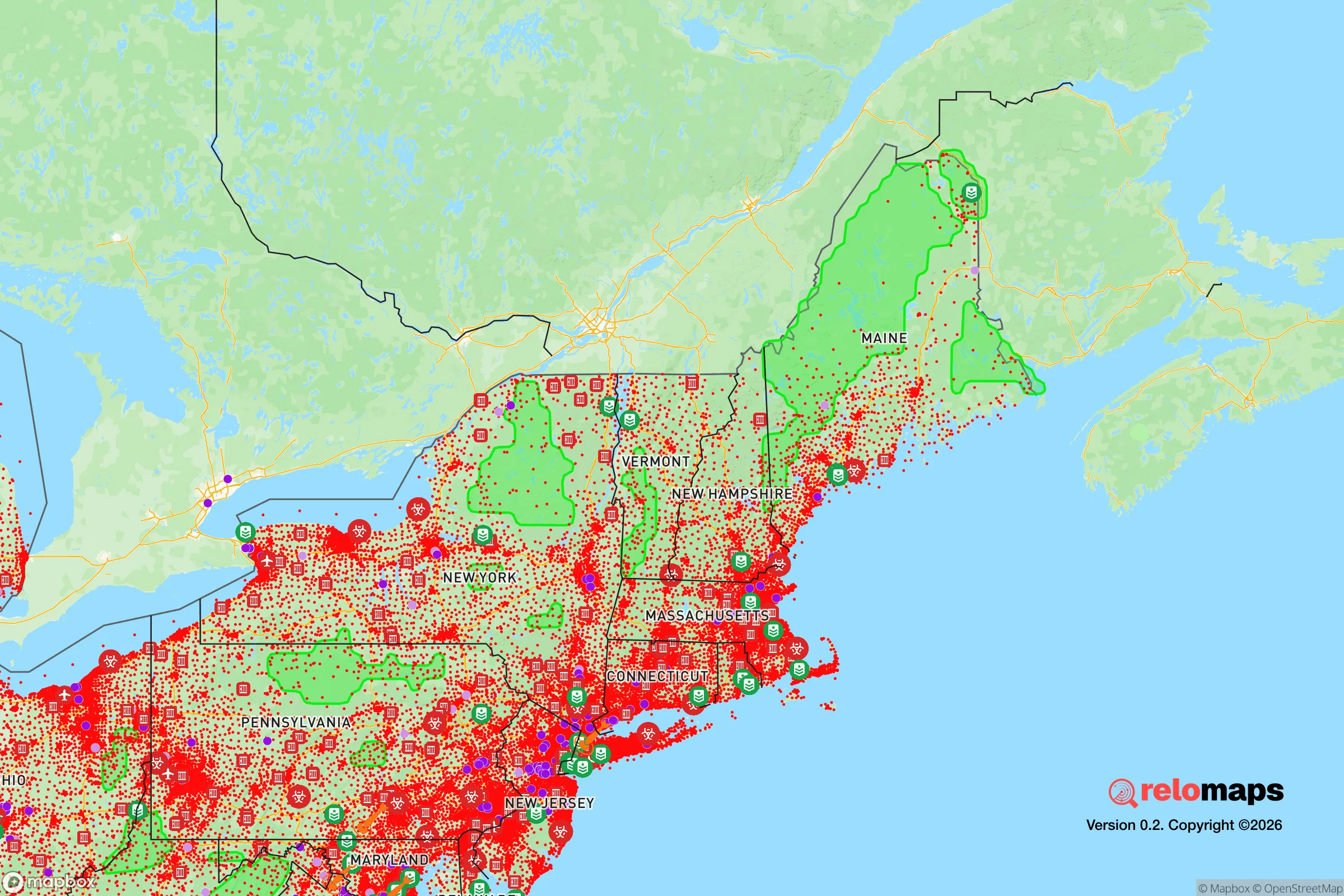
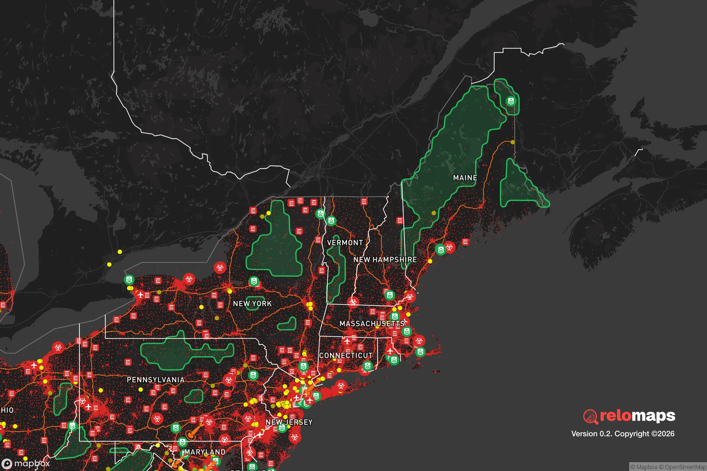


Important Note: For informational purposes only. This does not mean nothing bad ever happens in the green zones. Please use common sense. This is based on public data and modeled with AI. We tried to take a conservative approach but mistakes happen. We update this regularly as new information becomes available.
Solar Generator Recommendations
Backup power matters more here than in safer locations. We've picked three solar generators across budgets and capacity tiers — start with the budget unit if you only need a few essentials, or step up if you want to run a fridge and HVAC for days at a time.

Jackery Portable Power Station Explorer 300
Budget OptionPower on the Go: Weighing only 11 lbs, it's convenient to set up and store with book-sized foldable solar panels

BLUETTI Portable Power Station AC180
Designed for both indoor and outdoor scenarios, AC180 is highly capable as it has a robost capacity and continuous output power.

EF ECOFLOW DELTA Pro Ultra Power Station
Upgraded PickEcoFlow DELTA Pro Ultra is a whole-home energy system designed to grow with your family. Integrated with the Smart Home Panel 2, it scales to meet your evolving energy needs — keeping your home powered, intelligent, and secure through every stage of life.
We earn a commission, at no additional cost to you.
Strategic Assessment Analysis
Glen Rock, New Jersey, presents a mixed strategic picture for the relocation-minded reader focused on resilience and preparedness. Its location in Bergen County offers genuine advantages in terms of access to resources and infrastructure, but its proximity to the New York City metropolitan area introduces significant vulnerabilities that a serious disaster-readiness assessment cannot ignore. For the individual or family weighing self-sufficiency against convenience, Glen Rock demands a clear-eyed evaluation of its geographic position, exposure to risks, and practical capacity for sustained independence.
Geographic position and natural advantages for a prepared household
Glen Rock sits in the Piedmont region of northeastern New Jersey, roughly 20 miles northwest of Midtown Manhattan. The borough’s name derives from a distinctive 570-ton glacial erratic boulder, a reminder of the area’s stable bedrock geology. This underlying geology is a genuine asset: the region is not prone to significant seismic activity, and the local topography—gentle hills and valleys with elevations ranging from about 100 to 200 feet above sea level—provides natural drainage that reduces flood risk compared to low-lying coastal or riverine communities. The borough is not located in a designated floodplain, though localized street flooding can occur during heavy rain events. The climate is humid continental, with cold winters and warm summers, meaning a prepared household must plan for both snowstorms and heat waves. The area’s tree canopy is moderate, offering some natural cooling and windbreak benefits, but also presenting a risk of downed limbs during ice storms or high winds. For a relocator, the key natural advantage is the absence of major geological or hydrological threats—no hurricanes, no earthquakes, no wildfires of consequence—but the trade-off is a location that is deeply integrated into a dense, interdependent suburban and urban network.
Risks, exposures, and proximity to fallout-relevant landmarks
The most significant risk for Glen Rock is its proximity to the New York City metropolitan area, a primary target in any large-scale conflict or terrorist event. The borough lies within a 30-mile radius of Manhattan, placing it well within the zone of potential fallout, secondary attacks, or mass evacuation chaos. The area is also near several critical infrastructure nodes: the George Washington Bridge (about 12 miles southeast), the Lincoln Tunnel (about 15 miles southeast), and Newark Liberty International Airport (about 20 miles south). These are high-value targets that could be compromised in a crisis. Additionally, Glen Rock is within 10 miles of the Indian Point Energy Center (now decommissioned but still containing spent fuel), and within 20 miles of the Oyster Creek Nuclear Generating Station (also decommissioned but with ongoing decommissioning activities). While the risk of a nuclear incident from these sites is low, the presence of spent fuel pools and dry cask storage is a non-zero concern for the hyper-prepared. The borough’s location in Bergen County also means it is part of a dense suburban corridor with limited egress routes. Major evacuation arteries like the Garden State Parkway, Route 4, and Route 17 are notorious for congestion even on normal days; a mass evacuation scenario would likely gridlock these roads within hours. For the relocator, the strategic takeaway is that Glen Rock’s resilience is heavily dependent on the stability of the broader region. A localized disaster (e.g., a severe storm) is manageable, but a regional or national crisis would expose the borough to cascading failures from the nearby urban core.
Practical resilience for a relocator: food, water, energy, and defensibility
For a household committed to self-sufficiency, Glen Rock offers a mixed but workable environment. The borough is served by public water from Suez Water, which draws from the Hackensack River and the Oradell Reservoir. In a prolonged power outage, water pressure can fail, so a minimum of a two-week supply of stored water (one gallon per person per day) is a baseline recommendation. Private wells are rare in the borough, so rainwater collection (where permitted) or a backup well on a larger property would be a significant advantage. Food resilience is moderate: the area has several supermarkets (ShopRite, Stop & Shop, Whole Foods) within a 10-minute drive, but these are dependent on the same supply chains that serve the entire metro region. A serious prepper would want to establish a home garden (the growing season runs roughly April to October) and build a pantry with at least a three-month supply of non-perishables. Local farmers’ markets operate seasonally, but year-round local food production is limited. Energy resilience is a critical weak point. The borough’s power grid is served by PSE&G, and outages are common during storms—typically lasting a few hours to a day, but major events (like Superstorm Sandy in 2012) can cause multi-day blackouts. Solar panels with battery storage (e.g., Tesla Powerwall or similar) are a viable investment, as New Jersey has net metering policies and state incentives. A backup generator (natural gas or propane) is a more immediate solution, but fuel supply chains can be disrupted. Defensibility is the most challenging aspect. Glen Rock is a dense suburban borough with a population of about 11,000 in roughly 2.7 square miles. It has a single main police station and a volunteer fire department. The borough’s layout—grid-like streets with multiple access points—makes it difficult to secure in a crisis. There are no natural chokepoints or defensible perimeters. For the relocator, the practical reality is that Glen Rock is not a bug-out location; it is a live-in-place community that requires a high degree of personal preparedness and community cooperation to weather a prolonged disruption.
The overall strategic picture for Glen Rock is one of calculated trade-offs. Its geographic stability and access to regional resources are genuine assets for day-to-day life and moderate emergencies. However, its proximity to New York City and critical infrastructure, combined with limited evacuation routes and a dense, open layout, make it a less-than-ideal choice for the reader prioritizing long-term self-sufficiency and security in a major crisis. For the family that values strong schools, a walkable downtown, and a low-crime environment—and is willing to invest in home-based resilience measures like backup power, water storage, and a deep pantry—Glen Rock can be a viable option. But for the individual whose primary relocation criterion is strategic defensibility and distance from high-value targets, the borough’s location is a clear liability. The prepared relocator should view Glen Rock as a comfortable base camp, not a fortress, and plan accordingly.

* Values derived from national, state, county, city and local statistics and may differ in a specific area. Last updated: 2026-11-09T06:00:12.000Z
Narrative content on this page is AI-generated and may contain mistakes. Verify any details that matter before acting on them.
ReloMaps may earn a commission from affiliate links at no extra cost to you.

