
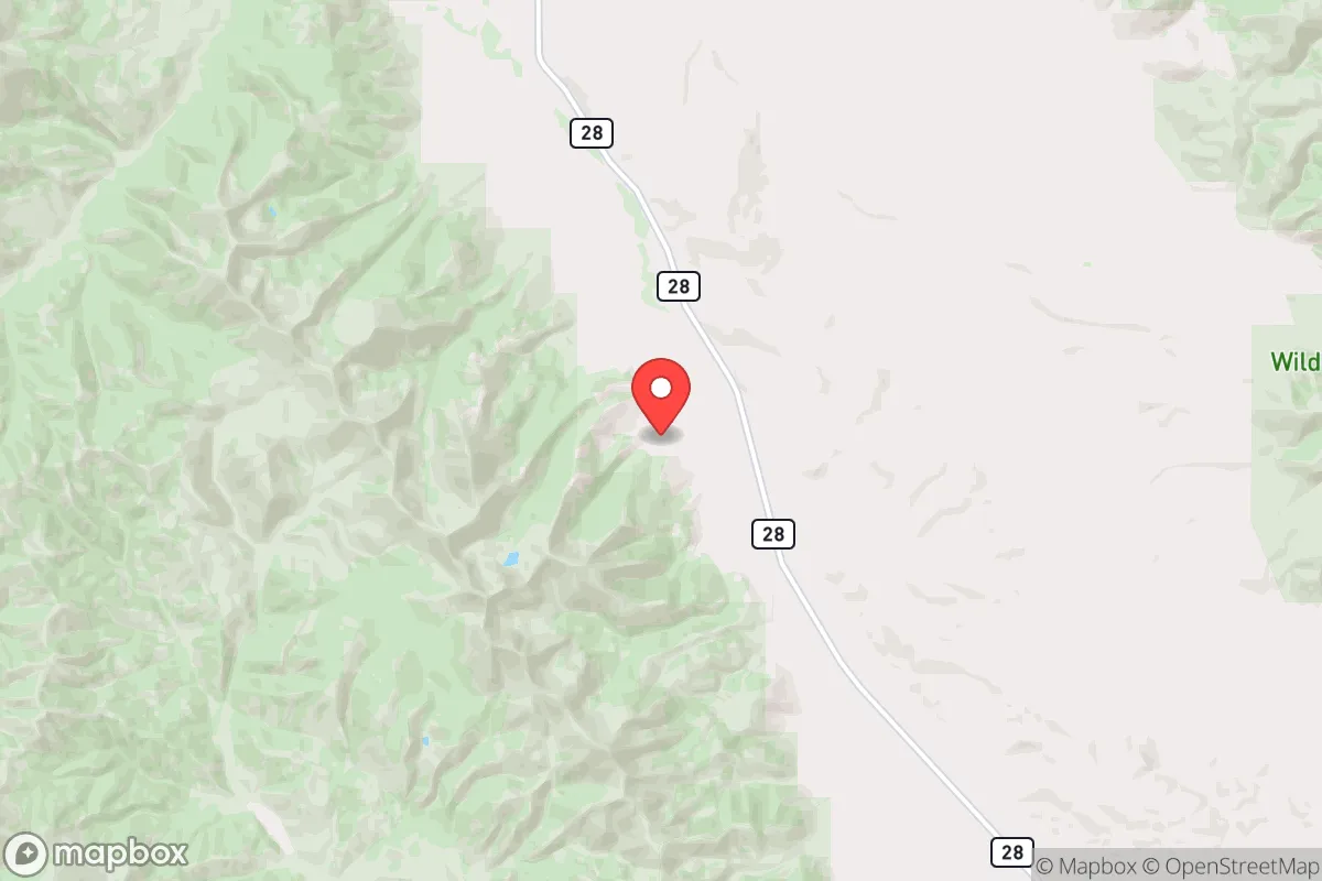
Strategic Assessment of Gilmore, ID
Deep buffer from population centers and strategic targets. Low natural disaster risk and minimal exposure to border or coastal threats.
What does the Strategic Assessment tell us?
Our Strategic Assessment grades tactical survivability of an area. Major population centers, military targets, fallout zones, natural disasters, and border exposure all drive risk — lower exposure means a more defensible position in a crisis.
This is heavily inspired by Joel Skousen's Strategic Relocation book. Highly recommended you checkout the book ($)What does this tell us?
Our Strategic Assessment grades tactical survivability of an area. Major population centers, military targets, fallout zones, natural disasters, and border exposure all drive risk — lower exposure means a more defensible position in a crisis.
This is heavily inspired by Joel Skousen's Strategic Relocation book. Highly recommended you checkout the book ($)Strategic Pillars

Key Distances
Regional Safe Places
Below is our recommended "safe zones" in Idaho and the surrounding area based on our strategic heuristics. For most people, it's unrealistic to live in a “safe zone” full-time due to work, family or other personal reasons. They tend to be more rural. However, many of these areas are perfect for second homes and retreat properties that double as a vacation home or even a short-term rental.
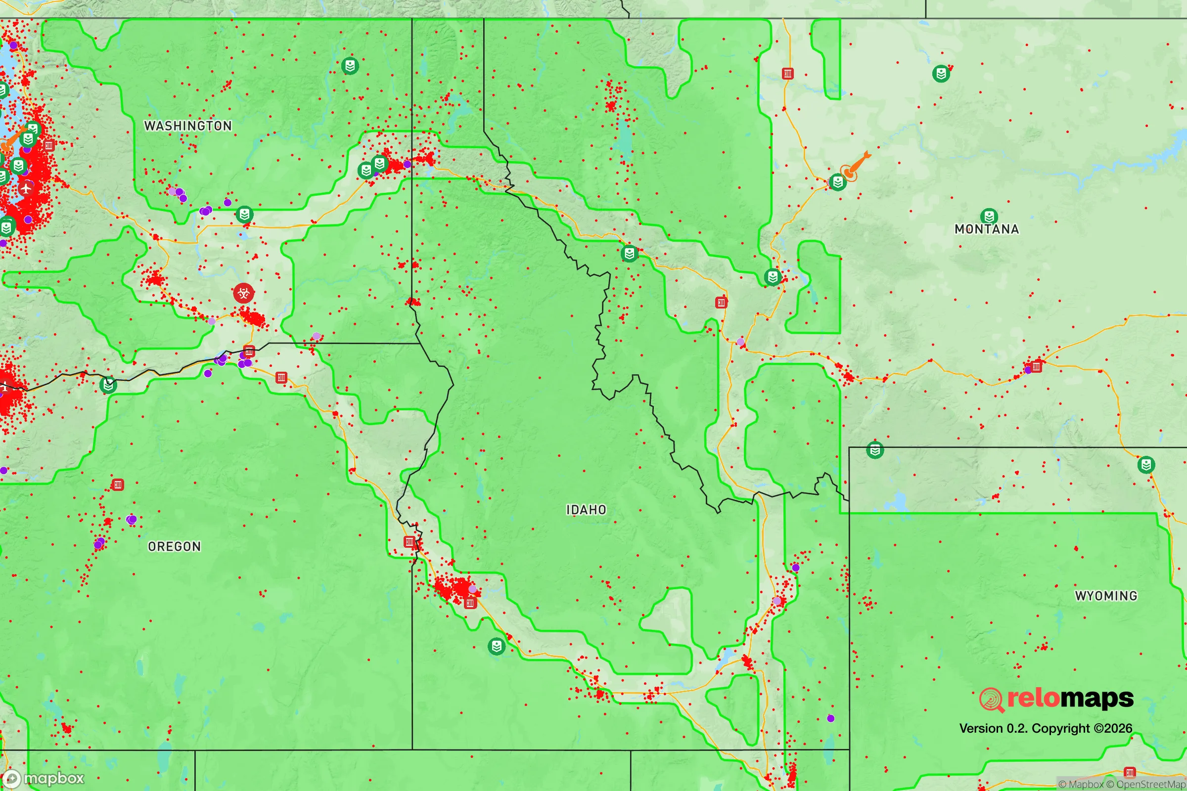


Important Note: For informational purposes only. This does not mean nothing bad ever happens in the green zones. Please use common sense. This is based on public data and modeled with AI. We tried to take a conservative approach but mistakes happen. We update this regularly as new information becomes available.
Solar Generator Recommendations
Backup power matters more here than in safer locations. We've picked three solar generators across budgets and capacity tiers — start with the budget unit if you only need a few essentials, or step up if you want to run a fridge and HVAC for days at a time.

Jackery Portable Power Station Explorer 300
Budget OptionPower on the Go: Weighing only 11 lbs, it's convenient to set up and store with book-sized foldable solar panels

BLUETTI Portable Power Station AC180
Designed for both indoor and outdoor scenarios, AC180 is highly capable as it has a robost capacity and continuous output power.

EF ECOFLOW DELTA Pro Ultra Power Station
Upgraded PickEcoFlow DELTA Pro Ultra is a whole-home energy system designed to grow with your family. Integrated with the Smart Home Panel 2, it scales to meet your evolving energy needs — keeping your home powered, intelligent, and secure through every stage of life.
We earn a commission, at no additional cost to you.
Strategic Assessment Analysis
Gilmore, Idaho, sits in a remote pocket of Lemhi County that offers a genuine strategic advantage for those prioritizing disaster readiness and self-sufficiency: extreme isolation combined with robust natural resources. This former mining camp, now a near-ghost town with a handful of year-round residents, is positioned in a high mountain valley at roughly 5,300 feet elevation, surrounded by the Beaverhead and Bitterroot ranges. For a relocator serious about resilience, Gilmore provides a blank slate—minimal infrastructure, low population density, and direct access to water, timber, and defensible terrain—but it demands a high level of self-reliance and a tolerance for harsh winters and limited services.
Geographic position and natural advantages for long-term survival
Gilmore’s primary resilience asset is its location deep in the Salmon-Challis National Forest, roughly 30 miles northwest of Salmon, Idaho, and 90 miles southwest of Dillon, Montana. The area sits in a rain shadow east of the Bitterroot Range, receiving about 12–15 inches of precipitation annually, which is low for the Rockies but sufficient for dryland grazing and small-scale irrigation from perennial creeks like Gilmore Creek and nearby Agency Creek. The surrounding mountains rise to over 10,000 feet, providing natural barriers that limit road access to a single paved route—Idaho State Highway 28—which connects to Salmon and then to Interstate 15. This chokepoint geography makes the area highly defensible: any approach is visible from miles away, and the terrain offers countless natural redoubts in the form of steep canyons, old mining adits, and forested ridges. The elevation also means cooler summers and deep snow in winter, which can be a double-edged sword—it preserves water in the snowpack but complicates year-round mobility. For a relocator, the key advantage is that Gilmore sits far from any major population center (the nearest city of 50,000+ is Idaho Falls, 150 miles south), reducing exposure to civil unrest, supply chain disruptions, and disease spread that would follow a major event.
Risks, exposures, and proximity to fallout-relevant landmarks
While Gilmore’s isolation is a strength, it is not immune to risks. The area lies within the Intermountain Seismic Belt, and the nearby Lemhi Fault (running roughly 20 miles west) is capable of a magnitude 6.5–7.0 earthquake, though the last significant event was in 1983 (the Borah Peak quake, magnitude 6.9, centered 60 miles south). Ground shaking in Gilmore would likely be moderate, but landslides triggered by seismic activity could block Highway 28 for days or weeks. Wildfire is a more immediate annual threat: the surrounding forests are dry, and the 2020s saw several large fires in Lemhi County, including the 2021 Mud Lake Fire that burned 12,000 acres within 15 miles of Gilmore. The area’s low humidity and frequent lightning storms create a persistent fire season from July through September. For a relocator concerned with fallout from nuclear events, Gilmore’s distance from major targets is a clear positive: the nearest potential high-value targets are the Idaho National Laboratory (INL) near Idaho Falls (150 miles south) and Malmstrom Air Force Base in Montana (200 miles northeast). Prevailing winds in the region are westerly, meaning fallout from a strike on INL would likely be carried eastward, away from Gilmore. However, the area is within 200 miles of the INL, which is a nuclear research and waste storage facility—a strike there could produce localized fallout, but the distance and mountain barriers significantly reduce risk compared to communities within 50 miles. The more realistic man-made risk is a prolonged power outage or EMP event, given the area’s reliance on a single transmission line from Salmon; a grid-down scenario would leave Gilmore without power for weeks, as restoration crews would prioritize larger towns.
Practical resilience for a relocator: food, water, energy, and defensibility
For a relocator willing to invest in infrastructure, Gilmore offers strong foundations for self-sufficiency. Water is the area’s most abundant resource: Gilmore Creek and several springs provide year-round flow, and the shallow groundwater table (typically 10–30 feet deep) means hand-dug wells or simple solar pumps can yield potable water. The U.S. Forest Service maintains a small reservoir on Gilmore Creek, but it is not treated; relocators should plan for filtration or boiling. For food, the growing season is short (roughly 90 frost-free days, mid-June to mid-September), but cold-hardy crops like potatoes, carrots, kale, and grains (barley, oats) can be grown in the valley bottom soils, which are sandy loam with moderate organic content. Hunting and fishing are viable: the surrounding national forest supports mule deer, elk, and black bear, and the Salmon River (20 miles west) offers steelhead and Chinook salmon runs. For energy, solar is the most practical option—the area averages 280 sunny days per year, and a 5 kW solar array with battery storage can cover a small home’s basic needs. Wood heating is essential, as winter temperatures frequently drop below -20°F; the national forest allows firewood collection with a permit, and deadfall is abundant. Defensibility is excellent: the valley is narrow, with only two practical entry points (Highway 28 from the south and a gravel road from the north via Tendoy), and the surrounding ridges offer natural observation posts. However, the area’s low population density (Lemhi County has about 8,000 people in 4,500 square miles) means no formal emergency services within 30 minutes—the nearest fire station is in Salmon, and the nearest hospital is Steele Memorial in Salmon (30 miles). Relocators must be prepared to handle medical emergencies, fire suppression, and security entirely on their own.
The overall strategic picture for Gilmore is one of high reward paired with high demands. It is not a place for someone seeking a turnkey retreat—there is no grocery store, no gas station, and no cell service (the nearest reliable signal is in Salmon). But for a relocator with the skills, capital, and tolerance for isolation, Gilmore offers a defensible, resource-rich location that is far from the vulnerabilities of urban centers and major infrastructure targets. The area’s resilience is built on its remoteness, water availability, and defensible terrain, but it requires a proactive approach to energy, food production, and emergency preparedness. For a conservative-leaning audience that values self-reliance and strategic positioning, Gilmore represents a genuine frontier option—one that demands respect for the land and a clear-eyed assessment of the trade-offs involved in living at the edge of the modern grid.

* Values derived from national, state, county, city and local statistics and may differ in a specific area. Last updated: 2026-07-23T02:26:12.000Z
Narrative content on this page is AI-generated and may contain mistakes. Verify any details that matter before acting on them.
ReloMaps may earn a commission from affiliate links at no extra cost to you.

