
Photo: Wikipedia
Strategic Assessment of Barrow County
Workable tactical position. Some exposure to population density or targets, but generally defensible in a crisis.
What does the Strategic Assessment tell us?
Our Strategic Assessment grades tactical survivability of an area. Major population centers, military targets, fallout zones, natural disasters, and border exposure all drive risk — lower exposure means a more defensible position in a crisis.
This is heavily inspired by Joel Skousen's Strategic Relocation book. Highly recommended you checkout the book ($)What does this tell us?
Our Strategic Assessment grades tactical survivability of an area. Major population centers, military targets, fallout zones, natural disasters, and border exposure all drive risk — lower exposure means a more defensible position in a crisis.
This is heavily inspired by Joel Skousen's Strategic Relocation book. Highly recommended you checkout the book ($)Strategic Pillars

Key Distances
Strategic Assessment Analysis
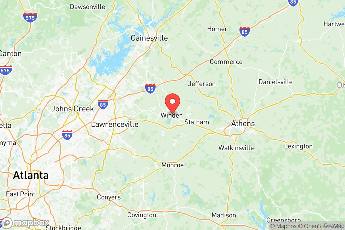
Barrow County, Georgia, occupies a strategic position roughly 45 miles northeast of Atlanta, offering a blend of rural character and proximity to major infrastructure that appeals to relocation-minded individuals and families focused on resilience and self-sufficiency. The county seat of Winder and the town of Statham anchor a landscape of rolling hills, farmland, and growing subdivisions, where the population has climbed past 85,000 as of 2025. For a reader weighing disaster readiness and long-term security, Barrow County presents a mixed picture: its location provides meaningful buffers from the most acute risks of the Atlanta metro area, yet its own growth trajectory and exposure to certain natural and man-made hazards demand careful consideration.
Geographic position and natural advantages for self-sufficiency
Barrow County sits in the Piedmont region, characterized by gently rolling terrain, clay-based soils, and elevations ranging from 800 to 1,000 feet above sea level. This topography offers natural drainage advantages over flatter coastal or floodplain areas, reducing the likelihood of catastrophic flooding from hurricanes or storm surge—a distinct benefit compared to counties nearer the Gulf or Atlantic coasts. The county is bisected by the Mulberry River and its tributaries, including the Middle Fork and the Apalachee River along its eastern border, providing multiple surface water sources for potential off-grid water collection or emergency supply. The area’s average annual rainfall of roughly 50 inches supports robust groundwater recharge and makes rainwater harvesting a viable option for relocators. Forest cover, predominantly mixed hardwoods and pines, blankets roughly 40% of the county, offering both timber resources and natural privacy buffers between properties. For a family seeking a homestead with defensible space, the unincorporated areas around Auburn and Bethlehem—where lot sizes of 2 to 10 acres remain common—provide room for gardens, livestock, and solar arrays without the density pressures of suburban Gwinnett County to the west.
Risks, exposures, and proximity to fallout-relevant landmarks
While Barrow County avoids the direct blast and fallout zones of major military or industrial targets, it is not immune to secondary risks. The county lies roughly 30 miles northeast of Hartsfield-Jackson Atlanta International Airport, a major transportation hub that could be a target in a conflict scenario. More immediately, the county is within 20 miles of the Georgia Nuclear Aircraft Laboratory site near Dawsonville—a decommissioned Cold War-era research facility that tested radiation shielding for nuclear-powered aircraft. Though the site is closed and remediated, its historical presence underscores the region’s past involvement in nuclear research. Additionally, Barrow County sits within 50 miles of the Vogtle Electric Generating Plant near Waynesboro, the nation’s newest nuclear power facility, which houses two operating reactors. In a major incident at Vogtle, prevailing winds from the south-southwest could carry fallout toward Barrow County, though the distance provides significant dilution. On the natural hazard front, the county experiences occasional tornadoes—an EF-3 struck Winder in 2021, causing damage—and severe thunderstorms with damaging winds are a seasonal reality. The county’s clay soils also pose challenges for septic systems and foundation stability during drought-swell cycles, a practical concern for relocators building or buying rural property.
Practical resilience for a relocator: food, water, energy, and defensibility
For a household prioritizing self-sufficiency, Barrow County offers a workable but not ideal baseline. The county’s agricultural heritage supports a network of local farms, farmers’ markets, and feed stores—particularly around Winder and Statham—where relocators can source seeds, livestock, and equipment. The growing season averages 220 days, from late March to early November, allowing for two crop cycles of warm-season vegetables like tomatoes, peppers, and squash. Water access is generally reliable: the Barrow County Water and Sewer Authority serves most developed areas, but private wells are common in rural zones, with typical depths of 150 to 300 feet yielding adequate flow for a household and small-scale irrigation. However, the county’s reliance on surface water from the Middle Oconee River and Bear Creek Reservoir means that prolonged drought could strain municipal supplies, making well ownership a strong advantage for resilience-minded relocators. Energy infrastructure is dominated by Georgia Power and Jackson EMC, both of which have improved grid hardening since 2020, but outages from storms remain frequent—typically 2 to 4 per year lasting 4 to 12 hours. Solar potential is moderate: the region receives about 4.5 peak sun hours per day, sufficient for a grid-tied system with battery backup to cover critical loads during outages. Defensibility is a mixed factor: the county’s rural areas offer natural chokepoints along narrow roads and creek crossings, but the growing population—up 18% since 2020—means more neighbors and less isolation. For a family seeking a retreat property, parcels along the Apalachee River or near Fort Yargo State Park provide wooded buffers and limited access points, though the park itself draws recreational traffic that could complicate a prolonged emergency scenario.
The overall strategic picture for Barrow County is one of moderate resilience with clear trade-offs. Its distance from Atlanta’s core and major military installations like Fort Moore (formerly Fort Benning, roughly 120 miles south) reduces exposure to primary attack vectors, while its agricultural base and water resources support a degree of self-sufficiency. However, the county’s growth trajectory—driven by Atlanta’s suburban expansion—is eroding the very isolation that makes rural living attractive for disaster preparedness. Relocators should target the eastern and southern fringes, near Statham and along the Oconee County line, where lot sizes remain larger and development pressure is lower. For a single individual or family willing to invest in well water, solar backup, and food storage, Barrow County offers a defensible, resource-rich base within a day’s drive of Atlanta’s medical and supply networks—a practical compromise between access and security in an uncertain future.

* Values derived from national, state, county, city and local statistics and may differ in a specific area. Last updated: 2026-06-15T12:04:55.000Z
Narrative content on this page is AI-generated and may contain mistakes. Verify any details that matter before acting on them.
ReloMaps may earn a commission from affiliate links at no extra cost to you.

