Photo: Wikipedia
Strategic Assessment of Exeter, NH
Meaningful friction. Expect exposure to either population pressure, blast zones, or natural disaster risk. Consider buying a retreat property.
What does the Strategic Assessment tell us?
Our Strategic Assessment grades tactical survivability of an area. Major population centers, military targets, fallout zones, natural disasters, and border exposure all drive risk — lower exposure means a more defensible position in a crisis.
This is heavily inspired by Joel Skousen's Strategic Relocation book. Highly recommended you checkout the book ($)What does this tell us?
Our Strategic Assessment grades tactical survivability of an area. Major population centers, military targets, fallout zones, natural disasters, and border exposure all drive risk — lower exposure means a more defensible position in a crisis.
This is heavily inspired by Joel Skousen's Strategic Relocation book. Highly recommended you checkout the book ($)Strategic Pillars

Key Distances
Regional Safe Places
Below is our recommended "safe zones" in New Hampshire and the surrounding area based on our strategic heuristics. For most people, it's unrealistic to live in a “safe zone” full-time due to work, family or other personal reasons. They tend to be more rural. However, many of these areas are perfect for second homes and retreat properties that double as a vacation home or even a short-term rental.




Important Note: For informational purposes only. This does not mean nothing bad ever happens in the green zones. Please use common sense. This is based on public data and modeled with AI. We tried to take a conservative approach but mistakes happen. We update this regularly as new information becomes available.
Solar Generator Recommendations
Backup power matters more here than in safer locations. We've picked three solar generators across budgets and capacity tiers — start with the budget unit if you only need a few essentials, or step up if you want to run a fridge and HVAC for days at a time.

Jackery Portable Power Station Explorer 300
Budget OptionPower on the Go: Weighing only 11 lbs, it's convenient to set up and store with book-sized foldable solar panels

BLUETTI Portable Power Station AC180
Designed for both indoor and outdoor scenarios, AC180 is highly capable as it has a robost capacity and continuous output power.

EF ECOFLOW DELTA Pro Ultra Power Station
Upgraded PickEcoFlow DELTA Pro Ultra is a whole-home energy system designed to grow with your family. Integrated with the Smart Home Panel 2, it scales to meet your evolving energy needs — keeping your home powered, intelligent, and secure through every stage of life.
We earn a commission, at no additional cost to you.
Strategic Assessment Analysis
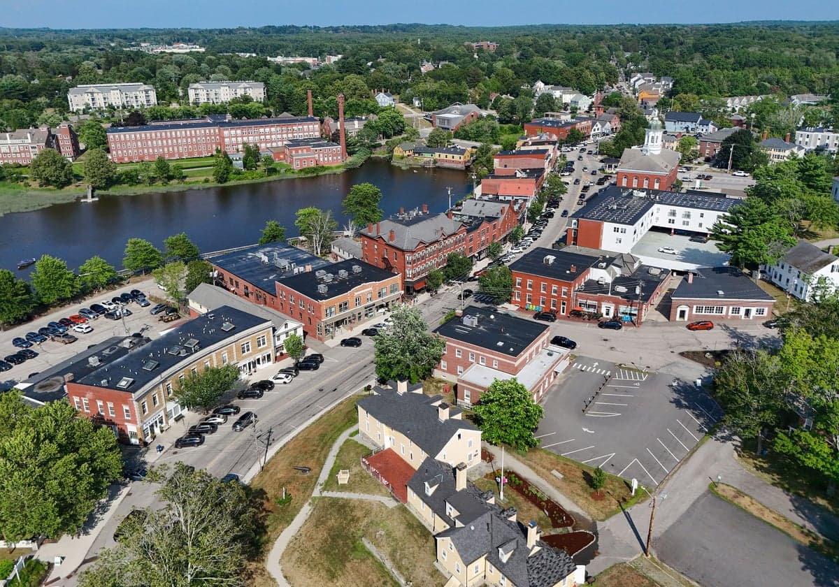
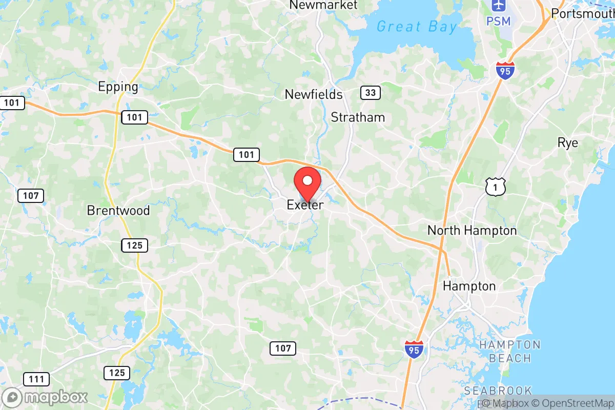
Exeter, New Hampshire, occupies a strategic position that balances rural access with proximity to the Seacoast's economic engine, but for a relocation-minded reader prioritizing disaster readiness and self-sufficiency, its true value lies in its layered resilience. Situated roughly 12 miles inland from the Atlantic and 50 miles north of Boston, Exeter avoids the direct coastal storm surge risks of Portsmouth or Hampton while remaining close enough to leverage regional infrastructure. The town's location along the Exeter River and its historic downtown, anchored by Phillips Exeter Academy, provide a stable economic and social core that has weathered recessions and natural events alike. For those assessing long-term viability, Exeter offers a credible mix of natural buffers, community cohesion, and access to resources that many purely suburban towns lack.
Geographic position and natural advantages for long-term stability
Exeter's inland position on the Exeter River places it in a zone that benefits from the moderating influence of the Atlantic without bearing the brunt of its worst weather. The town sits at the head of tide on the river, meaning it is far enough upstream to avoid the highest storm surges from nor'easters or hurricanes, yet close enough to the coast to enjoy milder winters than interior New Hampshire. The surrounding terrain is a mix of rolling hills, mixed hardwood forests, and wetlands, which provide natural drainage and reduce the risk of catastrophic flooding compared to flatter, more developed areas. The Great Bay estuary system, which the Exeter River feeds into, acts as a natural buffer against storm surge, absorbing and dispersing energy before it reaches the town. This geography also supports a robust local ecosystem, with ample wildlife for hunting and foraging—a practical consideration for those planning for extended disruptions. The area's bedrock geology, primarily granite and metamorphic rock, offers stable foundations for well drilling and underground structures, a factor often overlooked in resilience planning.
Risks, exposures, and proximity to fallout-relevant landmarks
Exeter's primary risks are not from natural cataclysm but from its position within the broader Northeast corridor. The town lies within 50 miles of the Seabrook Nuclear Power Station, located in Seabrook, New Hampshire, approximately 15 miles southeast. While the plant has operated safely for decades, its presence introduces a low-probability, high-consequence risk for any relocator concerned with radiological events. Exeter is also within the fallout zone of a hypothetical major incident at the plant, though prevailing winds typically carry airborne contaminants eastward over the Gulf of Maine. More immediate concerns include the town's proximity to Interstate 95, a major evacuation and supply route that could become a chokepoint during a regional crisis. The Boston metropolitan area, with its dense population and critical infrastructure, lies just over an hour south, meaning Exeter could face secondary effects from any major event in that hub—refugee flows, supply chain disruptions, or electromagnetic pulse (EMP) effects on the grid. The town itself is not a primary target for military or terrorist action, but its location along the Seacoast's transportation corridor makes it a potential staging area or transit point. Flooding from the Exeter River during heavy rain events is a recurring but manageable risk, with the downtown area historically experiencing minor inundation during storms like the 2010 Mother's Day floods.
Practical resilience for a relocator: food, water, energy, and defensibility
For a relocator serious about self-sufficiency, Exeter offers a mixed but workable picture. The town's water supply comes from the Exeter River and several groundwater wells, treated at the town's water treatment plant. While municipal water is reliable, a grid-down scenario would require backup power for pumping or reliance on private wells—many homes in the outer parts of town have their own wells, which is a significant advantage. The area's groundwater is generally clean and abundant, with the underlying aquifer recharged by the region's 40-50 inches of annual rainfall. Food resilience is moderate: Exeter has a strong local food scene, with the Exeter Farmers' Market operating seasonally and several community-supported agriculture (CSA) programs within a 10-mile radius. The surrounding towns of Stratham, Brentwood, and Epping have active agricultural operations, including apple orchards, dairy farms, and vegetable growers. However, the town itself is not a major food production hub—most grocery stores rely on regional supply chains that could falter in a prolonged disruption. For energy, Exeter is served by Eversource, with natural gas and electricity widely available. Solar adoption is growing but not dominant; the town's zoning allows for residential solar panels without major restrictions. Wood heat is common in older homes and rural properties, providing a decentralized heating option. Defensibility is a nuanced factor: Exeter's downtown is compact and walkable, but the town's layout is suburban and open, with few natural chokepoints. The surrounding forests and wetlands offer some cover and concealment, but the area's population density—roughly 16,000 residents in the town proper—means that a determined group could not easily secure the entire area. The presence of Phillips Exeter Academy, a private boarding school with its own security and resources, adds a layer of institutional stability but also a potential target for looting or unrest.
Overall, Exeter presents a credible option for the relocation-minded reader who values a balance of access and buffer. Its inland coastal position reduces the most acute natural threats, while its proximity to Boston and the Seacoast provides economic and medical resources that are hard to replicate in more remote areas. The town's risks are real but manageable: the nuclear plant to the south, the I-95 corridor, and the potential for regional grid failures are factors that require planning rather than avoidance. For a family or individual willing to invest in backup power, a private well, and a modest food storage system, Exeter offers a defensible, community-rich base that can function as a staging point for broader regional resilience. The key is to treat it not as a bunker but as a hub—a place from which to operate, network, and adapt, rather than a final redoubt. In the calculus of strategic relocation, Exeter earns a solid B+: not perfect, but far better than most suburban options within striking distance of the Northeast's major cities.

* Values derived from national, state, county, city and local statistics and may differ in a specific area. Last updated: 2026-09-22T00:53:16.000Z
Narrative content on this page is AI-generated and may contain mistakes. Verify any details that matter before acting on them.
ReloMaps may earn a commission from affiliate links at no extra cost to you.

