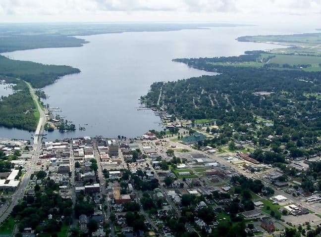
Photo: Wikipedia
Strategic Assessment of Elizabeth City, NC
Multiple tactical vulnerabilities. Population density, target proximity, or disaster risk are likely compounding. A retreat property and exit planning is required.
What does the Strategic Assessment tell us?
Our Strategic Assessment grades tactical survivability of an area. Major population centers, military targets, fallout zones, natural disasters, and border exposure all drive risk — lower exposure means a more defensible position in a crisis.
This is heavily inspired by Joel Skousen's Strategic Relocation book. Highly recommended you checkout the book ($)What does this tell us?
Our Strategic Assessment grades tactical survivability of an area. Major population centers, military targets, fallout zones, natural disasters, and border exposure all drive risk — lower exposure means a more defensible position in a crisis.
This is heavily inspired by Joel Skousen's Strategic Relocation book. Highly recommended you checkout the book ($)Strategic Pillars

Key Distances
Regional Safe Places
Below is our recommended "safe zones" in North Carolina and the surrounding area based on our strategic heuristics. For most people, it's unrealistic to live in a “safe zone” full-time due to work, family or other personal reasons. They tend to be more rural. However, many of these areas are perfect for second homes and retreat properties that double as a vacation home or even a short-term rental.

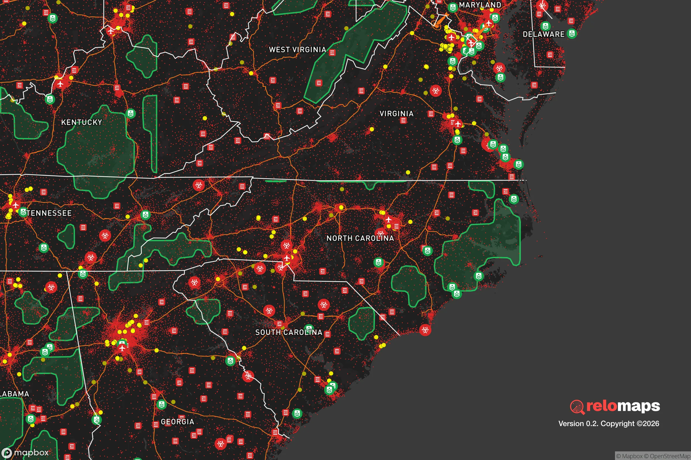


Important Note: For informational purposes only. This does not mean nothing bad ever happens in the green zones. Please use common sense. This is based on public data and modeled with AI. We tried to take a conservative approach but mistakes happen. We update this regularly as new information becomes available.
Solar Generator Recommendations
Backup power matters more here than in safer locations. We've picked three solar generators across budgets and capacity tiers — start with the budget unit if you only need a few essentials, or step up if you want to run a fridge and HVAC for days at a time.

Jackery Portable Power Station Explorer 300
Budget OptionPower on the Go: Weighing only 11 lbs, it's convenient to set up and store with book-sized foldable solar panels

BLUETTI Portable Power Station AC180
Designed for both indoor and outdoor scenarios, AC180 is highly capable as it has a robost capacity and continuous output power.

EF ECOFLOW DELTA Pro Ultra Power Station
Upgraded PickEcoFlow DELTA Pro Ultra is a whole-home energy system designed to grow with your family. Integrated with the Smart Home Panel 2, it scales to meet your evolving energy needs — keeping your home powered, intelligent, and secure through every stage of life.
We earn a commission, at no additional cost to you.
Strategic Assessment Analysis
Elizabeth City, North Carolina, presents a mixed strategic picture for the relocation-minded reader focused on resilience and self-sufficiency. Its position along the Pasquotank River and near the Albemarle Sound offers distinct geographic buffers, but its proximity to major military installations and the Hampton Roads metropolitan area introduces significant man-made risk factors that must be weighed carefully. For the conservative-leaning individual or family seeking a balance between rural access and logistical connectivity, Elizabeth City offers genuine advantages in food and water security, though its defensibility and exposure to fallout scenarios require a sober, grounded assessment.
Geographic position and natural advantages for long-term stability
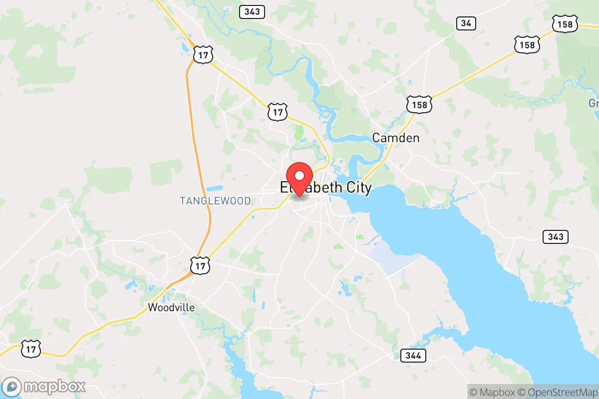
Elizabeth City sits in the northeastern corner of North Carolina, roughly 45 miles south of the Norfolk/Virginia Beach metro area and about 90 miles east of I-95. This location places it at the edge of the sprawling Hampton Roads region, which is both a blessing and a curse for resilience. On the positive side, the city is surrounded by the vast, sparsely populated coastal plain of the Albemarle region, with extensive wetlands, forests, and farmland that provide natural buffers and potential for local food production. The Pasquotank River and the nearby Dismal Swamp Canal offer freshwater access and alternative transportation routes that could prove valuable in a grid-down scenario. The area's flat terrain and moderate climate support year-round gardening and livestock, and the region's agricultural history means that local knowledge of subsistence farming is still present in the surrounding rural communities. However, the city's elevation is low—typically 10 to 20 feet above sea level—and its position on the Atlantic coastal plain means it is vulnerable to hurricane storm surge and flooding from the Pasquotank River and Albemarle Sound. The Great Dismal Swamp to the north provides a significant natural barrier to overland movement from the Virginia side, which could be advantageous for controlling access, but also limits egress routes to a handful of major roads, primarily US-17 and US-158.
Risks, exposures, and proximity to fallout-relevant landmarks
The most significant strategic liability for Elizabeth City is its proximity to the Hampton Roads military complex, which includes Naval Station Norfolk, Joint Base Langley-Eustis, and Naval Air Station Oceana. These are among the highest-value targets in the United States for any adversary considering a nuclear or conventional strike. Elizabeth City lies roughly 45 miles south of Norfolk, placing it well within the fallout zone of a ground burst or air burst targeting the naval base. Prevailing winds in the region are from the southwest and west, meaning that fallout from a strike on Norfolk would likely drift toward the Atlantic, but a shift in wind direction could put Elizabeth City directly in the plume path. Additionally, the city itself hosts the US Coast Guard Base Elizabeth City, a major air station and maintenance center that could be a secondary target. The nearby Chesapeake Bay Bridge-Tunnel and the Port of Virginia are also high-value infrastructure that could draw attack. For the relocator concerned with man-made risks, this is a serious consideration: Elizabeth City is not remote enough to escape the consequences of a major conflict involving the Hampton Roads area. On the natural disaster front, the region is prone to hurricanes, with the 2023 storm season reminding locals that even a Category 1 storm can cause widespread power outages and flooding. The flat, low-lying terrain also means that heavy rainfall can lead to standing water and road closures for days at a time. Tornadoes are a lesser but real risk, with the area falling within the southeastern tornado alley that sees occasional outbreaks, particularly in spring and fall.
Practical resilience for a relocator: food, water, energy, and defensibility
For the individual or family serious about self-sufficiency, Elizabeth City offers several concrete advantages. The surrounding region is rich in agricultural land, with corn, soybeans, and cotton being major crops, and there is a strong local network of farmers' markets, feed stores, and agricultural supply outlets. The Pasquotank River and nearby Albemarle Sound provide abundant fishing and crabbing opportunities, and the extensive wetlands and forests support hunting for deer, waterfowl, and small game. Freshwater access is excellent, with the river and the Dismal Swamp Canal offering year-round sources, though treatment would be necessary for drinking. The area's water table is high, meaning shallow wells are feasible in many parts of the county, and the city's municipal water supply draws from the Pasquotank River, which is a reliable surface water source. Energy resilience is more challenging. The region is served by Dominion Energy, and power outages are common during storms, sometimes lasting days. Solar potential is moderate, with the area receiving about 4.5 peak sun hours per day, but the frequent cloud cover from coastal weather patterns reduces reliability. Wood heating is a viable option given the extensive forests, but the local housing stock is not universally equipped with wood stoves or fireplaces. Defensibility is a mixed bag. Elizabeth City itself is a small city of roughly 18,000 people, with a compact downtown and surrounding suburban and rural development. The road network is limited, with US-17 and US-158 being the primary arteries, and both are vulnerable to flooding and congestion during an evacuation. The Dismal Swamp to the north and the river to the east create natural chokepoints, which could be used to control access, but also mean that escape routes are few. For a relocator seeking a truly defensible property, the rural areas west and south of the city, along the Pasquotank County line, offer more options for acreage, well water, and seclusion, but these areas are also more exposed to storm surge from the sound.
The overall strategic picture for Elizabeth City is one of trade-offs. It offers genuine advantages in food and water security, a moderate climate for self-sufficient living, and a location that is close enough to urban amenities for supply runs but far enough to avoid the worst of urban collapse scenarios. However, its proximity to the Hampton Roads military complex is a serious liability for anyone concerned with nuclear or conventional conflict, and its vulnerability to hurricanes and flooding cannot be ignored. For the conservative-leaning relocator who values practical resilience and is willing to invest in backup power, water filtration, and storm hardening, Elizabeth City can be a viable option—provided they are clear-eyed about the risks and have a plan for evacuation or sheltering in place during a major event. It is not a remote bug-out location, but it is a functional, affordable base for building a resilient lifestyle in a region with deep agricultural roots and a strong sense of community.

* Values derived from national, state, county, city and local statistics and may differ in a specific area. Last updated: 2026-10-21T18:42:18.000Z
Narrative content on this page is AI-generated and may contain mistakes. Verify any details that matter before acting on them.
ReloMaps may earn a commission from affiliate links at no extra cost to you.

