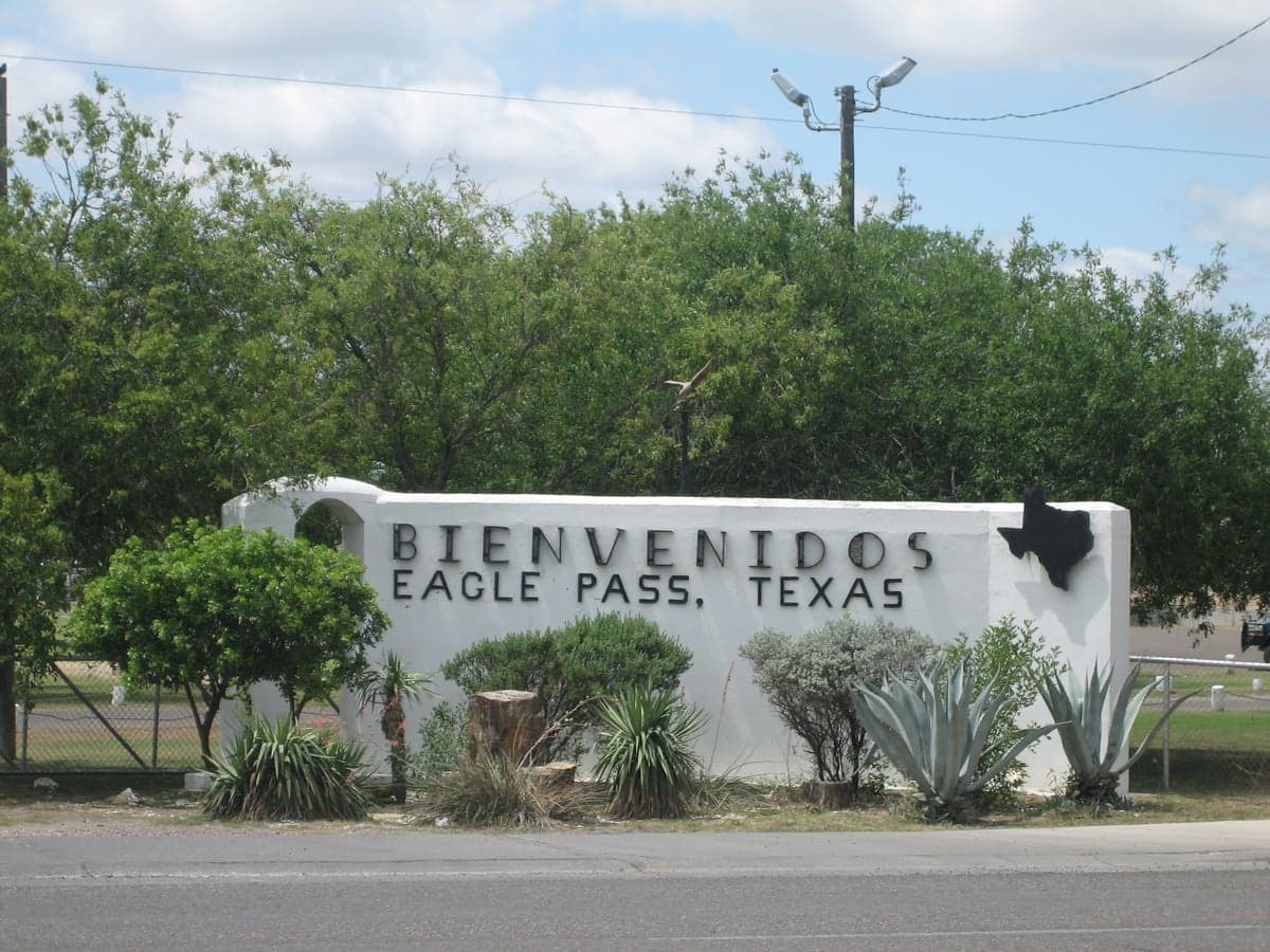
Photo: Wikipedia
Strategic Assessment of Eagle Pass, TX
Meaningful friction. Expect exposure to either population pressure, blast zones, or natural disaster risk. Consider buying a retreat property.
What does the Strategic Assessment tell us?
Our Strategic Assessment grades tactical survivability of an area. Major population centers, military targets, fallout zones, natural disasters, and border exposure all drive risk — lower exposure means a more defensible position in a crisis.
This is heavily inspired by Joel Skousen's Strategic Relocation book. Highly recommended you checkout the book ($)What does this tell us?
Our Strategic Assessment grades tactical survivability of an area. Major population centers, military targets, fallout zones, natural disasters, and border exposure all drive risk — lower exposure means a more defensible position in a crisis.
This is heavily inspired by Joel Skousen's Strategic Relocation book. Highly recommended you checkout the book ($)Strategic Pillars

Key Distances
Regional Safe Places
Below is our recommended "safe zones" in Texas and the surrounding area based on our strategic heuristics. For most people, it's unrealistic to live in a “safe zone” full-time due to work, family or other personal reasons. They tend to be more rural. However, many of these areas are perfect for second homes and retreat properties that double as a vacation home or even a short-term rental.

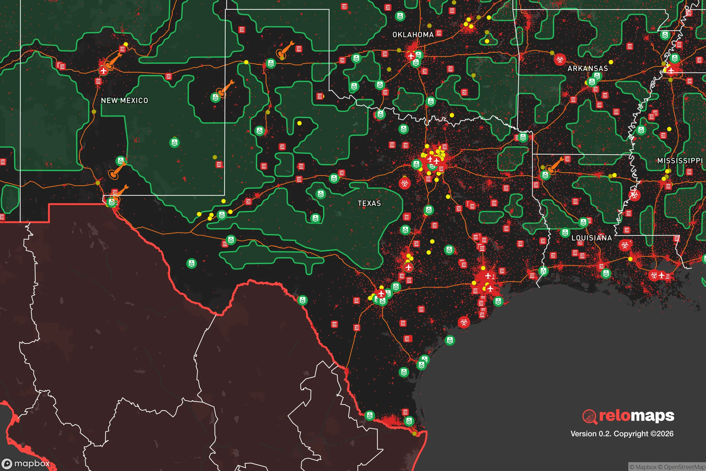


Important Note: For informational purposes only. This does not mean nothing bad ever happens in the green zones. Please use common sense. This is based on public data and modeled with AI. We tried to take a conservative approach but mistakes happen. We update this regularly as new information becomes available.
Solar Generator Recommendations
Backup power matters more here than in safer locations. We've picked three solar generators across budgets and capacity tiers — start with the budget unit if you only need a few essentials, or step up if you want to run a fridge and HVAC for days at a time.

Jackery Portable Power Station Explorer 300
Budget OptionPower on the Go: Weighing only 11 lbs, it's convenient to set up and store with book-sized foldable solar panels

BLUETTI Portable Power Station AC180
Designed for both indoor and outdoor scenarios, AC180 is highly capable as it has a robost capacity and continuous output power.

EF ECOFLOW DELTA Pro Ultra Power Station
Upgraded PickEcoFlow DELTA Pro Ultra is a whole-home energy system designed to grow with your family. Integrated with the Smart Home Panel 2, it scales to meet your evolving energy needs — keeping your home powered, intelligent, and secure through every stage of life.
We earn a commission, at no additional cost to you.
Strategic Assessment Analysis
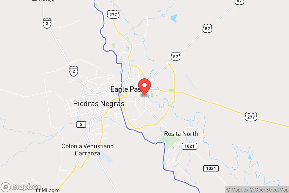
Eagle Pass, Texas, occupies a unique strategic position along the Rio Grande, offering a blend of geographic isolation and cross-border access that appeals to relocation-minded individuals and families prioritizing resilience and self-sufficiency. Its location roughly 140 miles southwest of San Antonio and 50 miles east of the Amistad Reservoir places it in a semi-arid, sparsely populated corridor where the nearest major metropolitan risk zones are distant, yet the area retains critical infrastructure for daily life. For a reader weighing disaster readiness, Eagle Pass presents a mixed picture: its border setting provides both natural buffers and distinct man-made vulnerabilities, but with careful planning, it can serve as a functional base for a prepared household.
Geographic position and natural advantages for self-sufficiency
Eagle Pass sits on the southern edge of the Texas Hill Country transition zone, where the terrain shifts from rolling scrubland to the floodplain of the Rio Grande. This location offers several natural advantages. The Rio Grande itself is a perennial water source, though its flow is heavily managed by international treaty and upstream dams, meaning it is not a guaranteed supply during drought or crisis. The area's elevation, around 750 feet above sea level, places it above the flood-prone coastal plains, and the local climate—averaging about 20 inches of rain annually—reduces the risk of catastrophic flooding compared to eastern Texas. The surrounding Maverick County is vast and thinly populated, with a population density of roughly 18 people per square mile, which provides a natural buffer against the cascading failures of dense urban centers. For a relocator, the proximity to the Amistad National Recreation Area (about 50 miles northwest) offers a large reservoir for fishing and potential water storage, while the expansive ranchlands to the north and east provide open space for off-grid living. The region's isolation from major military installations, nuclear power plants, and high-value industrial targets is a notable plus; the nearest significant fallout-relevant landmark is the South Texas Nuclear Generating Station near Bay City, over 250 miles away, well outside the dangerous plume zone for most scenarios.
Risks, exposures, and proximity to fallout-relevant landmarks
The most significant risk for Eagle Pass is its position as a major border crossing. The city is home to the Eagle Pass Port of Entry, one of the busiest in Texas, which processes hundreds of thousands of vehicles and pedestrians annually. This creates a unique exposure profile: during a national emergency or geopolitical crisis, the border could become a chokepoint for both migration and supply chain disruptions. The presence of U.S. Customs and Border Protection facilities, including a large processing center, makes the area a potential target for civil unrest or targeted attacks, though not for strategic nuclear strikes. Additionally, the city lies within 100 miles of the Piedras Negras coal-fired power plant in Mexico, which, while not a fallout source, could be a secondary hazard if industrial accidents occur. Natural risks include periodic drought and extreme heat, with summer temperatures regularly exceeding 100°F, which stresses water supplies and energy grids. Flash flooding is possible along the Rio Grande and its tributaries during heavy rains, but the flat terrain limits the risk of landslides. For a relocator, the key takeaway is that Eagle Pass's man-made risks are concentrated at the border crossing and government facilities, not from distant strategic targets. Staying several miles north of the river, away from the port area, significantly reduces exposure to border-related disruptions.
Practical resilience for a relocator: food, water, energy, and defensibility
For a household focused on self-sufficiency, Eagle Pass offers a workable but not ideal baseline. Water is the most critical concern. The city's municipal supply comes from the Rio Grande via the Eagle Pass Water Treatment Plant, but during severe drought, water restrictions are common. A well is the best option for rural properties, with groundwater available in the Carrizo-Wilcox Aquifer at depths of 200-500 feet, though yields vary. Rainwater harvesting is feasible given the semi-arid climate, but a 1,000-square-foot roof captures only about 12,000 gallons per year—enough for basic use but not for irrigation. Food production is limited by the hot, dry climate; the growing season is long (March to November), but soil is alkaline and low in organic matter. Raised beds with imported soil and drip irrigation are necessary for reliable vegetable production. Local ranching supports beef and goat production, and the Amistad Reservoir provides fishing for bass and catfish. Grocery access is adequate, with two major supermarkets (Walmart and H-E-B) in town, but supply chain disruptions during border closures could cause shortages. Energy resilience is a mixed bag. The local grid is served by the Electric Reliability Council of Texas (ERCOT), which has a history of winter storm failures (e.g., 2021). Solar is a strong option, with the area averaging over 260 sunny days per year; a 5 kW system can meet most household needs, but battery storage is essential for nighttime and grid outages. Natural gas is available in town, but rural properties rely on propane. Defensibility is aided by the low population density and open terrain, which provide good lines of sight and limited concealment for intruders. However, the border proximity means law enforcement presence is heavy, with U.S. Border Patrol and local police active, which can be a double-edged sword—offering security but also potential scrutiny for off-grid activities like firearms storage or unpermitted structures. The nearest major medical facility is the Fort Duncan Medical Center, a small hospital with limited trauma capabilities; serious emergencies require a 2-hour drive to San Antonio.
The overall strategic picture for Eagle Pass is one of calculated trade-offs. Its geographic isolation from major urban centers and strategic targets is a genuine advantage for disaster readiness, and the availability of water from the Rio Grande and groundwater, combined with strong solar potential, makes it a viable location for a prepared household. However, the border location introduces unique vulnerabilities—supply chain fragility, potential for civil unrest, and a heavy government presence—that require a relocator to plan for self-sufficiency in food, water, and security. For a conservative-leaning individual or family who values space, low cost of living (median home price around $180,000), and a slower pace, Eagle Pass can work as a resilience-focused base, provided they invest in well water, solar power, and a robust food storage system. It is not a bug-out location for a total collapse scenario, but for those willing to navigate its border dynamics, it offers a defensible, resource-accessible foothold in a region that remains off the radar of most relocation guides.

* Values derived from national, state, county, city and local statistics and may differ in a specific area. Last updated: 2026-11-11T04:03:54.000Z
Narrative content on this page is AI-generated and may contain mistakes. Verify any details that matter before acting on them.
ReloMaps may earn a commission from affiliate links at no extra cost to you.

