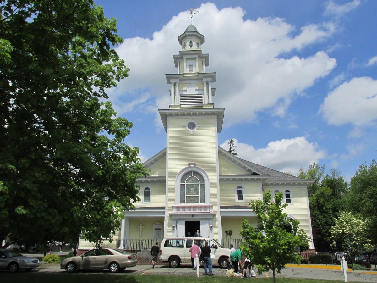
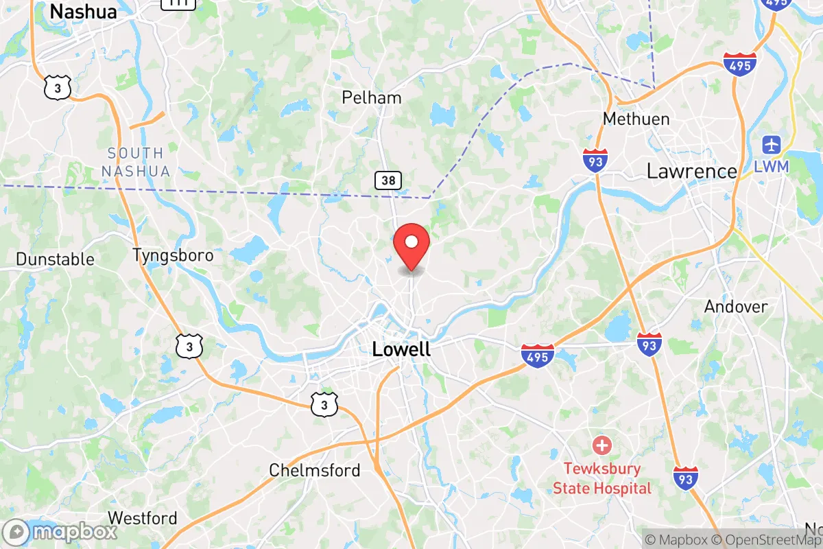
Photo: Wikipedia
Strategic Assessment of Dracut, MA
Multiple tactical vulnerabilities. Population density, target proximity, or disaster risk are likely compounding. A retreat property and exit planning is required.
What does the Strategic Assessment tell us?
Our Strategic Assessment grades tactical survivability of an area. Major population centers, military targets, fallout zones, natural disasters, and border exposure all drive risk — lower exposure means a more defensible position in a crisis.
This is heavily inspired by Joel Skousen's Strategic Relocation book. Highly recommended you checkout the book ($)What does this tell us?
Our Strategic Assessment grades tactical survivability of an area. Major population centers, military targets, fallout zones, natural disasters, and border exposure all drive risk — lower exposure means a more defensible position in a crisis.
This is heavily inspired by Joel Skousen's Strategic Relocation book. Highly recommended you checkout the book ($)Strategic Pillars

Key Distances
Regional Safe Places
Below is our recommended "safe zones" in Massachusetts and the surrounding area based on our strategic heuristics. For most people, it's unrealistic to live in a “safe zone” full-time due to work, family or other personal reasons. They tend to be more rural. However, many of these areas are perfect for second homes and retreat properties that double as a vacation home or even a short-term rental.
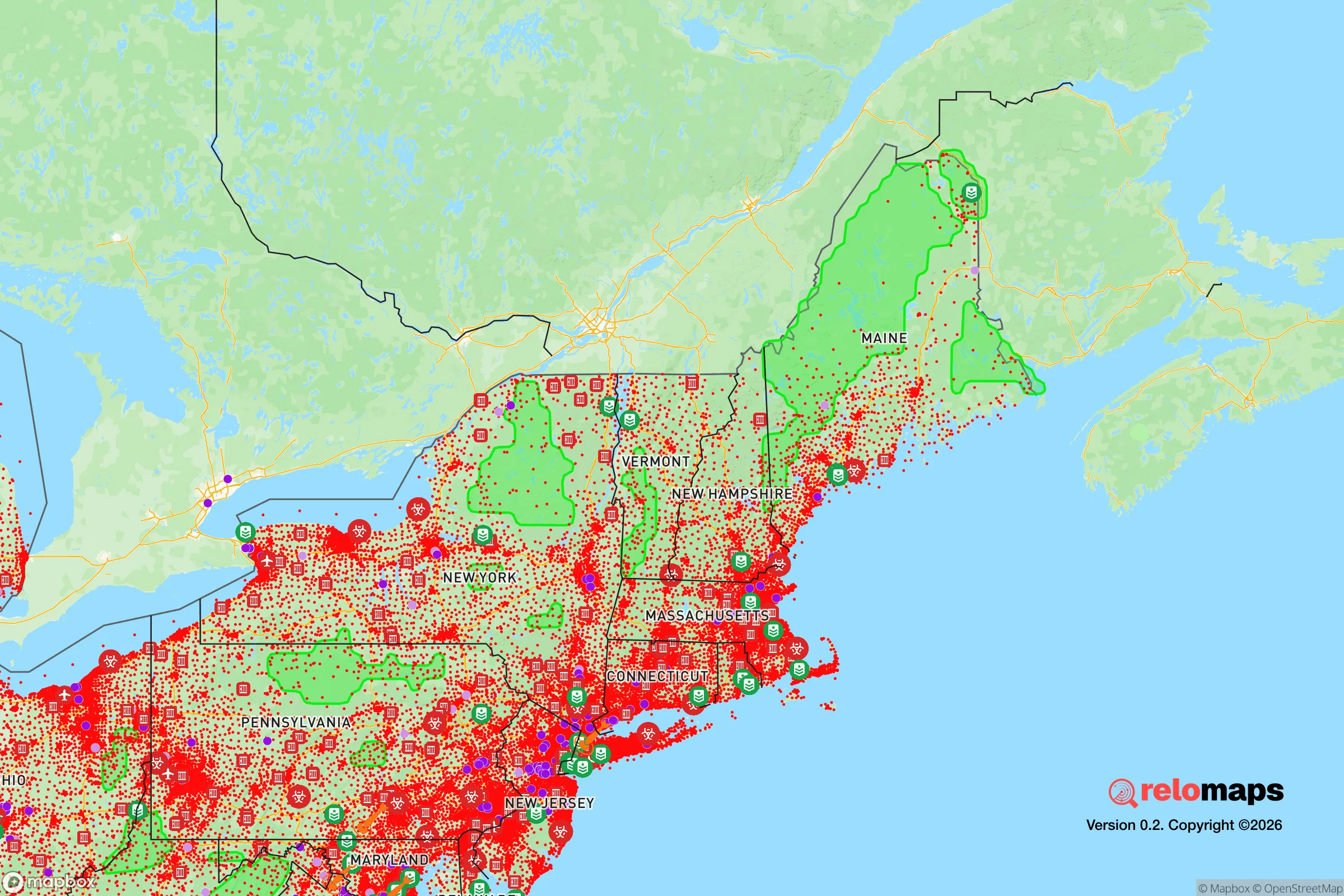
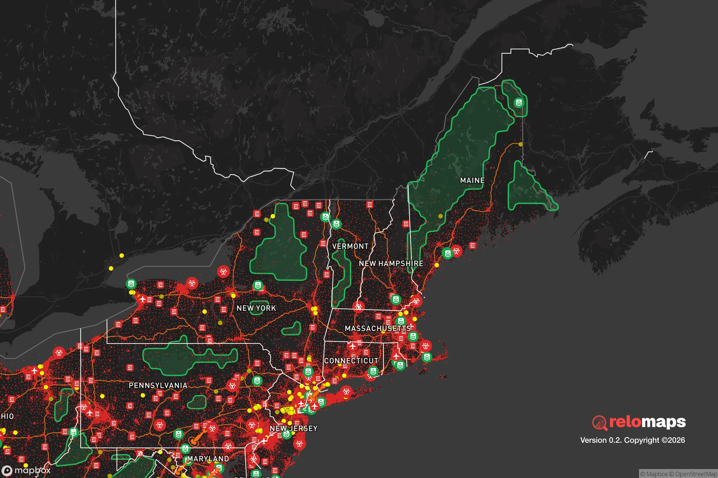


Important Note: For informational purposes only. This does not mean nothing bad ever happens in the green zones. Please use common sense. This is based on public data and modeled with AI. We tried to take a conservative approach but mistakes happen. We update this regularly as new information becomes available.
Solar Generator Recommendations
Backup power matters more here than in safer locations. We've picked three solar generators across budgets and capacity tiers — start with the budget unit if you only need a few essentials, or step up if you want to run a fridge and HVAC for days at a time.

Jackery Portable Power Station Explorer 300
Budget OptionPower on the Go: Weighing only 11 lbs, it's convenient to set up and store with book-sized foldable solar panels

BLUETTI Portable Power Station AC180
Designed for both indoor and outdoor scenarios, AC180 is highly capable as it has a robost capacity and continuous output power.

EF ECOFLOW DELTA Pro Ultra Power Station
Upgraded PickEcoFlow DELTA Pro Ultra is a whole-home energy system designed to grow with your family. Integrated with the Smart Home Panel 2, it scales to meet your evolving energy needs — keeping your home powered, intelligent, and secure through every stage of life.
We earn a commission, at no additional cost to you.
Strategic Assessment Analysis
Dracut, Massachusetts, offers a strategic blend of rural character and proximity to regional infrastructure that makes it a noteworthy option for relocation-minded individuals and families prioritizing resilience and self-sufficiency. Situated in northeastern Middlesex County, the town sits roughly 25 miles northwest of Boston and just north of Lowell, placing it within striking distance of urban resources while maintaining a distinct, semi-rural identity. Its location along the New Hampshire border, abutting the Merrimack River and surrounded by conservation land, provides natural buffers and access to water resources that many denser suburbs lack. For a reader thinking seriously about disaster readiness, Dracut presents a mixed picture: genuine geographic advantages in terms of water access and defensible terrain, but also real exposure to risks stemming from its proximity to major population centers and critical infrastructure.
Geographic position and natural advantages for self-sufficiency
Dracut’s topography and land use patterns offer tangible benefits for a self-sufficient lifestyle. The town spans roughly 21 square miles, with significant portions covered by forest, wetlands, and the sprawling Great Brook State Forest and Pawtucket State Forest. These contiguous green spaces provide natural cover, wildlife habitat for hunting or foraging, and a degree of separation from the more developed corridors along I-93 and I-495. The Merrimack River forms Dracut’s southern boundary, offering a reliable surface water source—though access is limited by private property and steep banks in many stretches. Several smaller ponds and brooks, including Long Pond and Beaver Brook, dot the interior, providing supplementary water for those with the means to treat or haul it. The terrain is gently rolling, with no extreme elevations, but the mix of wooded hills and lowlands creates natural chokepoints and defensible positions, particularly in the northern and western sections of town. The climate is typical of inland New England: cold winters with substantial snowfall (averaging 50-60 inches annually) and warm, humid summers. This means any resilience plan must account for heating fuel storage, snow removal capability, and freeze-proofing water systems—factors that favor those with wood-burning stoves, backup generators, and insulated outbuildings.
Risks, exposures, and proximity to fallout-relevant landmarks
The most significant strategic vulnerability for Dracut is its proximity to Lowell, a city of roughly 115,000 people located immediately to the south. In a major disaster—whether natural, economic, or geopolitical—Lowell’s population would likely attempt to evacuate northward along routes like Route 113, Route 38, and I-93, all of which pass through or near Dracut. This creates a real risk of gridlock, resource competition, and civil unrest in the immediate aftermath of a crisis. Dracut’s own population of about 31,000 is modest, but the town’s residential density is higher than many rural New England towns, with subdivisions and cul-de-sacs spreading across former farmland. This means fewer truly isolated homesteads and more reliance on road networks that can be easily blocked. Beyond population pressure, Dracut lies within roughly 30 miles of Hanscom Air Force Base in Bedford and Fort Devens in Ayer—both potential targets in a conflict scenario involving strategic assets. The Seabrook Nuclear Power Station in New Hampshire is about 30 miles to the northeast; while not in the immediate plume zone for a worst-case release, prevailing winds from the southwest could carry fallout toward Dracut in such an event. The town itself has no major industrial hazards, but the Merrimack River corridor downstream from Lowell carries legacy contamination risks from former textile mills and industrial sites. Natural disaster risks are moderate: the area is not prone to earthquakes, tornadoes, or wildfires, but nor’easters and ice storms are annual threats that can knock out power for days or weeks, as seen in the 2008 ice storm that left much of the region without electricity for up to two weeks.
Practical resilience for a relocator: food, water, energy, and defensibility
For a relocator serious about self-sufficiency, Dracut offers a mixed but workable foundation. Food production is feasible: the town still has active farmland, including Richardson’s Farm and several smaller market gardens, and soils in the river valley are fertile for vegetable gardening. The growing season runs roughly from May to October, with a frost-free period of about 150 days—adequate for most cool- and warm-season crops. Backyard chickens and small livestock are permitted in most residential zones, though pigs and larger animals require special permits. Deer hunting is legal in season, and the state forests provide opportunities for small game and turkey. Water security is a stronger point: the Merrimack River is a perennial water source, and many homes in the less developed parts of town rely on private wells rather than municipal water. However, well depth and yield vary significantly by location, and a power outage means electric pumps are useless without a backup generator. Rainwater catchment is legal in Massachusetts, but collection for potable use requires filtration and testing. Energy resilience is the weakest link. Dracut is served by National Grid for electricity and natural gas, and the grid is vulnerable to storm-related outages. Solar adoption is growing but still limited, and net metering policies are favorable but not exceptional. Wood heating is common in older homes, and firewood is abundant locally, but air quality regulations limit outdoor burning. For defensibility, Dracut’s layout is a double-edged sword. The northern and western edges, bordering Tyngsborough and Pelham, New Hampshire, are more rural with larger lots and dead-end roads that can be monitored. The southern and eastern sections, closer to Lowell and the river, have higher traffic volumes and more entry points. A relocator would want to prioritize a property on a low-traffic road with good sightlines, preferably with a well, septic, and a wood stove already in place.
Overall, Dracut occupies a middle ground in the strategic resilience landscape. It is not a remote redoubt—its proximity to Boston, Lowell, and critical infrastructure like Hanscom and Seabrook means it would face secondary effects from any major regional event. But it also offers genuine assets: abundant surface water, productive soil, forest cover, and a community that, while suburbanizing, still retains a New England independent streak. For a relocator who is prepared—with backup power, stored supplies, and a plan for managing the influx of evacuees from the south—Dracut can be a viable base. The key is to treat it as a forward operating position rather than a final retreat. Those seeking true isolation should look farther north or west, into New Hampshire or Vermont. But for someone who wants to stay within a few hours of Boston while maintaining a credible self-sufficiency setup, Dracut is a pragmatic choice—provided they go in with eyes open to the risks that come with being on the edge of a major metropolitan area.

* Values derived from national, state, county, city and local statistics and may differ in a specific area. Last updated: 2026-10-21T23:20:45.000Z
Narrative content on this page is AI-generated and may contain mistakes. Verify any details that matter before acting on them.
ReloMaps may earn a commission from affiliate links at no extra cost to you.

