Strategic Assessment of Diamond Springs, CA
Workable tactical position. Some exposure to population density or targets, but generally defensible in a crisis.
What does the Strategic Assessment tell us?
Our Strategic Assessment grades tactical survivability of an area. Major population centers, military targets, fallout zones, natural disasters, and border exposure all drive risk — lower exposure means a more defensible position in a crisis.
This is heavily inspired by Joel Skousen's Strategic Relocation book. Highly recommended you checkout the book ($)What does this tell us?
Our Strategic Assessment grades tactical survivability of an area. Major population centers, military targets, fallout zones, natural disasters, and border exposure all drive risk — lower exposure means a more defensible position in a crisis.
This is heavily inspired by Joel Skousen's Strategic Relocation book. Highly recommended you checkout the book ($)Strategic Pillars

Key Distances
Regional Safe Places
Below is our recommended "safe zones" in California and the surrounding area based on our strategic heuristics. For most people, it's unrealistic to live in a “safe zone” full-time due to work, family or other personal reasons. They tend to be more rural. However, many of these areas are perfect for second homes and retreat properties that double as a vacation home or even a short-term rental.

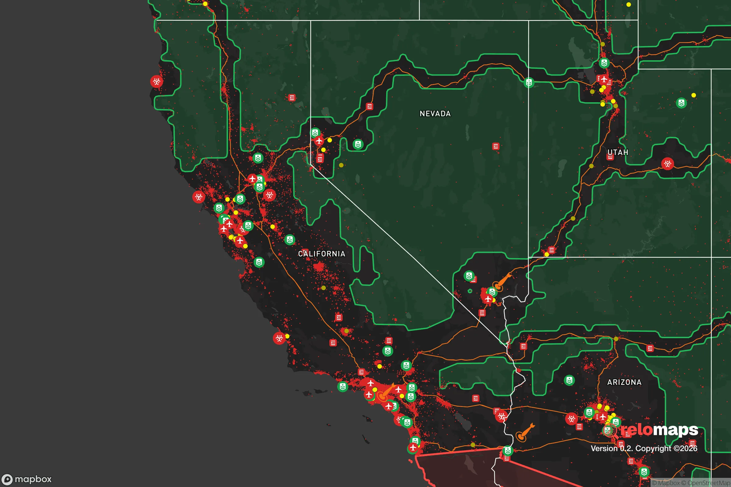


Important Note: For informational purposes only. This does not mean nothing bad ever happens in the green zones. Please use common sense. This is based on public data and modeled with AI. We tried to take a conservative approach but mistakes happen. We update this regularly as new information becomes available.
Solar Generator Recommendations
Backup power matters more here than in safer locations. We've picked three solar generators across budgets and capacity tiers — start with the budget unit if you only need a few essentials, or step up if you want to run a fridge and HVAC for days at a time.
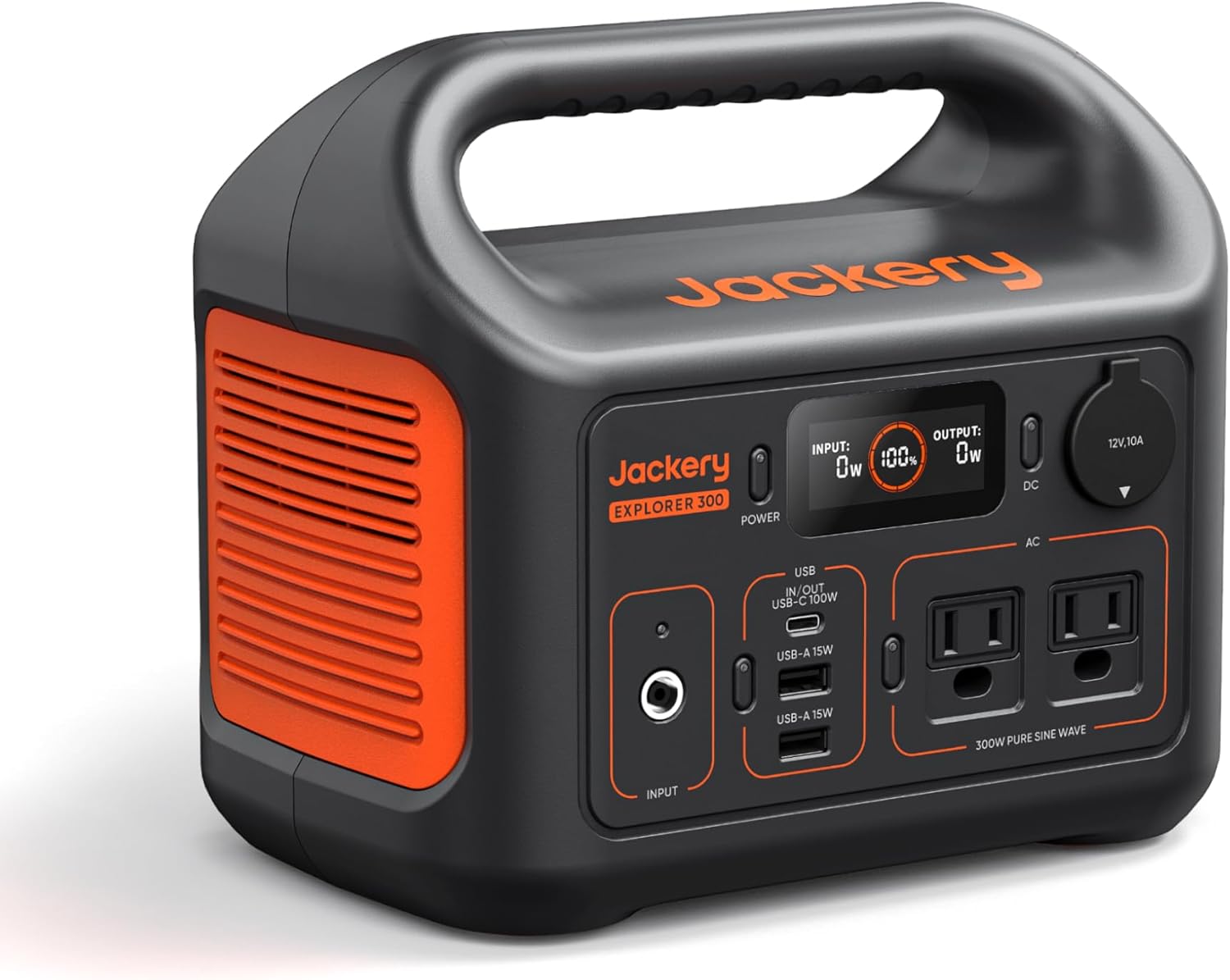
Jackery Portable Power Station Explorer 300
Budget OptionPower on the Go: Weighing only 11 lbs, it's convenient to set up and store with book-sized foldable solar panels

BLUETTI Portable Power Station AC180
Designed for both indoor and outdoor scenarios, AC180 is highly capable as it has a robost capacity and continuous output power.

EF ECOFLOW DELTA Pro Ultra Power Station
Upgraded PickEcoFlow DELTA Pro Ultra is a whole-home energy system designed to grow with your family. Integrated with the Smart Home Panel 2, it scales to meet your evolving energy needs — keeping your home powered, intelligent, and secure through every stage of life.
We earn a commission, at no additional cost to you.
Strategic Assessment Analysis
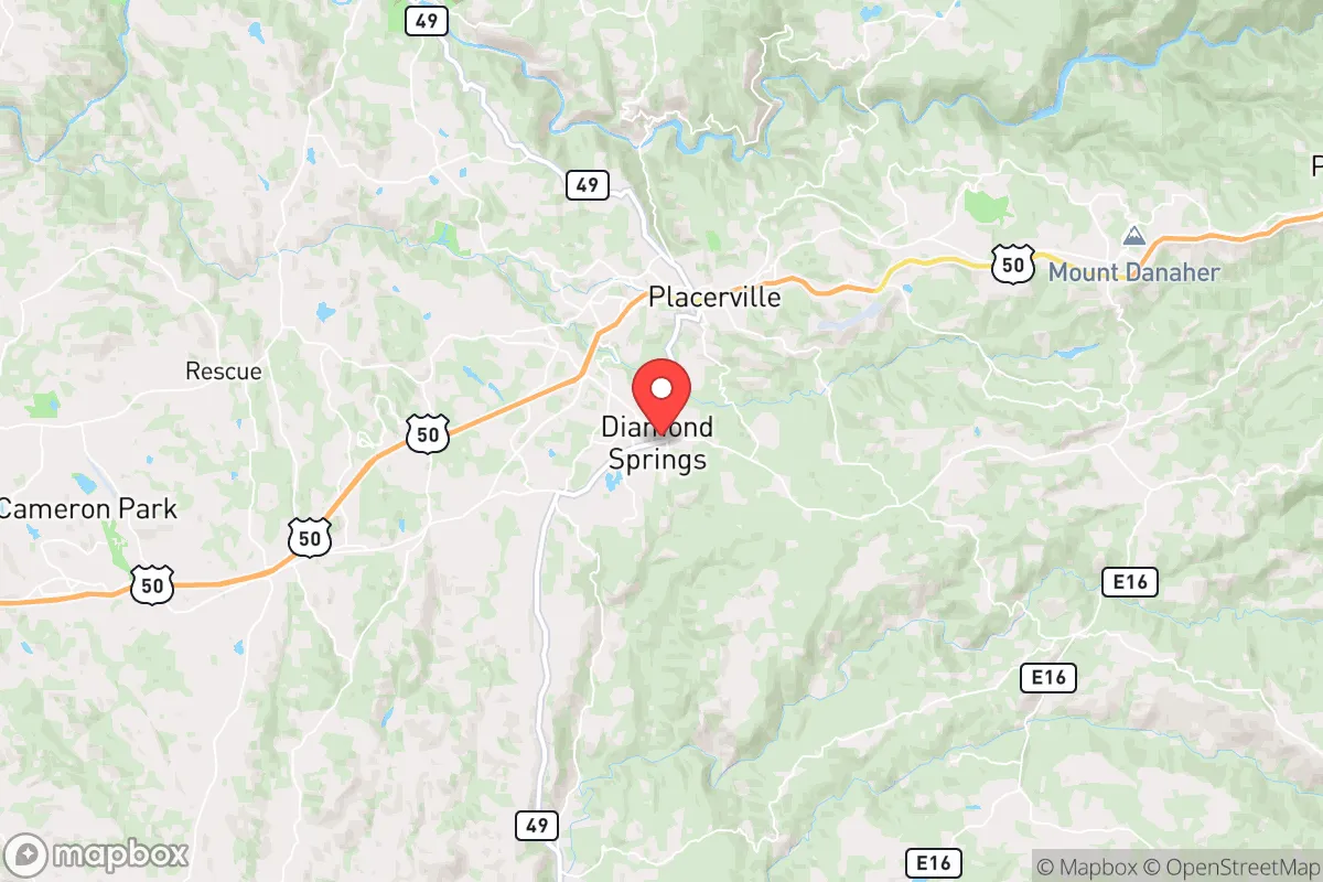
Diamond Springs, California, sits in a sweet spot for a relocator thinking seriously about resilience: close enough to Sacramento and the Sierra foothills' job centers to stay employed, yet far enough off the main corridors to avoid the worst of urban churn. The town's real strategic value is its position on the western slope of the Sierra Nevada, where elevation, water access, and a dispersed population create a defensible, self-sufficient base that most flatland suburbs simply cannot match. For a single individual or family weighing disaster readiness, this is a place where the geography does a lot of the heavy lifting before you even start building your own systems.
Geographic position and natural advantages for long-term stability
Diamond Springs sits at roughly 1,200 feet elevation in El Dorado County, about 45 minutes east of Sacramento and just a few miles south of Placerville, the county seat. That elevation is the first resilience win: it puts you above the Central Valley's summer heat inversions and smog, and it places the town on the cooler, forested side of the foothills where summer highs typically run 10–15 degrees lower than Sacramento's triple-digit stretches. Winters bring snow dustings but rarely the deep accumulations that shut down higher Sierra communities like South Lake Tahoe, meaning the access routes stay open more consistently.
The natural advantages stack up well for a preparedness-minded household. The surrounding El Dorado National Forest and the American River canyon system provide a massive, low-density buffer zone to the east and south—terrain that is difficult to traverse and effectively limits urban sprawl from ever reaching you. The town itself is unincorporated, which means no city council politics or municipal zoning fights to navigate if you want to build a shop, park an RV, or install solar panels; county permitting is generally more permissive than city rules. Water is the standout asset: the area sits atop the Cosumnes River watershed, and the Sierra snowpack feeds a network of creeks and groundwater basins that are far more reliable than the overdrafted aquifers of the Central Valley. For a relocator, this means the land itself is more forgiving of a well-and-septic lifestyle than most of California's populated zones.
Risk profile: wildfire, seismic activity, and proximity to high-value targets
The honest assessment of Diamond Springs' risks starts with wildfire, and it is not a minor consideration. The town sits in the wildland-urban interface, and the 2021 Caldor Fire came within roughly 15 miles to the east, forcing evacuations in nearby Pollock Pines and closing Highway 50 for weeks. The vegetation—mixed oak, pine, and manzanita—is fire-adapted and will burn again; the question is not if but when a dry, windy autumn pushes a blaze toward the community. That said, the town's position on the valley floor of the foothills, rather than on a steep ridgeline, gives firefighters more room to work, and the network of county roads provides multiple egress routes, which is more than many mountain communities can claim.
Seismic risk is moderate but manageable. The area is not on a major fault line like the San Andreas, but the nearby Placerville area has experienced minor quakes, and the western Sierra foothills can feel strong shaking from events on the Sierra Nevada fault system. The bigger man-made risk is proximity to Sacramento and the broader urban corridor. Sacramento is a major transportation and government hub, and in a conflict scenario or major grid-down event, it is a plausible target for disruption—whether from cyberattacks on the state's infrastructure or physical strikes on the I-80 and Highway 50 corridors that feed the region. Diamond Springs' 45-minute buffer from the city limits is a meaningful advantage, but it is not a remote mountain redoubt; you are still within the blast-radius-adjacent zone of a major metropolitan area's secondary effects, such as refugee flow, supply chain disruption, and civil unrest spillover.
Practical resilience: food, water, energy, and defensibility for a relocator
For a relocator building self-sufficiency, Diamond Springs offers a strong baseline. Water is the crown jewel: the area's groundwater is generally accessible at reasonable depths (50–150 feet for most wells), and the Cosumnes River—one of the last undammed rivers in the Sierra—provides a surface water source that runs year-round in most years. Rainwater catchment is viable, with the region averaging 30–40 inches of precipitation annually, concentrated in the November-to-March window. A household with a 5,000-gallon cistern and a basic filtration system can realistically achieve water independence for drinking and cooking, with well water covering irrigation and sanitation.
Food security is achievable but requires effort. The growing season is shorter than the Central Valley—roughly 180 days between last and first frost—but the climate supports a wide range of crops: apples, pears, stone fruits, berries, and cold-hardy greens thrive in the foothill soil. The surrounding county has a robust network of small farms and ranches, and the Placerville farmers' market operates year-round, meaning local food access is not just a theoretical exercise. For protein, the area supports small-scale poultry, goats, and even a few cattle operations on larger parcels; hunting is available in the national forest for deer and wild pig, though it requires a license and a commitment to the terrain.
Energy resilience is a mixed bag. The region gets abundant sun—over 260 sunny days per year—making solar a no-brainer for a preparedness-minded household. A typical 8–10 kW array with a battery bank (like a Tesla Powerwall or a larger off-grid setup) can cover most of a home's needs, and the county's net metering policies are favorable for grid-tied systems. The catch is winter: short, cloudy days in December and January can cut solar production by 60–70%, so a generator or a wood stove for heat is a practical backup. Firewood is plentiful and cheap from local suppliers, and the town's elevation means a well-insulated home with a wood stove can ride out a multi-week grid outage comfortably.
Defensibility is where Diamond Springs earns its keep. The town's layout—dispersed homes on 1–5 acre lots, winding county roads, and natural chokepoints at the creek crossings—makes it inherently harder to sweep through than a grid-pattern suburb. The community is small (roughly 5,000 residents in the immediate area) and has a noticeable rural character; neighbors tend to know each other, and the local sheriff's office has a visible presence. That said, it is not a gated compound; the town is open and accessible, and a relocator should not expect the kind of armed-neighborhood dynamics you might find in more remote Idaho or Montana communities. The realistic posture here is one of quiet preparedness: a well-stocked pantry, a reliable water system, and a defensible home perimeter, rather than a fortress mentality.
The overall strategic picture for Diamond Springs is favorable for a relocator who wants California's economic access without the state's urban vulnerabilities. The town offers a genuine balance: water and food security that most of the state lacks, a defensible geography that rewards preparation, and a community that is rural enough to be self-reliant but close enough to Sacramento to keep a job and access healthcare. The trade-offs are real—wildfire risk, a moderate earthquake exposure, and the ever-present proximity to a major metro area's fallout zone—but they are manageable with deliberate planning. For a single individual or family willing to invest in solar, a well, and a serious fire-hardening retrofit, Diamond Springs is one of the better strategic bets in the western Sierra foothills.

* Values derived from national, state, county, city and local statistics and may differ in a specific area. Last updated: 2026-11-03T19:09:43.000Z
Narrative content on this page is AI-generated and may contain mistakes. Verify any details that matter before acting on them.
ReloMaps may earn a commission from affiliate links at no extra cost to you.

