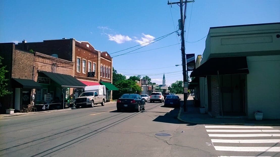
Photo: Wikipedia
Strategic Assessment of Creedmoor, NC
Meaningful friction. Expect exposure to either population pressure, blast zones, or natural disaster risk. Consider buying a retreat property.
What does the Strategic Assessment tell us?
Our Strategic Assessment grades tactical survivability of an area. Major population centers, military targets, fallout zones, natural disasters, and border exposure all drive risk — lower exposure means a more defensible position in a crisis.
This is heavily inspired by Joel Skousen's Strategic Relocation book. Highly recommended you checkout the book ($)What does this tell us?
Our Strategic Assessment grades tactical survivability of an area. Major population centers, military targets, fallout zones, natural disasters, and border exposure all drive risk — lower exposure means a more defensible position in a crisis.
This is heavily inspired by Joel Skousen's Strategic Relocation book. Highly recommended you checkout the book ($)Strategic Pillars

Key Distances
Regional Safe Places
Below is our recommended "safe zones" in North Carolina and the surrounding area based on our strategic heuristics. For most people, it's unrealistic to live in a “safe zone” full-time due to work, family or other personal reasons. They tend to be more rural. However, many of these areas are perfect for second homes and retreat properties that double as a vacation home or even a short-term rental.

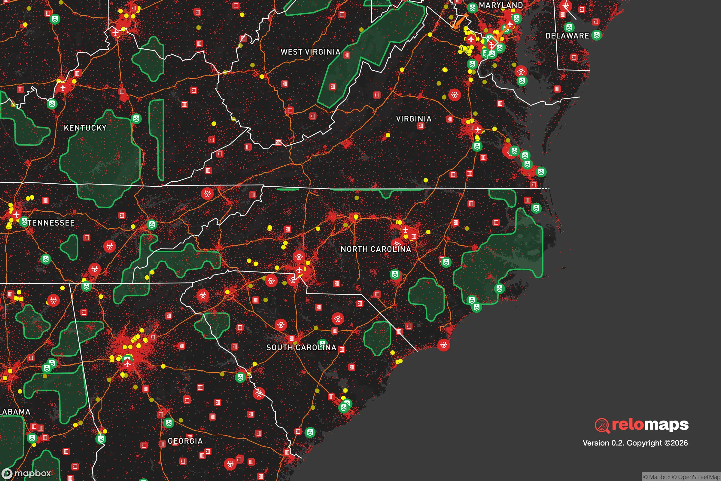


Important Note: For informational purposes only. This does not mean nothing bad ever happens in the green zones. Please use common sense. This is based on public data and modeled with AI. We tried to take a conservative approach but mistakes happen. We update this regularly as new information becomes available.
Solar Generator Recommendations
Backup power matters more here than in safer locations. We've picked three solar generators across budgets and capacity tiers — start with the budget unit if you only need a few essentials, or step up if you want to run a fridge and HVAC for days at a time.

Jackery Portable Power Station Explorer 300
Budget OptionPower on the Go: Weighing only 11 lbs, it's convenient to set up and store with book-sized foldable solar panels

BLUETTI Portable Power Station AC180
Designed for both indoor and outdoor scenarios, AC180 is highly capable as it has a robost capacity and continuous output power.

EF ECOFLOW DELTA Pro Ultra Power Station
Upgraded PickEcoFlow DELTA Pro Ultra is a whole-home energy system designed to grow with your family. Integrated with the Smart Home Panel 2, it scales to meet your evolving energy needs — keeping your home powered, intelligent, and secure through every stage of life.
We earn a commission, at no additional cost to you.
Strategic Assessment Analysis
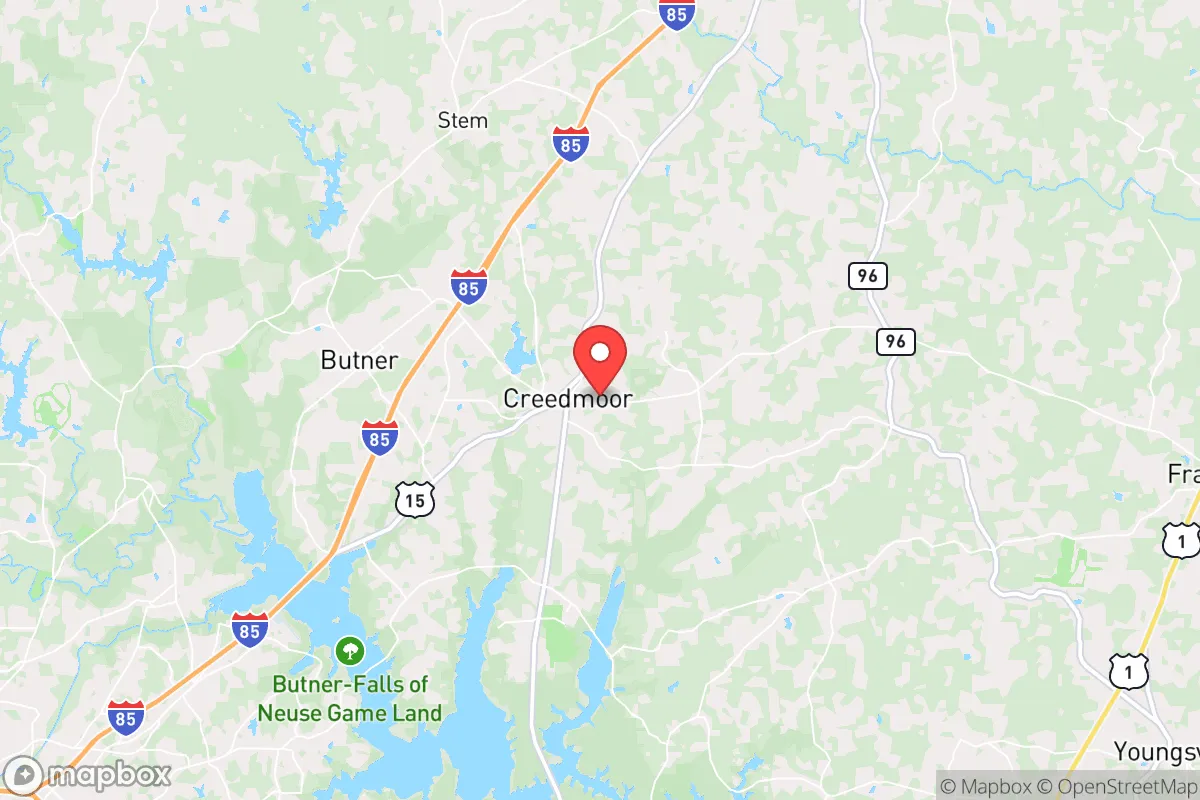
Creedmoor, North Carolina, occupies a strategic position in the state’s north-central Piedmont that offers a meaningful blend of rural buffer and logistical access, making it a location worth serious consideration for those prioritizing resilience and self-sufficiency. Situated roughly 25 miles northeast of Raleigh and 15 miles south of the Virginia line, the town sits outside the immediate blast and fallout zones of major metropolitan targets while remaining close enough to supply chains and medical infrastructure for practical daily life. The area’s resilience profile is shaped by its distance from high-value military and government installations, its position within a region less prone to catastrophic natural disasters than the coast or the mountains, and a growing but still manageable population density that allows for a degree of community cohesion without the anonymity of a large city.
Geographic position and natural advantages for long-term stability
Creedmoor’s location in Granville County places it on the eastern edge of the Piedmont, a region characterized by rolling hills, mixed hardwood and pine forests, and a temperate climate that supports year-round agriculture. The town sits at an elevation of roughly 400 feet above sea level, well above the flood-prone coastal plain and far enough inland to avoid the worst of hurricane storm surge, though tropical systems can still bring heavy rain and wind. The area’s underlying geology is predominantly crystalline bedrock and clay soils, which provide stable foundations for structures and limit the risk of liquefaction or sinkholes common in karst regions. Water resources are a genuine asset: the nearby Falls Lake and Kerr Lake reservoirs, along with the Tar River and its tributaries, offer surface water access, while the Piedmont’s deep aquifers provide reliable groundwater for wells. The region’s growing season runs from April to October, long enough for two crop cycles of staples like corn, beans, and squash, and the local soil, while not as rich as the Midwest’s loam, is workable with proper amendment. Forest cover is extensive, providing timber for fuel and construction, as well as natural cover that reduces visibility from the air and creates microclimates that moderate temperature extremes. The terrain is not mountainous, but the gentle ridges and valleys offer some natural defensibility and drainage advantages over flat, open ground.
Risks, exposures, and proximity to fallout-relevant landmarks
The most significant risk for Creedmoor is its proximity to Raleigh-Durham, a metropolitan area of over 2 million people that contains multiple potential targets in a major crisis. Raleigh is home to the state capital, North Carolina State University, and several federal office buildings; Durham hosts Duke University and its medical center; and the Research Triangle Park (RTP) is a concentration of biotech, pharmaceutical, and defense-related firms. In a nuclear exchange scenario, these would be high-priority targets, and Creedmoor’s 25-mile distance places it within the moderate fallout zone for a ground burst at RTP or downtown Raleigh. Prevailing winds in the region are from the southwest, meaning fallout from a strike on Raleigh would likely drift northeast, toward the Johnston County area, rather than directly toward Creedmoor. However, a strike on Fort Bragg (now Fort Liberty), roughly 70 miles southwest, or on the Norfolk Naval Base (150 miles east) could produce fallout patterns that affect the area depending on wind direction. Natural disaster risks are lower but not absent: the region sees occasional tornadoes (typically EF0-EF2), severe thunderstorms with hail, and the residual effects of hurricanes that weaken as they move inland. Ice storms are a recurring winter hazard that can knock out power for days, and the area’s clay soils can cause foundation issues if not properly managed. The nearby Harris Nuclear Plant (about 30 miles southwest) is a low-probability, high-consequence risk; a containment failure could render large areas uninhabitable for decades, though the plant’s design and regulatory oversight make a catastrophic event unlikely. On balance, Creedmoor’s risk profile is moderate: it avoids the highest-risk coastal and urban zones but is not remote enough to be insulated from regional disruptions.
Practical resilience for a relocator: food, water, energy, and defensibility
For someone serious about self-sufficiency, Creedmoor offers a workable foundation. Water is the strongest asset: the area’s groundwater is generally good quality, with wells typically producing 10-30 gallons per minute at depths of 100-300 feet. Surface water from the Tar River and nearby creeks is accessible but requires treatment for pathogens and agricultural runoff. Rainwater harvesting is viable, with the region averaging 45 inches of precipitation per year, spread fairly evenly across seasons. Food production is feasible on parcels of 2-5 acres, with enough space for a large garden, fruit trees, and small livestock like chickens or goats. The local extension service (Granville County Cooperative Extension) offers soil testing and workshops on sustainable agriculture, and there are active farmers’ markets in Creedmoor and nearby Oxford that provide seed stock and livestock sources. Energy resilience is more challenging: the grid is served by Duke Energy, which has a mixed reliability record during storms, but the area’s tree cover means solar panels require careful siting to avoid shading. Wood heating is practical given the forest resources, and propane delivery is available for backup cooking and heating. Defensibility is moderate: the town’s layout is spread out, with many homes on acreage separated by woods and fields, which limits the risk of close-proximity threats. The local law enforcement presence is small (Granville County Sheriff’s Office and Creedmoor Police Department), so community-based security arrangements—neighborhood watches, shared communication networks, and mutual aid agreements—are more realistic than relying on formal protection. The population is around 5,000, small enough that social trust can be built but large enough to have a hardware store, a grocery, and a medical clinic within a 10-minute drive. The biggest practical weakness is the lack of a robust local manufacturing base; most goods are trucked in from the Triangle, meaning supply chains are vulnerable to fuel shortages or highway disruptions. A relocator should plan for at least a 90-day supply of critical items, including medications, ammunition, and spare parts for equipment.
The overall strategic picture for Creedmoor is one of calculated trade-offs. It offers genuine advantages in water availability, agricultural potential, and moderate distance from high-value targets, all within a climate that supports year-round subsistence. The risks are real but manageable: proximity to Raleigh-Durham means fallout exposure is possible, and the area’s dependence on regional supply chains requires proactive stockpiling. For a family or individual willing to invest in well water, solar or wood heat, and a productive garden, Creedmoor provides a defensible base that balances isolation with access to the resources of a major metro area. It is not a bug-out location for a complete collapse scenario—there are better options in the mountains or the remote Midwest—but for someone who wants to maintain a professional career or family ties while building resilience, it is one of the more sensible choices in the North Carolina Piedmont. The key is to treat it as a long-term project: buy land with good water and southern exposure, build community relationships before a crisis, and accept that no location is perfectly safe, only better or worse prepared. Creedmoor, on balance, leans toward the better-prepared end of the spectrum for its region.

* Values derived from national, state, county, city and local statistics and may differ in a specific area. Last updated: 2026-09-02T22:29:34.000Z
Narrative content on this page is AI-generated and may contain mistakes. Verify any details that matter before acting on them.
ReloMaps may earn a commission from affiliate links at no extra cost to you.

