
Strategic Assessment of Western Connecticut Planning Region County
Multiple tactical vulnerabilities. Population density, target proximity, or disaster risk are likely compounding. A retreat property and exit planning is required.
What does the Strategic Assessment tell us?
Our Strategic Assessment grades tactical survivability of an area. Major population centers, military targets, fallout zones, natural disasters, and border exposure all drive risk — lower exposure means a more defensible position in a crisis.
This is heavily inspired by Joel Skousen's Strategic Relocation book. Highly recommended you checkout the book ($)What does this tell us?
Our Strategic Assessment grades tactical survivability of an area. Major population centers, military targets, fallout zones, natural disasters, and border exposure all drive risk — lower exposure means a more defensible position in a crisis.
This is heavily inspired by Joel Skousen's Strategic Relocation book. Highly recommended you checkout the book ($)Strategic Pillars

Key Distances
Strategic Assessment Analysis
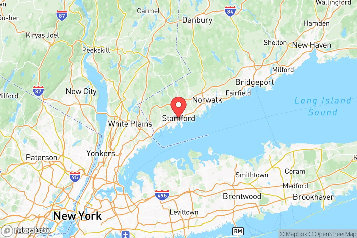
Western Connecticut Planning Region County, commonly referred to as the Western Connecticut Council of Governments (WestCOG) region, offers a strategic blend of geographic resilience and economic access that appeals to relocation-minded individuals and families with a conservative leaning. The region encompasses the cities of Danbury, Norwalk, Stamford, and the towns of Ridgefield, Newtown, and Brookfield, placing it within a two-hour drive of New York City while maintaining a distinctly suburban-to-rural character. Its position along the Housatonic River corridor and the foothills of the Berkshire Mountains provides natural barriers and defensible terrain, while the region's economic base in aerospace, advanced manufacturing, and insurance offers stable employment away from the most vulnerable coastal zones. For a relocator prioritizing disaster readiness and self-sufficiency, this area presents a nuanced picture: strong natural advantages in water and food access, but real exposure to metropolitan fallout risks and infrastructure chokepoints.
Geographic position and natural advantages for disaster readiness
The Western Connecticut region sits in a transitional zone between the densely populated New York metropolitan area and the sparsely populated Litchfield Hills and Berkshire Mountains. This positioning offers a critical strategic advantage: the ability to access urban resources while maintaining distance from the highest-density population centers. The Housatonic River, which runs through the region from north to south, provides a reliable freshwater source, and the numerous lakes—including Candlewood Lake, Lake Lillinonah, and Lake Zoar—offer both recreational water reserves and potential emergency water supplies. The terrain is rolling hills and forested ridges, with elevations reaching over 1,000 feet in the northern towns like New Milford and Sherman, which naturally limits flood exposure and provides defensible high ground. The region's soils are generally well-drained, supporting local agriculture and reducing landslide risk compared to steeper mountain areas. The climate is temperate, with four distinct seasons, and the region is far enough inland to avoid the direct storm surge impacts of Long Island Sound, though it does experience nor'easters and occasional hurricane remnants. For a family considering long-term self-sufficiency, the combination of abundant surface water, moderate elevation, and fertile valleys creates a solid baseline for food and water independence.
Risks, exposures, and proximity to fallout-relevant landmarks
The most significant risk for Western Connecticut relocators is its proximity to New York City and the associated fallout dangers from a major metropolitan event. The region lies directly in the prevailing wind path from New York City, meaning that any radiological, chemical, or biological release in the five boroughs would likely affect areas from Danbury southward within hours. Stamford and Norwalk, being coastal and directly adjacent to the New York border, are particularly exposed, with Stamford's population density of over 135,000 people creating its own concentration risk. The region also contains several infrastructure chokepoints: the I-95 corridor along the coast is a single artery that can be severed by storm surge or accident, and the Danbury Railway line is a single-track rail line that serves as the only freight rail connection to the interior. There are no major military bases within the region—the closest is West Point, about 40 miles north—but there are several sensitive industrial sites. The Danbury area historically housed a major Barden Corporation bearing plant (now part of Schaeffler) that supports defense and aerospace supply chains, and the region hosts several data centers and telecommunications hubs that could be secondary targets. The Indian Point Energy Center nuclear plant, located just across the New York border in Buchanan, NY, is approximately 30 miles from Danbury and has been a persistent concern for regional planners, though it ceased power generation in 2021 and is now in decommissioning. The region's water supply is vulnerable to contamination from upstream industrial sites along the Housatonic, including the former General Electric transformer plant in Pittsfield, Massachusetts, which left a legacy of PCB contamination in the river sediments. For a relocator, the key takeaway is that while the region offers good natural defenses, its position in the New York City shadow zone means that any major metropolitan disaster would have direct, rapid consequences for the entire southern half of the region.
Practical resilience for a relocator: food, water, energy, and defensibility
For a family or individual serious about self-sufficiency, Western Connecticut offers a mixed but workable picture. Water access is excellent: the region's numerous lakes, rivers, and groundwater aquifers provide multiple redundant sources, and many homes in the northern towns have private wells, reducing dependence on municipal systems. The Housatonic River alone has a mean annual flow of over 5,000 cubic feet per second at the Stevenson Dam, providing ample water for treatment and use. Food production potential is moderate but improving: the region has a growing local food movement, with farmers' markets in Danbury, New Milford, and Ridgefield, and the Connecticut Department of Agriculture reports over 1,200 farms in the state, many concentrated in the western counties. The growing season runs from April to October, and the soils in the Housatonic Valley are among the most productive in New England. However, the region is not a major grain or livestock producer, meaning that long-term food independence would require significant land and investment. Energy resilience is a weak point: the region is heavily dependent on the regional power grid, which is supplied by natural gas pipelines from the Marcellus Shale region and the Millstone Nuclear Power Station in Waterford, CT. Solar adoption is growing but still limited by the region's forested terrain and relatively high installation costs. Backup generators are common in rural areas, but fuel supply chains could be disrupted in a crisis. Defensibility is strong in the northern towns: the terrain of New Milford, Kent, and Sherman offers natural chokepoints along the Housatonic River valley, with narrow roads and dense forest providing cover and limited access. The region's population density drops sharply north of Danbury, from over 1,000 people per square mile in the city to under 100 in the northern towns, making it easier to secure a homestead. The local culture in these areas is notably self-reliant, with a strong tradition of hunting, fishing, and woodworking that supports practical skills. For a relocator, the northern half of the region—towns like New Milford, Kent, Sherman, and Warren—offers the best balance of access to resources and defensible isolation, while the southern towns near the coast are best avoided for those prioritizing disaster readiness.
Overall, Western Connecticut Planning Region County presents a strategic option for the disaster-conscious relocator who wants proximity to urban employment without living in the urban bullseye. The region's natural advantages in water, terrain, and climate are genuine, and the northern towns offer some of the best defensible land within two hours of New York City. However, the risks are real: the region's position in the New York City fallout zone, its dependence on vulnerable infrastructure corridors, and the legacy contamination of the Housatonic River mean that a relocator must be prepared for both natural and man-made disruptions. The smartest move for a family is to target the northern tier—specifically New Milford, Kent, or Sherman—where elevation, water access, and low population density combine to create a genuinely resilient base. With a well-stocked pantry, a backup power system, and a plan for water treatment, this region can serve as a long-term haven, provided the relocator understands that the southern half of the region is essentially a suburb of New York City and carries all the associated vulnerabilities. For the conservative-leaning individual or family who values self-reliance and strategic positioning, Western Connecticut offers a solid, if imperfect, foundation.

* Values derived from national, state, county, city and local statistics and may differ in a specific area. Last updated: 2026-06-17T00:30:19.000Z
Narrative content on this page is AI-generated and may contain mistakes. Verify any details that matter before acting on them.
ReloMaps may earn a commission from affiliate links at no extra cost to you.

