
Strategic Assessment of Naugatuck Valley Planning Region County
Multiple tactical vulnerabilities. Population density, target proximity, or disaster risk are likely compounding. A retreat property and exit planning is required.
What does the Strategic Assessment tell us?
Our Strategic Assessment grades tactical survivability of an area. Major population centers, military targets, fallout zones, natural disasters, and border exposure all drive risk — lower exposure means a more defensible position in a crisis.
This is heavily inspired by Joel Skousen's Strategic Relocation book. Highly recommended you checkout the book ($)What does this tell us?
Our Strategic Assessment grades tactical survivability of an area. Major population centers, military targets, fallout zones, natural disasters, and border exposure all drive risk — lower exposure means a more defensible position in a crisis.
This is heavily inspired by Joel Skousen's Strategic Relocation book. Highly recommended you checkout the book ($)Strategic Pillars

Key Distances
Strategic Assessment Analysis
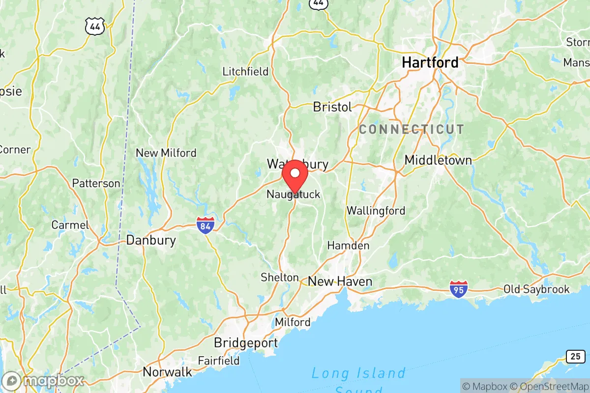
The Naugatuck Valley Planning Region, anchored by the cities of Waterbury, Naugatuck, and Torrington, presents a mixed strategic picture for a relocator prioritizing disaster readiness and self-sufficiency. Its primary advantage is a resilient, inland geography that avoids the direct hurricane storm surge and sea-level rise threats of Connecticut’s coastal communities, while its location within the densely populated Northeast corridor introduces significant man-made risk exposures. For a conservative-leaning individual or family, the region offers a workable balance of access to resources and relative isolation from the most acute fallout zones, provided one understands the specific vulnerabilities baked into its industrial history and transportation network.
Geographic position and natural advantages for long-term stability
The Naugatuck Valley sits in a series of river valleys carved through the western Connecticut highlands, a terrain that provides natural defensibility and a degree of separation from the major population centers of New York and Boston. The region’s elevation, ranging from roughly 200 to over 1,000 feet in the surrounding Litchfield Hills, offers a meaningful buffer against the worst of inland flooding from tropical systems, though the valley floors themselves—particularly in downtown Waterbury and along the Naugatuck River—have a history of flash flooding during intense rainfall events. The area’s water resources are a genuine asset: the Shepaug River, the Naugatuck River, and numerous reservoirs (including the sprawling Barkhamsted Reservoir to the north) provide a reliable freshwater supply that is less contested than in arid or semi-arid regions. For a relocator, the presence of state forests like Naugatuck State Forest and the adjacent Mohawk State Forest means ample wood for heating and construction, as well as game for hunting. The region’s agricultural potential is modest but real—the valley’s glacial till soils support small-scale farming, and the town of Litchfield, just west of the planning region, has a strong local food network. The climate is temperate, with four distinct seasons, meaning no single extreme (prolonged drought, deep freeze, or heat wave) dominates the risk profile, which is a stability advantage over regions prone to wildfire or hurricane landfalls.
Risks, exposures, and proximity to fallout-relevant landmarks
The Naugatuck Valley’s most significant vulnerability is its location within the New York–Boston–Philadelphia megaregion, placing it within plausible fallout and secondary disruption zones from a major event in those cities. Waterbury lies roughly 80 miles from Manhattan and 100 miles from Boston, meaning a nuclear detonation or large-scale industrial accident in either city could produce fallout patterns that affect the valley, depending on wind direction. More locally, the region is bisected by Interstate 84 and Route 8, major transportation corridors that would become chokepoints or targets during a crisis. The presence of the Sikorsky Aircraft plant in Stratford (about 20 miles south) and the Pratt & Whitney facilities in East Hartford (about 30 miles east) are defense-industrial landmarks that could be secondary targets or sources of hazardous material release. Within the valley itself, the legacy of brass and manufacturing—particularly in Waterbury and Naugatuck—has left a patchwork of brownfield sites and aging industrial infrastructure. The Naugatuck River itself has a history of industrial contamination, and while cleanup has progressed, the presence of old factories, chemical storage, and rail yards means a localized chemical spill or fire could compromise water quality. The region is also within the Indian Point Energy Center’s 50-mile emergency planning zone (though the plant is now decommissioned, spent fuel remains on site), and within 100 miles of the Millstone Nuclear Power Station in Waterford, CT. For a relocator, the key takeaway is that while the valley is not a primary target, it sits in a zone that would experience significant secondary effects from a major event in the Northeast corridor, and its own industrial legacy creates localized hazards that require awareness.
Practical resilience for a relocator: food, water, energy, and defensibility
For a family or individual serious about self-sufficiency, the Naugatuck Valley offers a mixed but workable foundation. Water availability is the region’s strongest card: the numerous rivers, streams, and reservoirs mean that a well-equipped property with a hand pump or rainwater catchment system can secure a reliable supply, unlike in the Southwest or even parts of the Northeast with sandy soils. The region’s growing season runs roughly from May to October, supporting vegetable gardens, fruit trees, and small livestock; the town of Bethlehem, just west of the planning region, is known for its dairy farms, and local farmers’ markets are common. Energy resilience is more challenging: the valley’s tree cover is dense, and winter ice storms routinely knock out power for days or weeks, as seen in the 2011 Halloween nor’easter and 2020 Tropical Storm Isaias. A relocator should plan for a backup generator or solar-plus-battery system, and wood heat is a practical supplement given the forested terrain. Defensibility varies by micro-location: properties on dead-end roads in the hills above Waterbury or Torrington offer natural chokepoints and visibility, while valley-floor neighborhoods in the cities are more exposed to foot traffic and vehicle access. The region’s population density is moderate—Waterbury has about 110,000 people, but the surrounding towns like Middlebury, Oxford, and Woodbury are rural or exurban, with lower density and more land per household. Gun ownership is common in the rural parts of the valley, and Connecticut’s firearm laws are relatively strict, but a relocator from a more permissive state should be aware of the state’s permitting requirements. The local culture in towns like Thomaston and Plymouth leans conservative and self-reliant, with a strong volunteer fire department and emergency services network, though response times in the most remote areas can be 20–30 minutes.
The overall strategic picture for the Naugatuck Valley Planning Region is one of a defensible, resource-rich interior location that is nonetheless tethered to the vulnerabilities of the Northeast megaregion. For a relocator who values water security, forest resources, and a temperate climate, and who is willing to invest in backup power and localized food production, the valley offers a credible base for long-term resilience. The trade-off is proximity to major population centers and defense-industrial targets, which introduces a non-trivial risk of fallout or secondary disruption. The region is not a remote bunker—it is a semi-rural corridor with real assets and real exposures. A prudent relocator would prioritize a property on elevated ground away from the Naugatuck River floodplain, with a well, a woodlot, and a defensible access point, and would maintain a situational awareness of events in New York, Boston, and the state’s coastal nuclear facilities. In the calculus of disaster readiness, the Naugatuck Valley scores as a solid B+: not the safest location in the country, but a far better bet than the coastal cities or the open plains, and one where a prepared family can thrive with reasonable effort.

* Values derived from national, state, county, city and local statistics and may differ in a specific area. Last updated: 2026-07-09T11:51:32.000Z
Narrative content on this page is AI-generated and may contain mistakes. Verify any details that matter before acting on them.
ReloMaps may earn a commission from affiliate links at no extra cost to you.

