
Quality of Life in Naugatuck Valley Planning Region County
A livable area that tracks near national norms for affordability, walkability, and neighborhood health.
What does Quality of Life tell us?
Quality of Life measures an area by evaluating factors like cost of living, nearby amenities, country club access, airport proximity, socioeconomic signals and neighborhood character. For large states, this is a general average — quality of life can vary dramatically between metro areas, suburbs, and rural communities within the same state.
What does this tell us?
Quality of Life measures an area by evaluating factors like cost of living, nearby amenities, country club access, airport proximity, socioeconomic signals and neighborhood character. For large states, this is a general average — quality of life can vary dramatically between metro areas, suburbs, and rural communities within the same state.
Cost of Living
8% above national average
104%
The Real Cost of Living in Naugatuck Valley Planning Region County for 2026
| Tier | Individual | Family (4) |
|---|---|---|
| Survival | $21k | $39k |
| Comfortable | $56k | $83k |
| Luxury | $153k+ | $237k+ |
| Elite (Top 5%) | $180k+ | $279k+ |
Quality-of-Life Analysis
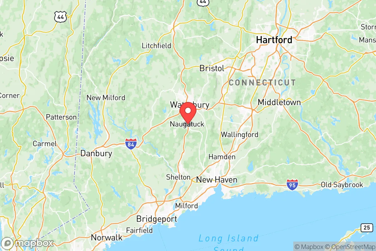
The Naugatuck Valley Planning Region in western Connecticut offers a quality-of-life spectrum that ranges from historic industrial boroughs and walkable town centers to quiet rural hillsides and suburban subdivisions, all within a 30-minute average commute. This region, anchored by the city of Waterbury and stretching through the Naugatuck River Valley, attracts a diverse mix of residents: young professionals seeking affordable starter homes near Hartford and New Haven, families drawn to strong school districts in smaller towns, and retirees looking for low-tax rural living in the Litchfield Hills foothills. With a cost-of-living index of 108 (slightly above the national average) and a median home value of $290,800, the region provides a more attainable entry point into Connecticut real estate compared to Fairfield County or the shoreline.
Largest town(s) & population centers
Waterbury, the region's largest city with roughly 114,000 residents, serves as the commercial and transportation hub. Daily life here centers on the redeveloped downtown area around the Palace Theater and the Green, with a mix of older triple-decker homes, brick apartment buildings, and modest single-family houses. The city offers the most diverse housing stock and the highest concentration of rental units, with median rent at $1,288 aligning closely with the county average. Naugatuck, a borough of about 31,000, blends a compact downtown with residential neighborhoods along the river, while Bristol (partially in the region) provides a more suburban feel with its ESPN headquarters and Lake Compounce amusement park. These population centers offer the most robust public transit options, including Metro-North rail service from Waterbury to Bridgeport and New York City, though most residents still rely on cars for the 28-minute average commute.
Smaller towns & rural pockets
Moving north and west from the valley floor, towns like Thomaston, Plymouth, and Wolcott offer a distinctly quieter lifestyle. Thomaston, with its historic clock-making heritage and access to the Naugatuck State Forest, attracts outdoor enthusiasts who want proximity to hiking and fishing. Middlebury and Southbury sit along the region's western edge, featuring larger lot sizes, higher home values, and top-rated school systems that draw families willing to pay a premium for space and safety. The rural pockets of Bethlehem and Woodbury (technically in the adjacent Litchfield Hills but functionally part of the same commuting shed) offer true countryside living with working farms, horse properties, and homes on 2-5 acre lots. These smaller communities lack the retail density of Waterbury but compensate with lower property tax rates and significantly less traffic.
Cost & lifestyle range
The cost-of-living spread across the Naugatuck Valley is substantial. At the affordable end, Waterbury's East End and Bunker Hill neighborhoods offer median home values below $200,000, with many fixer-upper Victorians and multifamily properties that attract first-time buyers and investors. Naugatuck's Union City section similarly provides entry-level pricing, with smaller capes and ranches in the $180,000-$240,000 range. At the upper end, Middlebury and Southbury command median home values exceeding $400,000, with newer subdivisions and custom homes on acreage. Wolcott sits in the middle, with a median home value around $290,000 and a strong sense of community centered on its town green and recreational fields. Renters face a similar gradient: Waterbury apartments average $1,100-$1,300 for two-bedrooms, while comparable units in Southbury or Middlebury run $1,500-$1,800. Amenities follow the money — Waterbury and Bristol offer the widest range of grocery stores, restaurants, and healthcare facilities, while smaller towns rely on local markets and require short drives for major shopping.
The Naugatuck Valley Planning Region works best for people who value affordability relative to coastal Connecticut and don't mind a trade-off between urban convenience and rural peace. Young professionals and commuters to Hartford, New Haven, or Danbury find the best value in Waterbury and Naugatuck, where the train station and highway access keep commute times manageable. Families with school-age children typically gravitate toward Middlebury, Wolcott, or Southbury for their higher-rated districts and lower crime rates. Retirees and remote workers often choose Thomaston or Bethlehem for the quiet, land, and lower property taxes. The region's defining strength is its variety — a single county that lets residents choose between a walkable city apartment, a suburban cul-de-sac, or a hillside homestead, all within a 20-minute drive of each other.

Crime in Naugatuck Valley Planning Region County
Generally safer than 71% of comparable U.S. locations.
Violent CrimeViolent Crime Analysis
Property CrimeProperty Crime Analysis
Crime Analysis
The Naugatuck Valley Planning Region, encompassing the historic brass-manufacturing corridor of western Connecticut, reports a violent crime rate of 110.5 incidents per 100,000 residents and a property crime rate of 1,157.3 per 100,000. These figures place the region in a complex safety landscape where overall risk is moderate by national standards, but significant variation exists between its core industrial cities and more suburban towns. Residents and prospective movers should pay close attention to specific municipality-level data, as the region’s justice system—influenced by progressive policies in larger jurisdictions—presents distinct concerns for public safety and recidivism.
Crime in context
Compared to the national average of roughly 380 violent crimes per 100,000, the Naugatuck Valley’s rate of 110.5 is notably low—roughly one-third the U.S. figure. Property crime at 1,157.3 per 100,000 also sits below the national benchmark of approximately 1,950. However, these regional averages mask stark internal disparities. The state of Connecticut’s overall violent crime rate hovers around 150 per 100,000, meaning the Naugatuck Valley is safer than the state as a whole. Yet this aggregate safety is heavily weighted by low-crime suburbs; the region’s urban centers tell a different story. Waterbury, the region’s largest city, consistently reports violent crime rates two to three times the regional average, driven by gang activity and drug-related offenses. In contrast, towns like Southbury and Oxford routinely record violent crime rates below 50 per 100,000, making them among the safest communities in Connecticut.
What residents experience
Property crime—particularly larceny and motor vehicle theft—is the most common safety concern for Naugatuck Valley residents. The region’s property crime rate of 1,157.3 per 100,000 is roughly 40% lower than the national average, but pockets of higher risk exist. Waterbury and Ansonia see elevated rates of burglary and theft, often linked to the region’s transportation corridors (I-84 and Route 8) that facilitate quick getaways. A significant factor shaping local safety is the judicial philosophy of the Waterbury Judicial District, which covers much of the region. Critics point to progressive bail reform and diversion programs that, while intended to reduce incarceration, have resulted in repeat property offenders cycling through the system with minimal consequences. Residents in Naugatuck and Derby have reported frustration with what they perceive as lenient sentencing for serial shoplifters and car thieves, contributing to a sense that the justice system prioritizes offender rehabilitation over victim protection. This dynamic is especially pronounced in the region’s larger, more liberal-leaning municipalities where district attorneys have adopted policies that reduce pretrial detention for nonviolent but chronic offenders.
Neighborhood-level variation is pronounced and predictable. The safest residential areas cluster in the region’s western and northern towns: Middlebury, Bethlehem, and Woodbury consistently report violent crime rates below 30 per 100,000 and property crime rates under 800 per 100,000. These communities benefit from smaller police forces with strong community ties and lower population density. Conversely, the downtown corridors of Waterbury—particularly the East End and Brooklyn neighborhoods—experience the highest concentration of violent incidents, including aggravated assaults and robberies. The Ansonia-Derby corridor along the Naugatuck River also sees elevated property crime, with break-ins targeting older multi-family homes. For those considering relocation, the safest strategy is to prioritize towns with independent police departments and conservative local governance, as these areas tend to maintain stricter enforcement and prosecution practices that correlate with lower crime rates.
* Values derived from national, state, county, city and local statistics and may differ in a specific area. Last updated: 2026-07-09T11:51:32.000Z
Narrative content on this page is AI-generated and may contain mistakes. Verify any details that matter before acting on them.
ReloMaps may earn a commission from affiliate links at no extra cost to you.

