
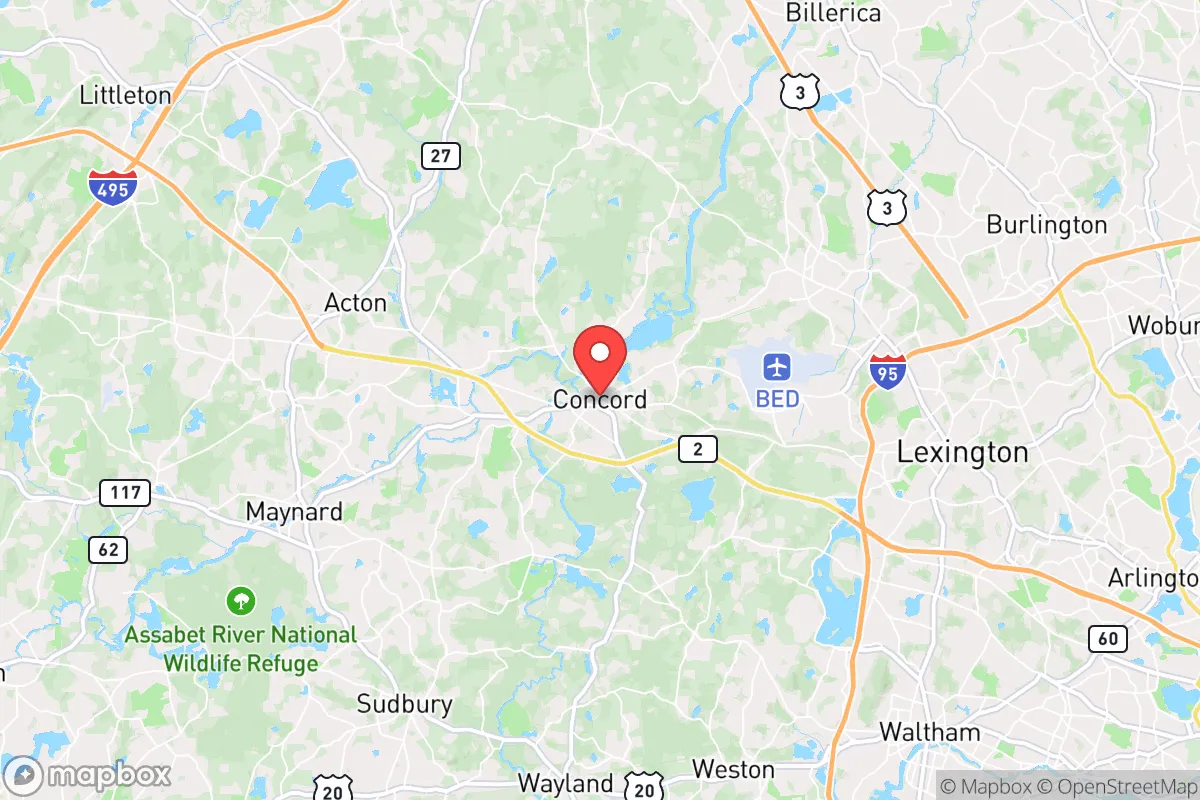
Strategic Assessment of Concord, MA
Multiple tactical vulnerabilities. Population density, target proximity, or disaster risk are likely compounding. A retreat property and exit planning is required.
What does the Strategic Assessment tell us?
Our Strategic Assessment grades tactical survivability of an area. Major population centers, military targets, fallout zones, natural disasters, and border exposure all drive risk — lower exposure means a more defensible position in a crisis.
This is heavily inspired by Joel Skousen's Strategic Relocation book. Highly recommended you checkout the book ($)What does this tell us?
Our Strategic Assessment grades tactical survivability of an area. Major population centers, military targets, fallout zones, natural disasters, and border exposure all drive risk — lower exposure means a more defensible position in a crisis.
This is heavily inspired by Joel Skousen's Strategic Relocation book. Highly recommended you checkout the book ($)Strategic Pillars

Key Distances
Regional Safe Places
Below is our recommended "safe zones" in Massachusetts and the surrounding area based on our strategic heuristics. For most people, it's unrealistic to live in a “safe zone” full-time due to work, family or other personal reasons. They tend to be more rural. However, many of these areas are perfect for second homes and retreat properties that double as a vacation home or even a short-term rental.




Important Note: For informational purposes only. This does not mean nothing bad ever happens in the green zones. Please use common sense. This is based on public data and modeled with AI. We tried to take a conservative approach but mistakes happen. We update this regularly as new information becomes available.
Solar Generator Recommendations
Backup power matters more here than in safer locations. We've picked three solar generators across budgets and capacity tiers — start with the budget unit if you only need a few essentials, or step up if you want to run a fridge and HVAC for days at a time.

Jackery Portable Power Station Explorer 300
Budget OptionPower on the Go: Weighing only 11 lbs, it's convenient to set up and store with book-sized foldable solar panels

BLUETTI Portable Power Station AC180
Designed for both indoor and outdoor scenarios, AC180 is highly capable as it has a robost capacity and continuous output power.

EF ECOFLOW DELTA Pro Ultra Power Station
Upgraded PickEcoFlow DELTA Pro Ultra is a whole-home energy system designed to grow with your family. Integrated with the Smart Home Panel 2, it scales to meet your evolving energy needs — keeping your home powered, intelligent, and secure through every stage of life.
We earn a commission, at no additional cost to you.
Strategic Assessment Analysis
Concord, Massachusetts, offers a compelling mix of historical significance and modern-day strategic advantages for the relocation-minded reader focused on resilience and self-sufficiency. Its position roughly 20 miles northwest of Boston places it far enough from the urban core to avoid the worst of a metropolitan collapse scenario, yet close enough to access critical infrastructure and markets during stable times. The town’s deep-rooted culture of civic preparedness, dating back to the Minutemen, is not just a historical footnote—it manifests in active local emergency management, robust community networks, and a landscape that naturally supports a degree of autonomy. For a conservative-leaning individual or family weighing disaster readiness, Concord presents a balanced profile: strong on natural buffers and community cohesion, but with real exposure to the risks that come with proximity to a major population and political center.
Geographic position and natural advantages for long-term security
Concord sits within the broader Boston Basin, but its specific locale offers several natural advantages that enhance its resilience profile. The town is defined by the Concord and Sudbury Rivers, which create a network of wetlands, floodplains, and wooded corridors that act as natural barriers to sprawl and provide significant water resources. The underlying geology is primarily glacial till and bedrock, which supports stable building foundations and reduces the risk of liquefaction compared to coastal areas. Elevation across the town ranges from roughly 100 to 200 feet above sea level, offering modest but meaningful terrain advantages—enough to provide good drainage and line-of-sight in many neighborhoods, but not so high as to create extreme weather exposure. The surrounding conservation land, including the 1,700-acre Great Meadows National Wildlife Refuge and the 900-acre Walden Pond State Reservation, creates a green buffer that limits dense development and provides a potential source of wild game, forage, and timber. This patchwork of protected land, combined with the town’s own extensive conservation areas (over 1,000 acres of town-owned land), gives Concord a defensible perimeter in a way that suburban sprawl communities lack. The region’s temperate climate, with four distinct seasons, supports year-round agriculture and reduces the likelihood of catastrophic weather events like hurricanes or wildfires, though nor’easters and occasional ice storms are a recurring challenge.
Risks, exposures, and proximity to fallout-relevant landmarks
The most significant vulnerability for Concord is its proximity to Boston and the associated infrastructure that makes it a potential secondary target or fallout zone in a major crisis. The town lies roughly 15 miles from Hanscom Air Force Base (a major Air Force and civilian research hub) and about 20 miles from the Boston metropolitan area’s dense population of 4.5 million. In a nuclear or large-scale conventional attack scenario, Concord sits within the moderate fallout risk zone—close enough that prevailing winds from the east could carry radioactive particles, but far enough that direct blast effects are unlikely. The town is also within 10 miles of the MBTA commuter rail line and major highways (I-95/Route 128 and Route 2), which are both evacuation corridors and potential chokepoints during a crisis. On the natural disaster front, Concord faces moderate risk from riverine flooding, particularly in low-lying areas near the Concord River and its tributaries. The Federal Emergency Management Agency (FEMA) designates portions of the town as Zone A (1% annual flood risk), and the 2023 Massachusetts Climate Assessment notes that heavy precipitation events have increased 70% since the 1950s, raising the likelihood of localized flash flooding. Wildfire risk is low due to the region’s humidity and forest composition, but drought conditions—like those experienced in 2022—can elevate fire danger in the extensive wooded areas. The town’s power grid is served by Eversource, which has a mixed reliability record; major storms in 2021 and 2023 caused multi-day outages in parts of Concord, highlighting the need for backup power. For the relocator, the key takeaway is that Concord’s risks are primarily man-made and proximity-driven, not natural. The town’s location near critical military and civilian infrastructure is a double-edged sword: it provides economic stability but also makes it a potential target or fallout zone in a worst-case scenario.
Practical resilience for a relocator: food, water, energy, and defensibility
For the self-sufficient-minded relocator, Concord offers a mixed but generally favorable picture. Water access is a standout advantage: the town sits atop the Concord River watershed, with multiple surface water sources and a municipal water system that draws from the Concord River and several groundwater wells. Private wells are common in outlying areas, and the town’s zoning allows for rainwater catchment systems. However, the municipal supply is vulnerable to contamination from upstream sources (including the Massachusetts Water Resources Authority’s discharge points) and would require filtration in a prolonged crisis. Food production potential is strong for a suburban town. Concord has a thriving agricultural community, with over 20 active farms (including the historic Gaining Ground and Verrill Farm) that produce vegetables, fruits, and livestock. The town’s zoning permits backyard chickens, beekeeping, and small-scale livestock, and the soil quality is generally good for gardening, though it can be rocky in some areas. The Concord Farmers Market operates year-round, and the town’s extensive conservation land provides foraging opportunities for mushrooms, berries, and edible plants. Energy resilience is a weak point. The town is heavily dependent on the regional grid, and while solar adoption is growing (Massachusetts offers strong net metering and tax incentives), the tree canopy in many neighborhoods limits rooftop solar viability. Natural gas is the primary heating fuel, which is reliable but creates a single-point dependency. Wood stoves are common in older homes and provide a backup heating option, but firewood availability is limited by the town’s conservation restrictions. Defensibility is moderate. Concord’s layout—a mix of dense historic village center, suburban subdivisions, and rural roads—makes it difficult to secure a single perimeter. However, the town’s strong community networks, active Neighborhood Watch programs, and a well-funded police department (with mutual aid agreements with surrounding towns) provide a social resilience layer. The town’s geography, with its rivers and wetlands, creates natural chokepoints on the main roads (Route 2, Route 62, and Route 126), which could be used for checkpoints or traffic control in a crisis. For the relocator, the practical advice is to prioritize a property with a private well, southern exposure for solar, and access to a woodlot or fireplace. The town’s zoning and building codes are strict (historic districts, conservation restrictions), so any prepping infrastructure must be discreet and compliant.
The overall strategic picture for Concord is one of a historically resilient community that has adapted to change for over 400 years, but whose modern vulnerabilities are tied directly to its proximity to Boston and the infrastructure of the Northeast corridor. For the conservative-leaning relocator who values community, history, and a degree of self-sufficiency, Concord offers a strong foundation: abundant water, productive soil, a civic culture of preparedness, and a landscape that provides natural buffers. The trade-offs are real—higher taxes, strict regulations, and exposure to the risks of a major metropolitan area—but for those willing to invest in backup systems (well, solar, wood heat) and engage with the community, the town provides a defensible and sustainable base. It is not a remote survivalist retreat, but it is one of the better-positioned suburbs in the Boston region for a family that wants to balance modern convenience with a serious approach to disaster readiness. The key is to treat Concord as a base of operations, not a bunker—its strength lies in its networks, its resources, and its history of standing firm when tested.

* Values derived from national, state, county, city and local statistics and may differ in a specific area. Last updated: 2026-08-29T03:40:00.000Z
Narrative content on this page is AI-generated and may contain mistakes. Verify any details that matter before acting on them.
ReloMaps may earn a commission from affiliate links at no extra cost to you.

