
Photo: Wikipedia
Strategic Assessment of Pueblo County
Workable tactical position. Some exposure to population density or targets, but generally defensible in a crisis.
What does the Strategic Assessment tell us?
Our Strategic Assessment grades tactical survivability of an area. Major population centers, military targets, fallout zones, natural disasters, and border exposure all drive risk — lower exposure means a more defensible position in a crisis.
This is heavily inspired by Joel Skousen's Strategic Relocation book. Highly recommended you checkout the book ($)What does this tell us?
Our Strategic Assessment grades tactical survivability of an area. Major population centers, military targets, fallout zones, natural disasters, and border exposure all drive risk — lower exposure means a more defensible position in a crisis.
This is heavily inspired by Joel Skousen's Strategic Relocation book. Highly recommended you checkout the book ($)Strategic Pillars

Key Distances
Strategic Assessment Analysis
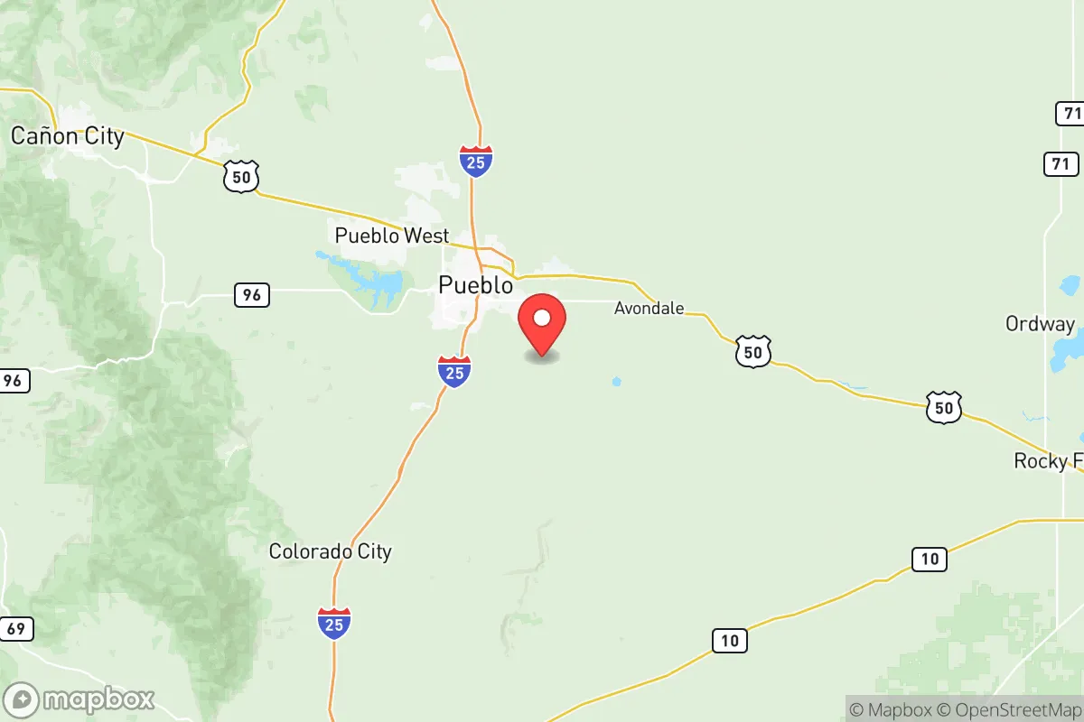
Pueblo County, Colorado, occupies a distinctive strategic position in the southern Front Range, offering a blend of geographic isolation from major metropolitan fallout zones and practical access to critical infrastructure. Located roughly 40 miles south of Colorado Springs and 110 miles south of Denver, the county’s seat and primary population center, Pueblo, sits at the confluence of the Arkansas River and Fountain Creek. This positioning provides a meaningful buffer from the concentrated risks of larger urban centers while still allowing for supply and transit connections. For a relocator prioritizing disaster readiness and self-sufficiency, Pueblo County presents a mixed but generally favorable assessment: its semi-arid climate, agricultural base, and distance from primary target zones are assets, but its proximity to certain industrial and military landmarks requires careful consideration.
Geographic position and natural advantages for resilience
Pueblo County’s geography is defined by its location at the edge of the High Plains and the foothills of the Wet Mountains, with elevations ranging from roughly 4,600 feet in the city to over 12,000 feet in the county’s western reaches. This topography offers natural defensibility: the county is not a primary corridor for intercontinental ballistic missile trajectories, nor is it situated near major fault lines like those in California. The Arkansas River, which runs through the heart of Pueblo, provides a reliable surface water source, a critical asset for long-term self-sufficiency. The county’s agricultural land, particularly in the Lower Arkansas Valley, supports local food production, including crops like hay, corn, and melons, as well as cattle ranching. The nearby Pueblo Reservoir and Lake Pueblo State Park offer additional water storage and recreational utility. Compared to the Denver metro area, Pueblo County experiences fewer extreme weather events; tornadoes are less frequent than in the eastern plains, and the risk of catastrophic wildfire is moderate, concentrated in the western foothills near Beulah and Rye. The county’s elevation also reduces the risk of flooding from the Arkansas River, though localized flash flooding can occur.
Risks, exposures, and proximity to fallout-relevant landmarks
The most significant strategic risk for Pueblo County is its proximity to several high-value military and industrial targets. Schriever Space Force Base and Peterson Space Force Base, both located near Colorado Springs, are critical nodes for U.S. space operations and missile warning systems. In a conflict scenario involving strategic strikes, these bases are high-priority targets, and Pueblo County lies within the potential fallout plume zone depending on wind patterns. Additionally, the U.S. Army’s Fort Carson, a major mechanized infantry base, is located just north of Pueblo County, further elevating the region’s target profile. On the industrial side, the Comanche Generating Station, a coal-fired power plant in Pueblo, and the Evraz Rocky Mountain Steel mill (now operated by EVRAZ North America) are significant infrastructure assets that could be secondary targets or points of failure during a grid-down scenario. The county’s position along the I-25 corridor, while convenient for travel, also makes it a potential chokepoint for evacuation or supply routes during a crisis. Natural risks include periodic drought, which can stress water supplies, and the potential for severe hailstorms that can damage crops and infrastructure. The county’s location in a semi-arid zone means that long-term water availability is a concern, particularly if the Arkansas River Compact with Kansas is challenged by prolonged drought.
Practical resilience for a relocator: food, water, energy, and defensibility
For a relocator focused on self-sufficiency, Pueblo County offers several practical advantages. Water access is the strongest asset: the Arkansas River provides a perennial surface water source, and groundwater from the alluvial aquifer is accessible in many areas. However, water rights are complex and senior appropriations are held by agricultural users, so any property purchase should include a thorough water rights assessment. Food production is viable, with a growing season of roughly 150 days and fertile soils in the river valley. The county’s agricultural extension service and local farmers’ markets, such as the Pueblo Farmers’ Market, indicate a supportive local food culture. For energy, the county is served by Black Hills Energy for electricity and natural gas, but grid reliability is a concern during winter storms and summer heat waves. Solar potential is excellent, with over 300 sunny days per year, making off-grid solar with battery storage a realistic option. Wood heating is feasible in the foothills but less so on the plains. Defensibility varies by location: rural properties in the western part of the county, near Wetmore or Colorado City, offer greater seclusion and natural barriers, while suburban areas like Pueblo West are more exposed but benefit from community infrastructure. The county’s population of roughly 170,000 is spread across a large area, meaning that rural relocators can achieve significant physical separation from population centers. However, the presence of the Pueblo Chemical Depot, which stores chemical weapons awaiting destruction, is a unique and serious risk that should be factored into any relocation decision. The depot is located east of the city and is scheduled for closure, but the timeline remains uncertain.
Overall, Pueblo County presents a nuanced strategic picture for the disaster-conscious relocator. Its geographic buffer from Denver and Colorado Springs, combined with reliable water and agricultural potential, make it a stronger candidate than many Front Range locations. However, the proximity to multiple military bases, the chemical depot, and major industrial infrastructure introduces risks that cannot be ignored. For a family or individual willing to invest in off-grid energy, secure water rights, and a rural property in the western or southern parts of the county, Pueblo County offers a viable balance of accessibility and resilience. The key is to avoid the more exposed suburban developments and to thoroughly vet any property for water and wildfire risk. In a regional context, Pueblo County ranks as a moderate-to-strong relocation option for those prioritizing preparedness, provided the specific risks are acknowledged and mitigated through careful site selection and infrastructure investment.

* Values derived from national, state, county, city and local statistics and may differ in a specific area. Last updated: 2026-07-28T18:02:54.000Z
Narrative content on this page is AI-generated and may contain mistakes. Verify any details that matter before acting on them.
ReloMaps may earn a commission from affiliate links at no extra cost to you.

