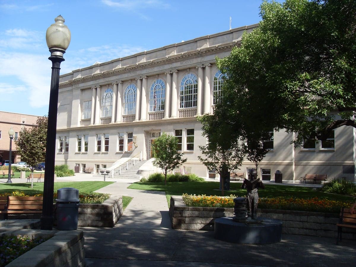
Photo: Wikipedia
Strategic Assessment of Mesa County
Strong survivability profile. Good buffer from population centers, with manageable environmental and tactical risks.
What does the Strategic Assessment tell us?
Our Strategic Assessment grades tactical survivability of an area. Major population centers, military targets, fallout zones, natural disasters, and border exposure all drive risk — lower exposure means a more defensible position in a crisis.
This is heavily inspired by Joel Skousen's Strategic Relocation book. Highly recommended you checkout the book ($)What does this tell us?
Our Strategic Assessment grades tactical survivability of an area. Major population centers, military targets, fallout zones, natural disasters, and border exposure all drive risk — lower exposure means a more defensible position in a crisis.
This is heavily inspired by Joel Skousen's Strategic Relocation book. Highly recommended you checkout the book ($)Strategic Pillars

Key Distances
Strategic Assessment Analysis
Mesa County, Colorado, anchored by the city of Grand Junction, presents a compelling case for relocation-minded individuals and families who prioritize resilience, self-sufficiency, and a buffer from the vulnerabilities of major metropolitan centers. Its position on the western slope of the Rockies, roughly 250 miles west of Denver and 200 miles east of Salt Lake City, offers a genuine geographic buffer while still providing access to essential infrastructure and services. This strategic assessment examines the area's natural advantages, its exposure to specific risks, and the practical day-to-day resilience factors that matter most to a conservative-leaning audience thinking seriously about long-term preparedness.
Geographic position and natural advantages for long-term stability
Mesa County's defining feature is its location within the Colorado Plateau, shielded by the Book Cliffs to the north and the Grand Mesa to the east. This topography provides a natural defensive posture that is rare in the continental United States. The region is not a primary target for intercontinental ballistic missile trajectories aimed at major command centers or population hubs, and it sits far from the nation's strategic nuclear triad basing—no Minuteman silos, no bomber wings, no major fleet concentrations. The nearest major military installation is Hill Air Force Base near Ogden, Utah, roughly 250 miles to the northwest, well outside any immediate blast or fallout zone. The area's elevation, averaging 4,600 feet in Grand Junction, offers a climate that is arid and sunny—over 300 days of sunshine annually—which reduces the risk of mold, structural decay, and crop failure that plague wetter regions. The Colorado River and its tributaries, including the Gunnison River, run through the county, providing a reliable surface water source that is managed by a network of reservoirs like Blue Mesa Reservoir and Vega Reservoir. This water security is a significant advantage over much of the arid West, though it is not without its own management challenges.
Exposure to natural hazards and proximity to man-made risks
No location is without risk, and Mesa County has specific exposures that a relocator must weigh. The primary natural hazard is wildfire, particularly in the wildland-urban interface zones around communities like Fruita, Palisade, and the Redlands area south of Grand Junction. The 2020 Pine Gulch Fire, which burned over 139,000 acres north of the county, and the 2021 Grand Junction-area fires are recent reminders that dry conditions and high winds can produce fast-moving fires. Seismic risk is low to moderate; the county is not on a major fault line like the San Andreas, but the Uncompahgre Plateau and surrounding areas do experience occasional minor tremors. Flood risk is localized along the Colorado and Gunnison rivers, but the Bureau of Reclamation's dam system provides substantial mitigation. On the man-made risk side, Mesa County's most notable exposure is its proximity to the Uravan Mineral Belt, a historic uranium and vanadium mining district that runs through the western part of the county and into Utah. While no active uranium mines operate within the county today, there are legacy mill sites and tailings piles, such as the former Uravan mill site near the Utah border, that require ongoing monitoring. The county is also home to the Grand Junction Chemical Agent Disposal Facility, which destroyed the nation's last stockpile of chemical weapons in 2023; the facility is now in closure and decommissioning, posing no active risk. There are no nuclear power plants, major oil refineries, or large-scale chemical manufacturing facilities within the county, which is a net positive for those concerned about industrial accidents or targeted strikes.
Practical resilience for a relocator: food, water, energy, and defensibility
For a family or individual serious about self-sufficiency, Mesa County offers a mix of strengths and gaps. Water is the county's strongest asset: the Colorado River and its tributaries provide a reliable surface supply, and the region's irrigation infrastructure supports a robust agricultural sector. The Grand Valley, which includes Grand Junction, Fruita, and Palisade, is one of Colorado's most productive agricultural regions, known for its orchards, vineyards, and hay production. A relocator with land and water rights can realistically pursue small-scale farming or ranching. Food security is further supported by local farmers' markets, a strong network of CSAs, and the presence of large-scale agricultural operations that supply regional grocery chains. However, the county's arid climate means that dryland farming is not viable; irrigation is essential, and new water rights are extremely difficult to obtain due to prior appropriation laws. Energy is a mixed picture: the county is served by Xcel Energy and the Grand Valley Power cooperative, with a grid that draws from coal, natural gas, and a growing share of solar and wind. The nearby Cameo Generating Station, a coal-fired plant, closed in 2022, but the county still has access to reliable grid power. For off-grid capability, solar is viable given the high number of sunny days, but battery storage is necessary for nighttime and winter cloud cover. Natural gas is widely available in the Grand Valley, which is a plus for heating and backup generation. Defensibility is where Mesa County's geography shines: the surrounding mesas, canyons, and river corridors create natural chokepoints. The main access routes are I-70 running east-west and US-50 running south, both of which can be monitored or controlled if necessary. The county's population of roughly 155,000 is concentrated in the Grand Junction urban area, leaving vast stretches of open land in the Book Cliffs, Grand Mesa, and Uncompahgre Plateau that offer true isolation. The local culture leans heavily toward self-reliance, with a strong hunting, fishing, and outdoor recreation tradition, and a political climate that is broadly conservative—Mesa County voted +20 points Republican in the 2024 presidential election—which aligns with the values of many in the preparedness community.
The overall strategic picture for Mesa County is one of a well-positioned secondary hub with genuine geographic buffers and a strong local resource base. It is not a remote wilderness—Grand Junction is a regional medical and commercial center with a regional airport, two hospitals, and a community college—but it offers a level of separation from the fragility of the Front Range and the Wasatch Front. The primary risks are natural (wildfire, drought) rather than man-made (industrial accident, military target), which is a favorable trade-off for most relocators. The key to maximizing the county's advantages is securing a property with legal water rights, preferably in the Grand Valley or along the Colorado River corridor, and building a home with fire-resistant construction and defensible space. For a family or individual looking to balance access to modern amenities with a serious posture of resilience, Mesa County is one of the stronger options in the Intermountain West.

* Values derived from national, state, county, city and local statistics and may differ in a specific area. Last updated: 2026-06-29T14:17:33.000Z
Narrative content on this page is AI-generated and may contain mistakes. Verify any details that matter before acting on them.
ReloMaps may earn a commission from affiliate links at no extra cost to you.

