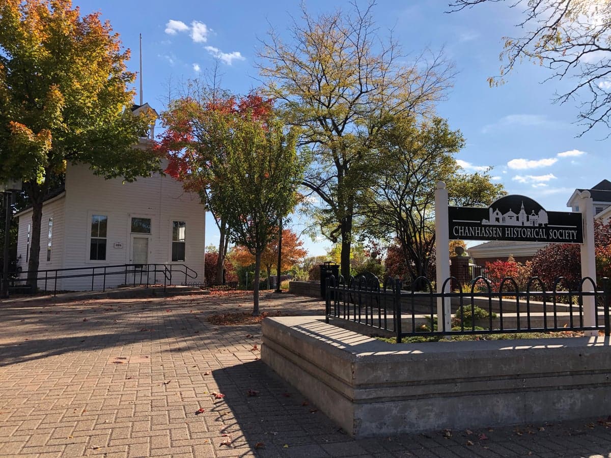
Photo: Wikipedia
Strategic Assessment of Chanhassen, MN
Meaningful friction. Expect exposure to either population pressure, blast zones, or natural disaster risk. Consider buying a retreat property.
What does the Strategic Assessment tell us?
Our Strategic Assessment grades tactical survivability of an area. Major population centers, military targets, fallout zones, natural disasters, and border exposure all drive risk — lower exposure means a more defensible position in a crisis.
This is heavily inspired by Joel Skousen's Strategic Relocation book. Highly recommended you checkout the book ($)What does this tell us?
Our Strategic Assessment grades tactical survivability of an area. Major population centers, military targets, fallout zones, natural disasters, and border exposure all drive risk — lower exposure means a more defensible position in a crisis.
This is heavily inspired by Joel Skousen's Strategic Relocation book. Highly recommended you checkout the book ($)Strategic Pillars

Key Distances
Regional Safe Places
Below is our recommended "safe zones" in Minnesota and the surrounding area based on our strategic heuristics. For most people, it's unrealistic to live in a “safe zone” full-time due to work, family or other personal reasons. They tend to be more rural. However, many of these areas are perfect for second homes and retreat properties that double as a vacation home or even a short-term rental.
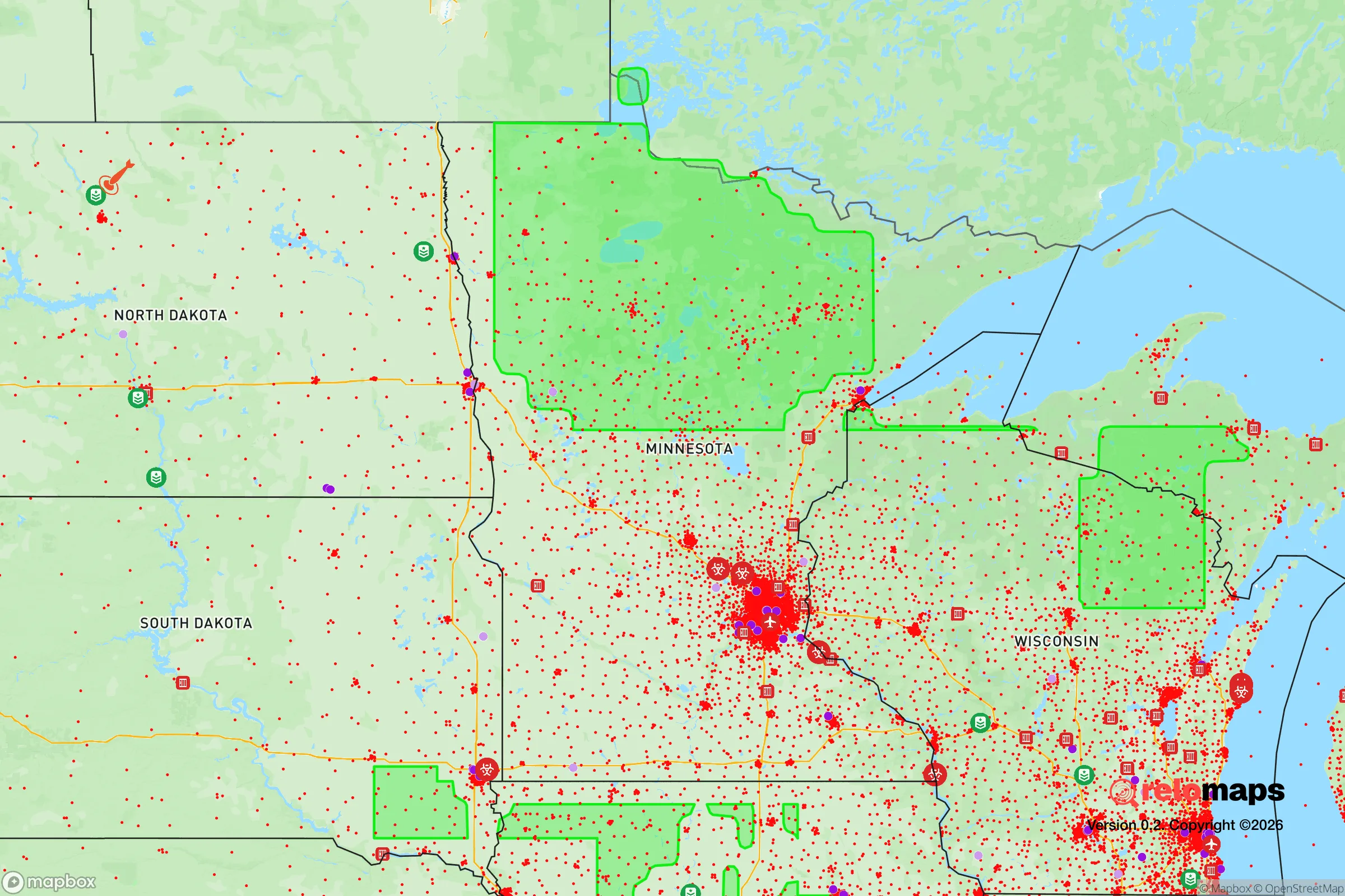
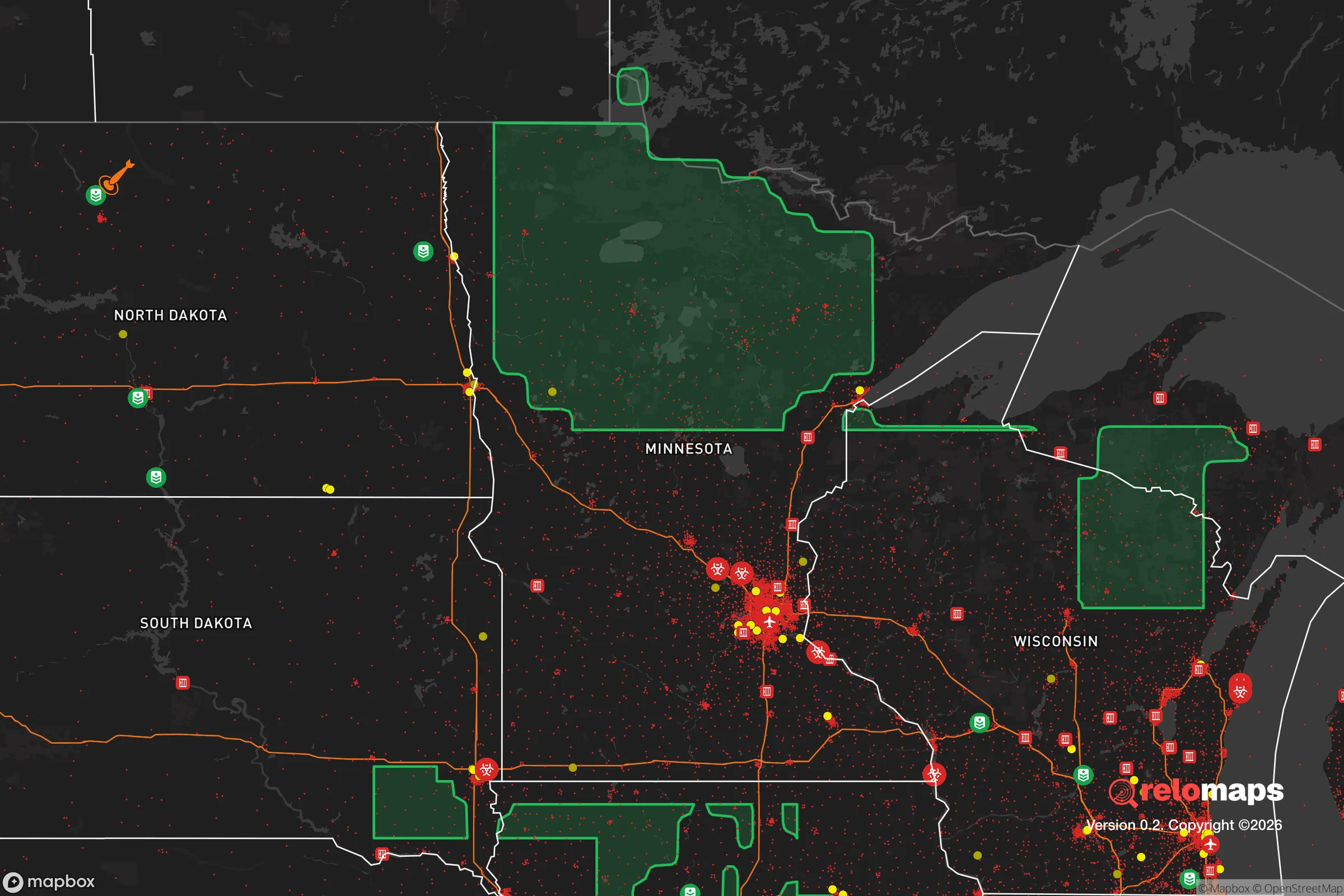


Important Note: For informational purposes only. This does not mean nothing bad ever happens in the green zones. Please use common sense. This is based on public data and modeled with AI. We tried to take a conservative approach but mistakes happen. We update this regularly as new information becomes available.
Solar Generator Recommendations
Backup power matters more here than in safer locations. We've picked three solar generators across budgets and capacity tiers — start with the budget unit if you only need a few essentials, or step up if you want to run a fridge and HVAC for days at a time.

Jackery Portable Power Station Explorer 300
Budget OptionPower on the Go: Weighing only 11 lbs, it's convenient to set up and store with book-sized foldable solar panels

BLUETTI Portable Power Station AC180
Designed for both indoor and outdoor scenarios, AC180 is highly capable as it has a robost capacity and continuous output power.

EF ECOFLOW DELTA Pro Ultra Power Station
Upgraded PickEcoFlow DELTA Pro Ultra is a whole-home energy system designed to grow with your family. Integrated with the Smart Home Panel 2, it scales to meet your evolving energy needs — keeping your home powered, intelligent, and secure through every stage of life.
We earn a commission, at no additional cost to you.
Strategic Assessment Analysis
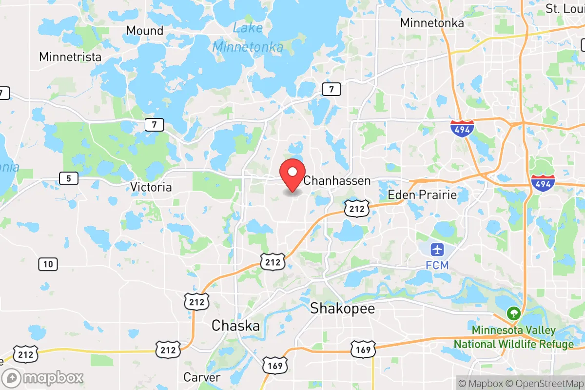
Chanhassen, Minnesota, occupies a strategic position in the western Twin Cities metro that offers a meaningful blend of proximity to urban resources and genuine geographic buffers, making it a location worth serious consideration for a relocator prioritizing resilience. The city sits on the edge of the Minnesota River Valley, with its southern and western boundaries defined by the river and its bluffs, creating a natural separation from the denser urban core. This placement provides a tangible advantage: Chanhassen is roughly 20 miles from downtown Minneapolis, close enough for employment and supply access, but far enough to avoid the immediate fallout zones and congestion that would plague a closer-in suburb during a crisis. The city’s elevation on the bluffs also offers a degree of topographic defensibility, with the river valley acting as a natural barrier to the south and west, while the surrounding agricultural land of Carver County provides a buffer of open space that most metro-adjacent suburbs lack.
Geographic position and natural advantages for self-sufficiency
Chanhassen’s geography is its strongest resilience asset. The city sits atop the Minnesota River bluffs, with elevations ranging from roughly 900 to 1,000 feet above sea level, well above the floodplain. This means the area is virtually immune to riverine flooding, a risk that plagues communities like Shakopee and Chaska directly across the valley. The bluffs themselves are steep and wooded in places, creating natural chokepoints and limited access points from the south—only a handful of bridges cross the Minnesota River in the region, and all are within a 10-mile radius. In a grid-down or evacuation scenario, this could be a double-edged sword: it limits ingress from the south but also means any threat from that direction is funneled through predictable, defensible corridors. The surrounding landscape is a mix of hardwood forests, wetlands, and farmland, with Carver County being one of the most productive agricultural counties in Minnesota. This provides a local food production base that many metro suburbs lack entirely. The city also sits near the headwaters of several small creeks that drain into the Minnesota River, offering multiple potential water sources for a prepared household, though none are large enough to be considered a primary water supply without treatment.
Risks, exposures, and proximity to fallout-relevant landmarks
The most significant risk for Chanhassen is its proximity to the Twin Cities metro, which is a major population and industrial center. In a nuclear exchange scenario, the city lies roughly 20 miles from downtown Minneapolis and 25 miles from St. Paul, placing it within the moderate fallout zone for a ground burst on either city. Prevailing winds in the region are from the northwest, meaning fallout from a strike on Minneapolis would likely drift southeast, away from Chanhassen, but a strike on St. Paul or the Minneapolis-St. Paul International Airport (MSP) could shift the risk. The city is also within 10 miles of the Xcel Energy Black Dog Generating Plant in Burnsville, a natural gas and coal facility that could be a secondary target. Additionally, Chanhassen is home to the MSP Airport’s secondary radar facility and a major communications tower farm on the bluffs, which could draw attention in a conflict. On the natural disaster front, the area is low-risk for earthquakes, hurricanes, and wildfires, but severe thunderstorms and tornadoes are a seasonal reality. The Minnesota River Valley can funnel storm systems, and the city has experienced multiple tornado warnings in recent years. The bluffs also create a microclimate that can produce localized flooding from heavy rain, though the city’s stormwater infrastructure is modern and well-maintained.
Practical resilience for a relocator: food, water, energy, and defensibility
For a relocator serious about self-sufficiency, Chanhassen offers a mix of advantages and trade-offs. Food security is a strong point: the city is surrounded by working farms, and the nearby town of Chaska has a year-round farmers’ market and several u-pick operations. The Minnesota River Valley is also a prime area for hunting (deer, turkey, waterfowl) and fishing (walleye, bass, catfish), though access to public land is limited and requires a license. For water, the city draws from the Prairie du Chien-Jordan aquifer, a deep, high-quality groundwater source that is unlikely to be contaminated by surface fallout. A private well is feasible on larger lots in the rural parts of the city, but most residential areas are on municipal water, which would be vulnerable to power loss. Energy resilience is a mixed bag: the grid is reliable but tied to the metro system, and the city has no major backup generation for residential areas. Solar is viable, with the region averaging 200 sunny days per year, but the long, dark winters mean battery storage is essential. Natural gas is the primary heating fuel, and the pipeline infrastructure is robust but could be disrupted in a prolonged outage. Defensibility is moderate: the bluffs and river provide a natural barrier to the south, but the city is otherwise open to the north and east, with multiple arterial roads (Highways 5, 41, and 101) providing easy access. The city’s layout is suburban, with cul-de-sacs and winding roads that create natural chokepoints, but also many entry points. The local population is roughly 26,000, which is small enough to avoid the chaos of a major city but large enough to have a police force and emergency services. The community is generally affluent and educated, which can be a double-edged sword: neighbors are likely to be resourceful, but also may be competitors for limited supplies in a crisis.
Overall, Chanhassen presents a strategic picture that is cautiously favorable for a relocator with a resilience mindset. Its geographic position on the bluffs, away from the immediate floodplain and with a buffer of farmland, provides a meaningful advantage over most metro-adjacent suburbs. The primary risks—proximity to the Twin Cities and the associated fallout danger—are real but manageable for someone who is prepared, with a well-stocked shelter and a plan for evacuation if necessary. The area’s natural resources (water, game, farmland) are above average for a suburban location, and the community’s character is one of quiet self-reliance rather than urban dependency. For a single individual or family willing to invest in a well, solar panels, and a root cellar, Chanhassen offers a solid foundation for long-term resilience without the isolation of a remote rural property. It is not a fortress, but it is a defensible, resource-rich position that balances access to the metro with genuine geographic buffers—a rare combination in the Twin Cities region.

* Values derived from national, state, county, city and local statistics and may differ in a specific area. Last updated: 2026-07-25T13:31:54.000Z
Narrative content on this page is AI-generated and may contain mistakes. Verify any details that matter before acting on them.
ReloMaps may earn a commission from affiliate links at no extra cost to you.

