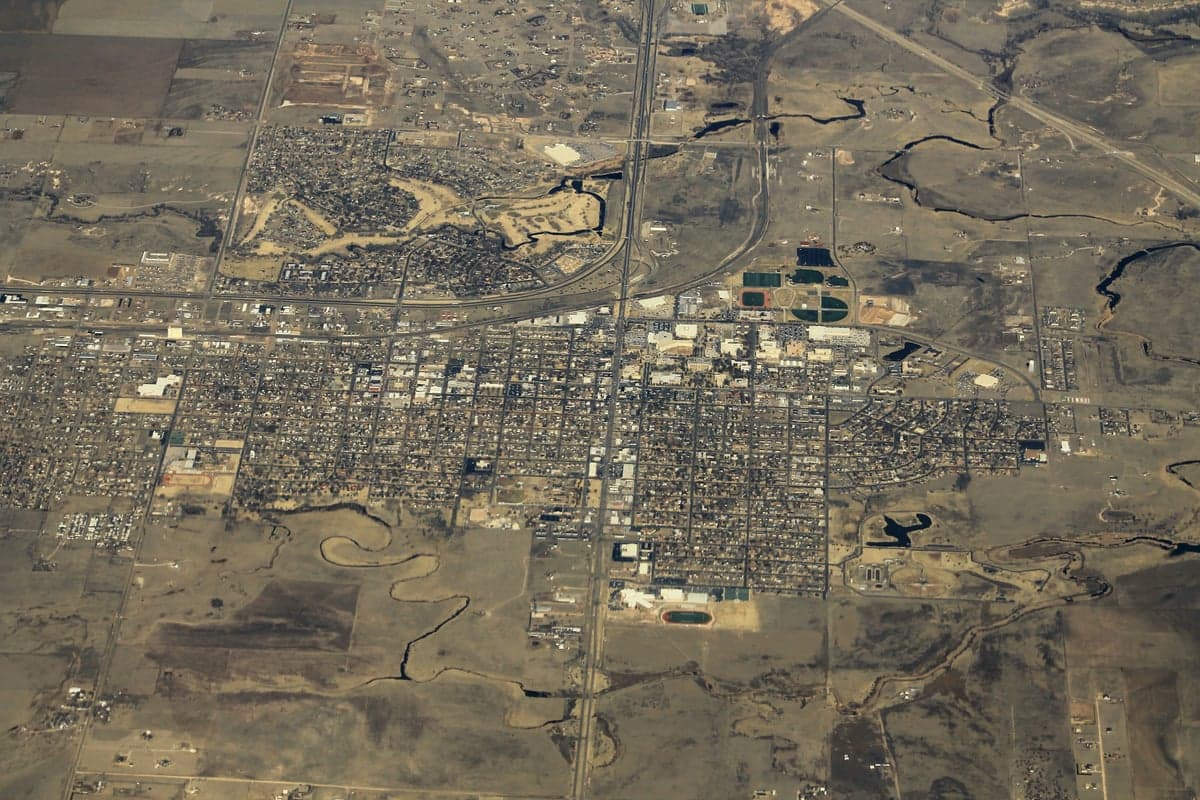
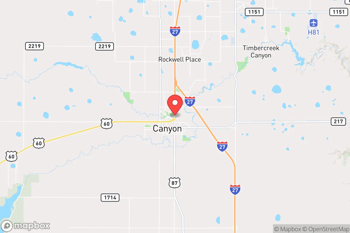
Photo: Wikipedia
Strategic Assessment of Canyon, TX
Workable tactical position. Some exposure to population density or targets, but generally defensible in a crisis.
What does the Strategic Assessment tell us?
Our Strategic Assessment grades tactical survivability of an area. Major population centers, military targets, fallout zones, natural disasters, and border exposure all drive risk — lower exposure means a more defensible position in a crisis.
This is heavily inspired by Joel Skousen's Strategic Relocation book. Highly recommended you checkout the book ($)What does this tell us?
Our Strategic Assessment grades tactical survivability of an area. Major population centers, military targets, fallout zones, natural disasters, and border exposure all drive risk — lower exposure means a more defensible position in a crisis.
This is heavily inspired by Joel Skousen's Strategic Relocation book. Highly recommended you checkout the book ($)Strategic Pillars

Key Distances
Regional Safe Places
Below is our recommended "safe zones" in Texas and the surrounding area based on our strategic heuristics. For most people, it's unrealistic to live in a “safe zone” full-time due to work, family or other personal reasons. They tend to be more rural. However, many of these areas are perfect for second homes and retreat properties that double as a vacation home or even a short-term rental.

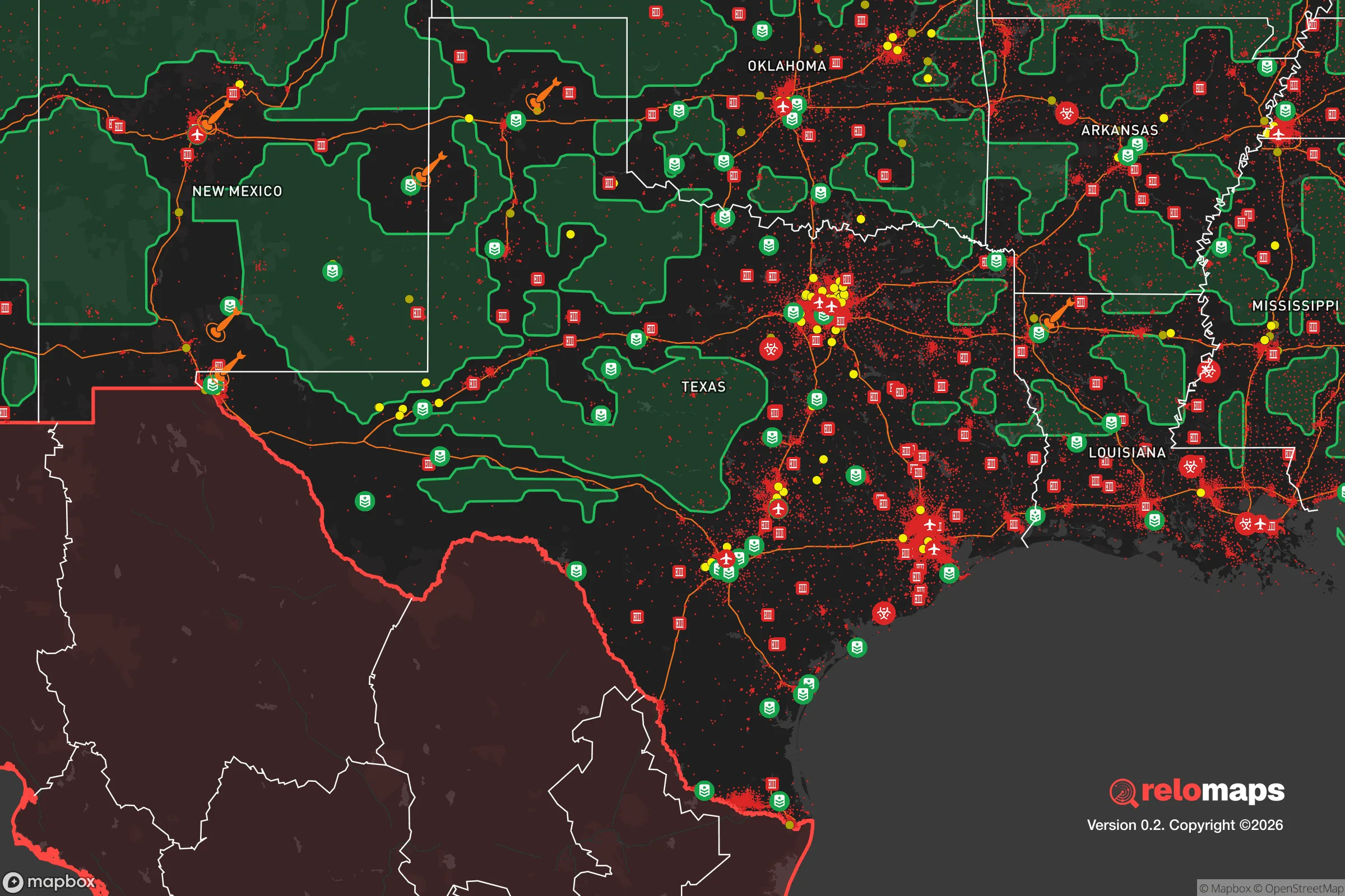


Important Note: For informational purposes only. This does not mean nothing bad ever happens in the green zones. Please use common sense. This is based on public data and modeled with AI. We tried to take a conservative approach but mistakes happen. We update this regularly as new information becomes available.
Solar Generator Recommendations
Backup power matters more here than in safer locations. We've picked three solar generators across budgets and capacity tiers — start with the budget unit if you only need a few essentials, or step up if you want to run a fridge and HVAC for days at a time.

Jackery Portable Power Station Explorer 300
Budget OptionPower on the Go: Weighing only 11 lbs, it's convenient to set up and store with book-sized foldable solar panels

BLUETTI Portable Power Station AC180
Designed for both indoor and outdoor scenarios, AC180 is highly capable as it has a robost capacity and continuous output power.

EF ECOFLOW DELTA Pro Ultra Power Station
Upgraded PickEcoFlow DELTA Pro Ultra is a whole-home energy system designed to grow with your family. Integrated with the Smart Home Panel 2, it scales to meet your evolving energy needs — keeping your home powered, intelligent, and secure through every stage of life.
We earn a commission, at no additional cost to you.
Strategic Assessment Analysis
Canyon, Texas, presents a compelling case for the relocation-minded reader focused on resilience and self-sufficiency, offering a blend of geographic isolation, stable governance, and access to critical resources that is increasingly rare in the modern American landscape. Situated in the heart of the Texas Panhandle, this community of roughly 15,000 residents benefits from a position that is far removed from the dense population corridors and strategic targets that define higher-risk zones, while still maintaining practical connectivity to essential supply chains and regional medical infrastructure. For the individual or family weighing long-term preparedness against the realities of daily life, Canyon represents a calculated bet on low-density living in a region with a strong agricultural backbone and a political culture that generally favors individual preparedness over reliance on federal systems.
Geographic position and natural advantages for long-term stability
Canyon's location on the southern edge of the Llano Estacado provides a set of natural defensive characteristics that are difficult to replicate in other parts of the country. The Caprock Escarpment, which rises dramatically just east of town, creates a natural barrier that historically limited large-scale military movements and continues to offer a degree of physical separation from the flatter, more exposed terrain to the east. The surrounding landscape is open, high-plains country with excellent visibility for miles in most directions, which is a genuine advantage for situational awareness and security planning. The region sits at an elevation of approximately 3,500 feet, placing it above the flood-prone river valleys that plague much of Texas and providing a climate that is cooler and drier than the rest of the state. This elevation also reduces the risk of the extreme heat events that are becoming more common in southern latitudes, making the area more sustainable for long-term habitation without heavy reliance on mechanical cooling. The Ogallala Aquifer, one of the largest freshwater aquifers in the world, lies beneath this region, and while its depletion rates are a legitimate concern for large-scale agriculture, it still provides a deep and accessible water source for those who plan ahead with proper well infrastructure. The combination of high ground, low population density, and a climate that supports dryland farming makes Canyon one of the more naturally defensible and resource-secure locations in the southern Great Plains.
Risk exposure, proximity to fallout-relevant landmarks, and man-made threats
When assessing risks from a strategic perspective, Canyon's primary vulnerabilities stem not from natural disasters but from its proximity to infrastructure that could become a liability in a major conflict or systemic collapse. The most significant concern is the Pantex Plant, located roughly 20 miles east of Canyon near Amarillo, which serves as the nation's primary nuclear weapons assembly and disassembly facility. While Pantex has operated for decades without a major incident, its existence makes the immediate region a potential target in any large-scale geopolitical conflict involving the United States. The prevailing winds in the Texas Panhandle blow from the south and southwest, meaning that a release from Pantex would likely carry contamination toward the Oklahoma border rather than directly over Canyon, but the psychological and strategic weight of living within the blast-radius-adjacent zone of a nuclear facility is a legitimate factor for the serious preparedness-minded reader. Beyond Pantex, the area is far removed from the major strategic targets that define higher-risk zones: there are no major military bases, no major ports, no major population centers over 250,000 within 100 miles, and no critical infrastructure like large-scale refineries or intercontinental ballistic missile silos in the immediate vicinity. Natural disaster risks are relatively low compared to other parts of Texas: tornadoes do occur, but the Panhandle sits west of the most active tornado alley zones, and the region's flat terrain actually reduces the likelihood of the violent, long-track tornadoes seen further east. Wildfire risk is moderate, particularly in drought years, but the open landscape and strong local volunteer fire departments provide a reasonable defense. The area's primary natural threat is severe winter weather, which can knock out power for days at a time, but this is a manageable risk for those who prepare with backup heating and food storage.
Practical resilience for a relocator: food, water, energy, and defensibility
For the relocator who takes self-sufficiency seriously, Canyon offers a practical foundation that is difficult to match in more populated or coastal regions. The Texas Panhandle is one of the most productive agricultural regions in the world, with an enormous concentration of cattle feedlots, grain elevators, and row-crop farming within a 50-mile radius. This means that in a scenario where supply chains falter, the local food system is not dependent on distant warehouses but on actual production happening in the fields and feedlots surrounding the town. Water access is the single most important factor for long-term resilience, and while municipal water in Canyon comes from Lake Meredith and the Ogallala Aquifer, the serious prepper should plan for a private well on any property purchased outside city limits. The Ogallala is a finite resource, but for a single household with responsible usage, a properly drilled well at 200-400 feet can provide decades of water independent of municipal systems. Energy resilience is also achievable here: the region has excellent solar exposure with over 260 sunny days per year, and wind speeds on the Caprock are consistently strong enough to make small-scale wind turbines a viable supplement. Natural gas is abundant in the region, and many rural properties already have access to propane or natural gas lines, which can power generators, heating, and cooking without reliance on the electrical grid. Defensibility is a mixed picture: the open terrain provides excellent visibility but limited natural cover, meaning that a rural property with a good perimeter, reinforced entry points, and a clear line of sight to approaching vehicles is essential. The local culture is heavily oriented toward hunting, firearms ownership, and self-reliance, which means that a newcomer who is competent and respectful will find a community that understands preparedness rather than one that views it as eccentric. The Randall County Sheriff's Office and Canyon Police Department are professional and well-funded relative to the population, and response times in the county are generally good for a rural area, though the serious planner should never rely on law enforcement for personal security.
The overall strategic picture for Canyon, Texas, is one of moderate risk with strong compensating advantages for the disciplined relocator. The proximity to Pantex is a genuine concern that cannot be dismissed, but for those who are not planning to live directly in the shadow of a nuclear facility, the practical reality is that the odds of a catastrophic event there are low, and the day-to-day benefits of living in a low-density, agriculturally rich, politically stable region far outweigh the theoretical risks for most families. The area offers a rare combination of affordable land, accessible water, abundant local food production, and a cultural environment that supports rather than discourages preparedness. For the reader who is serious about building a resilient life outside the major population corridors, Canyon deserves a hard look as a base of operations that balances isolation with access, risk with reward, and self-sufficiency with community.

* Values derived from national, state, county, city and local statistics and may differ in a specific area. Last updated: 2026-10-23T20:59:54.000Z
Narrative content on this page is AI-generated and may contain mistakes. Verify any details that matter before acting on them.
ReloMaps may earn a commission from affiliate links at no extra cost to you.

