Photo: Wikipedia
Strategic Assessment of Sacramento County
Multiple tactical vulnerabilities. Population density, target proximity, or disaster risk are likely compounding. A retreat property and exit planning is required.
What does the Strategic Assessment tell us?
Our Strategic Assessment grades tactical survivability of an area. Major population centers, military targets, fallout zones, natural disasters, and border exposure all drive risk — lower exposure means a more defensible position in a crisis.
This is heavily inspired by Joel Skousen's Strategic Relocation book. Highly recommended you checkout the book ($)What does this tell us?
Our Strategic Assessment grades tactical survivability of an area. Major population centers, military targets, fallout zones, natural disasters, and border exposure all drive risk — lower exposure means a more defensible position in a crisis.
This is heavily inspired by Joel Skousen's Strategic Relocation book. Highly recommended you checkout the book ($)Strategic Pillars

Key Distances
Strategic Assessment Analysis
Sacramento County offers a surprisingly balanced strategic position for relocators prioritizing resilience, combining the logistical advantages of California’s state capital with a geography that buffers it from the state’s most acute disaster risks. While no location in California is immune to disruption, the county’s inland location, access to major water infrastructure, and proximity to multiple military installations provide a foundation for self-sufficiency that coastal metros cannot match. For a conservative-leaning individual or family weighing disaster readiness, Sacramento County presents a credible option—provided its specific vulnerabilities are understood and mitigated.
Geographic position and natural advantages for long-term stability
Sacramento County sits at the confluence of the Sacramento and American Rivers, roughly 80 miles inland from San Francisco Bay. This inland position removes it from the direct tsunami and storm surge threats that plague coastal communities, while its elevation—averaging just 25 feet above sea level in the city center—keeps it out of the highest wildfire risk zones that dominate the Sierra Nevada foothills. The county is surrounded by a ring of agricultural land, including the rich soils of the Sacramento Valley, which provides a local food production buffer unmatched by most urban counties. The presence of Travis Air Force Base in neighboring Solano County and Beale Air Force Base in Yuba County means rapid federal response assets are within 30–45 minutes, a concrete advantage for emergency logistics. The county also sits near the Port of Sacramento in West Sacramento, a deep-water shipping channel connecting to the San Francisco Bay, offering an alternative supply route if overland highways are compromised.
Risks, exposures, and proximity to fallout-relevant landmarks
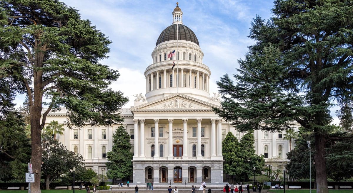
The most significant risk for Sacramento County is its location within the Sacramento-San Joaquin Delta floodplain. Approximately 80% of the county’s population lives in areas protected by levees that the U.S. Army Corps of Engineers rates as only "moderately" reliable. A catastrophic levee failure during a major earthquake or sustained atmospheric river event could inundate large portions of the city, including downtown Sacramento and the Sacramento International Airport. The county also sits within 100 miles of the Diablo Canyon Power Plant (San Luis Obispo County) and the Rancho Seco Nuclear Generating Station (a decommissioned site in Herald, within the county itself), though the latter poses minimal current risk. More relevant for a resilience-minded relocator is the county’s proximity to Mather Air Force Base (now Mather Airport) and McClellan Air Force Base (now a business park), both former Strategic Air Command installations that remain potential targets in a major conflict scenario. The county also hosts the California State Capitol complex, which could become a focal point for civil unrest or targeted disruption. On the positive side, Sacramento County is far from the state’s major oil refineries (concentrated in the Bay Area and Los Angeles Basin) and has no active nuclear power plants within its borders.
Practical resilience for a relocator: food, water, energy, and defensibility
Sacramento County’s practical resilience strengths are rooted in its agricultural and water infrastructure. The county sits atop the American River Groundwater Basin, one of California’s most productive aquifers, providing a reliable backup water source even during drought years. The Folsom Dam and reservoir, located in the county’s eastern foothills, supplies both drinking water and hydroelectric power to the region. For food security, the county is surrounded by some of the most productive farmland in the world: the Sacramento Valley produces rice, tomatoes, almonds, and walnuts, while the Delta region to the west yields pears, corn, and asparagus. Farmers’ markets operate year-round in communities like Fair Oaks, Elk Grove, and Citrus Heights, and the county’s agricultural extension service offers resources for home gardening and small-scale livestock. Energy resilience is moderate: the Sacramento Municipal Utility District (SMUD) has invested heavily in local solar and battery storage, but the grid remains connected to the statewide system and is vulnerable to Public Safety Power Shutoffs during high-fire-risk weather. For defensibility, the county’s suburban and exurban areas—particularly Granite Bay, Loomis, and Wilton—offer larger lots, lower population density, and natural chokepoints via the American River and Highway 50 corridor. However, the county’s flat terrain and extensive canal system make it difficult to secure large areas against a determined threat. The Sacramento County Sheriff’s Office maintains a well-regarded search and rescue team, and the region has a strong network of amateur radio operators and community emergency response teams (CERT).
Overall, Sacramento County offers a credible strategic option for the resilience-minded relocator who values inland security, water abundance, and agricultural self-sufficiency over coastal amenities. Its primary weaknesses—levee vulnerability and proximity to symbolic government targets—are manageable with proper site selection and preparation. For a family willing to invest in backup power, flood insurance, and a well-stocked pantry, the county provides a defensible base of operations within a state that otherwise presents significant challenges for long-term stability. The key is to choose a location east of Interstate 5, away from the Delta floodplain, and to build relationships with the local farming and ranching community that forms the backbone of the region’s true resilience.

* Values derived from national, state, county, city and local statistics and may differ in a specific area. Last updated: 2026-06-24T23:08:21.000Z
Narrative content on this page is AI-generated and may contain mistakes. Verify any details that matter before acting on them.
ReloMaps may earn a commission from affiliate links at no extra cost to you.

