Photo: Wikipedia
Strategic Assessment of Butte County
Workable tactical position. Some exposure to population density or targets, but generally defensible in a crisis.
What does the Strategic Assessment tell us?
Our Strategic Assessment grades tactical survivability of an area. Major population centers, military targets, fallout zones, natural disasters, and border exposure all drive risk — lower exposure means a more defensible position in a crisis.
This is heavily inspired by Joel Skousen's Strategic Relocation book. Highly recommended you checkout the book ($)What does this tell us?
Our Strategic Assessment grades tactical survivability of an area. Major population centers, military targets, fallout zones, natural disasters, and border exposure all drive risk — lower exposure means a more defensible position in a crisis.
This is heavily inspired by Joel Skousen's Strategic Relocation book. Highly recommended you checkout the book ($)Strategic Pillars

Key Distances
Strategic Assessment Analysis
Butte County, California, presents a mixed strategic picture for the relocation-minded reader focused on resilience and self-sufficiency. Its primary advantage is a degree of geographic insulation from the most acute fallout risks of the coastal megacities, while its location in the Sacramento Valley offers a solid agricultural and water resource base. However, the county’s own history of catastrophic wildfire and its position relative to major state infrastructure—including the Sacramento-San Joaquin Delta and the state’s primary north-south transportation corridor—demand a clear-eyed assessment. For a family or individual weighing long-term security, Butte County offers genuine advantages in water and food access, but it is not a low-risk zone; it is a trade-off zone where natural hazards replace man-made ones.
Geographic position and natural advantages for long-term security
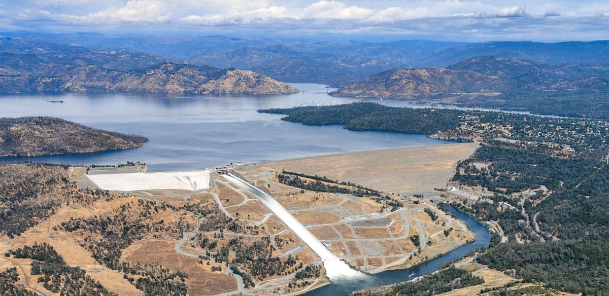
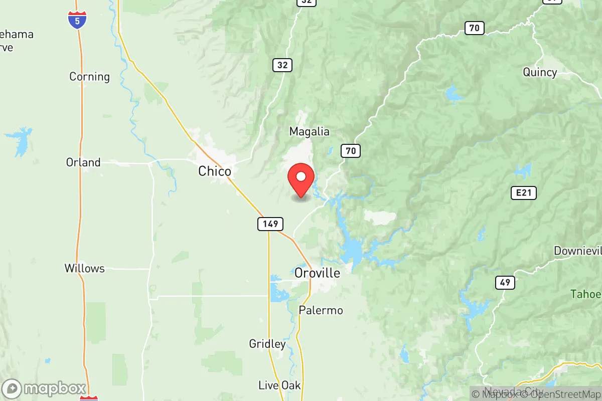
Butte County sits at the northern edge of California’s Central Valley, where the Sierra Nevada foothills meet the fertile Sacramento Valley floor. The county seat, Oroville, anchors the region, while Chico serves as the largest population center and economic hub. This location provides a meaningful buffer: the county is roughly 100 miles north of Sacramento and over 150 miles from the San Francisco Bay Area, placing it well outside the immediate blast and fallout zones of those major metropolitan targets. The Sierra Nevada range to the east acts as a natural barrier, and the county’s position along the Feather River watershed gives it access to some of California’s most reliable surface water. The Oroville Dam, while controversial, is a massive water storage asset—Lake Oroville holds over 3.5 million acre-feet when full, providing a strategic water reserve that few inland California counties can match. The agricultural base is real: rice, almonds, walnuts, and olives are grown extensively, and the valley floor offers deep, fertile soils. For a relocator thinking about food security, this is not theoretical farmland—it is actively productive land within a short drive of most county residences.
Risks, exposures, and proximity to fallout-relevant landmarks
The most significant risk in Butte County is not nuclear fallout from a distant city—it is the near-certainty of recurring catastrophic wildfire. The 2018 Camp Fire, which destroyed the town of Paradise and killed 85 people, was the deadliest and most destructive wildfire in California history. That event was not an anomaly; the county’s wildland-urban interface (WUI) zones are extensive, and fire risk is severe across the foothill communities of Paradise, Magalia, Concow, and Berry Creek. For a resilience-minded relocator, this is the single most important vulnerability: a home in the foothills may be defensible in theory, but the historical record shows that entire communities can be overwhelmed in hours. On the man-made risk side, Butte County is not near any major military bases, nuclear power plants, or large-scale industrial targets. The nearest significant military installation is Beale Air Force Base in Yuba County, about 40 miles south of Chico—close enough to be a secondary concern if targeted, but not a primary fallout source. The county’s distance from the Sacramento-San Joaquin Delta (roughly 80 miles south) is a positive: that delta is a critical infrastructure node whose disruption would cripple water delivery to Southern California, but Butte County draws its water from the Feather River system above the delta, giving it a degree of hydraulic independence. The main transportation vulnerability is Interstate 5, which runs west of the county through the Sacramento Valley; it is a likely chokepoint in any major disruption, but Butte County has alternative routes via State Routes 99, 70, and 162.
Practical resilience for a relocator: food, water, energy, and defensibility
For a family or individual serious about self-sufficiency, Butte County offers several structural advantages. Water is the strongest asset: the Feather River and its tributaries provide surface water that is relatively abundant by California standards, and groundwater in the valley floor is generally accessible and of good quality. The Thermalito Afterbay and Forebay, south of Oroville, are managed water bodies that could serve as emergency sources. Food production is viable at the household scale: the growing season is long (roughly March through November), and the valley soil is productive. Local farmers’ markets in Chico and Oroville are well-established, and the county has a strong network of small-scale farms and homesteading operations. Energy resilience is more mixed. Pacific Gas & Electric (PG&E) is the dominant utility, and its infrastructure has been a direct cause of wildfires (the Camp Fire was sparked by a PG&E transmission line). Public Safety Power Shutoffs (PSPS) are routine during high-wind events, meaning grid power is unreliable for weeks at a time in fire season. Solar with battery storage is a near-necessity for anyone living outside Chico’s core. Defensibility varies dramatically by location. The valley floor communities—Chico, Oroville, Gridley, Biggs—are less fire-prone but offer less privacy and more neighbors. The foothill communities offer more land and seclusion but at extreme fire risk. A defensible property in Butte County requires a minimum of 100 feet of clearance, non-combustible roofing and siding, an independent water source (well or pond), and a hardened access road. The county’s topography is not naturally defensible in a military sense—the valley is open and the foothills are dissected by canyons—but the low population density outside the towns means that a well-chosen property can offer genuine operational security.
The overall strategic picture for Butte County is one of high potential paired with a single, dominant, recurring threat. For a relocator who can manage wildfire risk through property selection, construction standards, and emergency planning, the county offers water security, agricultural viability, and meaningful distance from California’s primary target zones. For someone unwilling to invest in serious fire hardening and evacuation planning, the county is a trap—the same geography that provides water and isolation also creates the conditions for fast-moving, landscape-scale fires. Butte County is not a bug-out location; it is a live-in location that demands active, ongoing risk management. For the disciplined and prepared, it is one of the more viable options in Northern California. For the casual or unprepared, it is a dangerous bet.

* Values derived from national, state, county, city and local statistics and may differ in a specific area. Last updated: 2026-11-08T20:45:11.000Z
Narrative content on this page is AI-generated and may contain mistakes. Verify any details that matter before acting on them.
ReloMaps may earn a commission from affiliate links at no extra cost to you.

