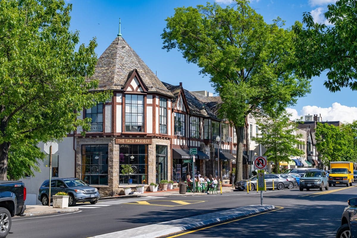
Photo: Wikipedia
Strategic Assessment of Bronxville, NY
High tactical risk. This location is likely close to major population centers, strategic targets, or sits in a high-disaster corridor. A retreat property and careful exit planning is required.
What does the Strategic Assessment tell us?
Our Strategic Assessment grades tactical survivability of an area. Major population centers, military targets, fallout zones, natural disasters, and border exposure all drive risk — lower exposure means a more defensible position in a crisis.
This is heavily inspired by Joel Skousen's Strategic Relocation book. Highly recommended you checkout the book ($)What does this tell us?
Our Strategic Assessment grades tactical survivability of an area. Major population centers, military targets, fallout zones, natural disasters, and border exposure all drive risk — lower exposure means a more defensible position in a crisis.
This is heavily inspired by Joel Skousen's Strategic Relocation book. Highly recommended you checkout the book ($)Strategic Pillars

Key Distances
Regional Safe Places
Below is our recommended "safe zones" in New York and the surrounding area based on our strategic heuristics. For most people, it's unrealistic to live in a “safe zone” full-time due to work, family or other personal reasons. They tend to be more rural. However, many of these areas are perfect for second homes and retreat properties that double as a vacation home or even a short-term rental.




Important Note: For informational purposes only. This does not mean nothing bad ever happens in the green zones. Please use common sense. This is based on public data and modeled with AI. We tried to take a conservative approach but mistakes happen. We update this regularly as new information becomes available.
Solar Generator Recommendations
Backup power matters more here than in safer locations. We've picked three solar generators across budgets and capacity tiers — start with the budget unit if you only need a few essentials, or step up if you want to run a fridge and HVAC for days at a time.

Jackery Portable Power Station Explorer 300
Budget OptionPower on the Go: Weighing only 11 lbs, it's convenient to set up and store with book-sized foldable solar panels

BLUETTI Portable Power Station AC180
Designed for both indoor and outdoor scenarios, AC180 is highly capable as it has a robost capacity and continuous output power.

EF ECOFLOW DELTA Pro Ultra Power Station
Upgraded PickEcoFlow DELTA Pro Ultra is a whole-home energy system designed to grow with your family. Integrated with the Smart Home Panel 2, it scales to meet your evolving energy needs — keeping your home powered, intelligent, and secure through every stage of life.
We earn a commission, at no additional cost to you.
Strategic Assessment Analysis
Bronxville, New York, presents a complex strategic picture for the relocation-minded individual or family prioritizing resilience and self-sufficiency. While its immediate advantages are rooted in affluence and proximity to Manhattan, a serious assessment reveals that its core strengths—dense suburban infrastructure and a high-profile location—are also its most significant liabilities in a disaster scenario. For the conservative-leaning reader who values preparedness, Bronxville offers a high standard of living under normal conditions but requires a clear-eyed understanding of its vulnerabilities, particularly its exposure to the risks inherent in being a wealthy, densely populated enclave within striking distance of New York City.
Geographic position and natural advantages in Westchester County
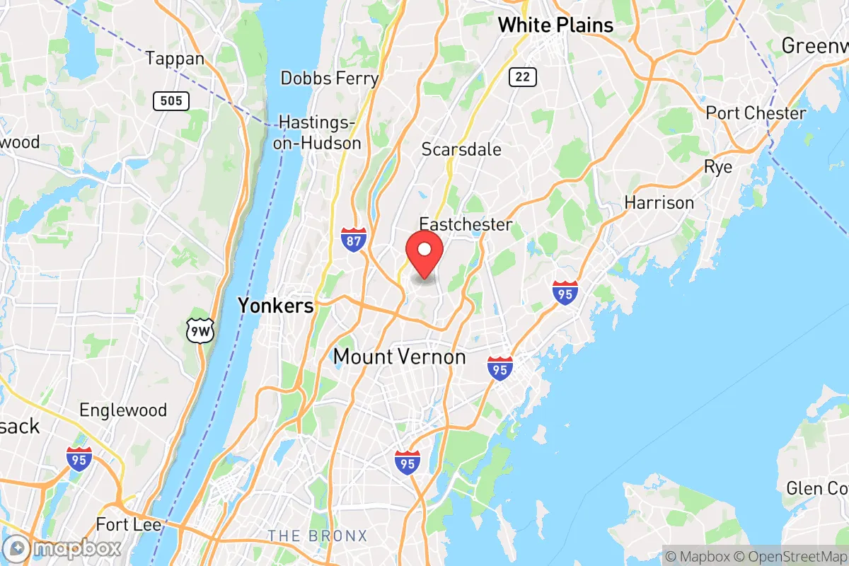
Bronxville occupies a uniquely compact and elevated position in southern Westchester County, roughly 15 miles north of Midtown Manhattan. The village sits on a series of hills and ridges that provide modest natural drainage and some vantage points over the surrounding area, though these are not significant enough to confer a defensive advantage. Its location along the Bronx River Parkway and the Metro-North Harlem Line offers exceptional connectivity, which is a double-edged sword: it makes daily life convenient but also places the village on a major evacuation and transit corridor that could become congested or targeted. The immediate natural environment is characterized by mature tree cover, manicured lawns, and the small, landscaped Bronx River Parkway reservation—pleasant for recreation but offering little in the way of true wilderness or off-grid resources. The area is not prone to major natural disasters like earthquakes, wildfires, or hurricanes in their most destructive forms, though nor'easters and occasional severe thunderstorms can cause localized power outages and tree damage. The most notable natural advantage is the village's position within the broader Hudson Valley watershed, which provides a generally reliable municipal water supply sourced from the New York City reservoir system—a system that is itself a potential single point of failure.
Risk exposure, proximity to fallout-relevant landmarks, and man-made threats
The most significant risk for a Bronxville resident is not natural but man-made, stemming directly from the village's proximity to New York City and its associated critical infrastructure. Bronxville lies approximately 15 miles from the Indian Point Energy Center (now decommissioned but still housing spent nuclear fuel), and within a broader radius that includes multiple major airports, chemical storage facilities, and the dense urban target set of Manhattan. In a scenario involving a radiological or large-scale conventional attack on New York City, Bronxville's location places it within a zone that could experience fallout, secondary effects, or mass evacuation chaos. The village is also situated near the Bronx River Parkway and the Cross County Parkway, both of which would become immediate chokepoints in any regional emergency. Furthermore, as one of the wealthiest villages in New York State, Bronxville's high-profile status could make it a target for looting or civil unrest during a prolonged breakdown of order, as its residents are perceived as having significant resources. The dense, interconnected suburban grid of southern Westchester means that a single infrastructure failure—a downed substation, a compromised water main, or a blocked road—can cascade rapidly through the community with few workarounds.
Practical resilience for a relocator: food, water, energy, and defensibility
For the relocator serious about self-sufficiency, Bronxville presents considerable challenges. The village has virtually no agricultural land or space for private food production; lots are small, and zoning is restrictive. Residents are entirely dependent on a tightly integrated supply chain of supermarkets, specialty grocers, and restaurants, all of which would be disrupted in a regional emergency. Water resilience is similarly fragile: while the municipal supply is generally excellent, there is no backup for individual households beyond what they store themselves, and the reliance on a centralized, regional system means a single contamination event or pump failure could leave the entire village without potable water. Energy infrastructure is above average for the region, with underground utilities in many parts of the village reducing storm-related outages, but the grid is still part of the larger Con Edison system and subject to the same regional vulnerabilities. Natural gas is the primary heating source for most homes, which is a vulnerability if the pipeline network is compromised. Defensibility is poor: Bronxville is a compact, walkable village with multiple entry points from surrounding roads, no natural barriers, and a dense population. While the village has its own police department, it is small and would be overwhelmed in a large-scale event. The community's social cohesion is a genuine asset—neighborhood associations and local networks are strong—but this does not substitute for physical security or resource independence. For the prepared individual, the practical takeaway is that Bronxville requires a high degree of pre-positioned supplies, a well-thought-out evacuation plan, and a realistic acceptance that long-term self-sufficiency is not feasible within the village itself.
The overall strategic picture for Bronxville is one of high convenience paired with high vulnerability. It is an excellent location for a professional or family who values top-tier schools, a walkable village center, and easy access to Manhattan during stable times. However, for the reader whose primary relocation criteria are disaster readiness, resource independence, and a lower-risk profile, Bronxville is a suboptimal choice. Its strengths are all tied to the very systems and proximities that create its risks. A more resilient posture would involve a property further north in Westchester or into Putnam or Dutchess counties, where land, water, and distance from urban targets provide genuine strategic depth. For those who choose Bronxville despite these concerns, the prudent path is to treat it as a base of convenience while maintaining a fully stocked retreat location and a practiced plan for rapid departure when the indicators turn south.

* Values derived from national, state, county, city and local statistics and may differ in a specific area. Last updated: 2026-10-12T19:38:05.000Z
Narrative content on this page is AI-generated and may contain mistakes. Verify any details that matter before acting on them.
ReloMaps may earn a commission from affiliate links at no extra cost to you.

