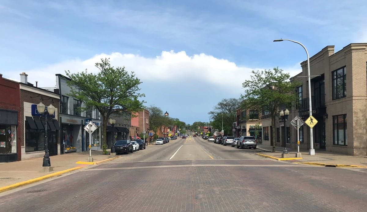
Photo: Wikipedia
Strategic Assessment of Brighton, MI
Meaningful friction. Expect exposure to either population pressure, blast zones, or natural disaster risk. Consider buying a retreat property.
What does the Strategic Assessment tell us?
Our Strategic Assessment grades tactical survivability of an area. Major population centers, military targets, fallout zones, natural disasters, and border exposure all drive risk — lower exposure means a more defensible position in a crisis.
This is heavily inspired by Joel Skousen's Strategic Relocation book. Highly recommended you checkout the book ($)What does this tell us?
Our Strategic Assessment grades tactical survivability of an area. Major population centers, military targets, fallout zones, natural disasters, and border exposure all drive risk — lower exposure means a more defensible position in a crisis.
This is heavily inspired by Joel Skousen's Strategic Relocation book. Highly recommended you checkout the book ($)Strategic Pillars

Key Distances
Regional Safe Places
Below is our recommended "safe zones" in Michigan and the surrounding area based on our strategic heuristics. For most people, it's unrealistic to live in a “safe zone” full-time due to work, family or other personal reasons. They tend to be more rural. However, many of these areas are perfect for second homes and retreat properties that double as a vacation home or even a short-term rental.


Important Note: For informational purposes only. This does not mean nothing bad ever happens in the green zones. Please use common sense. This is based on public data and modeled with AI. We tried to take a conservative approach but mistakes happen. We update this regularly as new information becomes available.
Solar Generator Recommendations
Backup power matters more here than in safer locations. We've picked three solar generators across budgets and capacity tiers — start with the budget unit if you only need a few essentials, or step up if you want to run a fridge and HVAC for days at a time.

Jackery Portable Power Station Explorer 300
Budget OptionPower on the Go: Weighing only 11 lbs, it's convenient to set up and store with book-sized foldable solar panels

BLUETTI Portable Power Station AC180
Designed for both indoor and outdoor scenarios, AC180 is highly capable as it has a robost capacity and continuous output power.

EF ECOFLOW DELTA Pro Ultra Power Station
Upgraded PickEcoFlow DELTA Pro Ultra is a whole-home energy system designed to grow with your family. Integrated with the Smart Home Panel 2, it scales to meet your evolving energy needs — keeping your home powered, intelligent, and secure through every stage of life.
We earn a commission, at no additional cost to you.
Strategic Assessment Analysis
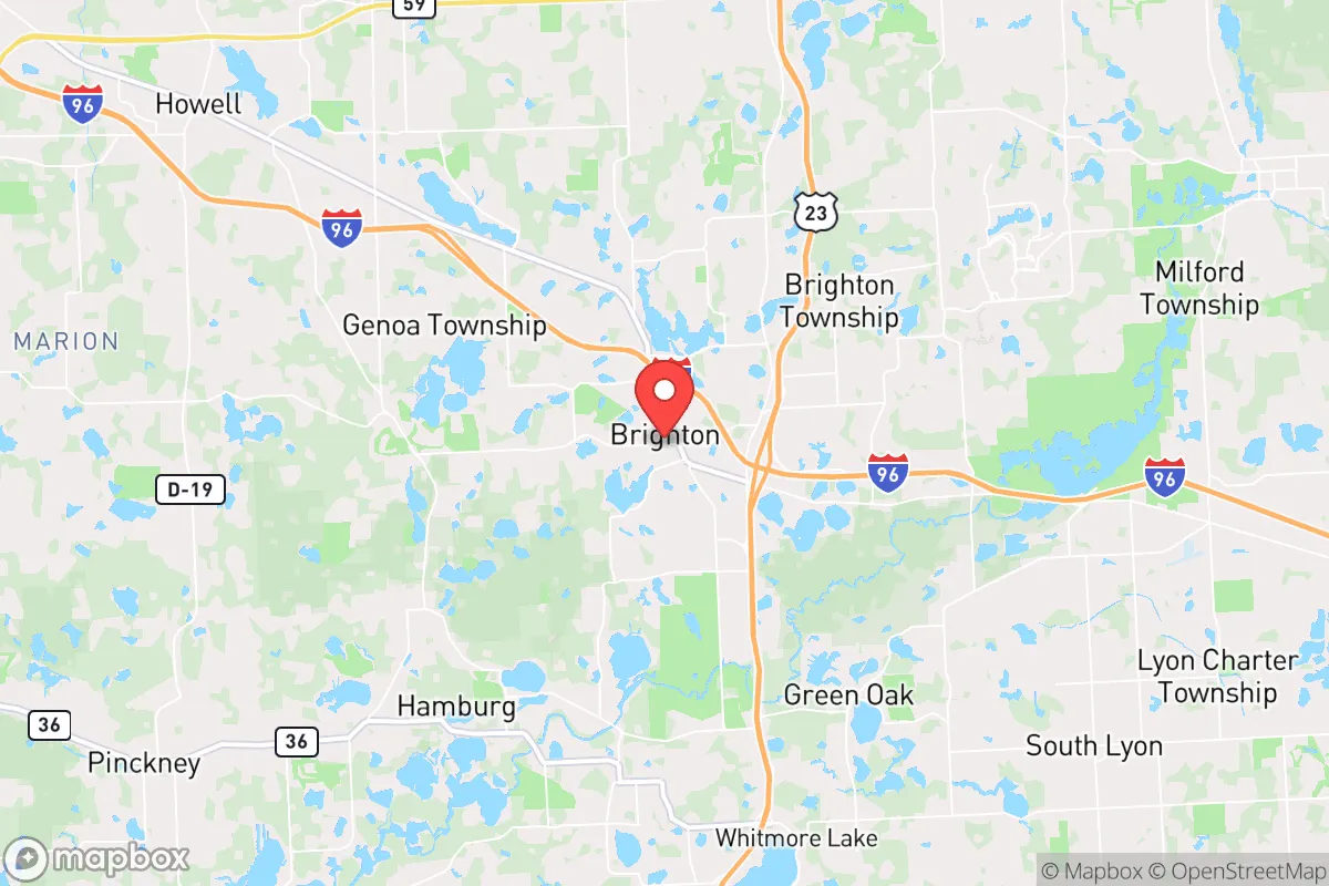
Brighton, Michigan, offers a strategic balance of rural access and suburban infrastructure that makes it a serious contender for relocation-minded individuals and families prioritizing resilience and self-sufficiency. Located in Livingston County, roughly 45 minutes northwest of Detroit and 30 minutes south of Flint, Brighton sits in a sweet spot: close enough to major medical and supply chains, yet far enough from dense urban cores to reduce exposure to cascading infrastructure failures, civil unrest, or fallout-related risks. The area’s position along the I-96 corridor and its proximity to the Great Lakes water system give it logistical and natural advantages that many inland communities lack.
Geographic position and natural advantages for long-term stability
Brighton’s geography is defined by its location within the Huron River watershed and its access to the region’s abundant freshwater resources. The Huron River runs through the area, and nearby lakes—including Brighton Lake, Bishop Lake, and the Chain of Lakes in the Huron-Clinton Metroparks—provide multiple surface water sources. This is a critical advantage in a region where groundwater depletion and contamination are growing concerns. The area sits on a glacial till plain with well-drained soils, which supports local agriculture and reduces flood risk compared to low-lying communities along the Detroit River or Lake Erie shoreline. The topography is gently rolling, offering natural drainage and defensible terrain without the isolation of mountainous regions. Brighton’s elevation (roughly 950 feet above sea level) places it above the floodplains of major rivers, and the area has no history of significant seismic activity, hurricanes, or wildfires. The climate is temperate, with cold winters and moderate summers, which supports year-round food storage and reduces the risk of heat-related infrastructure stress. For a relocator focused on long-term stability, Brighton’s position within the Great Lakes basin—the largest freshwater system in the world—is a foundational asset. The region is not dependent on distant aquifers or inter-basin water transfers, and the local water table is generally reliable, though well depths vary and should be tested before purchase.
Risks, exposures, and proximity to fallout-relevant landmarks
No location is without risk, and Brighton’s proximity to several high-value targets is the primary concern for a resilience-minded relocator. The area lies within 50 miles of the Detroit metropolitan area, which includes the Detroit Metro Airport (DTW), the Ambassador Bridge, and the Detroit-Windsor Tunnel—all potential targets for conventional or asymmetric attacks. Additionally, the I-96 corridor runs directly through Brighton, connecting it to the urban core and making it a likely evacuation route or chokepoint during a crisis. The nearby Fermi 2 nuclear power plant (about 40 miles southeast in Monroe County) and the Enrico Fermi Nuclear Generating Station are within the 50-mile emergency planning zone, meaning a radiological incident could affect air and water quality in the area. The region also hosts several chemical and industrial facilities along the Detroit River and in the Downriver area, which could release hazardous materials in a disaster. On the natural disaster front, Brighton faces moderate tornado risk—Livingston County averages 1-2 tornadoes per decade, typically EF0-EF2—and occasional severe winter storms that can disrupt power and transportation for days. The area is not prone to earthquakes, tsunamis, or volcanic activity. For a relocator, the key takeaway is that Brighton’s risks are primarily man-made and tied to its proximity to Detroit and industrial infrastructure. Mitigation strategies include maintaining a 72-hour evacuation kit, having a plan for sheltering in place during a radiological event, and avoiding properties directly adjacent to major highways or rail lines that could become targets or chokepoints.
Practical resilience for a relocator: food, water, energy, and defensibility
Brighton’s practical resilience profile is strong but requires intentional preparation. The area has a robust local food system: Livingston County is home to dozens of farms, farmers’ markets (including the Brighton Farmers Market), and community-supported agriculture (CSA) programs. The growing season runs roughly from May to October, with cold-hardy crops extending into November. For a relocator looking to supplement food supplies, the region supports small-scale vegetable gardening, fruit orchards, and even limited livestock (chickens, goats, bees) on parcels of 1-5 acres. The local soil is generally fertile, though it may require amendment depending on the specific lot. Water access is excellent: the Huron River and numerous inland lakes provide surface water, and many rural properties have private wells. However, well water should be tested for nitrates and bacteria, especially near agricultural areas. The city of Brighton’s municipal water system draws from groundwater wells and is treated, but a relocator on a well should have a backup hand pump or generator-powered pump. Energy resilience is a mixed picture. Brighton is served by DTE Energy, which has a mixed reliability record—outages are common during winter storms and summer thunderstorms, typically lasting 4-12 hours. Solar potential is moderate: the region averages about 180 sunny days per year (below the national average of 205), but a properly sized solar array with battery storage can cover most household needs, especially with net metering available through DTE. Wood heating is a viable backup, as firewood is abundant and affordable in the area. Defensibility is moderate: Brighton’s suburban layout with cul-de-sacs and wooded lots offers natural screening, but the area is not remote or easily fortified. The local law enforcement presence is solid (Livingston County Sheriff’s Office and Brighton Police Department), and the community has a low crime rate, but a relocator should consider physical security measures—fencing, lighting, and a neighborhood watch—rather than relying on isolation.
Overall, Brighton presents a compelling strategic picture for a relocator who values proximity to urban resources without being immersed in urban risk. The area’s freshwater abundance, agricultural potential, and moderate climate provide a solid foundation for long-term self-sufficiency. The primary trade-off is the proximity to Detroit and industrial infrastructure, which introduces man-made risks that require active mitigation—evacuation planning, radiological awareness, and energy redundancy. For a family or individual willing to invest in a well-tested well, a solar backup system, and a modest food garden, Brighton offers a realistic path to resilience without the extreme isolation or harsh climate of more remote locations. It is not a bug-out location for a total collapse scenario, but it is a strong base for weathering regional disruptions, economic instability, or moderate-scale disasters. The key is to treat Brighton as a hub—not a fortress—and to build relationships with local farmers, neighbors, and emergency services as part of a layered preparedness strategy.

* Values derived from national, state, county, city and local statistics and may differ in a specific area. Last updated: 2026-10-08T08:48:38.000Z
Narrative content on this page is AI-generated and may contain mistakes. Verify any details that matter before acting on them.
ReloMaps may earn a commission from affiliate links at no extra cost to you.

