Strategic Assessment of Bellemont, AZ
Workable tactical position. Some exposure to population density or targets, but generally defensible in a crisis.
What does the Strategic Assessment tell us?
Our Strategic Assessment grades tactical survivability of an area. Major population centers, military targets, fallout zones, natural disasters, and border exposure all drive risk — lower exposure means a more defensible position in a crisis.
This is heavily inspired by Joel Skousen's Strategic Relocation book. Highly recommended you checkout the book ($)What does this tell us?
Our Strategic Assessment grades tactical survivability of an area. Major population centers, military targets, fallout zones, natural disasters, and border exposure all drive risk — lower exposure means a more defensible position in a crisis.
This is heavily inspired by Joel Skousen's Strategic Relocation book. Highly recommended you checkout the book ($)Strategic Pillars

Key Distances
Regional Safe Places
Below is our recommended "safe zones" in Arizona and the surrounding area based on our strategic heuristics. For most people, it's unrealistic to live in a “safe zone” full-time due to work, family or other personal reasons. They tend to be more rural. However, many of these areas are perfect for second homes and retreat properties that double as a vacation home or even a short-term rental.
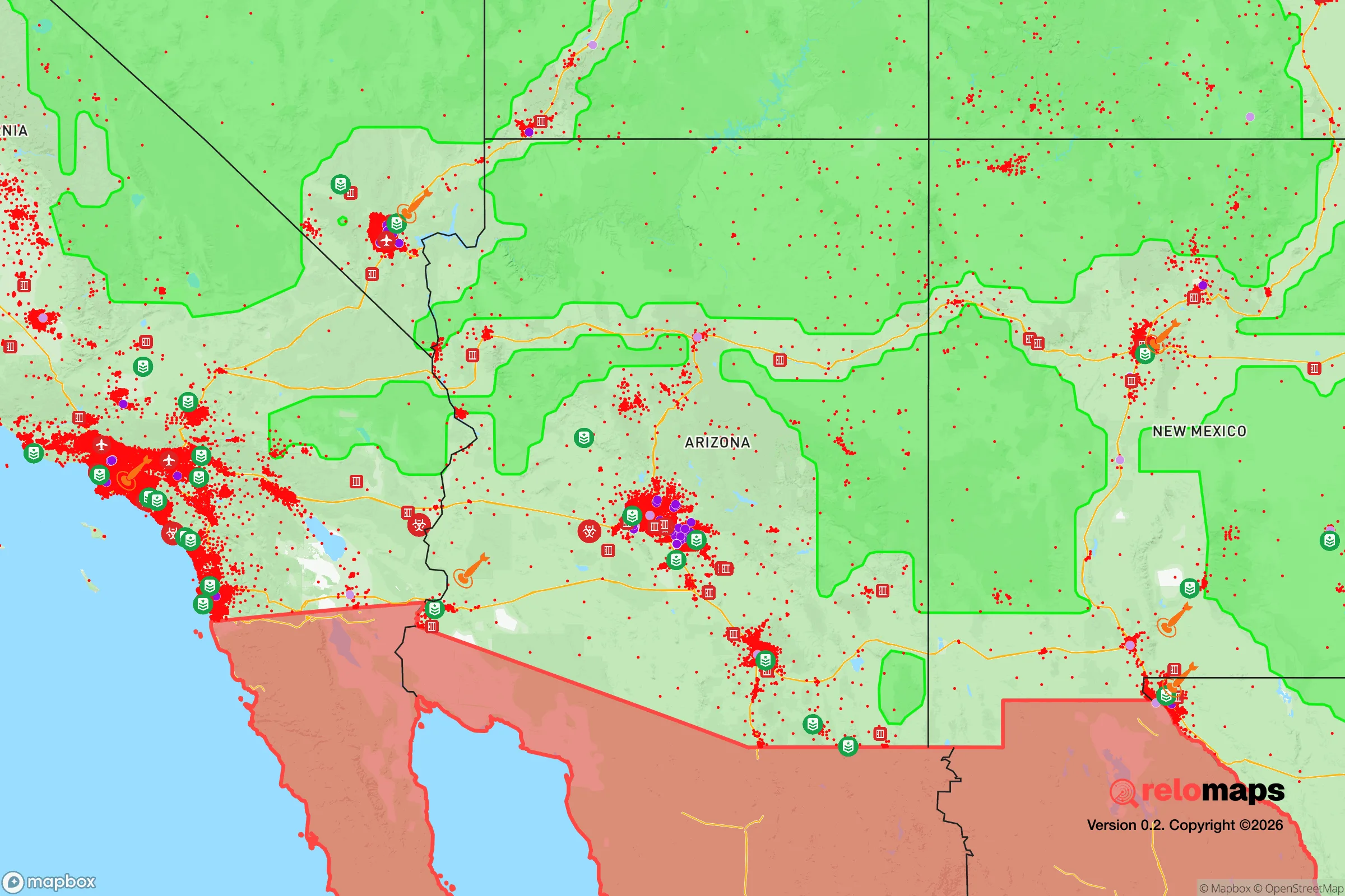
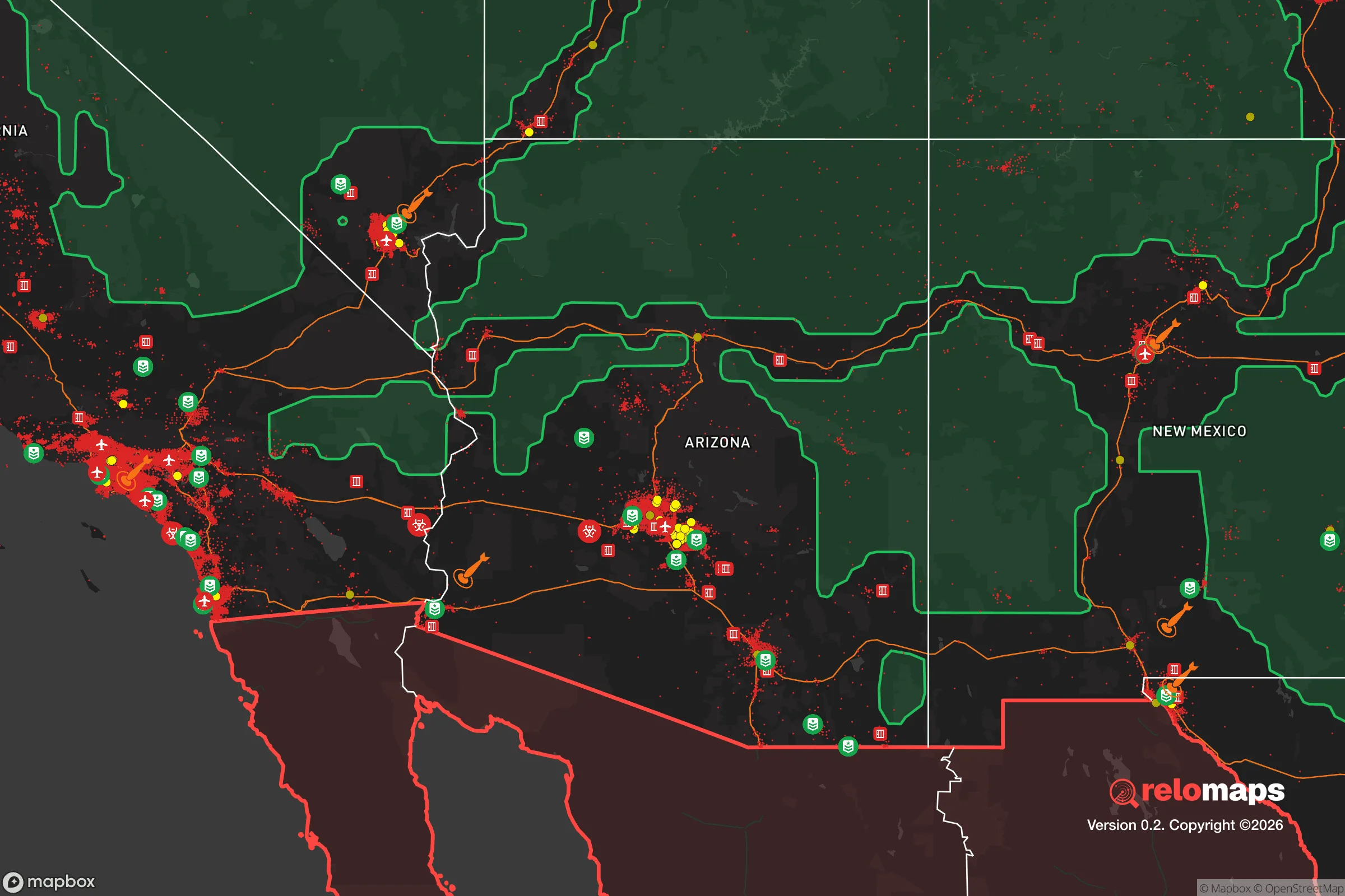


Important Note: For informational purposes only. This does not mean nothing bad ever happens in the green zones. Please use common sense. This is based on public data and modeled with AI. We tried to take a conservative approach but mistakes happen. We update this regularly as new information becomes available.
Solar Generator Recommendations
Backup power matters more here than in safer locations. We've picked three solar generators across budgets and capacity tiers — start with the budget unit if you only need a few essentials, or step up if you want to run a fridge and HVAC for days at a time.

Jackery Portable Power Station Explorer 300
Budget OptionPower on the Go: Weighing only 11 lbs, it's convenient to set up and store with book-sized foldable solar panels

BLUETTI Portable Power Station AC180
Designed for both indoor and outdoor scenarios, AC180 is highly capable as it has a robost capacity and continuous output power.

EF ECOFLOW DELTA Pro Ultra Power Station
Upgraded PickEcoFlow DELTA Pro Ultra is a whole-home energy system designed to grow with your family. Integrated with the Smart Home Panel 2, it scales to meet your evolving energy needs — keeping your home powered, intelligent, and secure through every stage of life.
We earn a commission, at no additional cost to you.
Strategic Assessment Analysis
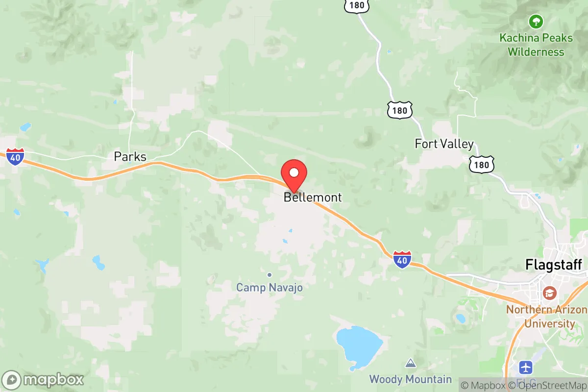
Bellemont, Arizona, sits at a strategic crossroads roughly 15 miles west of Flagstaff along Interstate 40, offering a mix of remote feel and practical access that appeals to relocators prioritizing disaster readiness and self-sufficiency. Its position on the Colorado Plateau at around 7,000 feet elevation provides a cooler, drier climate than much of Arizona, reducing risks tied to extreme heat and wildfire while supporting longer-term food and water strategies. For a single individual or family thinking seriously about resilience, Bellemont presents a balanced option—close enough to Flagstaff for supplies and medical care, but far enough to avoid the congestion and vulnerability of a larger urban center. The area's low population density and surrounding national forest land create a buffer that many relocation-focused buyers find attractive when assessing long-term security and preparedness.
Geographic position and natural advantages for long-term security
Bellemont's location on the Mogollon Rim places it in a transition zone between high desert and pine forest, giving residents access to diverse ecosystems and resources. The area receives roughly 20-25 inches of precipitation annually, mostly as winter snow and summer monsoon rain, which supports natural water sources like springs and seasonal creeks. This is a significant advantage over lower-elevation Arizona communities that depend entirely on groundwater or the Colorado River system, which faces ongoing allocation disputes and long-term supply concerns. The surrounding Coconino National Forest and Kaibab National Forest provide a vast, sparsely populated buffer—hundreds of thousands of acres of public land that limit dense development and create natural separation from potential threats. Elevation also means cooler summer temperatures, typically 10-15 degrees below Phoenix, reducing heat-related health risks and lowering water demand for basic survival. For a relocator assessing defensibility, the terrain offers natural chokepoints along I-40 and the BNSF railway corridor, but the forested hills and canyons also provide cover and multiple egress routes if needed.
Risks, exposures, and proximity to fallout-relevant landmarks
No strategic assessment of Bellemont is complete without acknowledging its proximity to Flagstaff (population roughly 77,000) and the I-40 corridor, which connects to major population centers like Albuquerque and Los Angeles. In a widespread crisis, this highway could become a liability—funneling evacuees or displaced populations through the area. Bellemont itself is small, with a year-round population estimated under 1,000, but its position along a major transcontinental rail and trucking route means it could see secondary effects from disruptions farther west. The area is roughly 100 miles from the Nevada Test Site and 150 miles from the Barry M. Goldwater Range, placing it outside the most severe fallout zones from a major incident at those locations, but not entirely immune to particulate drift depending on wind patterns. Wildfire risk is moderate to high, especially during dry springs and summers, though the mixed conifer forest is less fire-prone than the chaparral and scrublands of central Arizona. Earthquake risk is low, and the region is not prone to hurricanes or tornadoes. Flooding is localized and typically limited to low-lying areas near seasonal washes. For a relocator weighing man-made risks, Bellemont's distance from major military installations, nuclear power plants, and large urban targets is a net positive, though the I-40 corridor remains a variable worth monitoring.
Practical resilience for a relocator: food, water, energy, and defensibility
Water is the most critical factor for any self-sufficiency plan in the arid West, and Bellemont offers a mixed picture. The area relies on groundwater wells and municipal supply from the City of Flagstaff system for properties within the service area, but many rural parcels depend on private wells. Well depths in the region typically range from 200 to 600 feet, with yields varying by location; a pre-purchase well test is essential. The higher precipitation compared to Phoenix or Tucson means rainwater catchment is more viable, and several properties already have cistern systems in place. For food production, the growing season is short—roughly 90-120 days between last and first frost—but cool-season crops like potatoes, carrots, kale, and root vegetables do well. Greenhouse or hoop house extension is common among serious gardeners in the area. Soil quality varies, with volcanic-derived loams in some areas and clay-heavy soils in others; raised beds and soil amendment are standard practice. Energy resilience is strong: solar potential is excellent due to high elevation and clear winter skies, and many off-grid properties already use photovoltaic systems with battery storage. Propane delivery is available for backup heating and cooking, and wood-burning stoves are common given the surrounding forest. Defensibility is aided by the low population density and natural terrain, but the area is not isolated—Flagstaff is a 20-minute drive, and emergency services from the Coconino County Sheriff's Office and Flagstaff Medical Center are within reach. For a relocator, the practical takeaway is that Bellemont supports a semi-self-sufficient lifestyle with reasonable effort, but it is not a remote survivalist retreat; it is a buffer-zone community that balances access with separation.
The overall strategic picture for Bellemont is one of moderate-to-strong resilience with clear trade-offs. Its elevation and precipitation give it natural advantages over most of Arizona for water and food production, and its distance from major urban and military targets reduces exposure to the most severe man-made risks. The presence of I-40 and proximity to Flagstaff are double-edged—they provide supply lines and medical access but also introduce vulnerability to population movement and supply chain disruptions. For a relocator who values a cooler climate, forested surroundings, and a small community with room to spread out, Bellemont is a defensible choice that avoids the extremes of full isolation or urban dependence. It is not a bug-out location for a total collapse scenario, but for a family or individual building a resilient lifestyle in an uncertain decade, it offers a solid foundation with manageable risks and real advantages over both the desert floor and the crowded Front Range.

* Values derived from national, state, county, city and local statistics and may differ in a specific area. Last updated: 2026-10-24T16:17:52.000Z
Narrative content on this page is AI-generated and may contain mistakes. Verify any details that matter before acting on them.
ReloMaps may earn a commission from affiliate links at no extra cost to you.

