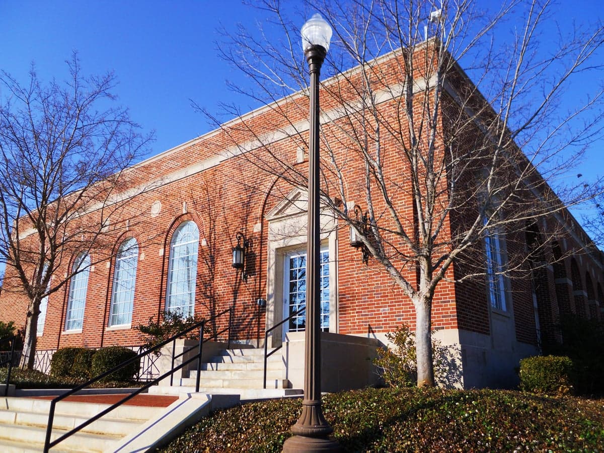
Photo: Wikipedia
Strategic Assessment of Auburn, AL
Workable tactical position. Some exposure to population density or targets, but generally defensible in a crisis.
What does the Strategic Assessment tell us?
Our Strategic Assessment grades tactical survivability of an area. Major population centers, military targets, fallout zones, natural disasters, and border exposure all drive risk — lower exposure means a more defensible position in a crisis.
This is heavily inspired by Joel Skousen's Strategic Relocation book. Highly recommended you checkout the book ($)What does this tell us?
Our Strategic Assessment grades tactical survivability of an area. Major population centers, military targets, fallout zones, natural disasters, and border exposure all drive risk — lower exposure means a more defensible position in a crisis.
This is heavily inspired by Joel Skousen's Strategic Relocation book. Highly recommended you checkout the book ($)Strategic Pillars

Key Distances
Regional Safe Places
Below is our recommended "safe zones" in Alabama and the surrounding area based on our strategic heuristics. For most people, it's unrealistic to live in a “safe zone” full-time due to work, family or other personal reasons. They tend to be more rural. However, many of these areas are perfect for second homes and retreat properties that double as a vacation home or even a short-term rental.
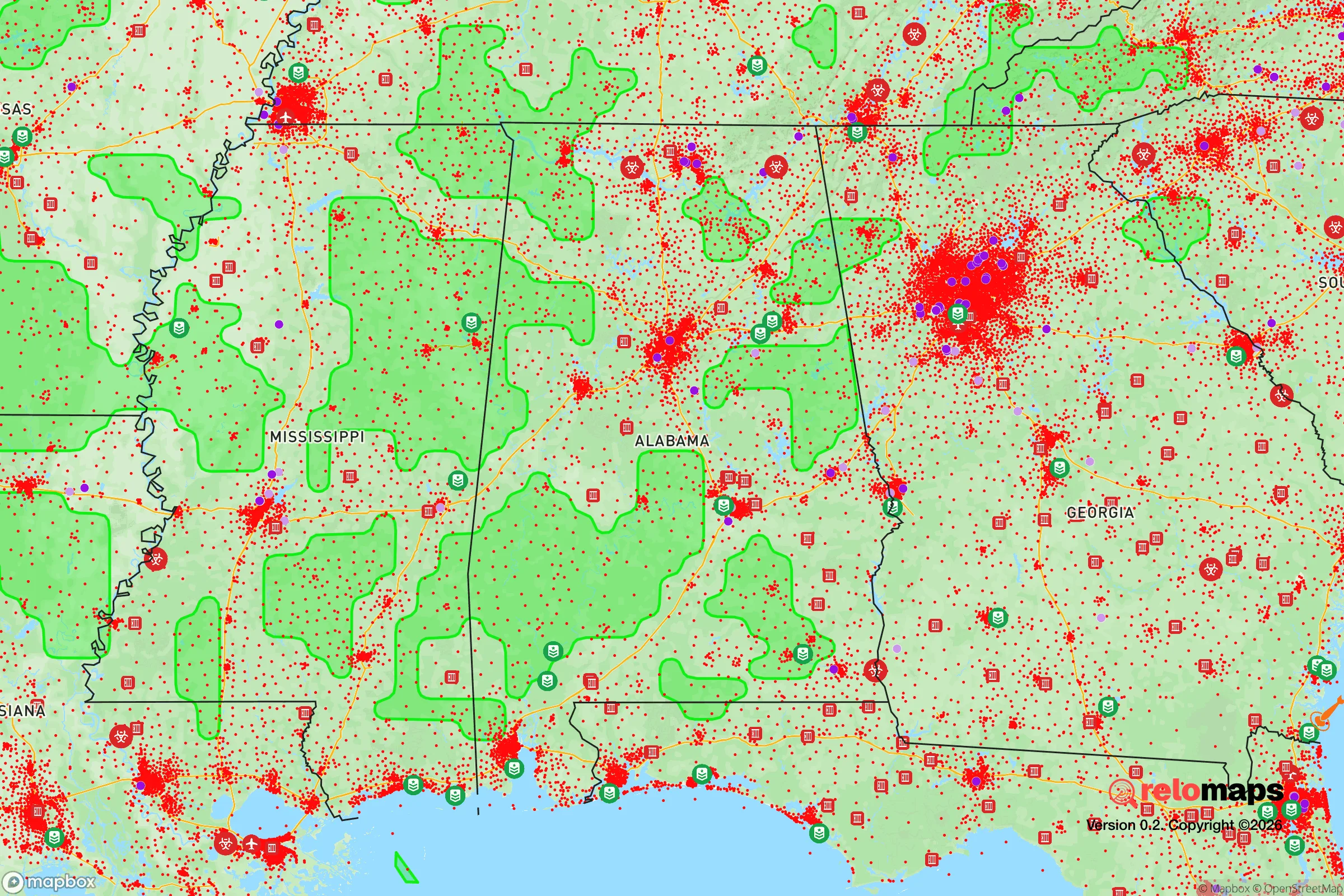
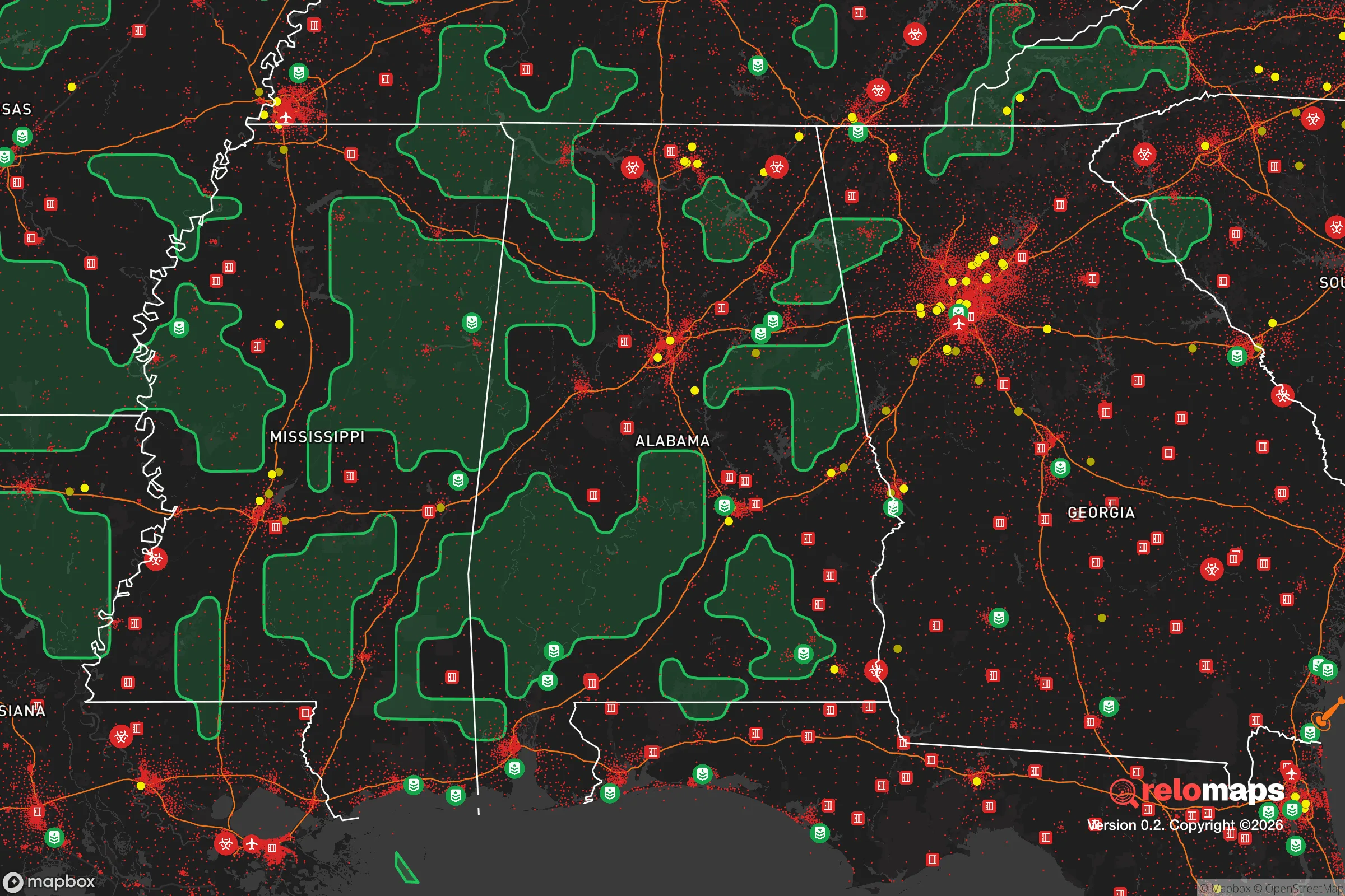


Important Note: For informational purposes only. This does not mean nothing bad ever happens in the green zones. Please use common sense. This is based on public data and modeled with AI. We tried to take a conservative approach but mistakes happen. We update this regularly as new information becomes available.
Solar Generator Recommendations
Backup power matters more here than in safer locations. We've picked three solar generators across budgets and capacity tiers — start with the budget unit if you only need a few essentials, or step up if you want to run a fridge and HVAC for days at a time.

Jackery Portable Power Station Explorer 300
Budget OptionPower on the Go: Weighing only 11 lbs, it's convenient to set up and store with book-sized foldable solar panels

BLUETTI Portable Power Station AC180
Designed for both indoor and outdoor scenarios, AC180 is highly capable as it has a robost capacity and continuous output power.

EF ECOFLOW DELTA Pro Ultra Power Station
Upgraded PickEcoFlow DELTA Pro Ultra is a whole-home energy system designed to grow with your family. Integrated with the Smart Home Panel 2, it scales to meet your evolving energy needs — keeping your home powered, intelligent, and secure through every stage of life.
We earn a commission, at no additional cost to you.
Strategic Assessment Analysis
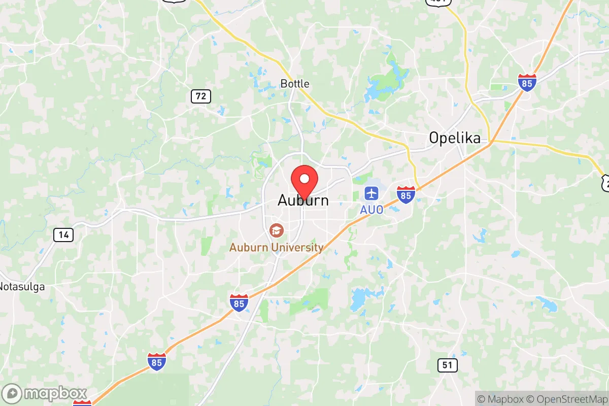
Auburn, Alabama, occupies a strategic position in the southeastern United States that balances proximity to major economic corridors with a degree of geographic insulation. Located roughly 100 miles southwest of Atlanta and 60 miles east of Montgomery, the city sits at the intersection of I-85 and US-280, providing solid logistical access without being directly adjacent to any single major metropolitan center. This placement offers a meaningful buffer against the immediate fallout of a major urban disruption—whether from civil unrest, a natural disaster, or a larger-scale event—while still allowing for resupply or evacuation routes if needed. The local economy is anchored by Auburn University, which provides a stabilizing institutional presence and a steady flow of educated residents, but the surrounding Lee County and East Alabama region also includes working farms, timberland, and light manufacturing that give the area a more self-sufficient character than many college towns.
Geographic position and natural advantages for long-term security
Auburn’s geographic advantages are rooted in its location within the Piedmont region, a transition zone between the coastal plain and the Appalachian foothills. This means the terrain is gently rolling rather than flat, offering some natural defensibility and good drainage—important for anyone thinking about water management or property security. The area sits atop the Piedmont aquifer system, which provides reliable groundwater access for wells, though most residential properties rely on municipal water from the city of Auburn or Lee County Water Authority. The climate is humid subtropical, with hot summers and mild winters, which supports year-round gardening and livestock operations if you have the land. The growing season runs roughly from late March to early November, allowing for two full crop cycles in a good year. Forest cover is extensive, with mixed pine-hardwood stands that provide timber, firewood, and wildlife habitat. For a relocator thinking about long-term sustainability, the combination of arable soil, reliable rainfall (averaging 52 inches per year), and moderate temperatures makes Auburn a viable location for small-scale food production and off-grid living, provided you secure property outside the immediate city limits where zoning is less restrictive.
Risks, exposures, and proximity to fallout-relevant landmarks
The most significant risk factor for Auburn is its proximity to two major population centers: Atlanta (about 100 miles northeast) and Montgomery (60 miles west). In a scenario involving civil unrest, a coordinated attack, or a major infrastructure failure, these cities could become sources of refugee flow, supply chain disruption, or secondary hazards. I-85 is the primary corridor connecting Auburn to Atlanta, and it is a known chokepoint—any event that closes that highway would effectively isolate the area from the northeast. Additionally, Auburn is within 150 miles of the Savannah River Site (a nuclear weapons facility and waste storage site in South Carolina) and roughly 200 miles from the Tennessee Valley Authority’s nuclear plants at Browns Ferry and Sequoyah. While these are not immediate fallout zones, a major incident at any of them could produce plume patterns that affect East Alabama depending on wind direction. The area is also in a moderate seismic zone—the 1886 Charleston earthquake was felt here—but the risk of a damaging quake is low. Tornado risk is real but not extreme; Lee County was hit by an EF4 tornado in 2019 that killed 23 people, so storm shelters or reinforced safe rooms are a prudent investment. Flooding is limited to low-lying areas near Chewacla Creek and the Tallapoosa River, but most of Auburn sits on well-drained ridges. The biggest practical exposure for a prepper-minded relocator is the area’s dependence on the electrical grid and the fact that Auburn’s water treatment plants draw from surface water sources (Lake Ogletree and the Tallapoosa River), which could be compromised in a prolonged outage or contamination event.
Practical resilience for a relocator: food, water, energy, and defensibility
For someone looking to establish a resilient household in Auburn, the key is to secure property outside the city’s urban growth boundary. The city itself is dense and walkable near the university, but that also means higher crime rates (property crime is above the national average) and less privacy. The surrounding unincorporated areas of Lee County, as well as neighboring communities like Opelika, Loachapoka, and Notasulga, offer larger lots, lower taxes, and fewer zoning restrictions. Water is the first priority: municipal water is reliable day-to-day, but a well with a hand pump or solar-powered pump is a smart backup. The water table in the Piedmont is generally 20-60 feet deep, so drilling a well is feasible but not cheap—expect $5,000-$10,000 depending on depth and yield. For food, the local farmers’ markets (Auburn’s is year-round on Saturdays) and the presence of several U-pick farms within 20 miles mean you can source fresh produce without relying on grocery chains. The area also has a strong hunting culture—deer, turkey, and small game are abundant on public lands like the Tuskegee National Forest (about 30 miles south) and the Talladega National Forest (about 50 miles north). For energy, solar is viable but not optimal due to frequent cloud cover; a backup generator running on propane or diesel is more practical. Defensibility is moderate: the rolling terrain and tree cover provide natural concealment, but the lack of natural barriers (rivers, mountains) means a determined group could approach from multiple directions. A rural property with a long driveway, a good fence, and a clear line of sight to the road is worth the investment. The local sheriff’s office is professional but understaffed—Lee County has about 1.2 deputies per 1,000 residents, so response times in rural areas can be 20-30 minutes. That means you are your own first responder, and the community is generally armed and self-reliant, which is a cultural advantage for someone with a prepper mindset.
Overall, Auburn presents a mixed but workable strategic picture for a conservative-leaning relocator focused on resilience. The university town veneer hides a deeper layer of rural self-sufficiency, and the area’s moderate climate, good soil, and access to multiple water sources make it a viable location for long-term preparation. The biggest downsides are the proximity to Atlanta and Montgomery—which could become liabilities in a crisis—and the dependence on surface water for municipal supply. But if you choose your property wisely, invest in a well and backup power, and integrate into the local community (which is generally friendly, church-going, and armed), Auburn offers a solid base of operations. It is not a bug-out location in the remote sense—you are still within a day’s drive of several major targets—but it is a place where you can build a life that is both comfortable and prepared, without the extreme isolation that some prepper destinations require. The key is to treat it as a strategic hub, not a final redoubt: stock supplies, build relationships, and keep a vehicle ready to move if the situation deteriorates beyond what local resources can handle.

* Values derived from national, state, county, city and local statistics and may differ in a specific area. Last updated: 2026-04-19T18:43:34.000Z
Narrative content on this page is AI-generated and may contain mistakes. Verify any details that matter before acting on them.
ReloMaps may earn a commission from affiliate links at no extra cost to you.

