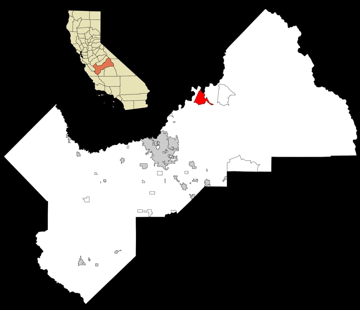
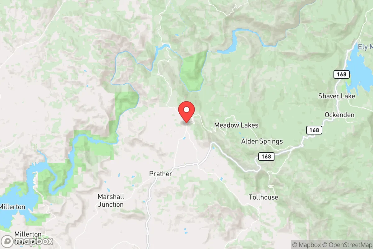
Photo: Wikipedia
Strategic Assessment of Auberry, CA
Workable tactical position. Some exposure to population density or targets, but generally defensible in a crisis.
What does the Strategic Assessment tell us?
Our Strategic Assessment grades tactical survivability of an area. Major population centers, military targets, fallout zones, natural disasters, and border exposure all drive risk — lower exposure means a more defensible position in a crisis.
This is heavily inspired by Joel Skousen's Strategic Relocation book. Highly recommended you checkout the book ($)What does this tell us?
Our Strategic Assessment grades tactical survivability of an area. Major population centers, military targets, fallout zones, natural disasters, and border exposure all drive risk — lower exposure means a more defensible position in a crisis.
This is heavily inspired by Joel Skousen's Strategic Relocation book. Highly recommended you checkout the book ($)Strategic Pillars

Key Distances
Regional Safe Places
Below is our recommended "safe zones" in California and the surrounding area based on our strategic heuristics. For most people, it's unrealistic to live in a “safe zone” full-time due to work, family or other personal reasons. They tend to be more rural. However, many of these areas are perfect for second homes and retreat properties that double as a vacation home or even a short-term rental.

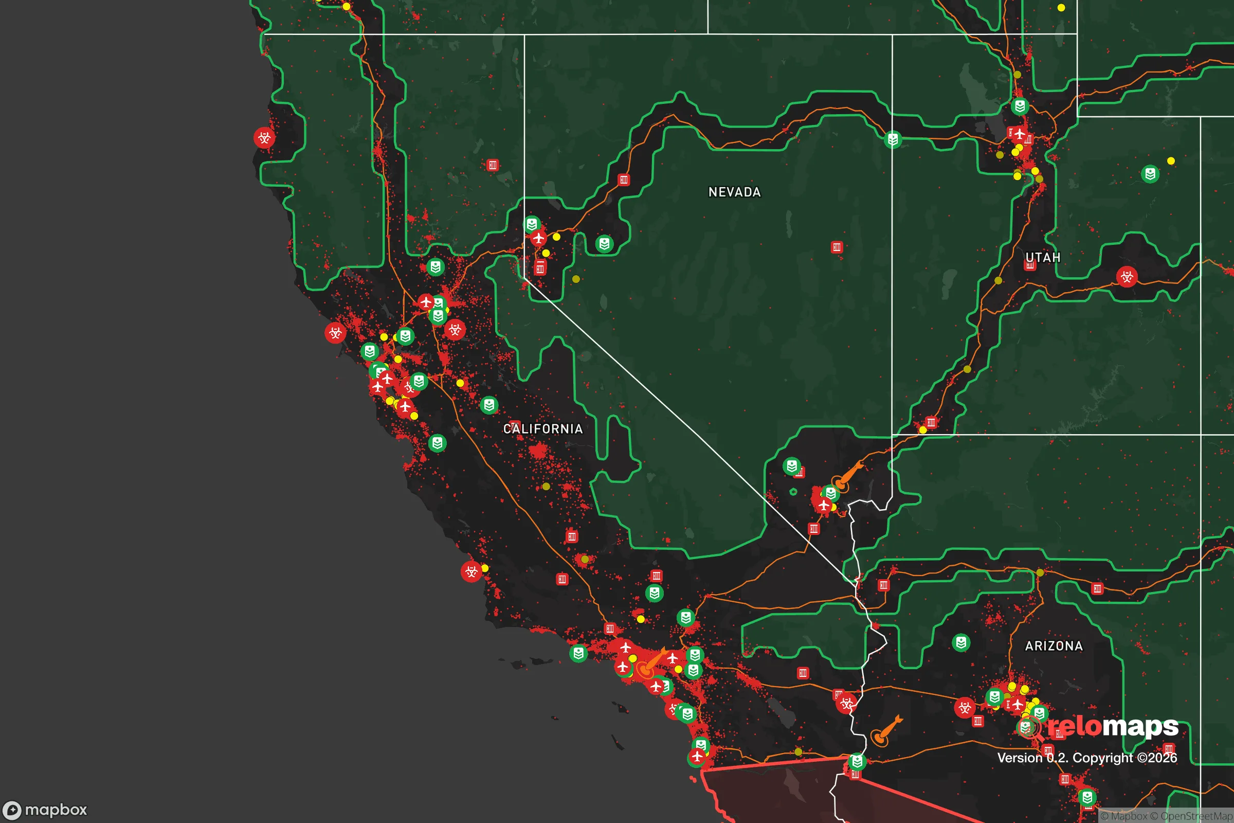


Important Note: For informational purposes only. This does not mean nothing bad ever happens in the green zones. Please use common sense. This is based on public data and modeled with AI. We tried to take a conservative approach but mistakes happen. We update this regularly as new information becomes available.
Solar Generator Recommendations
Backup power matters more here than in safer locations. We've picked three solar generators across budgets and capacity tiers — start with the budget unit if you only need a few essentials, or step up if you want to run a fridge and HVAC for days at a time.

Jackery Portable Power Station Explorer 300
Budget OptionPower on the Go: Weighing only 11 lbs, it's convenient to set up and store with book-sized foldable solar panels

BLUETTI Portable Power Station AC180
Designed for both indoor and outdoor scenarios, AC180 is highly capable as it has a robost capacity and continuous output power.

EF ECOFLOW DELTA Pro Ultra Power Station
Upgraded PickEcoFlow DELTA Pro Ultra is a whole-home energy system designed to grow with your family. Integrated with the Smart Home Panel 2, it scales to meet your evolving energy needs — keeping your home powered, intelligent, and secure through every stage of life.
We earn a commission, at no additional cost to you.
Strategic Assessment Analysis
Auberry, California, occupies a distinctive strategic position in the Sierra Nevada foothills that offers genuine resilience advantages for those prioritizing disaster readiness and self-sufficiency, yet it carries specific trade-offs that demand clear-eyed assessment. Located roughly 30 miles northeast of Fresno at an elevation of approximately 2,000 feet, this unincorporated community of about 3,200 residents sits at the transition zone between the San Joaquin Valley floor and the higher Sierra Nevada range. For a relocator weighing long-term security, Auberry provides meaningful geographic insulation from many urban risks while maintaining practical access to essential resources, though its proximity to certain critical infrastructure and natural hazard zones requires careful consideration.
Geographic position and natural advantages for long-term security
Auberry’s elevation and terrain create several inherent defensive characteristics that are rare in California’s Central Valley region. The community sits above the valley inversion layer, which means cleaner air and fewer particulate hazards during wildfire season compared to lower-elevation areas like Clovis or Fresno. The surrounding landscape is a mix of oak woodlands, granite outcroppings, and pine forests, offering natural cover and multiple egress routes via State Route 168 and smaller forest service roads. The area’s position on the western slope of the Sierra Nevada provides access to reliable watersheds — the nearby Kings River and San Joaquin River systems originate in high-country snowpack, giving Auberry a significant water security advantage over valley communities that depend on the Sacramento-San Joaquin Delta, which is vulnerable to earthquake disruption and saltwater intrusion. The local microclimate is notably cooler than the valley floor, with summer highs typically 10–15°F lower than Fresno, reducing heat-related stress on infrastructure and agriculture. For a relocator thinking about long-term habitability under climate stress, Auberry’s elevation and water proximity place it in a relatively favorable position compared to most Central Valley locations.
Risks, exposures, and proximity to fallout-relevant landmarks
No strategic assessment of Auberry would be honest without addressing its proximity to several high-consequence targets. The community lies roughly 25 miles northeast of Fresno’s urban core, which includes Fresno Yosemite International Airport, major rail yards, and Interstate 5 — all potential secondary targets in a conflict scenario. More significantly, Auberry is approximately 45 miles from the Diablo Canyon Power Plant near San Luis Obispo, though the coastal mountain range provides substantial shielding. The more immediate concern is the community’s location within the Sierra Nevada foothills fire corridor, which has seen increasingly severe wildfire seasons. The 2020 Creek Fire, which burned over 379,000 acres, came within a few miles of Auberry’s western edge, forcing evacuations and demonstrating the area’s vulnerability to fast-moving wildland fires. Seismic risk is moderate but real — the area sits near the Sierra Nevada fault zone, and while major quakes are less frequent than along the San Andreas, the 1983 Coalinga earthquake (magnitude 6.5) and the 2020 Ridgecrest sequence show that significant seismic events can occur in the broader region. For a relocator concerned about fallout from man-made disasters, Auberry’s distance from major military installations (such as Naval Air Station Lemoore, about 60 miles south) and its position behind the Sierra crest offer some protection, but the community is not remote enough to be considered a true fallout refuge. The primary risk profile is natural rather than man-made, but the area’s proximity to Fresno’s critical infrastructure means it would not escape the secondary effects of a major urban disruption.
Practical resilience for a relocator: food, water, energy, and defensibility
Auberry’s practical resilience metrics are mixed but generally favorable for a relocator willing to invest in self-sufficiency. Water security is the area’s strongest asset — the community sits within the Kings River watershed, which has senior water rights and is fed by Sierra snowpack. Many properties have access to groundwater through private wells, though well depths vary significantly (typically 100–400 feet) and some areas have experienced declining water tables during drought years. The local utility, Pacific Gas & Electric, provides electricity, but the area is prone to Public Safety Power Shutoffs during high-fire-risk conditions, making solar-plus-battery systems a near-necessity for reliable power. The region’s solar insolation is excellent, with over 260 sunny days per year, and off-grid solar installations are common among long-term residents. Food production potential is moderate — the growing season is shorter than the valley floor (roughly 150–180 frost-free days), but the area supports orchards, vineyards, and vegetable gardens, and there is a strong local culture of hunting (deer, wild pig) and foraging (mushrooms, acorns). The Auberry Farmers Market and nearby producers provide some local food access, but year-round self-sufficiency would require significant land and infrastructure investment. Defensibility is a mixed picture — the terrain offers natural chokepoints along the few access roads, but the community’s dispersed layout means there is no centralized defensible perimeter. The local population is small and generally self-reliant, with a strong volunteer fire department and an active community emergency response team, but law enforcement response times from the Fresno County Sheriff’s Office can be 20–40 minutes for outlying properties. For a relocator, the key takeaway is that Auberry offers a solid foundation for resilience but requires proactive investment in backup power, water storage, and fire-hardened construction to realize its potential.
The overall strategic picture for Auberry is one of qualified opportunity. It is not a hardened retreat — it lacks the isolation and infrastructure of true remote mountain communities like those in the eastern Sierra or northern California’s coastal ranges. But for a relocator seeking a balance between accessibility and security, Auberry provides a defensible position with strong natural resources, particularly water, and a community culture that values self-reliance. The primary strategic weakness is its proximity to Fresno’s urban vulnerabilities and the persistent wildfire threat, both of which require active mitigation rather than passive acceptance. For a family or individual willing to invest in fire-resistant construction, backup systems, and community engagement, Auberry represents a viable option in California’s increasingly complex resilience landscape. The area rewards preparation and punishes complacency — which, for the right relocator, is precisely the point.

* Values derived from national, state, county, city and local statistics and may differ in a specific area. Last updated: 2026-10-21T10:32:52.000Z
Narrative content on this page is AI-generated and may contain mistakes. Verify any details that matter before acting on them.
ReloMaps may earn a commission from affiliate links at no extra cost to you.

