
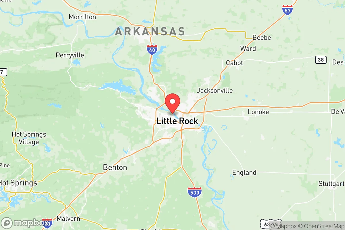
Photo: Wikipedia
Strategic Assessment of Pulaski County
Workable tactical position. Some exposure to population density or targets, but generally defensible in a crisis.
What does the Strategic Assessment tell us?
Our Strategic Assessment grades tactical survivability of an area. Major population centers, military targets, fallout zones, natural disasters, and border exposure all drive risk — lower exposure means a more defensible position in a crisis.
This is heavily inspired by Joel Skousen's Strategic Relocation book. Highly recommended you checkout the book ($)What does this tell us?
Our Strategic Assessment grades tactical survivability of an area. Major population centers, military targets, fallout zones, natural disasters, and border exposure all drive risk — lower exposure means a more defensible position in a crisis.
This is heavily inspired by Joel Skousen's Strategic Relocation book. Highly recommended you checkout the book ($)Strategic Pillars

Key Distances
Strategic Assessment Analysis
Pulaski County, anchored by Little Rock, occupies a strategic sweet spot in the central Arkansas corridor—close enough to the state's economic and political heart to access resources, yet far enough from coastal hurricane zones and major metropolitan targets to offer a baseline of resilience. The county sits at the confluence of the Arkansas River and Interstate 30, a key east-west and north-south transit junction, and its position within the Arkansas River Valley provides natural shielding from the worst of Gulf weather. For a relocator thinking about disaster readiness, Pulaski County offers a mix of moderate infrastructure, solid water access, and a climate that supports year-round self-sufficiency efforts.
Why central Arkansas’s geography works for disaster preparedness
The natural layout of Pulaski County gives it a few quiet advantages that matter when things go sideways. The Arkansas River runs through the heart of the county, providing a reliable surface water source that can support both drinking needs and small-scale irrigation if municipal systems take a hit. The river also feeds the Port of Little Rock, a full-service inland port that connects to the Mississippi River system—critical for moving supplies in a supply-chain disruption. To the north and west, the foothills of the Ozarks and Ouachita Mountains offer varied terrain that can serve as natural barriers against high winds and provide defensible retreat options in rural pockets like Roland or Scott. The county sits well outside the highest-risk zones for hurricanes (over 400 miles from the Gulf) and major seismic activity (the New Madrid fault zone is roughly 150 miles northeast, with dampened impact here). That geographic buffer means fewer direct weather emergencies and more time to prepare when storms do approach.
The real-world risks: tornadoes, flooding, and nearby infrastructure targets
No place is without exposure, and Pulaski County has a few distinct ones worth naming. Tornado risk is the standout natural hazard—the county sits squarely within Tornado Alley's southern reach, with a history of strong EF3 and EF4 events, including the devastating 2023 Little Rock tornado that cut through West Little Rock and North Little Rock. Flooding from the Arkansas River is another recurring threat, as seen in the prolonged 2019 flood that swamped low-lying areas near North Little Rock and Jacksonville, so any property purchase needs careful elevation checking. On the man-made side, the Little Rock Air Force Base in Jacksonville is a major strategic asset—home to the C-130 fleet and a key mobility hub—which makes it a plausible target in a conflict scenario. The Pine Bluff Arsenal, about 45 miles southeast in Jefferson County, stores chemical weapons and munitions, and while it's not inside Pulaski County, it's close enough that a catastrophic release or attack could affect downwind areas. The county also has a modest industrial base along the river, including chemical and steel facilities, that could produce secondary fallout if damaged. Being near these landmarks doesn't make the area a direct dime-a-dozen target, but it does mean relocators should understand evacuation routes and wind patterns specific to their chosen neighborhood.
Practical steps for self-sufficiency: food, water, energy, and defensibility in Pulaski County
For someone serious about self-sufficiency, Pulaski County offers a workable mix of assets and gaps. Water is a real advantage: the Arkansas River and the underlying Alluvial Aquifer provide year-round access for those with a well or surface-water collection setup, though well depth varies (expect 100–200 feet in most areas). Food production is viable—the county has decent growing soil in its eastern half, with a growing season of about 215 days, and local farms in surrounding counties (rice, soybeans, poultry) mean bulk food sourcing is possible through co-ops and farmers' markets in downtown Little Rock and Sherwood. Energy is the bigger question: the grid is moderately reliable but not hardened against major storms, so solar panels with battery backup are a smart investment, and natural gas is widely available in the urban core. Defensibility depends on location—the rolling hills and river bluffs west of the city (toward Roland) provide natural concealment and bottleneck points, while the flatter eastern side near Scott is more open and harder to secure. The county's population density of about 400 people per square mile overall is moderate, but the urban core around Little Rock is denser, so relocators should look to the outer townships for better spacing and reduced competition for resources during a crisis.
Ultimately, Pulaski County presents a balanced picture for the preparedness-minded relocator—not a hardened bunker, but a solid base with natural advantages and manageable risks. The key is to choose your specific location carefully, favor areas outside the immediate urban core like Roland or the southwest part of the county, and build local knowledge of flood plains and tornado shelter options. For those willing to invest in off-grid water and energy backup and stay informed about nearby strategic infrastructure, it's a defensible, resource-rich region that rewards foresight and planning. The county's central location also means you can tap into state-level relief networks quickly without being so close to a major metropolitan target that you become a secondary casualty. If you do your homework on elevation and proximity to the Air Force base, it's a strong candidate for a strategic relocation with room to grow into deeper self-sufficiency over time.

* Values derived from national, state, county, city and local statistics and may differ in a specific area. Last updated: 2026-06-16T02:00:33.000Z
Narrative content on this page is AI-generated and may contain mistakes. Verify any details that matter before acting on them.
ReloMaps may earn a commission from affiliate links at no extra cost to you.

