
Photo: Wikipedia
Strategic Assessment of Lonoke County
Workable tactical position. Some exposure to population density or targets, but generally defensible in a crisis.
What does the Strategic Assessment tell us?
Our Strategic Assessment grades tactical survivability of an area. Major population centers, military targets, fallout zones, natural disasters, and border exposure all drive risk — lower exposure means a more defensible position in a crisis.
This is heavily inspired by Joel Skousen's Strategic Relocation book. Highly recommended you checkout the book ($)What does this tell us?
Our Strategic Assessment grades tactical survivability of an area. Major population centers, military targets, fallout zones, natural disasters, and border exposure all drive risk — lower exposure means a more defensible position in a crisis.
This is heavily inspired by Joel Skousen's Strategic Relocation book. Highly recommended you checkout the book ($)Strategic Pillars

Key Distances
Strategic Assessment Analysis
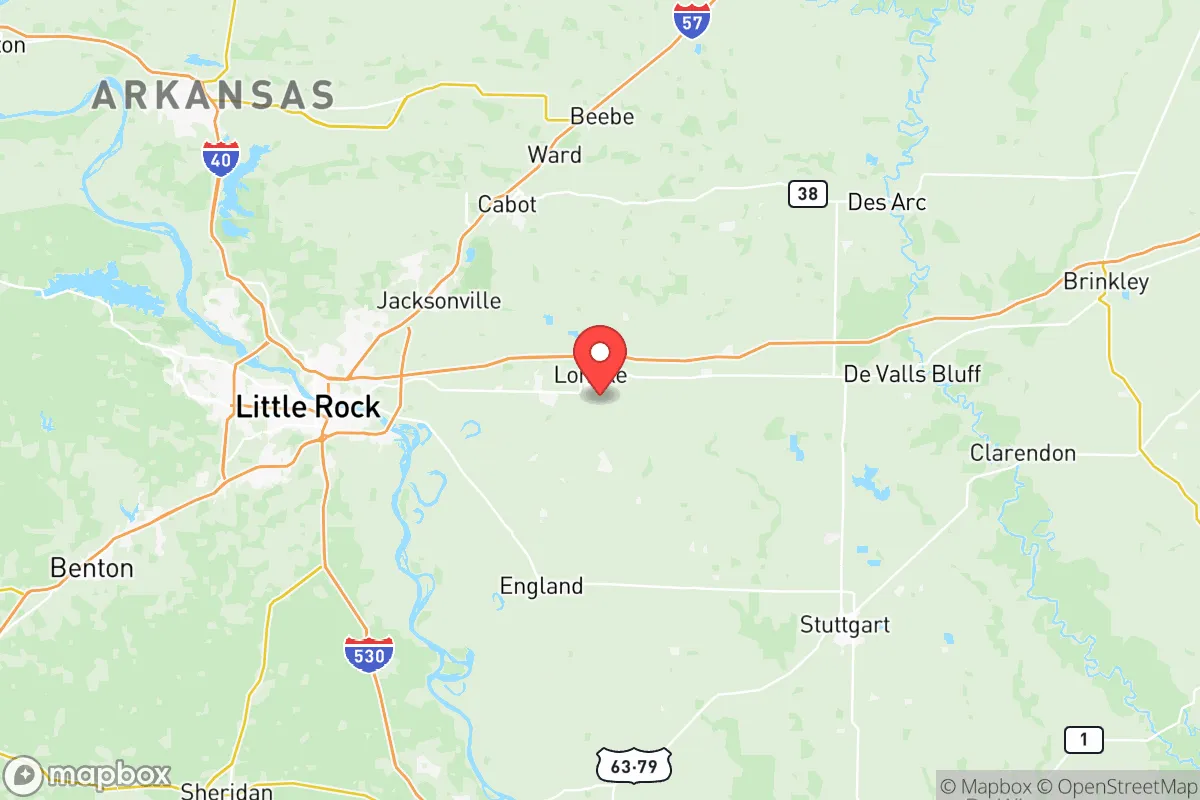
Lonoke County, Arkansas, offers a strategic balance of rural self-sufficiency and access to critical infrastructure, making it a viable relocation option for those prioritizing disaster readiness and long-term resilience. Located just east of Little Rock along the Arkansas River, the county provides a buffer from major metropolitan fallout zones while still being close enough to leverage regional resources. Its position within the Central Arkansas region, away from coastal hurricane zones and major seismic fault lines, gives it a baseline geographic advantage for families and individuals seeking a stable, defensible home base.
Geographic position and natural advantages for self-sufficiency
Lonoke County sits in the Arkansas River Valley, a corridor that offers fertile soil, abundant freshwater, and moderate climate patterns. The county is roughly 30 miles east of Little Rock, placing it outside the immediate blast radius of a major urban target while still within a reasonable distance for supply runs or medical access. The Arkansas River itself is a major water artery, providing both a reliable water source and a potential transportation route for goods. The terrain is predominantly flat to gently rolling, with a mix of agricultural fields and hardwood forests, which supports both farming and timber resources. The county’s proximity to the Grand Prairie region—a major rice and soybean production area—means local food supply chains are robust, with Lonoke County being one of the top rice-producing counties in the United States. This agricultural base is a concrete advantage for anyone thinking about food security, as local farms and cooperatives can supply staples even during supply chain disruptions. The county also sits near the Carlisle and England communities, which have strong agricultural roots and smaller populations, offering lower density and more defensible positions than the suburban sprawl around Little Rock.
Risks, exposures, and proximity to fallout-relevant landmarks
While Lonoke County avoids the highest-risk coastal and seismic zones, it is not without exposure. The primary man-made risk comes from its proximity to Little Rock Air Force Base, located just west in Pulaski County. This base is a strategic asset for the U.S. military, housing C-130 transport aircraft and supporting global operations. In a major conflict scenario, the base could be a high-value target, placing the western edge of Lonoke County within a potential fallout zone. Additionally, the Arkansas River's industrial corridor includes chemical plants and fertilizer storage facilities near the county line, particularly around the North Little Rock port area. A catastrophic event at these facilities could release hazardous materials downwind into Lonoke County. Natural risks are moderate: the region experiences occasional tornadoes, flash flooding from the Arkansas River, and ice storms. The county is not in a major earthquake zone, though the New Madrid Seismic Zone to the northeast could produce ground shaking that affects older infrastructure. For a relocator, the key takeaway is that Lonoke County's risk profile is lower than coastal or urban areas, but not zero—especially regarding military and industrial targets within a 30-mile radius.
Practical resilience for a relocator: food, water, energy, and defensibility
For someone serious about self-sufficiency, Lonoke County offers strong fundamentals. Water access is excellent: the Arkansas River provides a surface water source, and the county sits atop the Mississippi River Valley Alluvial Aquifer, one of the most productive groundwater sources in the country. Many rural properties have private wells, and the county’s agricultural irrigation infrastructure means well-drilling services are common and affordable. Food production is a major asset. The county is a top producer of rice, soybeans, corn, and catfish, with local farmers’ markets and cooperatives in towns like Lonoke, Cabot, and Ward. For those willing to garden or raise livestock, the growing season runs from April to October, and the soil is fertile with proper management. Energy infrastructure is moderately resilient. The county is served by Entergy Arkansas and several electric cooperatives, but the grid is vulnerable to ice storms and tornadoes. Solar panel adoption is growing, and many rural properties have space for off-grid solar arrays. Propane and wood heating are common backups. Defensibility varies by location. The western part of the county, near Cabot and the interstate corridor, is more suburban and less defensible due to higher population density and road access. The eastern and southern parts—around England, Coy, and Humnoke—are sparsely populated, with long gravel roads, agricultural fields, and natural tree lines that provide cover and chokepoints. These areas offer better options for a retreat-style property, though they require a vehicle for supply runs. The county’s law enforcement presence is limited in rural areas, so personal security measures—like fencing, dogs, and community networks—are advisable.
Overall, Lonoke County presents a pragmatic option for the resilience-minded relocator. It avoids the highest-risk zones while offering abundant water, fertile land, and a lower population density than nearby urban centers. The main trade-offs are proximity to Little Rock Air Force Base and industrial river infrastructure, which introduce moderate fallout and chemical exposure risks. For a family or individual willing to invest in off-grid energy, water storage, and community ties, the county’s agricultural base and geographic position provide a solid foundation for long-term self-sufficiency. The key is to choose a property east of Highway 67/167, away from the suburban sprawl of Cabot, and to establish relationships with local farmers and cooperatives before any crisis hits.

* Values derived from national, state, county, city and local statistics and may differ in a specific area. Last updated: 2026-06-15T22:00:17.000Z
Narrative content on this page is AI-generated and may contain mistakes. Verify any details that matter before acting on them.
ReloMaps may earn a commission from affiliate links at no extra cost to you.

