Photo: Wikipedia
Strategic Assessment of Yuma County
Meaningful friction. Expect exposure to either population pressure, blast zones, or natural disaster risk. Consider buying a retreat property.
What does the Strategic Assessment tell us?
Our Strategic Assessment grades tactical survivability of an area. Major population centers, military targets, fallout zones, natural disasters, and border exposure all drive risk — lower exposure means a more defensible position in a crisis.
This is heavily inspired by Joel Skousen's Strategic Relocation book. Highly recommended you checkout the book ($)What does this tell us?
Our Strategic Assessment grades tactical survivability of an area. Major population centers, military targets, fallout zones, natural disasters, and border exposure all drive risk — lower exposure means a more defensible position in a crisis.
This is heavily inspired by Joel Skousen's Strategic Relocation book. Highly recommended you checkout the book ($)Strategic Pillars

Key Distances
Strategic Assessment Analysis
Yuma County, Arizona, offers a distinctive strategic profile for relocation-minded readers focused on resilience and self-sufficiency. Its position at the far southwestern corner of the state, bordering California and Mexico, provides a combination of geographic isolation from major metropolitan fallout zones and access to critical infrastructure that many other rural counties lack. The area's agricultural backbone, reliable water rights from the Colorado River, and year-round growing season create a foundation for food security that is rare in the arid Southwest, while its distance from high-value military and industrial targets in Phoenix, Tucson, and San Diego reduces exposure to many man-made risks.
Geographic position and natural advantages for long-term security
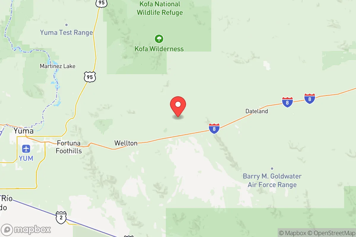
Yuma County sits roughly 180 miles from Phoenix and 170 miles from San Diego, placing it outside the immediate blast and fallout zones of either major metropolitan area. The county's 5,519 square miles include the Gila River Valley, the Colorado River corridor, and the expansive Yuma Desert, offering a mix of irrigated agricultural land and sparsely populated desert terrain. The city of Yuma itself is the county seat and population center, with roughly 100,000 residents, while smaller communities like Somerton, San Luis, and Wellton provide additional population dispersion. The Colorado River forms the county's western border, providing a reliable surface water source that is legally allocated through the 1922 Colorado River Compact — a significant advantage over much of Arizona that relies on groundwater or distant Central Arizona Project canals. The region's low population density outside the Yuma urban area — roughly 45 people per square mile countywide — means ample space for private food production, water catchment, and defensible property layouts. The area's 350+ days of sunshine per year also support year-round solar energy generation, reducing dependence on grid power for those who invest in panels and battery storage.
Risks, exposures, and proximity to fallout-relevant landmarks
While Yuma County avoids the worst-case scenarios of a Phoenix or San Diego strike, it is not without exposure. The Yuma Proving Ground, a U.S. Army installation covering 1,300 square miles in the county's northern half, tests artillery, missiles, and other munitions — making it a potential secondary target in a conflict involving U.S. military assets. The San Luis Port of Entry on the U.S.-Mexico border sees heavy commercial and passenger traffic, and any disruption at the border could create supply chain bottlenecks for food and fuel entering the region. Interstate 8, the county's primary east-west highway, runs through Yuma and connects to San Diego and Phoenix, making it a likely evacuation route that could become congested during a crisis. The county also sits within 100 miles of the Palo Verde Nuclear Generating Station in neighboring La Paz County — the largest nuclear power plant in the United States by net generation — though prevailing winds typically carry any potential fallout eastward, away from Yuma's population centers. Natural risks include extreme summer heat (average July highs of 107°F), flash flooding in arroyos during monsoon season, and the potential for Colorado River flooding in low-lying areas near the river. The region's desert climate also means limited natural building materials and high water demand for any significant agriculture or livestock operation.
Practical resilience for a relocator: food, water, energy, and defensibility
Yuma County's agricultural sector is a genuine strategic asset. The region produces over 90% of the nation's leafy greens during the winter months, along with substantial quantities of citrus, melons, and dates. For a relocator seeking food self-sufficiency, the availability of irrigated farmland, established seed suppliers, and agricultural expertise in the Yuma Valley is unmatched in the Southwest. Water rights are the critical variable: properties with senior Colorado River water rights are far more valuable for long-term resilience than those relying on groundwater, which is being depleted at an estimated 2-3 feet per year in some parts of the county. The Yuma Mesa area, east of the city, offers higher ground with less flood risk and good solar exposure, while the Gila River Valley provides fertile soil and irrigation infrastructure. Energy resilience is achievable through rooftop solar, which offsets the region's high summer cooling loads, but battery storage is essential for nighttime and cloudy-day operation. Defensibility varies by location: the open desert terrain offers long sightlines but limited cover, while the agricultural areas near the river have more vegetation and irrigation canals that could serve as natural barriers. The county's law enforcement presence is concentrated in Yuma and San Luis, leaving rural areas with longer response times — a factor that favors properties with good access control, perimeter visibility, and a community of like-minded neighbors.
Overall, Yuma County presents a balanced strategic picture for the resilience-minded relocator. Its strengths — reliable water, year-round growing conditions, low population density, and distance from major metropolitan targets — are genuine and durable. Its weaknesses — extreme heat, dependence on the Colorado River legal framework, proximity to military infrastructure and the border, and limited natural building materials — require careful property selection and advance preparation. For a single individual or family willing to invest in solar, water storage, and a defensible property layout, the county offers one of the more viable long-term options in the Southwest for a self-sufficient lifestyle that is not entirely disconnected from essential services and supply chains.

* Values derived from national, state, county, city and local statistics and may differ in a specific area. Last updated: 2026-07-10T15:42:52.000Z
Narrative content on this page is AI-generated and may contain mistakes. Verify any details that matter before acting on them.
ReloMaps may earn a commission from affiliate links at no extra cost to you.

