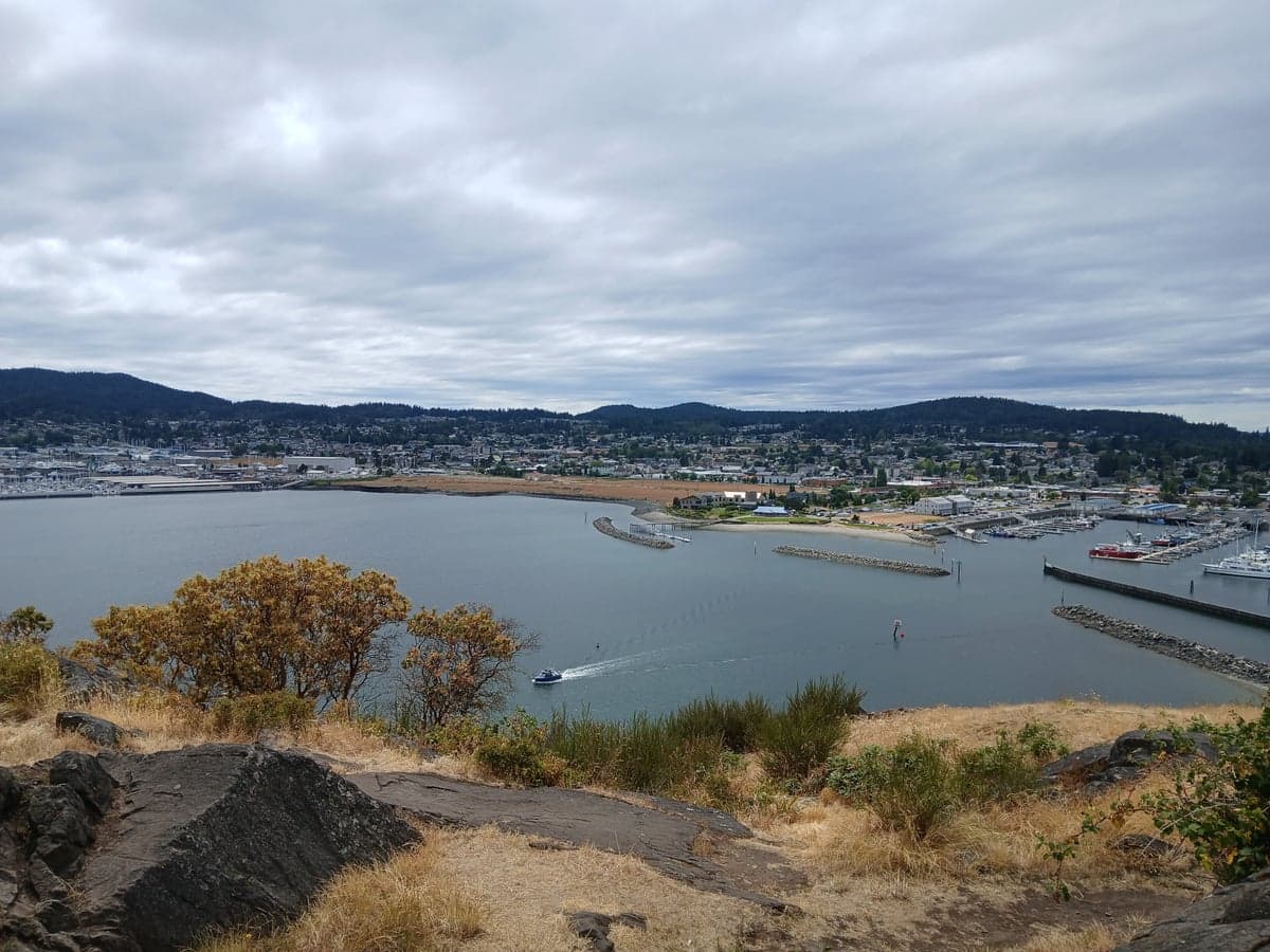
Photo: Wikipedia
Strategic Assessment of Anacortes, WA
Meaningful friction. Expect exposure to either population pressure, blast zones, or natural disaster risk. Consider buying a retreat property.
What does the Strategic Assessment tell us?
Our Strategic Assessment grades tactical survivability of an area. Major population centers, military targets, fallout zones, natural disasters, and border exposure all drive risk — lower exposure means a more defensible position in a crisis.
This is heavily inspired by Joel Skousen's Strategic Relocation book. Highly recommended you checkout the book ($)What does this tell us?
Our Strategic Assessment grades tactical survivability of an area. Major population centers, military targets, fallout zones, natural disasters, and border exposure all drive risk — lower exposure means a more defensible position in a crisis.
This is heavily inspired by Joel Skousen's Strategic Relocation book. Highly recommended you checkout the book ($)Strategic Pillars

Key Distances
Regional Safe Places
Below is our recommended "safe zones" in Washington and the surrounding area based on our strategic heuristics. For most people, it's unrealistic to live in a “safe zone” full-time due to work, family or other personal reasons. They tend to be more rural. However, many of these areas are perfect for second homes and retreat properties that double as a vacation home or even a short-term rental.
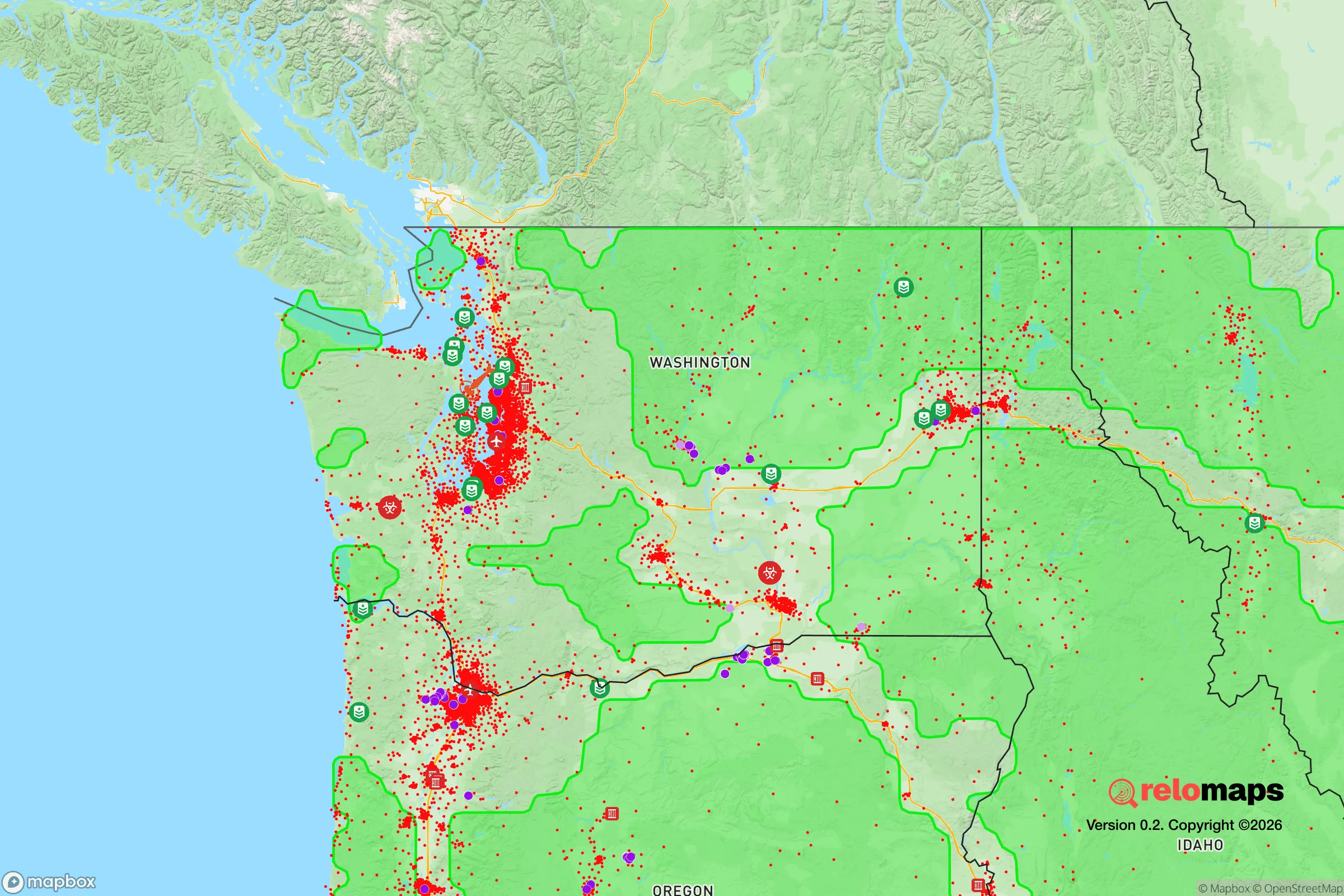
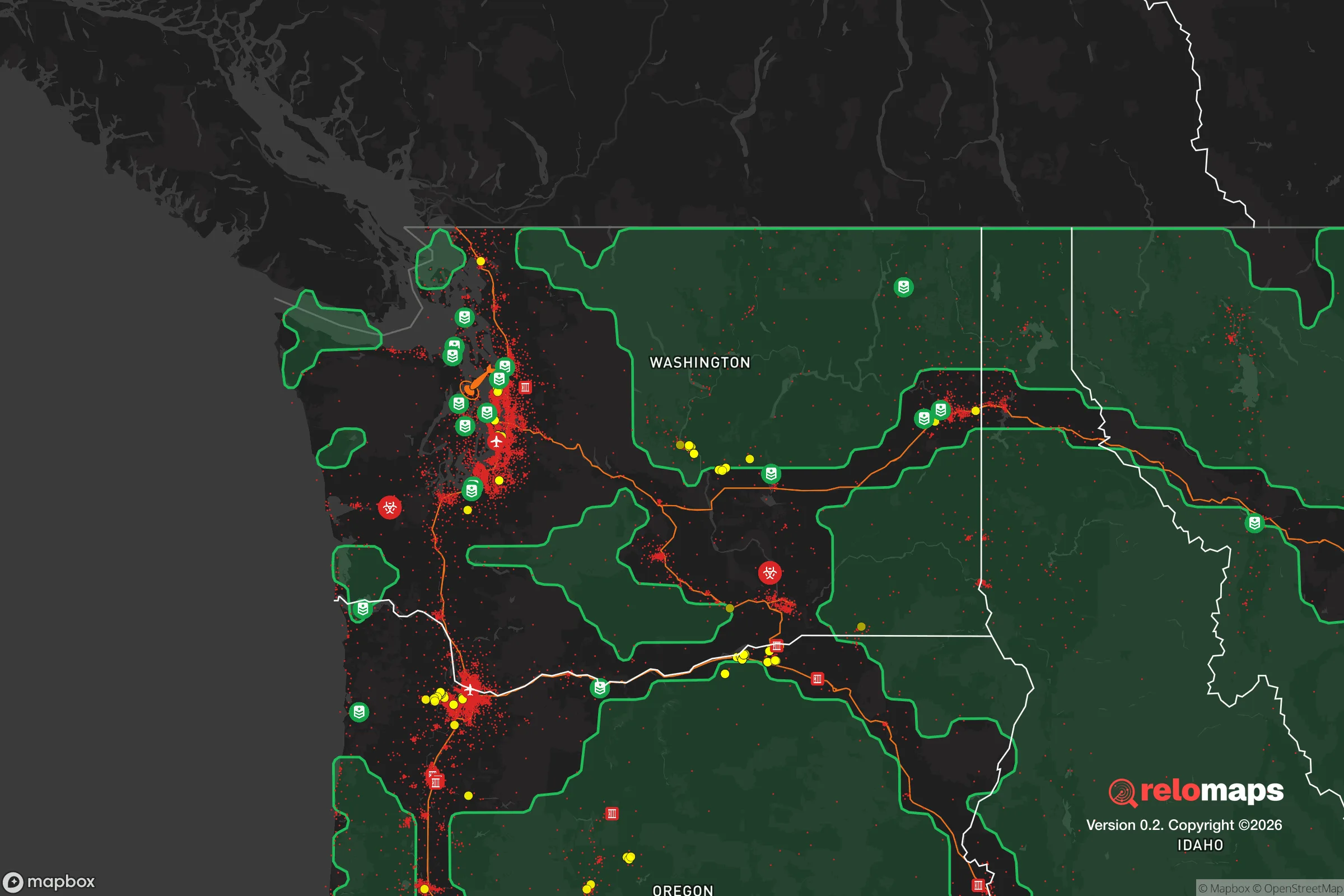


Important Note: For informational purposes only. This does not mean nothing bad ever happens in the green zones. Please use common sense. This is based on public data and modeled with AI. We tried to take a conservative approach but mistakes happen. We update this regularly as new information becomes available.
Solar Generator Recommendations
Backup power matters more here than in safer locations. We've picked three solar generators across budgets and capacity tiers — start with the budget unit if you only need a few essentials, or step up if you want to run a fridge and HVAC for days at a time.

Jackery Portable Power Station Explorer 300
Budget OptionPower on the Go: Weighing only 11 lbs, it's convenient to set up and store with book-sized foldable solar panels

BLUETTI Portable Power Station AC180
Designed for both indoor and outdoor scenarios, AC180 is highly capable as it has a robost capacity and continuous output power.

EF ECOFLOW DELTA Pro Ultra Power Station
Upgraded PickEcoFlow DELTA Pro Ultra is a whole-home energy system designed to grow with your family. Integrated with the Smart Home Panel 2, it scales to meet your evolving energy needs — keeping your home powered, intelligent, and secure through every stage of life.
We earn a commission, at no additional cost to you.
Strategic Assessment Analysis
Anacortes, Washington, offers a compelling strategic position for relocation-minded individuals and families who prioritize disaster readiness and self-sufficiency, but it comes with clear trade-offs. Situated on Fidalgo Island in Skagit County, the city leverages a maritime climate, access to the Salish Sea, and proximity to the North Cascades while remaining within a 90-minute drive of Seattle and a 30-minute ferry ride from the San Juan Islands. For a conservative-leaning reader weighing resilience, the area’s natural buffers and resource access are strong, but its proximity to major population centers and critical infrastructure introduces vulnerabilities that demand careful consideration.
Geographic position and natural advantages for disaster preparedness
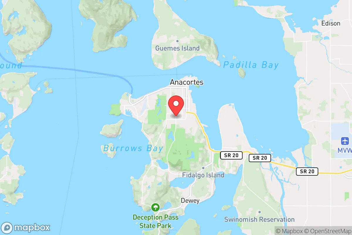
Anacortes sits on the northwest corner of Fidalgo Island, connected to the mainland by a single bridge (the Highway 20 bridge over the Swinomish Channel) and to Whidbey Island via the Deception Pass Bridge. This insular geography provides a natural defensibility advantage: any overland approach is funneled through two chokepoints, making the area easier to secure or monitor in a crisis. The surrounding waters—Puget Sound, the Strait of Juan de Fuca, and the Rosario Strait—offer abundant marine resources, including salmon, Dungeness crab, and shellfish, which can supplement food supplies. The city’s elevation ranges from sea level to about 200 feet, with nearby Mount Erie (1,273 feet) providing a high-ground vantage point for communications or observation. The maritime climate moderates temperature extremes, reducing risks of wildfire compared to eastern Washington, though the region is not immune to drought conditions. Annual rainfall averages 35 inches, supporting local watersheds like the Skagit River, which feeds the city’s primary reservoir at Heart Lake. For a relocator, this means reliable freshwater access, a temperate growing season for gardens, and natural barriers that slow external threats.
Risks, exposures, and proximity to fallout-relevant landmarks
The most significant strategic downside is Anacortes’ proximity to high-value targets and population centers. The city lies roughly 70 miles north of Seattle and 50 miles south of the Canadian border, placing it within the fallout zone of a major metropolitan attack or a strike on Naval Air Station Whidbey Island (NASWI), located just 15 miles south by air. NASWI is home to the Navy’s P-8 Poseidon and EA-18G Growler squadrons, making it a plausible military target in a conflict scenario. Additionally, the Anacortes Refinery—one of the largest oil refineries on the West Coast, processing up to 149,000 barrels per day—sits on the city’s southern edge. While the refinery is an economic engine, it also represents a potential industrial accident or sabotage risk, including toxic releases or fires. The city’s single-bridge access is a double-edged sword: it limits entry for outsiders but also creates a single point of failure for evacuation or resupply. A major earthquake (the Cascadia subduction zone is 80 miles offshore) could damage the bridge, isolating the island for days or weeks. Tsunami risk is low for the city itself, as it sits on the lee side of the island, but low-lying areas along the waterfront could see surge. For a relocator, the key takeaway is that Anacortes is not a remote bunker; it is a semi-urban island with critical infrastructure that could attract attention in a crisis.
Practical resilience for a relocator: food, water, energy, and defensibility
Anacortes scores well on practical self-sufficiency metrics, but the details matter. The city draws its municipal water from the Skagit River via a pipeline and from Heart Lake, with a treatment plant capable of producing 12 million gallons per day—far exceeding current demand of about 3 million gallons per day. This surplus means water rationing is unlikely in most scenarios, though a prolonged power outage could disrupt pumping. For off-grid capability, many homes have access to private wells, particularly in the more rural areas east of the city center near the Anacortes Community Forest Lands (ACFL), a 2,800-acre tract of second-growth forest with trails and potential for foraging. The ACFL also provides firewood and game (deer, rabbits), though hunting is restricted within city limits. Food resilience is moderate: the Skagit Valley, just east of the island, is one of Washington’s most productive agricultural regions, with farms growing potatoes, berries, and grains, plus dairy operations. A 20-minute drive to Mount Vernon or Burlington gives access to farm stands and bulk suppliers like the Skagit Valley Food Co-op. However, the island itself has limited arable land, so a relocator would need to rely on mainland connections or personal gardening. Energy is a vulnerability: the city’s grid is served by Puget Sound Energy, with power lines running across the Highway 20 bridge. A single downed line could cut electricity to the entire island. Solar potential is moderate (about 150 sunny days per year), but marine cloud cover limits winter generation. Backup generators or battery systems are advisable. Defensibility is the strongest asset: the island’s perimeter and limited access points make it easier to monitor than a sprawling suburban area. The local police force (about 30 officers) and Skagit County Sheriff’s Office provide law enforcement, but in a prolonged crisis, residents would likely need to form neighborhood watch groups. The city’s population of roughly 18,000 is small enough for community cohesion but large enough to have a hospital (Island Hospital, with 24 beds) and a fire department with three stations. For a relocator, the practical picture is one of moderate self-sufficiency with a strong reliance on mainland supply chains for food and energy.
The overall strategic picture for Anacortes is that of a defensible but not isolated outpost—a place where natural advantages like water access, moderate climate, and island geography are offset by proximity to military and industrial targets. For a conservative-leaning individual or family serious about disaster readiness, the city offers a realistic middle ground: it is not a prepper’s paradise, but it provides a foundation for resilience that can be strengthened with personal preparation. The key is to treat Anacortes as a base camp rather than a fortress—stockpile supplies, invest in off-grid energy, and build relationships with local farmers and neighbors. The city’s location near the San Juan Islands and the North Cascades also opens escape routes by boat or foot if conditions deteriorate. Ultimately, Anacortes rewards the prepared relocator who understands that no location is risk-free, but that smart positioning and community ties can make the difference in a crisis.

* Values derived from national, state, county, city and local statistics and may differ in a specific area. Last updated: 2026-08-27T19:29:18.000Z
Narrative content on this page is AI-generated and may contain mistakes. Verify any details that matter before acting on them.
ReloMaps may earn a commission from affiliate links at no extra cost to you.

