Photo: Wikipedia
Strategic Assessment of Kenai Peninsula County
Strong survivability profile. Good buffer from population centers, with manageable environmental and tactical risks.
What does the Strategic Assessment tell us?
Our Strategic Assessment grades tactical survivability of an area. Major population centers, military targets, fallout zones, natural disasters, and border exposure all drive risk — lower exposure means a more defensible position in a crisis.
This is heavily inspired by Joel Skousen's Strategic Relocation book. Highly recommended you checkout the book ($)What does this tell us?
Our Strategic Assessment grades tactical survivability of an area. Major population centers, military targets, fallout zones, natural disasters, and border exposure all drive risk — lower exposure means a more defensible position in a crisis.
This is heavily inspired by Joel Skousen's Strategic Relocation book. Highly recommended you checkout the book ($)Strategic Pillars

Key Distances
Strategic Assessment Analysis
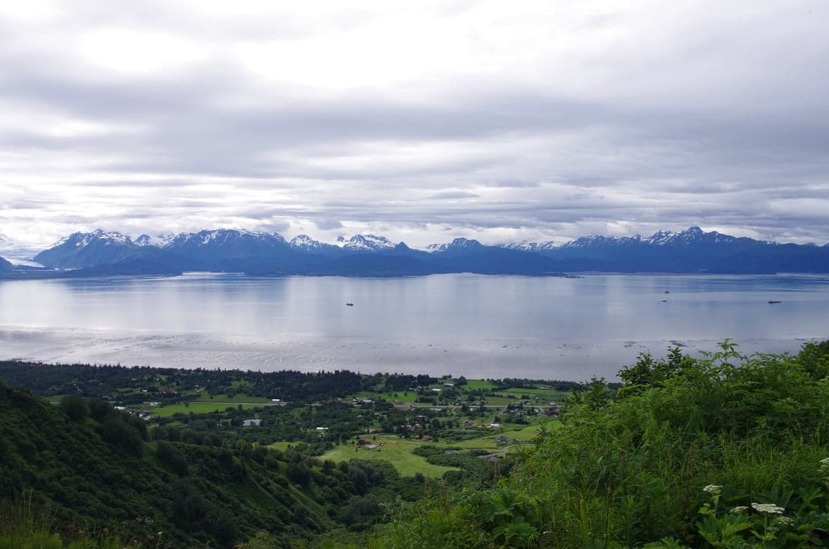
Kenai Peninsula County offers a compelling mix of geographic isolation and practical self-sufficiency that appeals to relocation-minded individuals and families prioritizing resilience. Stretching south from Anchorage across the Cook Inlet, the borough is anchored by the city of Homer at the tip of the Kenai Peninsula, with Soldotna and Kenai serving as its commercial and administrative hubs. The area’s strategic value lies in its separation from Alaska’s largest population center—Anchorage is roughly 160 miles north by road—while still retaining access to critical infrastructure like the Port of Nikiski and the Kenai Refinery. For a reader weighing disaster readiness and long-term self-reliance, the Kenai Peninsula presents a balanced profile: remote enough to avoid the worst of urban cascade failures, yet connected enough to support a modern standard of living.
Geographic position and natural advantages for long-term security
The Kenai Peninsula’s geography is its primary asset for resilience. The borough is bounded by the Cook Inlet to the west and the Gulf of Alaska to the east, with the Kenai Mountains forming a natural spine that limits overland access from the north. The only road connection to the rest of Alaska is the Sterling Highway and the Seward Highway, both of which pass through the Turnagain Arm corridor—a narrow, avalanche-prone route that can be easily monitored and, in a crisis, controlled. This chokepoint means that any large-scale movement of people or goods from Anchorage into the peninsula is funneled through a single, defensible corridor. The borough’s coastline provides access to the Gulf of Alaska for maritime resupply and evacuation, though the waters are notoriously rough. The Kenai River system, which drains from Skilak Lake and Tustumena Lake, offers a reliable freshwater source and supports one of the world’s largest salmon runs, giving residents a natural protein supply that is both renewable and difficult to disrupt.
Risks, exposures, and proximity to fallout-relevant landmarks
While the Kenai Peninsula is far from the continental U.S. nuclear targets, it is not without its own risk profile. The Kenai Refinery in Nikiski, operated by Marathon Petroleum, processes roughly 60,000 barrels of crude oil per day and is a key supplier of jet fuel to Joint Base Elmendorf-Richardson (JBER) near Anchorage. In a conflict scenario, this refinery could be a secondary target—not a primary strike, but a plausible follow-up to degrade Alaska’s fuel supply. The Port of Nikiski also handles liquefied natural gas exports, adding another layer of industrial exposure. The borough’s proximity to Anchorage (population ~290,000) means that fallout from a strike on JBER or the Port of Anchorage could drift south depending on prevailing winds, though the Kenai Mountains provide some shielding. Natural risks are more immediate: the peninsula sits on the Pacific Ring of Fire, with the 1964 Good Friday earthquake (magnitude 9.2) having devastated the area, including the town of Seward, which was hit by a tsunami. The Mount Spurr volcano, 80 miles northwest of Kenai, is currently under monitoring for potential eruption, which could disrupt air travel and deposit ash across the peninsula. For a relocator, these natural hazards are more probable than man-made ones, but the borough’s low population density (roughly 60,000 residents across 16,000 square miles) means that even a major event would affect fewer people than a similar disaster in a metropolitan area.
Practical resilience for a relocator: food, water, energy, and defensibility
The Kenai Peninsula is one of the few places in the United States where a relocator can achieve near-total food and water self-sufficiency without extreme measures. The Kenai River and its tributaries provide year-round freshwater, and the region’s high precipitation (around 20 inches annually in the lowlands) means rainwater catchment is viable. The growing season is short—roughly 90 days between last and first frost—but the long summer daylight hours (up to 19 hours in June) allow for productive vegetable gardens, especially in the Kenai Lowlands around Soldotna and Homer. Wild game is abundant: moose, caribou, and black bear are common, and the Kachemak Bay area offers shellfish and marine protein. For energy, the borough is served by Homer Electric Association, which draws power from the Bradley Lake Hydroelectric Project—a renewable source that is less vulnerable to fuel supply disruptions than diesel generators. However, the grid is not redundant; a major earthquake could knock out transmission lines for weeks. Defensibility is strong due to the geography: the single road corridor from Anchorage can be monitored, and the interior of the peninsula is heavily forested with limited road networks, making it easy to establish a low-visibility homestead. The borough’s property tax rate is moderate (roughly 1.2% of assessed value), and land prices in unincorporated areas like Nikiski or Sterling remain affordable compared to the Anchorage Bowl, allowing a relocator to purchase acreage without a mortgage that would be a liability in a crisis.
The strategic picture for Kenai Peninsula County is one of balanced risk and reward. It offers genuine geographic isolation from the most likely continental U.S. targets, a robust natural resource base, and a community that is accustomed to self-reliance—many residents already heat with wood, fish for subsistence, and maintain off-grid capabilities. The trade-offs are real: the climate is harsh (winter lows of -20°F are not uncommon), the medical infrastructure is limited to Central Peninsula Hospital in Soldotna and a handful of clinics, and the nearest major trauma center is in Anchorage, a 3-hour drive in good conditions. For a family or individual who values preparedness over convenience, the Kenai Peninsula is a strong candidate—provided they are willing to invest in cold-weather skills, seismic retrofitting, and a backup power system. It is not a bug-out location for a weekend prepper; it is a long-term home that demands respect for the environment but rewards that respect with a level of security few other regions in the United States can match.

* Values derived from national, state, county, city and local statistics and may differ in a specific area. Last updated: 2026-06-15T11:53:51.000Z
Narrative content on this page is AI-generated and may contain mistakes. Verify any details that matter before acting on them.
ReloMaps may earn a commission from affiliate links at no extra cost to you.

