
Photo: Wikipedia
Strategic Assessment of Limestone County
Workable tactical position. Some exposure to population density or targets, but generally defensible in a crisis.
What does the Strategic Assessment tell us?
Our Strategic Assessment grades tactical survivability of an area. Major population centers, military targets, fallout zones, natural disasters, and border exposure all drive risk — lower exposure means a more defensible position in a crisis.
This is heavily inspired by Joel Skousen's Strategic Relocation book. Highly recommended you checkout the book ($)What does this tell us?
Our Strategic Assessment grades tactical survivability of an area. Major population centers, military targets, fallout zones, natural disasters, and border exposure all drive risk — lower exposure means a more defensible position in a crisis.
This is heavily inspired by Joel Skousen's Strategic Relocation book. Highly recommended you checkout the book ($)Strategic Pillars

Key Distances
Strategic Assessment Analysis
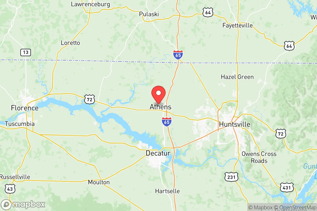
Limestone County, Alabama, offers a compelling strategic position for relocators prioritizing resilience and self-sufficiency, blending rural accessibility with proximity to critical infrastructure. Anchored by the city of Athens and the rapidly growing town of Madison, the county sits in the Tennessee Valley, roughly 20 miles west of Huntsville and 90 miles north of Birmingham. Its location provides a buffer from major metropolitan fallout zones while still granting access to supply chains, medical hubs, and transportation networks—a balance that appeals to those thinking seriously about disaster readiness and long-term stability.
Geographic position and natural advantages for long-term stability
Limestone County’s geography is defined by the Tennessee River, which forms its northern border and provides a reliable freshwater source—a critical asset for any resilience-minded relocation. The county lies within the Tennessee Valley, a region known for relatively mild seismic activity and low hurricane risk compared to coastal Alabama. The terrain is gently rolling, with elevations ranging from 550 to 800 feet, offering natural drainage and reducing floodplain exposure outside immediate river zones. The area is also part of the broader Huntsville-Decatur combined statistical area, which benefits from the Tennessee Valley Authority’s (TVA) robust electrical grid, powered by a mix of hydroelectric, nuclear (Browns Ferry Nuclear Plant in nearby Limestone County), and natural gas sources. This energy diversity reduces vulnerability to single-point failures, a key consideration for those evaluating grid stability. The county’s position along Interstate 65 and U.S. Highway 72 provides direct routes to Huntsville, Nashville, and Birmingham, enabling evacuation or supply movement without relying on choke-point-prone coastal highways.
Risks, exposures, and proximity to fallout-relevant landmarks
While Limestone County avoids the highest-risk zones for hurricanes and earthquakes, it is not without exposures. The most significant man-made risk stems from the Browns Ferry Nuclear Plant in Limestone County itself, located near the Tennessee River. Though modern safety protocols are stringent, a major incident at this facility could render large portions of the county uninhabitable for extended periods, depending on wind patterns. Additionally, the county lies within 50 miles of the Redstone Arsenal in Huntsville, a U.S. Army base focused on missile defense, space operations, and chemical weapons storage. While this proximity brings economic benefits, it also makes the area a potential target in a conflict scenario. The Tennessee Valley Authority’s dams along the river, including Wheeler Dam and Wilson Dam, present a low but non-zero risk of structural failure or targeted disruption. For relocators, the key takeaway is that Limestone County’s risks are concentrated in industrial and military assets rather than natural disasters—meaning preparedness should focus on situational awareness and evacuation planning for specific man-made events, rather than broad weather-related threats. The county’s distance from major petrochemical corridors (e.g., Houston’s refinery row or Louisiana’s Chemical Corridor) is a net positive, reducing exposure to cascading industrial accidents.
Practical resilience for a relocator: food, water, energy, and defensibility
For those serious about self-sufficiency, Limestone County offers strong fundamentals. Water access is excellent: the Tennessee River provides a year-round surface water source, and the county’s aquifer system supports private wells in rural areas. Athens Utilities and Madison Utilities maintain treated water systems, but a well with a hand pump or solar-powered backup is a realistic option for off-grid living. Food resilience is bolstered by the county’s agricultural base—Limestone County is a top producer of cotton, corn, soybeans, and livestock in Alabama. Local farmers’ markets in Athens and Elkmont, plus the presence of the Alabama Cooperative Extension System in Athens, provide resources for gardening, canning, and livestock management. The county’s energy profile is favorable: TVA’s grid is supplemented by local solar installations and the potential for small-scale hydro or wind on rural properties. The area’s relatively low population density (roughly 100,000 residents across 560 square miles) means less competition for resources in a crisis, though the Huntsville metro area’s growth is increasing suburban sprawl. Defensibility is moderate: the county’s open farmland and rolling hills offer good visibility, but the lack of natural barriers (mountains, dense forests) means a determined threat could approach from multiple directions. Rural properties with creek or river frontage, combined with a well and solar array, offer the best balance of seclusion and resource access. The town of Ardmore, straddling the Tennessee border, provides a secondary exit route north, while Elkmont offers a quieter, more isolated option for those prioritizing privacy.
The overall strategic picture for Limestone County is one of calculated trade-offs. Its strengths—reliable water, diverse energy, agricultural capacity, and distance from coastal hurricane zones—make it a strong candidate for a resilience-focused relocation. The primary weaknesses are the nearby nuclear plant and military base, which introduce a low-probability but high-consequence risk. For a relocator who values self-sufficiency and is willing to invest in off-grid infrastructure (well, solar, food storage), the county offers a realistic path to long-term stability without the isolation of more remote areas. The growing Huntsville economy provides employment and supply access, but the county’s rural character remains intact enough to support a serious preparedness lifestyle. As with any location, the key is to assess personal risk tolerance and build redundancy into water, energy, and food systems—Limestone County gives you the raw materials to do that, provided you stay aware of the industrial and military assets in your backyard.

* Values derived from national, state, county, city and local statistics and may differ in a specific area. Last updated: 2026-07-03T04:28:39.000Z
Narrative content on this page is AI-generated and may contain mistakes. Verify any details that matter before acting on them.
ReloMaps may earn a commission from affiliate links at no extra cost to you.

