Photo: Wikipedia
Strategic Assessment of Coffee County
Workable tactical position. Some exposure to population density or targets, but generally defensible in a crisis.
What does the Strategic Assessment tell us?
Our Strategic Assessment grades tactical survivability of an area. Major population centers, military targets, fallout zones, natural disasters, and border exposure all drive risk — lower exposure means a more defensible position in a crisis.
This is heavily inspired by Joel Skousen's Strategic Relocation book. Highly recommended you checkout the book ($)What does this tell us?
Our Strategic Assessment grades tactical survivability of an area. Major population centers, military targets, fallout zones, natural disasters, and border exposure all drive risk — lower exposure means a more defensible position in a crisis.
This is heavily inspired by Joel Skousen's Strategic Relocation book. Highly recommended you checkout the book ($)Strategic Pillars

Key Distances
Strategic Assessment Analysis
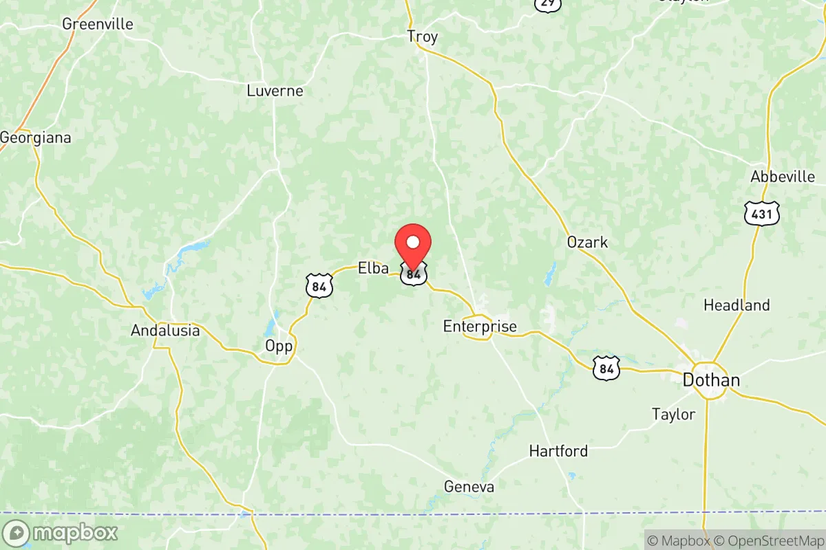
Coffee County, Alabama, occupies a strategic position in the southeastern U.S. that balances relative isolation from major metropolitan vulnerabilities with access to critical infrastructure and resources. For the relocation-minded reader prioritizing disaster readiness and self-sufficiency, this area offers a compelling mix of geographic advantages, moderate risk exposure, and practical resilience features that merit serious consideration. The county’s location—roughly 85 miles south of Montgomery and 50 miles north of the Florida Panhandle—places it outside the immediate blast or fallout zones of major strategic targets while still within reach of supply chains and medical facilities.
Geographic position and natural advantages for long-term stability
Coffee County sits in the Coastal Plain region of Alabama, characterized by gently rolling terrain, abundant surface water, and a climate that supports year-round food production. The county seat, Enterprise, anchors the area with a population of roughly 29,000, while Elba and New Brockton offer smaller, more rural alternatives. The Pea River and the Choctawhatchee River watershed provide reliable freshwater sources, a critical asset for any long-term resilience plan. The area’s elevation—ranging from 200 to 400 feet above sea level—offers natural drainage and reduces flood risk compared to coastal zones, though low-lying areas near rivers do experience periodic flooding. The climate is humid subtropical, with a growing season of roughly 230 days, allowing for multiple crop cycles and livestock grazing nearly year-round. This agricultural capacity is a tangible advantage for anyone serious about food self-sufficiency, as the surrounding region is already a major producer of peanuts, cotton, and poultry.
Risk exposures and proximity to fallout-relevant landmarks
While Coffee County avoids the highest-risk zones, it is not without exposure. The most significant man-made risk comes from Fort Novosel (formerly Fort Rucker), located just south of Enterprise. This U.S. Army aviation base is a primary training center for helicopter pilots and could be a secondary target in a major conflict, though its strategic value is lower than nuclear command centers or major naval bases. The base’s proximity—roughly 10 miles from downtown Enterprise—means that a conventional strike or accident could affect the county, but the risk of a direct nuclear hit is low given its non-nuclear mission. More concerning is the county’s position relative to the Houston refinery corridor and the Port of Mobile. Mobile, about 120 miles southwest, is a major port handling chemicals, coal, and petroleum products, making it a plausible target. Fallout patterns from a strike on Mobile would depend on wind direction, but prevailing winds in the region are generally from the south and southwest, which would push contamination away from Coffee County in most scenarios. Similarly, the Tennessee Valley Authority’s Browns Ferry Nuclear Plant near Decatur, Alabama, is roughly 200 miles north—far enough to avoid direct fallout but worth noting for long-term planning. Natural risks include tornadoes (the county lies in the Deep South’s tornado alley), occasional hurricanes that weaken as they move inland, and flash flooding along the Pea River. The 1990 flood in Elba, which destroyed much of the downtown, is a reminder that low-lying areas require careful site selection.
Practical resilience for a relocator: food, water, energy, and defensibility
For the self-sufficient relocator, Coffee County offers several concrete advantages. Water availability is strong: the Floridan Aquifer underlies the region, providing clean groundwater at moderate depths (typically 100-300 feet for residential wells). Surface water from the Pea River and numerous creeks is accessible, though treatment would be necessary for drinking. Food production is viable, with fertile soils (primarily sandy loam) suitable for gardens, orchards, and small-scale livestock. The county’s agricultural extension office in Enterprise offers resources for new farmers, and local feed stores and farm supply outlets are plentiful. Energy resilience is mixed: the grid is served by Alabama Power, which has a moderate reliability record, but frequent thunderstorms cause outages. Solar potential is good, with roughly 215 sunny days per year, and net metering is available for grid-tied systems. Off-grid solar is feasible, though battery storage costs remain a consideration. Natural gas is available in Enterprise and Elba, but rural properties often rely on propane or wood heat. Defensibility is a key consideration for the preparedness-minded. The county’s low population density (roughly 90 people per square mile) and dispersed settlement pattern make it harder to target or isolate. The terrain is mostly open farmland and pine forests, offering good visibility and multiple escape routes via U.S. Highway 84 (east-west) and Alabama State Route 167 (north-south). However, the area lacks natural defensive features like mountains or large bodies of water that could slow an advancing threat. The local law enforcement presence is modest—the Coffee County Sheriff’s Office and Enterprise Police Department cover the area—so community-based security networks would be prudent. The county’s gun culture is strong, with multiple shooting ranges and gun shops, and Alabama’s constitutional carry law (effective 2022) allows permitless concealed carry, which aligns with the self-defense priorities of this audience.
The overall strategic picture for Coffee County is one of moderate resilience with clear trade-offs. It avoids the high-risk zones of major cities, military command centers, and industrial corridors, while still offering access to healthcare (Enterprise’s Medical Center Enterprise is a 150-bed facility), supply chains, and transportation routes. The county’s agricultural base, abundant water, and favorable climate support long-term self-sufficiency, but the risks from tornadoes, flooding, and proximity to Fort Novosel require active mitigation. For the relocator who values a balance between isolation and access, and who is willing to invest in well-drilling, solar power, and food storage, Coffee County represents a defensible, livable option in the Southeast. It is not a bunker location, but it is a place where a prepared family can build a resilient life without the paranoia of living next to a primary target.

* Values derived from national, state, county, city and local statistics and may differ in a specific area. Last updated: 2026-06-24T16:04:30.000Z
Narrative content on this page is AI-generated and may contain mistakes. Verify any details that matter before acting on them.
ReloMaps may earn a commission from affiliate links at no extra cost to you.

