
Photo: Wikipedia
Strategic Assessment of Ozaukee County
Meaningful friction. Expect exposure to either population pressure, blast zones, or natural disaster risk. Consider buying a retreat property.
What does the Strategic Assessment tell us?
Our Strategic Assessment grades tactical survivability of an area. Major population centers, military targets, fallout zones, natural disasters, and border exposure all drive risk — lower exposure means a more defensible position in a crisis.
This is heavily inspired by Joel Skousen's Strategic Relocation book. Highly recommended you checkout the book ($)What does this tell us?
Our Strategic Assessment grades tactical survivability of an area. Major population centers, military targets, fallout zones, natural disasters, and border exposure all drive risk — lower exposure means a more defensible position in a crisis.
This is heavily inspired by Joel Skousen's Strategic Relocation book. Highly recommended you checkout the book ($)Strategic Pillars

Key Distances
Strategic Assessment Analysis
Ozaukee County, Wisconsin, offers a compelling blend of rural resilience and proximity to Great Lakes resources, making it a noteworthy option for relocation-minded individuals and families prioritizing strategic preparedness. Situated directly north of Milwaukee along the Lake Michigan shoreline, the county provides a buffer from the densest urban fallout zones while still granting access to major infrastructure. Its combination of a stable freshwater source, a diversified local economy, and a relatively low population density positions it as a defensible and self-sufficient base for those serious about long-term disaster readiness.
Geographic position and natural advantages for long-term stability
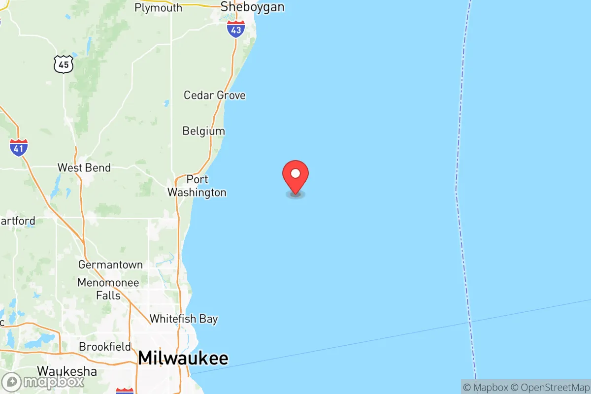
Ozaukee County’s primary strategic asset is its 25-mile Lake Michigan coastline, which provides an essentially unlimited supply of fresh water—a critical factor in any prolonged disruption scenario. The county’s terrain is gently rolling, with fertile glacial soils that support active agriculture, particularly in the northern townships like Belgium and Fredonia. This agricultural base means local food production is not just theoretical; it’s a functioning reality. The county seat, Port Washington, sits on a deep-water harbor that could serve as a secondary supply route or evacuation point if overland routes become compromised. The area’s position places it roughly 30 miles north of Milwaukee’s urban core, far enough to avoid the immediate blast and fallout effects of a major metropolitan strike, yet close enough to access medical and logistical resources if needed. The prevailing westerly winds also carry airborne contaminants away from the lakeshore, a subtle but meaningful advantage for air quality in a fallout scenario.
Risks, exposures, and proximity to fallout-relevant landmarks
No location is without vulnerabilities, and Ozaukee County’s proximity to several high-value targets is the primary concern. The most significant risk is the Point Beach Nuclear Plant, located just north in Manitowoc County, roughly 20 miles from the county line. While the plant has a strong safety record, a catastrophic failure or targeted attack would place the entire county within the plume exposure pathway. Additionally, the county lies within 50 miles of Milwaukee’s Mitchell International Airport and the Port of Milwaukee, both potential secondary targets in a conflict scenario. The I-43 corridor, which bisects the county, is a major evacuation and supply route that could become a chokepoint during a crisis. On the natural disaster front, the county faces moderate risks from severe winter storms and lake-effect snow, which can paralyze transportation for days. Tornado risk is present but lower than in the central Plains. Flooding is localized, primarily along the Milwaukee River and its tributaries, which run through Mequon and Thiensville. The county’s lack of major military installations or heavy industrial targets (like refineries or chemical plants) is a net positive, reducing the likelihood of a direct strike.
Practical resilience for a relocator: food, water, energy, and defensibility
For a relocator focused on self-sufficiency, Ozaukee County offers a strong foundation. Water security is excellent: private wells are common in rural areas, and the lake provides a backup source for those with filtration systems. Municipal water in towns like Grafton and Port Washington is drawn from Lake Michigan and treated to high standards, but a grid-down scenario would require personal storage or pumping capability. Food resilience is above average for a suburban county. The agricultural land in the northern half supports dairy, grain, and vegetable operations, and farmers’ markets are plentiful. The county also has a robust network of small-scale farms and homesteaders, particularly around Belgium and Fredonia, which could form the basis of a local food-sharing network. Energy infrastructure is moderately resilient. The grid is interconnected with the regional MISO system, but rural areas are more prone to outages from storms. Solar potential is adequate, though winter cloud cover reduces output. Natural gas is widely available in towns, but rural properties often rely on propane or fuel oil, which require storage. Defensibility is a mixed picture. The county’s layout—a mix of open farmland, wooded bluffs, and suburban subdivisions—makes it difficult to secure as a whole. However, individual properties in the northern townships offer good natural cover and limited road access, which aids in perimeter security. The Ozaukee County Sheriff’s Office is well-regarded and maintains a visible presence, but in a prolonged crisis, law enforcement resources would be stretched thin. The county’s population of roughly 90,000 is small enough to avoid the chaos of a major city, but large enough to have a functional social structure.
The overall strategic picture for Ozaukee County is one of calculated trade-offs. It offers a rare combination of abundant fresh water, productive farmland, and a buffer from the most severe urban and industrial fallout zones. The proximity to the Point Beach nuclear plant and the Milwaukee metro area are real but manageable risks, especially for a relocator who prepares accordingly—stockpiling potassium iodide, maintaining a go-bag, and having a plan for inland retreat if necessary. For a family or individual serious about disaster readiness, the county’s balance of natural resources, community cohesion, and relative isolation from major targets makes it a strong candidate. It is not a remote wilderness, but it is a place where a prepared person can build a sustainable, defensible life without being cut off from the world entirely. The key is to treat it as a base of operations, not a fortress: invest in water storage, local food networks, and off-grid energy, and you will be far ahead of most Americans in terms of resilience.

* Values derived from national, state, county, city and local statistics and may differ in a specific area. Last updated: 2026-07-10T08:30:06.000Z
Narrative content on this page is AI-generated and may contain mistakes. Verify any details that matter before acting on them.
ReloMaps may earn a commission from affiliate links at no extra cost to you.

